
-
 4188 Hits
-
 74.92% Score
-
 5 Votes
|
|
Route |
|---|---|
|
|
46.44110°N / 13.84660°E |
|
|
Mountaineering, Scrambling |
|
|
Spring, Summer |
|
|
Most of a day |
|
|
UIAA II., snow up to 50 degrees |
|
|
Class 4 |
|
|
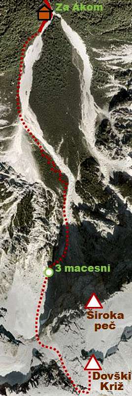
Approach
The trailhead starts just in the village of Martuljek, 750 m.Route Description
Jug couloir from its entrance up
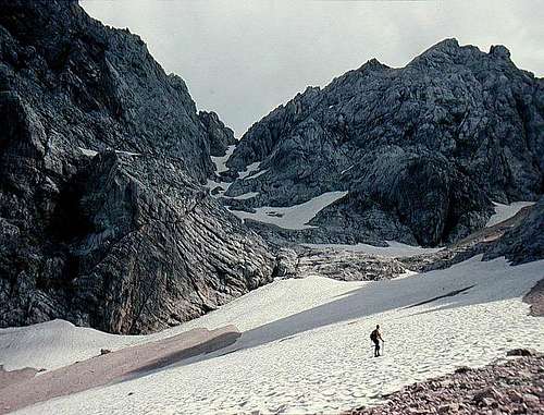
In Jug Couloir
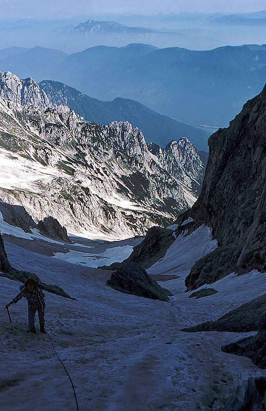
From 3 larches you proceed towards south by a scree shoulder. It is not dangerous, but also not very comfortable. Above it's likely you will already reach snow fields. They proceed southwards, but as the Siroka pec wall is now over, one steep snow couloir goes also towards left, in SE direction. It's broad on the bottom, but becomes steeper and much more narrow at the top (Jug's couloir). But what is most important - it brings you almost to the main ridge. In early summer (or even May, June) the conditions are the best and you will likely reach the main ridge. If not, on the top of the couloir some easy rock climb awaits you (I.-II. degree). From the main ridge you go on south slopes of the fore summit and reach by ledges the summit rocks and the main summit (easy climb, I.-II.). Altogether some 5 hours.
To descend certainly the best advice is, to choose the south route (see the description). This way you will use more than 500 meters of fine debris below Splevta and reach the Vrata valley in the shortest possible time. Of course you must now go around to the main Sava valley and to Martuljek.