
|
|
Mountain/Rock |
|---|---|
|
|
48.77120°N / 121.2868°W |
|
|
Mountaineering |
|
|
Summer |
|
|
7880 ft / 2402 m |
|
|
Overview
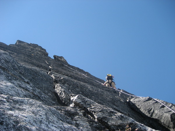
The Pickets Range is the most rugged and unexplored region of the North Cascades which in turn is likely the most rugged mountain range in the lower 48 states. Choked with impenetrable brush below timberline and heavily glaciated just above timberline, these peaks are spectacularly difficult to access and some equally tough to climb (by even their easiest lines). Inspiration Peak is located at the eastern edge of the Southern Pickets Group and is part of a ridge running roughly east-west. This relatively thin fin is bordered by West McMillan Spire on the east side and The Pyramid/Mt. Degenhardt complex on the west. Mount Terror lies just beyond Degenhardt. Terror Glacier clings to the southern slopes of the mountain and the steep McMillan Cirque Glaciers lie on the northern flanks. The rock here is “Skagit Gneiss” or more practically “some solid granite and bit o’ choss” which are encountered in distinct but intermixed patches. Inspiration is probably one of the easiestpeaks to access in the Pickets. This is of course relative – you will still need to gain ~7500 feet of elevation (much of which is on a “functional” climbers’ bootpath) and cross a heavily crevassed glacier before you can even touch the rock on the easiest summit line (West Ridge III 5.7……probably “R”). Starting the approach hike at ~500 feet implies that you will be suffering through oppressive summer heat for much of the way or alternatively miserably cold and wet conditions up high. Alan Kearney’s book (see below) – with focus on the Pickets chapters – is a great read on this matter.Acknowledgement: Thanks to Martin for approach beta.

Getting There


Drive WA highway 20 (North Cascades Highway) to the settlement of Newhalem (general store) – about >10 miles east of Marblemount. On the west edge of town turn north following signs of WA DOT maintenance yard. Almost immediately turn left and in a couple hundred feet stay right at a fork following signs for a group campground (at end of road). Before you get to the campground (fraction of a mile from fork), look for a 30 yard long pull-out fork on the right. Park there.
Goodell Creek Trail:
From the trailhead “turnoff” (~500 feet elevation) hike straight into the forest along overgrown trail heading north. In about 0.25 miles you join up with the “main” Goodell Creek Trail coming in from the left (trailhead board). Continue up Goodell Creek Trail for the next 4+ miles. Two washout sections are crossed. 200 yards after the 2nd one, look for a climbers’ boot path on the right (right at the campsite with a fire ring). Hint: in both cases you pick up the trail at roughly the same level on opposite bank.
On To Timberline And Camp:
Hike this switchback-free trail (NE heading) from the junction at ~1600 feet to timberline at ~5200 feet. You break through dense timber just above a steep section of root-pulling. Small stream is crossed here. Keep hiking north (indistinct trail) gently gaining elevation as you veer slightly east (right). Second stream (larger) is crossed and uphill grade picks up. Timber disappears altogether at a great overlook and you enter a section of snow/slabs/heather slopes. Continue traversing north towards a high saddle (6000+ feet). Drop down the steep, broad gully on the other side (down ~400 feet). Good camping here at the base of a heap of scree.
Approach From Camp To Peak:
From camp, traverse more heather/snow slopes heading north/northwest gently losing elevation. You need to drop low enough to cross a drainage from a small lakelet (surrounded by vertical rock walls) just SE of McMillan spires. Beyond the drainage pick your way up via slabs and snow slopes heading NW for the edge of Terror Glacier.
For West Ridge, South Face, and East Ridge routes pick your way across Terror Glacier (low angle but heavily crevassed). If you’re planning on a North Face assault (the 3rd one incl. FA?), chances are you’re not reading this.
Note that other camping options exist – closer to Terror Glacier.
Red Tape
Approach, basecamp, and peak itself are in North Cascades National Park. Overnight stays require a backcountry permit (quota, no fee). Permits issued on a first-come-first-served basis starting in the morning of the previous day (Saturday night permits start being issued Thursday morning etc.). No reservations. Climbers in the Park have the option of signing into a climbers’ register at the Marblemount Ranger Station (left outside 24/7) – don’t forget to sign out after your climb. No parking permits needed. No fees. Permit information from the NPS website is here.Camping
See Red Tape section for backcountry camping rules.Car camping within North Cascades National Park is of course possible. Information can be found on the NPS website.
Mountain Conditions
The Peak is located in North Cascades National Park. Official NPS website for the park is here. Marblemount ranger station is likely the best bet for any information on the approach (the approach though is NOT on maintained NPS trails) and general area conditions. Their number is (360)873-4500 (ext. 39).Also, check out this NPS webcam. This is a shot from the Marblemount Ranger Station of The Chopping Block (on left), Mt. Degenhardt/Pyramid further right, and Inspiration on the far right (need to confirm?).
Guidebooks Summary
(1) Selected Climbs In The Cascades, Volume II by Jim Nelson and Peter Potterfield (ISBN 0-89886-561-1).(2) Classic Climbs Of The Northwest by Alan Kearney (ISBN 0-9669795-5-9).
(3) Cascade Alpine Guide, Volume 3 by Fred Beckey (ISBN 0-89886-561-1).
Routes Overview
Below is a list of routes (chronological order by F.A. date) that have been established on the mountain and appear in print.(1) West Ridge II-III 5.6 (Ref. 3) or III 5.7 (Ref. 1). F.A. (of route and mountain) by Fred Beckey and Helmy Beckey in 1940. Ref. 1, 3. Beckey also discusses a variation to this route.
(2) East Ridge II-III (Ref. 3) or IV (Ref. 1) 5.9. F.A. by Fred Beckey, Dave Collins, Ed Cooper in 1958. Ref. 1, 3.
(3) South Face III 5.8. F.A. by Michael Heath and Bill Sumner in 1969. Ref. 2, 3.
(4) North Face IV 5.9. F.A. by Alex Bertulis, Sergei Efimov, Mark Fielding, Alexei Lebedehin in 1977. Repeated only in 2000’s. Ref. 3.
External Links
(1) South Face TR.(2) East Ridge TR.
(3) South Face TR.
(4) North Face TR (2nd ascent).
(5) West Ridge TR (FWA).
(6) Southern Picketts Traverse TR by Wayne Wallace (incl. Inspiration).
(7) Beautiful TR from the East Ridge courtesy of Eric & Lucie.
(8) Another nice TR from East Ridge. Note the photo of the money pitch...apparently there are 2 cracks to choose from. These guys went up the right one while we went up the unoccupied one in this photo.

