
|
|
List |
|---|---|
|
|
Overview
The intent of this page is to provide cursory information for those Washington 2,000-ft prominence peaks that do not (yet) have their own dedicated page on Summitpost. There are currently (as of April 2010) 45 peaks that could receive information here. Some of these peaks are worthy enough objectives from a mountaineering standpoint, such as Mineral Mountain, to have their own SP pages.Not all of the peaks will be served here right away. Information on them will appear as we, the administrators, find time to address them. Fourty-seven peaks is a lot of peaks.
The peaks on this page are arranged in alphabetical order.
Addy Mountain
Elevation: 4885 ft Prominence: 2525 feet (Rank: tied for 79th out of 144)Addy Mountain (map) is the highpoint of the so-called Iron Mountains 11 miles west of the hulking massif of 6,855-ft Calispell Peak. It is located nine miles north of Chewelah. There appear to be several options to climb the peak. I did it from the west from a logging road off of North Twelvemile Road, which parallels US-395. The logging road extends eastward up Slide Creek then crosses south into the next drainage of Twelvemile Creek. A road fork in Twelvemile Creek's valley can take you east up to the head of the valley under the west or southwest foot of the peak. However, if you go right you can take a road into Monaghan Creek then up several switchbacks to the west ridge of Pk 4645. A final road goes across the north slope of Pk 4645 to an end at the 4,200-ft saddle south of Addy Mountain. From there it is a relatively straightforward though mildly brushy climb to the summit (if you don't get lost like I did).
PK: "The lamest of the lame for me. I never get lost. But in this case I did. From the spur ending at the 4,200-ft saddle on Addy's south, I simply walked up the ridge to the summit. It had been raining so the foliage was all wet, but I was expecting that so wasn't irritated with how wet my legs and feet were getting. 1 hour up. On the way back I somehow lost my way at around 4,400 ft not too far from the car. I had A) no compass, B) no distant landmarks, and C) no clue. The terrain started looking different than it had on the way up. More logging (helicopter logging, I presume), less brush. I wandered left and right, back and forth for an extra 30 minutes in the 4,000 to 4,300-ft level wondering which way to go. So close yet so far, I supposed. And now I really was getting irritated at how wet I was. Finally, the clouds lifted and I could see the peak to the south (Pk 4645) thus giving me the much needed bearing. Then it took me another 30 minutes to contour from the you're-waaaaay-off Land of the Lurdane to my lunch waiting for me in my car." --Paul Klenke, May 18, 2005
EN: "I approached from the Southeast and was able to drive fairly close to the top of the mtn. The route to the summit was rather unpleasant though due to a ton of downed trees. A different line from car to summit may avoid this problem.
"Addy - From US 395 North turn right onto Sand Canyon Road. Proceed to Major Road and turn left. Proceed to road 150 (signed) and turn left. Go through FS gate which warns of an annual closure from 12/1-3/31. At unsigned fork proceed uphill to right on road 900. This is a standard low use FS road but there is nothing problematic about the road that would stop a car. I parked ESE of the summit and went up a gully/slope directly towards the summit. There was some brush but it was not prickly nor particularly dense so that part was OK. On the other hand, the deadfall for the line I picked was a real annoyance. Gaiters for the brush might be a good idea here. This mtn needs a fire to make it healthy again and burn off the dead trees. There were two similar highpoint candidates within a hundred feet. I returned via the same route. On the descent I scared off a small black bear. The final tally on obstacles: no signage, no snow, and one open gate." --Eric Noel, June 22, 2006
MS: "I followed the same approach as Eric. Be sure to get the right map, since this road isn't shown on topozone. It's 12 miles from Sand Canyon Road to the road end at 4400 ft just east of the summit. The east "ridge" offered a reasonably brush-free route." -- Martin Shetter, May 27, 2007
DM: "In the two weeks since Martin did this route, they (guys with a bulldozer) have blocked the road about 8/10th-of-a-mile from the end with some giant berms. Smaller berms await you for the rest of the way until you decide on a route up to the top through the brush and deadfall. Four of us did this together: myself, Grant M., Bob B., and Duane G." --Dean Molen, June 16, 2007
Aeneas Mountain
Elevation: 5167 ft Prominence: 3327 feet (Rank: 37th out of 144)Aeneas Mountain (map) is the second-most-prominent summit in the Okanogan River Valley (Mt. Bonaparte to the east being first). The mountain massif is about 10 miles long, running roughly North-South. The main summit is at the center of the massif with the deep Sinlahekin Valley on the west. This summit also goes by the name "Lemanasky Mountain" as it is north of Lemanasky Lake and Lemanasky Road, the latter being the best access direction. But the mountain has private property issues. I had to be sneaky...
PK: "Driving to the base of this peak was the easy part. Walking the road to the summit was also easy. There was, however, a crux middle section. I arrived at the four-way junction south of the peak and saw no gate. Dr. Roper's report speaks of a gate. Well there was no gate at this junction. I drove straight on because a sign said "Aeneas Mountain Lookout" was thattaway. One of those ubiquitous "No Hunting, No Trespassing signs" adorned one of the old posts. The road winds up the draw past a big field and shortly arrives at a house and a gate. This gate had a "Private Property, Private Drive" sign on it. I knocked on the house there. No answer. I drove back to the four-way intersection thinking I had taken the wrong road. I had not. I drove back up toward the gate. This must be Roper's gate, I thought. About 300 yards before the house and gate I spotted a ramp road leading up over a rise. I snuck my car up there out of sight and parked. Now what I did next shall not be discussed in detail here but suffice it to say I found a way 'around' this gate and finally arrived at the Roper gate (it is about 500 yards up the road from the first gate). This one was padlocked and said no motor vehicles beyond. A hunter's 4-wheeler was there. Hunter(s) were obviously up that way. I hiked the road beyond the gate to the top. It's a lot longer than I had expected. The summit has a lookout and a radio tower with strange antennae on it. I did not see the hunters. Note: I would rather this mountain be called Lemanasky in the 2kP list since there is another Aeneas Mountain about 22 miles to the SE. But my suggestions generally count for nothing--especially since this was John Roper's last Top 52 peak by prominence in Washington. That is, this was John's last 3000+ prominence peak in Washington to complete." --Paul Klenke, October 16, 2004
EN: "I had not intended to do Aeneas on this particular trip. But as I was driving back from another peak I saw county road signs pointing the way towards Aeneas/Lemanasky Lookout. Since I knew that Aeneas possessed an outstanding lookout and was a prominence peak it was of obvious interest to me. I decided to check it out on the hope that the county road signs were an indication that it could be driven or nearly so. I followed these signs for approximately 20 miles until the final spur road. This road was not bad at all and I was able to drive it in the Accord. However, I unexpectedly came upon a gate with a house to the left of it. There was a no trespassing sign as well as a sign indicating the road was private and the gate was locked. I thought the signs were fairly dubious as this is DNR land, with signs showing it as a county road, and the county had basically been advertising the way here from Tonasket. But the road was fairly narrow and parking would have meant possibly blocking the road unless I parked in his driveway. I also had no topo so I turned back deciding to come back another day after checking out trip reports and arming myself with a topo. As I headed back a person who I presumed to be the owner of the house drove in towards his property. He was not happy at all about me being on the road. He claimed the road belonged to him and even the DNR was breaking the law by using the road. Right. It might not be open to the public but I highly doubt that the Department of National Resources does not have a right of way to a LO on a mtn and road that has existed for 90 years. He informed me that I best leave before the sheriff came and arrested me. And he made a show of pointing out that he was armed. Naturally I was deferrential, apologetic and left quickly. In summary, this guy is probably not someone you want to run into or bother asking for permission. I'll be back though, one way or another.
In retrospect, I know now that there are numerous cabins/houses up on that mtn so it is quite possible that the person I talked to does not live at the house by the gate."
EN: "I returned to this mountain with Dean. We headed up to the turnoff road which goes north from Lemanasky Lake. There are old signs on this gate which probably forbid entry although they are now so fragmented and faded that they are illegible. It's still not clear to me that this is a private road but it may be that it is. After a few miles we came near to the house whose owner I had met last time. We didn't approach all the way to the gate. Instead we followed what we first thought was a spur but turned out to be basically a driveway. I won't describe where we parked because I would strongly recommend not parking thereabouts. We were lucky no one was around but it was a big risk to leave our car where we did. Definitely take only one car when doing this hike. I'm not sure where you could park, maybe back at Lemanasky Lake. Maybe a spur road that shows on the map heading northwest towards the main ridgeline. Anything else, well, you'd be taking a chance.
"From the car we went off-trail on a mix of meadows, unmapped roads, and brush. Basically we were to the east of the summit road. The details are better left forgotten, but, in summary, gaining permission from several private property owners would be necessary to do this hike legally for the path we took. Eventually, we hit the summit road at about 4500 ft. From there we walked the road to the summit. Moralists and private property advocates need not fear about us getting away unscathed. We were forced to slog through wet brush while being pelted by a strong hailstorm as lightning and thunder flashed and boomed around us. I received a few scratches from barbed wire. We were racing darkness with heads on a swivel on the return. For a couple of miles and 1200 feet of gain on a peak with a road to the top, it was quite a trial.
"There is some new logging going on up there. There are gates with signs. There are cabins--not a ton but more than one or two. In my opinion, trying to go legit on this would be a futile effort frankly as we know the first landowner is hostile and there are others to charm besides him. You either go for the down low, while trying to stay legal and considerate by avoiding crossing anything that is signed or coming near to homes. Or you walk the road--with chest puffed out--to expedite the trip and hope that you come across no one and if you do you claim you thought it was OK to go to the lookout. Going in hunting season may or may not be of benefit. It would depend on whether they were more inclined to tolerate people out hunting or if they were more likely to be eagle-eyed about keeping people out because they knew people were out hunting. Either way, you want to step lightly." --Eric Noel, June 29, 2007
Amabilis Mountain
Elevation: 4560+ ft Prominence: 2080 feet (Rank: tied for 129th out of 144)Amabilis Mountain now has its own dedicated page on summitpost. Click here.
Amabilis Mountain (map) would like to hide from us but it can't. Despite the fact that thousands of people drive by it and see it from Interstate 90 everyday, it's probably one of the most inconspicuous summits on the 2000-ft prominence list. The mountain is located on the west side of the south end of Kachess Lake. In summer the mountain can be driven nearly to the top by a switchbacking road on the west side. In winter the mountain is popular as a backcountry ski.
EN: Peakbaggers should note that the summit of this peak is the small 4560+ contour which is a little rocky knob a bit to the northwest of the flatter forested area. This might seem obvious but I know of at least one person who headed for the 4554 spot elevation w/o realizing that this is a lower spot in some trees than the 4560+ summit. Nice views can be found from the very tip top.
DM: This is a great view point and worthy of a visit, even if it wasn't a prominence peak. My wife was amazed by the views and was pleased she rode along with me on this gorgeous July day.

Trip Report from December 2006 (ragman and rodman)
Trip Report from January 2007 (JimK)
Anderson Mountain
Elevation: 3364 ft Prominence: 3034 feet (Rank: 50th out of 144)Redwic has put up a dedicated SP page for Anderson Mountain. Click here.
Anderson Mountain (map) is one of the most proturberant mountains in the state when measured by its height divided by its prominence (a ratio of 1.09). Its extremely low footings are a consequence of it being the highest summit among the Bellingham Alps, which themselves are cut off from the main Cascades front by the Samish River and the South Fork Nooksack River. The low saddle (330 ft) is in the narrow isthmus between these two rivers and connects to Lyman Hill (4,257 ft), the next-higher mountain in the chain leading east. The summit itself can be driven nearly to the top (if the gate low on the south side near Parsons Creek Road is open). You drive up and up to a wide landing at 3000 ft closely south of the summit. The gravel road continues down the other (east) side of the mountain. Park at the landing and take the north-bearing, overgrown summit road. The summit road doesn't quite make the top and at some point it will be necessary to leave it for an evergreen branch-choked track. This also peters out in the green thickness of evergreen regrowth. The summit is up there somewhere. Just find it. But duly note: there are two 3360+ tops. Though the southern one is triangulated at 3364 ft, the northern one may well be higher. Thrash over to it...and then thrash back.
A trivial note: this is the only "Anderson Mountain" in the state.
EN: A good map of Anderson Mountain can be found here. The approach road is shown on this map as A-1000 though we never saw any road number signs. Note that there are two possible summit contours with the south summit triangulated at 3364 and the north summit being 3360+40.
EN: "From I-5 we took Exit 236 on our approach to Anderson Mountain. At the end of the ramp we headed east and then turned left on Old Hwy 99. After that, we turned right on Parsons Creek Road, left on Butler Creek Road and then right onto Echo Hill Road. The summit road is Skaarp Road (signed private but well used by the public it seems) which is reached at the first stop sign along Echo Hill Road. At that stop sign we turned left and soon reached the DNR property boundary where an open gate was found. Based on usage by the locals I would guess that this gate is seldom if ever gated or at least isn't gated on weekends. From here mostly good road passable in season to a passenger car took us up about 8 miles to about 3000 ft. Stay on the obvious main road the entire way and ignore various spurs until you reach the parking spot at the main summit ridge south of the summit. It wouldn't hurt to have a saw with just in case as we saw (the verb form of saw) a decent number of small downed trees. Only a smattering of snow remained and the stuff that was falling on this day was rain and more rain. The summit spur road is bermed at the junction with the main road, a busted up TV marks the spot currently, so off into the drizzle we went. The road was mostly covered in two or three feet of snow with some bare spots here and there. We continued on the road until reaching an unmapped fork at a saddle about halfway between the summit and the car. We went left as that looked more uphill but this seemed to become a bit overgrown and was heading too far west so we backtracked and went right instead. This road worked fine until we reach the point on the map where the road busts a U-turn and curls around clockwise to head South. The summit was just west and a bit north of us. Backtracking a couple hundred feet, we found a path of lesser resistance up the hill through the soggy brush. The south summit was quite mossy and open with a little bit of wind. Once we were off the road there really was very little snow. A quick drop down through the brush led us to the north summit which was also fairly open. I have no idea which was taller, I doubt a person could tell anyway but I couldn't see a damn thing with all the rain on my glasses. But it's easy enough to grab one from the other. We returned the way we came, dropping off the ridge to the east and back down the same road. Overall an easy and quick peak. On this day though, I kind of felt that we bagged the peak, but the rain bagged us. Probably the fork to the left would work if you really wanted to go that way but you'd probably be faced with more off-trail through the brush and it looked steeper dropping off that side of the range from what little I could see so the right fork is recommended. If snow levels were real low you would get stopped quite a ways from this peak so it isn't recommended for January. But for March or April or November this is a solid choice, though a dry day might be preferred. But dry days in the off-season are not exactly in great supply in Western Washington" --Eric Noel, March 24, 2007
Annie, Mt.
Elevation: 6055 ft Prominence: 2455 feet (Rank: 84th out of 144)Mount Annie (map) is nine miles south of Mt. Bonaparte. The summit used to have a lookout at the top but now there's just debris and high, obscuring trees.
PK: "Mt. Annie Road junctions off of SR-20 north of the peak. A trip report from Stefan Feller speaks of a gate at 5,000 ft. I got to two gates at that elevation and one of them (the one on the right) was open so I took to driving the road up it. I crested the ridge and started down the other side. Clearly something was wrong. I wasn't on the road shown in my gazeteer. Again (once again!) hunters helped me out, telling me the left gate back at the two-gate junction was the way to the summit. They said you have to walk the last mile or so to the top. I think the gate is here. It is 6.1 miles from SR-20. You can almost drive around it with a skinny car (and I debated doing so with my Honda) but the soil was wet and I feared sinking and getting stuck. I speed-walked instead. It is really about 2 miles and 1,000 vertical to the top and the road seems to go on and on and on. There is another quartet of lookout foundation pylons there but no lookout. No wonder: all the trees have grown up too much. I took a shortcut cross-country northward to cut-off some of the distance. Including time spent at the summit it was about 75 minutes round-trip." --Paul Klenke, October 17, 2004
EN: "The next stop was Mt. Annie, another P2000 and thus another repeat for John [Roper]. We contoured around to the West of the peak on a different road before giving up on that option and heading back to a different gate. We parked at a gate and walked the overgrown road. Occasional deadfall across the road slowed us a little. At one point John was assaulted by a rogue- albeit stationary- log. I thought it was just a scrape and he didn't seem outwardly bothered much. Later when I saw the cut I was surprised at how deep it was. Sliced all the way through the skin exposing the layers of fat and muscle beneath with a small but deep gouge into there. It was a nasty cut. Nevertheless the summit was made and another peak checked off. There is no reward of views to be found at the top. But we didn't notice that too much anyway as we were revisiting our pitching skills from days of yore. We chucked a bunch of rocks at a stump with only marginal success. Eventually, we headed back down, and went cross country for a bit for a more direct time saving path than that of the old road." --Eric Noel, July 28, 2006
Bacon Peak
Elevation: 7061 ft Prominence: 2501 feet (Rank: 82nd out of 144)External trip reports for Bacon Peak:
Bacon to Blum Traverse
Bacon Peak and Mount Watson
Bacon and Watson
Another Bacon to Blum Traverse
Badger Mountain
Elevation: 4254 ft Prominence: 2674 feet (Rank: 72nd out of 144)A dedicated Badger Mountain page has been put up on summitpost. Click here.
Badger Mountain (map) is the Douglas County Highpoint. Some trip reports can be found here. Badger is the massive plateau-like uplift NNE of Wenatchee. It is the bulk east of the Columbia River through here. US Hwy 2/US-97 runs on its western slopes above the river. The key saddle (Noah's saddle) by which Badger's prominence is calculated is 19 miles east of the summit at Dry Falls Dam at the south end of Banks Lake. This is an earthen dam so the actual elevation of the key saddle is somewhat dubious.
PK: "I approached Badger from the north (from near Waterville). I found the highpoint with little trouble (using Bob Bolton's report on cohp.org). The private property signs that mar the summit expanse were ignored. Besides, with my piece o' crap car, I fitted right in. I suppose if you showed up with a fancy Lexus SUV or, worse yet, a Hummer, you'd be apt to leave with shotgun scars on your paint job. I took the time to measure exact distances and the most efficient route (no turns once you get off the main road). Here it is (for future reference):
"If approaching from the north, leave US-2 about a mile west of Waterville and drive south on dirt road 'P NW.' In two miles this road junctions with Baseline Road. Go right (west) on Baseline. (Baseline Road becomes Badger Mountain Road as soon as it starts up the main hill.) Drive 3.8 miles from the P NW-Baseline junction to a 5-way junction at the crest of the hill (there are radio towers here). Continue south on Badger Mountain Road (which is paved south of the intersection) for 0.2 miles to Falcon Crest Road. Go right (west) on Falcon Crest. Follow it 0.6 miles to a crossing (this is Hummingbird Road). Go straight through the crossing continuing west for 0.8 miles to another lesser junction featuring a trailer sheltered by a lean-to on the SW corner. Continue west for 0.3 miles to where the road comes to a crest. Pull off the dirt road into a clearing covered with embedded flat rocks. About 50 feet to the SW of the road at the crest, on top of a tussock of sagebrush, look for a bent over pole and another yellow sign. The geodetic marker is located atop this tussock." --Paul Klenke, May 30, 2004
DM: "I 'summitted' this monster for the third time with Eric (he bought me a Subway sandwich as a bribe). Paul's description works but I just take Hummingbird road all the way until it turns left. Then stay on the dirt road as it goes past the crappy trailer on the left and go straight even though the road looks like it is deteriorating. Follow it until it goes up the hill and comes to a clearing that has some surveyor's flags in the bushes and park. The BM is just ahead and is the highest spot (see Paul's description above)." --Dean Molen, June 30, 2007
 Badger Mtn BM
Big Gee
Elevation: 5080+ ft Prominence: 3120 feet (Rank: 46th out of 144)Big Gee (map) is big in prominence greatness but is not shaped like a gee. Ah gee! Oh well! The peak isn't even officially named, but is instead Pk 5080+ near the head of Gee Creek. At 1.5 miles south of Big Gee is Gee Point, the officially named summit in the area but not the one with enough prominence to be considered a "peak." Gee Point is at the head of Gee Creek, though. Meanwhile, between Gee Point and Big Gee is "Golly Peak" (Pk 4960+, 480P) and "Gee Peak" (Pk 5000+, 640P). Confused? Then I won't even tell you about "Aw Peak" (Pk 4701, 541P) or "Willickers Point" (Pk 4480+, 480P).
There are four 2kP summits on Logger's Island (see the Round Mountain page for a description of this "island") and Big Gee is one of them. It is second-most prominent among them, ahead of "Silo Mountain" (2130P) and North Mountain (2200P) but behind Round (4780P).
Although Logger's Island implies lots of forested mountains with not much interest among them, Big Gee itself is an exfoliated fin (at least for the north side). The north side of Big Gee is an impressive face of high-angle slabs. And if the rock weren't flaky Skagit gneiss, it might offer fun technical routes. Reaching the summit via something other than the north face involves no more than slabby Class 3 with the occasional Class 4 move sprinkled in. That's the hard part. The easy part is the short (summer) approach. Well, easy is relative here. There's brush to deal with, but from car to summit is less than 2 miles.
PK: "After a Lucullan feast in town, I drove to the road on the upper east ridge of Big Gee near the west end of Leonards Ridge. I car-camped at the saddle junction near the gate (c. 4060 ft). Big Gee was tomorrow's goal. It is the second-most prominent peak on 'Logger's Island'.
"By 7:30am I was walking the road toward Big Gee. It ends at a quarry (10 minutes). From the southwest corner of the quarry, I did a little bushwacking then climbed steep slopes to the ridge crest immediately west of Pt. 4600+. The slopes were wet with dew and not pleasant. However, unless hampered by rock outcrops, the ridge walk itself was mostly through open forest.
"In about an hour I had made the top of a rocky sub-peak (you get on top of it by going left at the initial rock wall then climbing Class 3 heather and rock on the southeast side). This is Pt. 4680+. After a steep but manageable downclimb on the west side, I continued on my way to the main objective. There are a few crags to negotiate. Most were no problem but one looked formidable to climb over. I downclimbed a little on the crags' south side and found a nice slab escalator that saved traversing sketchy vegetated talus lower down. The escalator was Class 3/4. Once past that, nothing worthy of note occurred all the way to the false east summit of Big Gee. A final Class 3 scramble (with minor Class 4 steps) got me to the summit, which is 1.7 miles from the car, in 2 hours, 15 minutes. The gain was about 1,000 feet plus maybe 500 feet of ups and downs. No register was found." --Paul Klenke, August 21, 2004
Boistfort Peak
Elevation: 3120+ ft Prominence: 2680 feet (Rank: 71st out of 144)Boistfort Peak (map) isn't much to boast about if you are a vain Cascadian who would rather keep secret your dirty little desire to get to the top of little pieces of nothin' far from anything--anything that would qualify as interesting. And yet here we have the highest summit in Southwest Washington in the little range that could be called the Washington Coastal Hills. In fact, as you drive up or down I-5, the mountain can be seen off to the west. Sure, it looks like nothing more than a broad shield of scalped and unscalped timber. And if you look closer, it is further marred by a radio facility. But what did you expect?
PK: "I had heard varying reports as to the accessibility of Boistfort's summit. Some peakbagger friends had to bike it. Some hiked it (in snow). I myself found that I could drive it...all the way to the top...in my erstwhile beater 1981 Honda Civic. I don't remember the extent of the gating for this realm of the logger, but I do know I had to drive roads that didn't seem to be conveying me in the right direction. I left Pe Ell-McDonald Road here and proceeded to the T-junction whereupon I went right toward Slide Creek. I eventually found myself in the 1700-ft flats one mile east of the summit. I took the road west across the flats up to this junction where I met a better road. I took this better road south around the mountain. An obvious spur shortcuts a route to the 2677-ft saddle immediately southwest of the summit. Here an open gate did little to stop my upward vehicular progress and I soon found myself wandering around my car at the summit looking for a respectable view. I didn't really find one (not the greatest weather) but I suspect the South Cascades volcanoes would look stunning across the way." --Paul Klenke, November 12, 2004

Buckhorn Mountain
Elevation: 5602 ft Prominence: 2202 feet (Rank: 108th out of 144)Buckhorn Mountain (map) is a large uplift in the northeast corner of Okanogan County. The uplift's highest point is about four miles from the Canadian Border. The mountain can be driven to within a hundred yards of the top, whereupon a short, gated road can be strolled to the remains of a lookout in the regrown (tall) trees. There are mine artifacts and old shafts and adits to the west of the highpoint. Take Pontiac Ridge Road from the south along the east slope to a junction NNE of the top, then back up and left to the crest at an old mine and a landing. The summit is a short distance to the south.
EN: This peak is the subject of a controversial mine. Without getting sidetracked by the politics, it is worth knowing about as this may impact access in the future at some point. A battle raged for the last decade about a proposal to surface mine portions of this mountain for gold. That plan is dead. However, a scaled back version has now been suggested involved underground mining. If the mine were to come to fruition then there would be significant added traffic, construction on the mtn and workers present. Conceivably this could impede access so it may be better to do this peak sooner than later. Also, because the mining company has a lot of gear up there and because they've got a fair number of political foes, they may well look on any visitors with skepticism- not knowing whether they are peakbaggers or someone with more sinister motivations for visiting Buckhorn. To their credit though, the miners we ran into were pleasant enough and did do us the favor of granting access.
PK: "I arrived at Buckhorn Mountain just at dark and immediately took the wrong road to the ridge top. I was way to the south. Luckily (once again) some hunters came by. They said I was on the wrong road (on private property) but would show me down and then where to go. We took a shortcut on a road through a very grassy field--grass way higher than the hood of my car--in the dark. Kind of surreal. It turns out I took a left at a wye too early. The correct wye (the FR-140/FR-120 wye) was a couple miles up the road. The road up to the ridge top is very nice. I came to an overlook with a sign elaborating on the mine that once occupied the mountain and its subsequent clean up and restoration. I drove on southward on the west side on a mildly-rough road not shown on the map until finding a suitable place to camp. It rained at first but when I could no longer hear the rain I looked outside. Was it clearing up or...was it silently snowing. Upon seeing a half-inch of accumulation I decided to move my car back to the overlook. The snow did not hassle me after that. The next morning it was somewhat foggy and I did not know where the summit was. I drove back up to my original camp location and made a quick jaunt up to a high point, stepping through a fence to visit a small heap of rocks with a surveyor's stick poking out of it. Is this the summit? Don't know. Back down I went. A little farther north I stopped again to visit another flat rise. More surveyor's marks but still no conclusive evidence. My final excursion was up a gated road (gate with Road Closed sign on it). I took this up to a landing then continued cross-country (already noting on my altimeter I was higher than before) to find another road. Taking this right (south) I finally arrived at the foundation remains of a lookout. Ah ha! This is the top. The road I found at the top is probably from the other Road Closed gate on the east side of the hill (the one encountered just before coming to the big overlook). This eastside gate is 1.7 miles from the FR-140/FR-120 wye." --Paul Klenke, October 17, 2004
EN: "We parked just South of the summit and headed up an unsigned road. We immediately came upon two miners whom we had passed on the road earlier. We chatted briefly about the controversial Buckhorn mine; they were nice guys about it but were a little bit defensive about the mine. John inquired about using arsenic during the mining process and the frustration at this and other misconceptions was evident in the miners' burrowed frows. They corrected this apparently common misconception and stated that no arsenic was used and instead they would leech the gold with cyanide. It was quite odd, he mentioned Cyanide (NaCN) as if it were completely harmless. In the end, the schmoozing went well enough and they said it was OK if we went up and visited the summit. A short walk brought us up to the summit, featuring no views but a lot of mining equipment. I have to say this is one damn ugly summit! But it was good to be able to check this one off. After stopping to use an unstable portapotty and viewing their impressive collection of lithium grease, we moved on." --Eric Noel, July 27, 2006
Calispell Peak
Elevation: 6855 ft Prominence: 3635 feet (Rank: 30th out of 144)Calispell Peak (map) is the dominant summit in the North-South mass of peaks between the Pend Oreille River on the east and the Colville River on the west. The peak is located 14 miles northeast of Chewulah. The mountain looks like a huge blob of timber from many vantages. At its summit is a radio facility, so ubiquitous on the highest peaks of this, the Northeast part of the state. But where there's a radio facility there's usually an access road. Yes indeed. Calispell Peak can be driven all the way to the top (once snow clears from the road and the mud wallows dry up). Take Tacoma Creek Road off of Hwy-20. This road goes past the USAF Survival School. Just past the school is Calispell Peak Road, which winds for several miles up to the top.
Another option is to approach from the southwest up Chewelah Creek on Sand Canyon Road. This road becomes FR-9521 and it can be driven past Hidden Meadows to the west base of the mountain. A logging road continuance not shown on Topozone can convey you in your car to the saddle between Calispell Peak and Saddle Mountain. Here a rough jeep road goes straight up the ridge to meet the Calispell Peak Road at the final switchback. With a sturdy four-wheel drive vehicle in dry conditions you might be able to motor all the way to the switchback. But, if not, its only about a twenty minute walk.
Interestingly, the benchmark at the summit has 6867 ft stamped on it. Is the peak 6855 ft or is it 6867 ft?
PK: "Since I knew there was a mud wallow impasse a good 10 miles before the summit using Calispell Peak Road on the east, I purposely chose to approach from the west after doing Addy. Eventually, I found myself at the saddle near Saddle Mountain on Calispell's South Ridge. A rough, steep "road" led directly up the ridge toward the summit. I was able to drive it for half-a-mile to about 5,800 ft. I then walked the remainder to the top (30 minutes). There's an interesting large anemometer at the summit. It looks like an airplane propeller. It sounds like one too in a steady 30-knot wind." --Paul Klenke, May 18, 2005
Chelan Butte
Elevation: 3835 ft Prominence: 2275 feet (Rank: 103rd out of 144)Chelan Butte (map) is a rectangle of land on the Eastern fringes of the Cascades. The prominence it has is more a result of the cutting away of surrounding terrain by glaciers moreso than the uplift of this very diminutive summit. The Columbia River rounds the eastern and southern edges of Chelan Butte while the deep fjord of Lake Chelan sits to the north. Navarre Coulee forms the key saddle to the west though the closer Knapp Coulee forms the boundary between Chelan Butte and Bear Mountain. This is one of the few prominence peaks in Washington that offers a close up view of a decent sized town and in fact the town of Chelan has been getting closer and closer over the years to the summit. Homes have crept up to the 2000-foot level on the north side of the mountain, although the other three sides remain largely untouched.
This summit is an easy drive-up, if easy is what you desire. Neither high clearance nor 4WD is needed. From the City of Chelan, turn south on the Chelan Butte Road a bit west of The Lady of the Lake dock. Pass through houses on the lower stretch and you'll come to a fork at ~2000 feet where you bear to the right heading nearly due south. This continues on, until gaining the ridge with the only other fork being at ~2800 feet where you naturally want to take the road heading for the visible summit rather than the one heading down the south side of the mountain. The road goes all the way to the summit where a pair of signed and fenced communication complexes can be found in place of the former lookout tower. The highest rock may or may not be inside the easterly of the two complexes; you'll have to judge for yourself. Aside from the towers, this area features sweeping views of the lake and surrounding mountains. There is a nice flat place by spot mark 3716 that also gives nice views; hang gliders and radio-controlled planes are supposedly launched from this spot. With the short road drive-up, Chelan Butte could also make an excellent site to catch a sunrise or sunset for those who like to mix their romance with their prominence peakbagging. For a more interesting outing than just the drive-up option, it might be possible to head up the slopes directly or even to snowshoe or ski the road in winter. Or, outside of winter, use your bicycle to get to the top. The terrain would permit all of these options, provided that you could find a good place to park your vehicle where it wouldn't bother anyone (ie the homeowners at the Northern base of the mountain). Even for those who don't bag prominence peaks, this is a good summit to keep in the back of your mind because you can easily tack a quick visit to Chelan Butte onto any other trip that has you driving out along US 97A. There are no gates or signs, save for those around the equipment right on the summit.
MS: Chelan Butte is a popular hang gliding and paragliding site. Information about the site, including restrictions on driving up the road from Lakeside, can be found here. Note that you are required to have a fire extinguisher and a shovel in your vehicle to drive up the road. If folks are flying, you could make some new friends by offering to give pilots a ride up.
PK: "This was the easiest tag of the trip. Albeit, I was low on gas and the steep road out of Lakeside had me worried. It was raining quite hard now (I even saw lightning) and the road was beginning to look more like a creek in places. But the summit was attained anyway (4.7 miles and 2700 vertical up from Lakeside). Lots of radio equipment inside chainlink cages. I drove down the south side of the peak (the one ending at Stayman Road) and found it to be just as steep as the one from Lakeside. This mountain is actually quite large with deep drainages. It is 11.1 miles to Alt-US-97 going this way. Downie Road leading west along the ridgeline looked sketchy at its start and the Primitive Road warning sign seemed to indicate this. It might go but I didn't verify it." --Paul Klenke, October 17, 2004
Daemon Peak
Elevation: 7514 ft Prominence: 2194 feet (Rank: 111th out of 144)Daemon Peak (map) ranks as 48th-highest of the 144 2,000-ft prominence peaks in the state. It is, however, the highest summit on that list with no official name (8080+ ft “Big Chiwaukum” notwithstanding since that name is generally accepted by the climbing community). Daemon Peak was named by Dr. John Roper “because of Devils around. And while standing atop with fog in all the valleys, one felt like the being between Heaven and Earth.” The Devils Roper speaks of are the nearby named features Devils Dome, Devils Pass, Devils Creek, and Devils Park. Be it known that, while devils are generally evil entities, a daemon can be good or evil (see here).
Rarely visited Daemon Peak sits lonely on its throne in the Western Pasayten about six miles northeast of mighty Jack Mountain. The peak sort of stands off on an outlier ridge at the eastern terminus of the long divide containing Devils Dome that extends west to Ross Lake. Daemon’s west, north, and east sides drain to Three Fools Creek. Daemon’s south side drains to Canyon Creek. Both creeks ultimately drain to Ross Lake, so Daemon therefore lies entirely within the Ross Lake watershed. All of its waters flow to the Skagit River thence the Puget Sound.
The summit lies five miles west of the Cascade Crest and the Pacific Crest Trail. A connector trail connects the peak’s south slope to the PCT. This connector goes from the PCT to Devils Pass. At Devils Pass it forks, one route going west along or near the divide over Devils Dome and eventually to Ross Lake’s East Bank Trail and the other traversing under Jackita Ridge on its west side. This latter trail goes to Devils Park thence McMillan Park and eventually down to the Canyon Creek Trailhead. So, in fact, if one were so inclined, one could do a Devils Dome-Devils Park loop trip in about four days, picking off the big Daemon on one of those days. Another distinct possibility is to make a 12-mile roundtrip sorté to fight that Daemon from the PCT. This would be especially doable if combining Daemon with Three Fools Peak, the nearby 2kP peak six miles the northeast.
By the way, there are no other land features in the United States with “Daemon” in the name. So Roper's appellation is unique.


Elbert, Mt.
Elevation: 4327 ft Prominence: 2607 feet (Rank: 74th out of 144)Mount Elbert (map) is the unofficial name for Pk 4327 two miles east of The Rockies in the south-central Washington Cascades. The peak is about 20 miles southwest of Mt. Rainier. For those that don't know, Mt. Elbert in Colorado is the highest point in the Rocky Mountains. So this unofficial name for Pk 4327 is both whimsical and apropos at the same time. There is some uncertainty as to which is actually higher--Elbert or The Rockies. The former has a triangulated elevation of 4327 ft. The latter is defined by the highest closed contour of 4320+ feet, meaning it could be as high as 4359 ft. There is more evidence that The Rockies could be higher (see trip report link below). So, to be sure you attained the 2,000-ft prominence winner among the two, a climb of both summits would be necessary. Fortunately, this is not a big deal. The Rockies is a short climb by an old trail. It took me 30 minutes from the car walking at a brisk pace. Mt. Elbert can be climbed in less than 30 minutes from either a short logging spur on the south or from the west up a draw from the road on that side.
Trip Report from November 2004 (Paul Klenke)
EN: "I did this via the same route as Paul. His report is spot on. The main difficulty on this trip would be the road coming in from the south. There are now three washouts. I was able to manage all of them with no real difficulty, however, the washout where the road crosses Wallanding Creek is growing quite large and the creek was running right over the road when I visited. It would not be at all surprising to me if the November 2006 floods have rendered this spot more difficult to drive across, possibly requiring 4WD and some careful driving to get across. Whoever comes along next will have to find out whether or not that is the case for himself. But it may be worth considering when planning to hit this peak, with the possibility of navigating the roads from the north kept in mind as a backup plan." --Eric Noel, October 28, 2006
Elija Ridge
Elevation: 7739 ft Prominence: 2019 feet (Rank: 139th out of 144)Trip Report from August 2005 (Paul Klenke)
Ellemeham Mountain
Elevation: 4659 ft Prominence: 3183 feet (Rank: 44th out of 144)Ellemeham Mountain (map) is 13 miles due north of higher and more prominent Aeneas Mountain (see above). The two summits are separated by a deep valley containing Spectacle Lake. Ellemeham is about four miles from the Canadian border and looms large above a crook of the Similkameen River to the west. As a viewpoint to Palmer Lake and Aeneas Mountain, Ellemeham is superb. The view north is not so good due to trees. A road goes to the top of the the mountain but the road is supposedly private and the turns complex. I was lucky enough to have a woman with her child show me the way...
PK: "Access to this peak is from the east. A road junctions off of Ellemeham Mountain Road. I followed the road 0.9 miles to a T-junction then got confused. More of those No Trespassing signs. Left goes to a gate with residence behind. Right goes down and over a cattle grate to more No Trespassing signs. I was in a funk and about ready to do a long cross-country trek until I met Bliss and her son Hank. They came by and were on their way up to where I was going (what a stroke of luck!). She had me follow her to the top. She said her family owned some property on the mountain. She said the No Trespassing signs can be ignored as long as you are respectful and don't litter the place. She drove really slow because her son was riding in the back bed with the three dogs. Go straight up the hill from the cattle grate, going past a 'residence' with two shipping containers on the right. Distances and directions from the cattle grate:
0.6 miles --> double wye; take the road going straight
1.9 miles --> road junction; go right, don't go straight
~3.3 miles --> road junction; go right up the hill, don't go straight
3.7 miles --> end of the road at an overlook; summit is to the right (west) about 50 yards away. Do some Class 4 if you like.
The views of Palmer Lake and down the Sinlahekin Valley were great with the sun shining through the clouds in the distance in just the right way to convey infinity."
--Paul Klenke, October 16, 2004
EN: "Dean skillfully drove up this one with some help from Klenke's TR and a little bit of tentative navigation on my part. We took the Ellemeham Mtn Road up from the metropolis of Oroville. This is a good mainline road and though it is ranching territory I do not think there is any signage along it. We did have to wait several times for the heifers to be cowed out of our way by Dean's Tacoma. I was somewhat tentative in determining that the little used road we saw going up the gully to the west towards the Silver Horn mine was the one we had originally planned on, so instead we keep going until just past the horse corral (map shows this on the wrong side of the road). At the subsequent turnoff, we found that from this point on the roads were a bit overgrown, not even two tracked, but actually completely covered with grass in some spots. But the grade was in good shape, not rough at all. If anything it might be a little bit soft, though it was raining out. I'd say it is passable to a passenger car, but 4WD could be helpful in spring or fall and possible private property that is a long long ways from a town that ain't much of a town in the middle of nowhere is the last place you want to get your low rider stuck.
"Anyway, from the turnoff from Ellemeham Mtn Road it is about a mile as Klenke says to the crux road junctions. From there you can follow his directions with the one addendum that the final leg is more like 1.4 miles rather than .4 miles so 4.8 or so to where you might park. Be aware that at one point you will have to go over a cattle guard marked by a No Trespassing sign while will immediately be followed by those two metal shipping containers and other metallic junk on the right side of the road. There are campers but no actual house at that site. Naturally we would not trespass, as that is illegal and just plain wrong! [Not that anyone would ever know if we did given that the people editing this page are the only ones who ever read it.] We couldn't find anyone home, so naturally we continued on to the top with the hope that the owners would be up there at the top soaking in the view, or the rain, that they would then grant us permission. But sadly, we never did run across them, unless they are bovine. We figured it was OK anyway cause if Bliss and Hank were willin' to let in a peakbaggin' scoundrel like that Klenke fellow, then surely two innocent mtn devotees such as ourselves would be welcomed in as well.
"As you approach the top the road will continue on past the saddle just north of the peak even though the map shows it ending 3/4ths of a mile before the top at that saddle. Somewhere in that last segment I think we took a wrong fork- going right instead of left- but it was not a big deal. We were able to get within a quarter mile of the spot elevation and so we just hoofed it SE from there. We passed over several small rock knobs with limited visibility that prevented us from telling if anything was higher and we skillfully avoided the moving gendarmes that will someday become Angus steaks. Finally, we came to the most pronounced summit rockpile right at the south end of the contour where the map shows the spot elevation for the HP. It definitely seemed the highest thing around. There was no BM to be found which I found slightly annoying since the 1400+10 meter contour cannot be reconciled with the 1420 meter spot elevation and so I wanted to know what the elevation really is. Oh well. Our trip down was uneventful. As I repeatedly told Dean, there are some peaks upon which I really enjoy the journey to the summit. Then there are others where I am real glad to have summitted and moved on to something else. This was definitely the latter." --Eric Noel, June 29, 2007

Huckleberry Mountain
Elevation: 5825 ft Prominence: 3865 feet (Rank: 23rd out of 144)Huckleberry Mountain (map) is a big big mountain with lots of trees. I didn't see much in the way of huckleberries, though. But then I was there in May. The mountain can darn near be driven to the top. It's kind of nice you can't quite do so, for the walk along the ridge is pleasant. The crest contains several potential highest points; and these points are hard to see from one another so knowing which is the highest can be difficult. But I suppose a GPS puts an end to that uncertainty. Sans a GPS, you can try to find the "No Huck" 5822 BM and backtrack from there. Or just be sure to tag every single pile of rocks along the crest.
Note: A good view of Huckleberry Mountain can be obtained from Stensgar Mountain by walking east from Stensgar's lookout (a view from the lookout itself is blocked by an incidious radio tower) to a rock outcrop above the "n" in Mountain on the map.
To get up there, take Red Marble Road from the east past active mining and mine ruins to Stensgar Mountain. Another road leads from Stensgar over to Huckleberry. There are some spurs from this final road that lead up to the ridge crest.
PK: "After spending the night on the crest not far from the top, I was able to finish the driving portion to the saddle between Pts. 5810 & 5703. I then walked the timbered ridge northward, visiting all tops on the way in search of the 'No Huck' 5822 BM, which is just north of HP spot 5825. I passed several candidate highpoints and noted that the first one I got to (5800+ closed contour just north of 5810 spot elevation) 'seemed' highest going out and coming back. Also, the only BM I located was one that may or may not have been the 'No Huck' one, as it was farther out along the ridge than anticipated. Stamped onto it was 'Mark No. 1' with an arrow pointing south. So, my advice for those who are sticklers, visit all tops (there are three candidates). With Huckleberry finished, it was good to be done with the 2kP peaks in NE Washington." --Paul Klenke, May 19, 2005
Huffaker Mountain
Elevation: 3640+ ft Prominence: 2320 feet (Rank: tied for 97th out of 144)Huffaker Mountain (map) is an island of rock in the middle of the wide Cowlitz River Valley. Well, sort of. It is located about 27 miles SSW of Mt. Rainier and 5 miles SSW of the town of Randle off of U.S. Highway 12. The mountain is traversed by logging roads and is actively logged. Currently the south slope is the active area. The summit is currently tree-free and so good views can be obtained southward to Mt. St. Helens and environs (the views to the north are sadly blocked, else Mt. Rainier would be visible too). Mt. St. Helens is only 19 miles to the SSW. Mt. Adams is also visible to the southeast (I think, as it was cloudy when I did Huffaker).
One trivial note: "Huffaker" is the maiden name of the wife of our very own prominencian Bob Bolton.
PK: "My dad and I drove up the east slope to a point where we couldn't go anymore then simply went cross-country from there. We left FR-25 about here on a good road not shown on Topozone. This road wound its way up to about here in a muddy mess (c. 3,000 ft). We then simply walked through open, twiggy forest until we hit the good summit road at 3,440 feet. This conveyed us past the 3586 BM and onward to the log landing summit (3,640+ ft). This short road to the top is also not shown on Topozone. The south slope below the summit and Pt. 3586 has some interesting rock exposures. See this trip report. Note that the road we encountered at 3,440 ft descends all the way down to FR-25 on the south side of the peak (in the Cispus River drainage) but the road is gated way down at the main road. You could bike it that way, or do the short climb like we did." --Paul Klenke, October 31, 2004
EN: "I did this peak the same way that Paul, Dean, Bob and the former Miss Huffaker did it. I would just add that it would be helpful to have decent clearance on your vehicle and a saw to deal with the many fallen small trees along the road. It's just the deadfall on the drive that could slow you or stop you; the road itself is a bit grassy but in surprisingly good shape up until the USFS boundary. The property boundary is marked on the south side of the road but I saw no signs forbidding trespassing for the land beyond. Soon thereafter it degrades within a half-mile so you'll want to park as the road worsens. At present a decent sized tree blocks the way even for those ambitious enough to continue beyond 3000 feet elevation. Eventually this overgrown road joins the good summit road but access is walled off by large boulders at this intersection so don't punish your car in the hope that you can reach the good road because you can't.
"For whatever reason, the map versions shown by topozone and TOPO differ for some quads. This is one of those quads and so if you have access it to it you'll want to print your map off using TOPO because it shows all of the roads that you want to take on the approach. As Klenke point out, these roads are not shown on topozone. Neither TOPO nor topozone shows the continuation of the good summit road going clockwise all the way up to the summit but it is there to be walked by prominence peak baggers." --Eric Noel, June 1, 2007
Trip Report from February 2006 (Stefan Feller)


Indian Head Peak
Elevation: 7400+ ft Prominence: 2000 feet (Rank: tied for 142nd out of 144)No information yet.
EN: "Unlike the majority of mountains on this page, Indian Head is actually a fairly scenic mountain. It can be found South of Glacier Peak and features excellent views of that volcano. There are two contours of equal elevation at the summit but the SW peak is most likely higher and the register can be found there.
We elected to visit from the East because it was early in a snowy year and we wanted as much of the trail to be melted out as possible. Unfortunately it was very hot that particular weekend and temps into the 90s left us drained of energy. Additionally, the heat caused massive amounts of snow to melt and so several small creeks became more formidable with the conditions. In total we had 20 creeks to cross that required either finding a log or taking off our boots and fording the narrow and deep streams. But these are unusual conditions and future visitors are unlikely to encounter such problems.
Our route was from the White River. We parked at the end of the White River Road at ~2300'. From here we hiked the trail along the W bank of the river for 2 miles or so and then turned left up Indian Creek. We followed this trail to some point as close to Indian Pass as we could manage and camped. Along the way we had to cross a long and nasty swath of avalanche debris with trees strewn everywhere.
The next morning we headed up the remainder of the way towards Indian Pass. In a clearing at about 4700' we lost the trail in snow and so we headed up the mapped gully which curls clockwise up into the basin below the peak near the 5604 spot elevation. From here it was a mix or snow, scree and steep grass to the summit. It probably was no worse than class 2 although there may some route-finding to avoid trickier terrain. I don't recall the specific details but once you are above tree line it should be easy enough to navigate by sight without detailed beta as we managed just fine that way. We then traversed over to the E summit which I rate as maybe easy class 3 but we were fairly confident that the W summit is highest. Our descent route was the same as our path upwards and we made it out after a long second day.
This route isn't necessarily recommended, but it gets you to the peak. You can also come in from the North Fork Sauk River via White Pass from the North. Or you could come in via West Cady Ridge. Or by Johnson Mtn. There are trails approaching from numerous directions so it is easy to build an itinerary that gets you near Indian Head. For those seeking a more challenging option it is possible to traverse over from Mount Saul to Indian Head but it may (or may not) require a rope or at least dropping off of the ridgeline proper." --Eric Noel, June 29, 2008
Indian Rock
Elevation: 5823 ft Prominence: 2543 feet (Rank: 78th out of 144)This is the Klickitat County Highpoint. Some trip reports for Indian Rock can be found here.
Lakeview Peak
Elevation: 3868 ft Prominence: 2188 feet (Rank: tied for 112th out of 144)Lakeview Peak (map) is a double-topped summit propped up in a labyrinth of logging roads. The peak's two tops are very close to each other with each possessing a 3840+ highest contour. However, each point has been triangulated with the lower, southern point being about 20 feet lower (is the southern point 3859 ft or 3850 feet on the map?). But although the southern point is lower, it has the steeper eastern face overlooking the small lake in a talus basin nearly 1000 feet below. The mountain is an outstanding viewpoint to Mt. St. Helens some 15 miles to the northeast as well as to another 2,000 prominence summit: the 4,965-ft Goat Mountain. Views in other directions are less inspiring (it's prime logging territory). The peak is bounded by the Kalama River on the north and Yale Lake and Lake Merwin on the east and south.
The summit can be driven all the way to the top provided the multiple gates are open. The most expeditious route is to drive Highway 503 along the shore of Lake Merwin. At just east of Rock Creek where the highway spans the waters on a bridge with chainlink walls, a junction (c. 950 ft) on the left can take you up onto the upper plateau of logging fun. The logging road bears east under Pt. 2055 (375P) then around to its north side at a 1660-ft saddle. Take the major road leading north up and then around the east side of Pk 3217 (537P). The road will convey you to another saddle on the west side of which swampy ground rules the terrain. Find another junction going back northeast. Follow this road up to the ridge immediately south of Lakeview's two summits. At a prominent saddle (c. 3560 ft) just before the south summit, take a good road northward at its base to the saddle between the peaks. A final, steep road can be driven or walked a short distance to the northern top, which is a log landing or two with some tree regrowth. There's also some debris up there. And, if you're unlucky like me, you might see a deer's entrails laying on the road.
EN:"We took the same route as Klenke and others who have traveled these roads before. After going about seven or so miles we ran into a gate here. It was signed as closed to motorized recreation though walk-in visitation seemed permissable. The gate was locked so we walked it and naturally we immediately came across 5 ATVers who had used a rough track to the east of the gate to circumvent the obstacle that had stopped us. We continued on uneventfully and made the summit and return in short order. The round-trip distance from the gate was about 5 miles with about 1000 feet of gain plus a few ups and downs. The road would be driveable up until very close to the summit if not for this gate. There may be a way to detour around this gate to the east, but we didn't bother to poke around as we just wanted to get it done. Except for the sign forbidding motorized use beyond the gate there were no other signs forbidding access to the property and no other gates. Honestly, a 4WD vehicle could have used the ATV path to get around the gate but then you'd be going against the rules of the property owner just to save a fairly modest roadwalk.
"Like most of these low elevation peaks with roads to the top, I think the choice on Lakeview is between doing it in summer while driving up to get the thing done as quickly as possible or doing this as a spring snowshoe trip to make it a bit more enjoyable but longer outing. We opted for the former as we felt this made for a good combo with Lemei Rock which we did earlier in the day; total hiking was maybe 12 miles and 3000+ feet of gain. We left after work and car camped at Lemei the night before- you could do both peaks and the driving all in one day but if you drive both ways from Seattle along with both hikes it would be a long day. Alternatively, you could substitute Goat 4965 instead of Lemei Rock and that pairing would work quite well too." --Eric Noel, September 21, 2007
MS: I did Lakeview on Ocotober 24 and found the above-mentioned gate locked (at seven miles from Hwy 503, near the 2863-ft junction). This leads me to believe that the gate is closed year-round and isn't opened in hunting season. However, while hiking beyond the gate, we encountered a hunter in a pickup who said he had driven in from the north (from the Kalama River) and had not encountered any gates. Thus it might indeed be possible to drive all the way to the summit, although after the three-hour drive down there we were happy to stretch our legs on the short hike to the summit. --Martin Shetter, October 24, 2009
Trip Report from April 2001 (John Roper)
Larch Mountain
Elevation: 2660 ft Prominence: 2316 feet (Rank: 99th out of 144)Redwic has put up a dedicated SP page for Larch Mountain. Click here.
Larch Mountain (map) is the highpoint of the Black Hills just to the southwest of Olympia. The Black Hills are a small low-elevation forested sub-range, primarily in use for logging as the Capitol State Forest. Hunting and mountain biking are also very popular here, but hiking is much less common. The area is laced with logging roads and for navigating those a good topo and/or the DNR Capitol Forest map is quite helpful. Larch has the distinction of being the lowest of all the inland 2000 ft prominence peaks in WA and is third lowest out of the ~1200 summits with 2000 ft of prominence in the Western part of the lower 48. Larch Mountain has a fairly broad flat summit which is covered in dense new growth trees. Additionally, Capitol Peak to the south has two possible summits at nearly the same height. One is a 2640+40 contour and the other has a spot elevation at 2659 which is just one foot shorter than Larch's 2660 spot. After a visit, it became clear that the 2640+ is lower than the 2659 summit so that can be ruled out. You can get a good view of Larch from Capitol but the reverse is not true due to the trees. My GPS and my eyes were inclined to think that the 2659 spot on Capitol Peak is higher than Larch but who knows? In any event, it is quite easy to visit both at the same time and Capitol Peak is worth doing for the view as well. Both summits are small private inholdings within the larger public forestland. I did not see any signs on Larch although ribbons marked the property boundary. Capitol Peak may have had a sign on the gate, I don't remember. Certainly there were signs on the tower complexes on Capitol Peak but that does not matter.
EN: "I came in from the south and up the main access road. I went to Larch first where I found a steep spur to the left of the main road with locked gate. Parking here, I headed up the road. At the switchback towards the lower east summit there is an old abandoned road through the brush. I followed this road until it petered out and then entered the woods where I quickly found the BM on a pole sticking a few feet out of the ground. The area is flat and wooded, indistinct, and with no views at all. I walked around for a while, felt satisfied, and returned the same way. I drove back South to a gate on the Capitol Peak spur road then walked this road up to the summit. I counted 17 towers all together- Towerutopia. It's unclear to me if the land by the towers is entirely natural. Larch Mtn can be seen as well as great views to everything northeast to southeast if you walk down the east slope a few feet past the towers. My GPS said this summit is definitely higher than Larch and I thought Larch looked lower too. But maybe my brain had been microwaved by the towers. I also visited the other candidate highest contour to the north and it is lower. There is a video camera on one of those towers at the 2640+ summit to deter visitors from being mischevious with their equipment. I went back to the car and out the way I came."--Eric Noel, November 17, 2005
Lawson, Mt.
Elevation: 5401 ft Prominence: 2521 feet (Rank: 80th out of 144)Trip Report from September 2001 (John Roper)
Trip Report from May 2006 (Paul Klenke)
Trip Report from May 2009 (Martin Shetter)
Lime Creek Mountain
Elevation: 4739 ft Prominence: 2559 feet (Rank: 77th out of 144)Lime Creek Mountain (map) is a peak of modest elevation even by Eastern Washington standards. However, it does have respectable prominence as it is bounded by a major waterway as well as the Deep Lake valley. The Columbia River enters the U.S. just a bit north of Lime Creek Mountain; while the North Fork Deep Creek tracks clockwise around the southern edge of the mountain and Cedar Creek forms the final waterway cutting off Lime Creek Mountain from other higher peaks. This mountain appears to have lost many of its trees recently due to both logging and fire. Because of that, the north slopes offer unimpeded walking. The views are quite spacious but admittedly not especially scenic. The best views to Abercrombie and peaks to the east can be found while heading up the ridge before the summit because trees still adorn the eastern edge of the summit.
As a climb, Lime Creek Mountain is a very short and easy walk-up by the most obvious route. From the Deep Lake Road to the southwest of the peak take the signed turnoff for Black Canyon Road. This road is passable to any passenger car, but was a bit muddy during a June visit. Stay on the main road the entire way, ignoring all lesser spur roads and staying left at a steepish fork at circa 4000 ft. The road will pass beyond private property on the lower stretch, then switchback South and then east onto the ridge, with parking at the open and obvious saddle. From this location the way ahead can be seen. I chose to take a an overgrown road as the less overgrown and more easterly of the spurs seen from the saddle was heading too far east and downhill. I followed the overgrown spur for a few minutes, then decided it wasn't going to the summit and struck off uphill. After 75 feet or so I stumbled onto another road which appeared abandoned but in fairly good condition. This road went right up to within 150 feet of the summit. Unfortunately, there is a large pile of logging slash just before the summit which requires either circling around briefly or clambering over the tree debris. At the top is a fairly unremarkable summit. From here views to the major logging and road building taking place on the south side of the mtn can be seen. I descended the way I came, once the good road abruptly ended I just dropped down to the right and picked up the overgrown road back to the saddle. It is possible that the summit could be accessed from other ways, but it is probably not interesting enough to merit a longer excursion and there is likely no other option for making it an even shorter one.
The ownership of the land is not certain but it shows on at least one map as Washington Department of Natural Resources property. Regardless of who owns it, there is no negative signage and no reason to worry about accessing the summit.
PK: "I drove Black Canyon Road on the west side all the way to the 4,160-ft saddle north of the summit. A lot of the mountain has been burned and it appears salvaging operations are in effect. This explains the odd green polka-dotting on the map. After 250 yards of windfall cluttered overgrown roadway going up the ridge, the road cleared up nicely. I took an investigative tack to the east side of the summit on the way up but went straight down the ridge road on the return. The summit acreage has been hacked away at by big men in red plaid shirts. I noted a lot of spared trees with blue bands painted on them. I then understood: a tree that is blue is a tree saved from me and you. The highpoint is simply the highest hump rising out of the piles of debris littering the place. Such a shame and an unfitting end to my 2kP adventures in the upland Northeast. Note to biker ascensionists: if you come this way, my advice is to carry/push the bike through the aforementioned 250 yards of cluttered road because after that there is half-a-mile of prime bikable road. To stay on the ridge road to the summit area, take the spur switching back to the right (north) about 100 yards after the cluttered part ends. This spur winds around and up." --Paul Klenke, April 29, 2006
MS: "I think if you take the road from the saddle Paul mentions, the one going east and slightly downhill, you can drive nearly to the summit. At least when I followed his route directly up the ridge I found recent tire tracks on the upper portion of the road. Oh well, after all the driving to get there it felt good to get some exercise. I was there on the Saturday before Memorial Day and found that the local Lions Club was sponsoring an ATV Poker Run in the area, so I was heading up the Black Canyon Road as hundreds of ATVs were coming down. Every other one flagged me to a stop to warn me about all the ATVs and basically imply that only a durned fool would try to drive up there during a Poker Run. If that's an annual event, this area is best avoided on Memorial Day weekend." -- Martin Shetter, May 26, 2007
DM: "Thanks to Martin Shetter's report above, we continued on the road from the saddle that goes east and slightly downhill. The road will round a corner or two and level out. You'll notice a road heading uphill to the right and that is the one you take. If you have high clearance and 4-wheel drive, you can drive to where I did in my Tacoma truck at this log landing 1/10th-of-a-mile away from the summit. It was about 150 feet of elevation gain to go through a bit of a logging slash obstacle course but was easily managed. I found a tick on my back on the truck so beware of these nasty little bloodsuckers." --Dean Molen, June 9, 2007

Lookout Mountain
Elevation: 2677 ft Prominence: 2197 feet (Rank: 110th out of 144)Lookout Mountain (map) is the lowest of the three 2000+ prominence summits in the Bellingham Alps. The mountain mass, made up of two main summits and a couple of subsidiary prominence summits, trends across an arc of Earth between Lake Whatcom on the northeast and the valley of Lake Samish and Interstate 5 on the southwest. The two main summits are triangulated at 2677 feet and 2676 feet respectively. Though the former is higher (by one foot), either one could have higher ground within its 2640+ maximum closed contour. I will attest that for the former the benchmark (actually, there are two) sits atop a small rock outcrop that is most definitely the highest point in the vicinity (the highest point on that summit). The rock outcrop is next to a radio tower facility. Both summits have radio towers at the top. The subsidiary summits include Pk 1958 (478P) off the main crest toward the south end of Lake Whatcom and "Galbraith Hill" (Pk 1780+, 440P) NNW of the main summit(s). One other satellite summit is Pk 1315 (715P) at the south end of the massif. This summit is the highest point of the "Alger Alps."
EN: "My original plan was to do both the north and south summits of Lookout Mountain because their spot elevations are triangulated within a foot of each other. The idea was to take the main road on the east side of the peak up to a junction where it splits into spurs for each summit. Then I intended to take the road to the south summit, drop off-trail from there down to the saddle between the two peaks, and then take the main road to the north summit. My probable route of descent was to take the path to the northeast, shown as trail and then road on the map, as that would be more direct and faster than returning via the main road which loops farther south. The trip did not get off to a smooth beginning as I got a very late start after battling with my printer in a futile attempt to coerce it into adding ink to the pages it was spitting out. I lost. So with a late start and no map I headed up I-5, getting off at Exit 240 and circling counter-clockwise around Lookout Mountain I found Lake Louise Road and the correct locked gate easily enough. There were no signs forbidding trespassing but there was a sign stating that access was under review and to call Clare Fogelsong at Bellingham Public Works at (360) 676-6961 for continued access. I wouldn't have bothered to call anyway, but I felt this sign was addressed more to those with keys to the gate than to the general public. Still, it might not be a bad thing to call as this lady may be able to grant permission to access. Or she might deny in which you probably would be better off not asking since it isn't signed anyway.
"I headed up the road, passed some houses and construction on the left, and soon reached the obvious fork where you choose your route. I went left as planned. This road continued on through the forest rather uneventfully with patches of snow appearing around 1600 feet. After a while I reached the road split for the two summits. I had passed a few abandoned roads but this was the first maintained side road that I came upon beyond the lower fork and it is marked by two green electric boxes. Since I was running low on daylight I decided to skip the south summit. I continued on to the right as views opened up a bit towards Baker and the Twin Sisters as well as the uglier but also prominent Whacme. The going was quite slow for a road walk as cars had packed the snow down and it was now slippery ice. Soon enough I reached the summit area and a final road split. The tower complex to the left had one sign saying that it was guarded by surveillance and alarms. The other sign warned that the radio frequency emitted was beyond the level considered safe for humans. Great. The unsafe radio frequency was probably the better deterrant than the alarms. Thankfully, the right summit looked higher anyway so up it I went. Two fenced complexes flank a large rock which is the clear highpoint. This rock also has two benchmarks embedded in it. If this summit were bald or if a person could stand atop the microwave/radio/cell towers atop the peak then you would have excellent views of the San Juans, B.C., Baker/Twin Sisters as well as the other Bellingham 2000 prominence peaks. In particular, the views of the islands would be great as this peak is only about seven miles from Bellingham Bay and maybe twenty miles or so from Mount Constitution. Sadly, there were plenty of trees and man-made equipment to block out parts of the scenery and prevent pleasant pictures. I guess I can't complain about these towers too much since I own a cell phone. On this day it wouldn't have mattered that much anyway due to gray skies and light rain. I dropped down and skipped the left-most complex deciding after deciding that it was clearly lower and not worth the hassle. Though it is possible it might have better views. A cursory search revealed no sign of a path down to the northeast and my planned descent route. Seeing the mix of dense new growth and second growth and with daylight fading I decided to stick with the devil I knew and so I returned via the somewhat tedious road. The descent was unremarkable. Round trip was maybe 4.5 hours, probably more like 3.5 with no ice on the road. The round trip was perhaps 11 miles and would be 13 or 14 miles if you added the south summit. It may be possible to park SSW of where I parked in some residential areas and then inconspicuously scamper the short distance past some houses and up to the road which would save perhaps a mile each way. The road was muddy due to the rain and of course also covered in snow and ice for the last two miles. But it would be just fine for a bike trip anytime other than winter. I may have to return for the 2676 spot sometime in the future but at least I got the map-indicated HP so I'm calling it a summit." --Eric Noel, December 2006
PK: I have the following information to provide: you can ride a bike up to this junction very easily. There is a faint road (purple dashed on the map) that goest back right (north) here away from the summit(s). The "main road" continuance southwest up the valley quickly becomes unbikable. It degrades to an overgrown track teeming with large beautiful ferns among towering alders. However, you can walk this road (somewhat rutted and tedious at times). The map shows the road reducing to a 4WD track (single dashed line) but the road doesn't get much worse than it already is. At some point just below the summit (the north 2677 summit) I completed the final 500 vertical feet by going straight up the open hillside. No problems." --Paul Klenke, December 19, 2004
Lyman Hill
Elevation: 4280+ ft Prominence: 3400 feet (Rank: 36th out of 144)A dedicated page has been put up for Lyman Hill on Summitpost. Click here.
Lyman Hill (map) is a large, broad mountain northeast of Sedro Woolley and offers fine views of the San Juan Islands to the west and of the Twin Sisters range to the northeast. Although it has several logging roads that go high on the mountain, all were gated at the base when I checked. I started out on my mountain bike at the Crown Pacific mainline gate near Hamilton here, southeast of the mountain. This road is open for non-motorized use. After 3 miles I turned left on a well-traveled road which descended to cross Jones Creek; from there it's mainly a matter of following the map and the main road all the way to the summit. I believe you could shorten the bottom portion of the ride by taking an ATV trail which connects the end of Pipeline Road (3 miles east of Hamilton) to this road system, but the mainline road is a quick and pleasant ride. Total of 4000 ft of elevation gain; 25 miles round trip. -- Martin Shetter, April 28, 2007
Martin Peak (no info)
Elevation: 8511 ft Prominence: 2111 feet (Rank: 124th out of 144)No information yet.
McDonald Mountain
Elevation: 3570 ft Prominence: 2170 feet (Rank: 115th out of 144)A dedicated McDonald Mountain page has been put up on summitpost. Click here.
McDonald Mountain (map) is not named for the fattening burger chain, but you might like to have a burger from that chain after climbing this mountain. The best way to do so is by bicycle because there are a lot of logging road miles to cover. And who likes to walk logging roads? The McDonald Mountain massif is a northwest-southeast trending uplift bounded by the Green River on the south and Taylor Creek on the north. The massif is 15 miles east of Kent and, believe it or not, is visible from Queen Anne Hill in Seattle (it was visible from my, PK's, old apartment on the east side of Queen Anne).
DM: "Eric Noel and I parked here and hopped over the blue gate as we elected to push bikes up so we could ride them down. The way up passes an old shot up pickup truck and a couple wash outs but at this point, go left. Stay on the left road and at the next road junction, again go left and up the hill to where you will find a big blue gate. Most likely this gate will be closed so just hop over it and continue up the road. When you reaach this point, you'll see a borrow pit and another blue gate, but just continue on as the gated road leads to a radio tower. Continue down the road and you'll come to another fork, the right one which goes slightly uphill at this point, and the main road which drops downhill. Take the right fork as it ascends a bit and then ascends even more, eventually topping out here before it drops back downhill. When you reach the junction with the original main road, go right and head uphill and this will lead you close to the highpoint. The topozone map doesn't show a small spur that goes to the right off of the main road but you'll see it about here, just follow it around and up and you'll be very close to the highpoint of McDonald Mtn. No benchmark or register and a limited view to the south and southwest. Mt. Rainier will fill your viewscreen on a clear day. Stat's for this route: a bit over 12 miles and 3500 feet (includes the ups and downs). Credit for the short cut which shows only as a 4wd track on topozone but is indeed a road goes to Eric. I just followed his good directions and it probably saved about a mile each way. --Dean Molen, May 25, 2007
Mineral Mountain
Elevation: 6800+ ft Prominence: 2080 feet (Rank: tied for 129th out of 144)Mineral Mountain (map) is the somewhat solitary massif with two summits about seven miles east of Mt. Shuksan. The massif lies on the complex divide between the primeval upper reaches of the Baker River on the south and the Chilliwack River on the north. The typical access direction for climbing Mineral is from the west (from Hannegan Pass). One takes to the brushy north or northwest slope to get to subalpine and alpine terrain higher up. The main summit is 6800+ ft. The south summit is 6720+ ft with 400 feet of prominence. It has been called Mineraloid Mountain by the only person who has climbed it: me. It's not called Animal Mountain.
PK: "I started out from the Copper Creek camp (3,100 ft), three miles east of Hannegan Pass, at 6:20am. I had a long day ahead of me, I knew. I walked the trail eastward for about 15 minutes (half-a-mile) then descended a couple hundred feet to the Chilliwack River near to the 2841 point. The crossing was easy (more like a creek). This had been my best idea for the approach all along. It was Stefan Feller's suggestion as well after he had done a rough traverse to Mineral from the east shoulder of Ruth Mountain. My intention was to climb up the timbered north ridge of Pt. 5680+. I kept to the right at first, doing my best to gain admittance to the Club of Devils. The forest was either open or moderately brushy (mostly huckleberry and salmonberry). I then diagonalled up and left until I came to the proper corner of the ridge and an out of place overhanging rockwall at 4,400 ft. Above this the terrain opened up to prime bear feeding ground: all you can eat blueberries. I kept going up the ridge noting that Pt. 5680+ had several viable gullies and ramps on its north side. But I hoped I didn't have to bother with them. Instead I noted on the map what appeared to be a ledge or bench on the point's east side that would bypass it. And at 4,900 ft this was indeed the case. So with that problem solved, my next problem was water. To my chagrin, the upper basin was dry. I could hear water plummeting down Mineral's rugged North Face-especially below a small ice sheet.
"I gained the West Ridge of Mineral at 5,640+ ft desperately in search of agua. I had purposely not filled up at the river to save weight, but now it was nearly two hours later and I was parched. As I ascended the ridge on its north side to avoid tight evergreens I passed a murky pool. Pass. I then came to a small snowpatch that offered itself to my bottle. Shortly thereafter I came to a notch and gully that allowed for a short downclimb onto the North Face then across to the toe of the ice sheet where a precious gusher ushered. Gulp gulp gulp. Ah, refreshing.
"And with that the summit was made 15 minutes later. It was easy climbing other than a few loose boulders precariously propped. A stick stuck out of the summit cairn. And on the tip of this stick was staked a tennis shoe. Okay, so who's shoe? I knew it wasn't Stefan's because it was the shoe from a right foot and Stefan has two left feet. Maybe it was Nike's since it was a Nike.
"I signed the small register and admired the views westward to typically magnificent Shuksan. But Ruth and Sefrit looked cool too. Stefan Feller, Michael Collins, Dave Creeden, and Juan Lira were the last there on May 28, 2005. There were a few more entries dating back to 1991. The only other name I recognized was [the late] Roger Jung, who I climbed Buckner, Bonanza, and Copper with. He called Mineral a minor diversion after nine days in the Northern Pickets (July 2002)." --Paul Klenke, July 31, 2005
Two images of Mineral Mountain:
Monumental Mountain
Elevation: 5534 ft Prominence: 2294 feet (Rank: 100th out of 144)Monumental Mountain (map). Another mountain that can be driven all the way to the top once snow clears from the road. A road can be followed up the mountain from the northern base over Mingo Mountain. One starts from Gold Creek Loop Road northeast of the summit then to Monumental Road as it goes up the upper Gold Creek drainage. Once on the ridge proper this road was severely rutted for me in late April 2005. Beware. The road continues along the south ridge to places unknown (by me).
PK: "With the help of directions from Norm the repair shop owner (see Snyder Hill below), I was able to drive to within a few miles of the summit via the ridge road on the north. The road was severely rutted but thankfully dry (mostly). It was all I could do to stay on the raised dirt rails between ruts. Was I driving a car or a locomotive? I didn't know exactly how far along the ridge I was as I wasn't quite on my map print out yet. I later discovered where I was (about here, c. 4600 ft). I simply walked to the top along the easy road. The only exasperation was my continually thinking I was close enough to be on my map when I wasn't, therefore adding the distance I had to go. This was especially the case as I rounded a corner and saw the radio tower still far off. The summit itself was pretty boring. The benchmark has been installed into the apex of a half-buried frustum of concrete next to the wall of a radio building. Such a demeaning life for a benchmark. Where's the respect? Upon walking off the summit I came upon an outhouse right behind a building. It had a nice composting toilet inside. I left a doodootyful donation but didn't turn the crank (I didn't want to break the bank, I mean tank)." --Paul Klenke, April 28, 2005
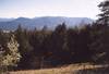

MS: There's a good quality gravel road up the south side of Monumental. From 3 miles south of Colville, turn west on the Orin-Rice Road and go 9.0 miles to a gravel road on the right, unsigned except for a sign warning about private property, no trespassing 2.2 miles ahead. This turnoff is just east of the South Basin Road. I expected to be turned back by a gate or 'no trespassing' signs at 2.2 miles, but never saw anything that would impede our progress until the gated spur going the last few hundred yards to the summit. -- Martin Shetter, May 26, 2007
EN: "I took the same route as Martin. This is a pretty good road and goes right up to the ridgeline and to the gated summit spur. No gates. Right at the turnoff from Orin-Rice Road is a handmade sign saying 'Private Property 2.2 miles No Trespassing'. One could interpret this to mean either Private Property for the next 2.2 miles or Private Property 2.2 miles ahead as Martin interpreted it. I assumed it meant 2.2 miles ahead. As I drove the road, I passed several driveways to cabins or trailers. Eventually these cabins ended somewhere below 4000' and it was just dirt road through the forest to the summit. Therefore after the fact I came to a slightly different conclusion about what the sign meant but by then it was too late to correct my errant ways. The area right around the summit shows as DNR land on the Colville NF map. Given the lack of gates and no houses right along the road, I probably wouldn't worry about access too much on this one. It's a good thing this is a quick driveup because I can't say there is much about this ugly summit to make it worth spending more time on. On the way down, I chased five wild turkeys and a scrawny moose down the road. The moose stared me down for a few minutes and then slowly trotted down the road in the way I need to go. I slowly followed him for a good mile before he finally headed off to the side into the brush. My moose meeting made Monumental Mtn mildly memorable. --Eric Noel, September 28, 2007
Moses Mountain
Elevation: 6774 ft Prominence: 4134 feet (Rank: 16th out of 144)Moses Mountain (map) was not named after the Egyptian adoptee-outcast-exoduser-pharoah befuddler. And it was not named in homage to Charlton Heston. No, it was named for Chief Moses of the Colville Indians. It is appropriate that this mountain be named for a former Indian chief, for it is the most prominent mass of earth for miles around. In fact, with its prominence of 4,134 feet, you have to travel over land about 40 miles northeast to Copper Butte (4740P) and about 60 miles northwest to Remmel Mountain (4365P) to find a more prominent peak. The former can be seen from Moses' summit. I'm not sure about the latter. Moses is, in truth, the most prominent mountain in Washington without a dedicated summitpost page. Does it deserve one? I suppose it is no more or no less deserving than Mount Spokane.
The mountain is a solitary dome with a little brother of a summit to the north (5,963-ft Little Moses Mountain) and is located in the Okanogan Highlands about 13 miles north of the Columbia River. It is part of the Colville Indian Reservation and the summit should be attempted with the knowledge that you are trespassing, but not in a completely illegal sort of way. The reservation police may hassle you or they may not. The summit of Moses possesses what is said to be the tallest lookout in a West Coast state. You can't climb up it, ordinarily, though, so you have to walk the large, flattish, semi-treed summit area to find the views in the various directions.
There is a switchback-bitten and pothole-pitted road that winds its way up the mountain's southwest side starting from the road up Trail Creek. This road is accessed via Hwy 155 to the west. It is also possible to get to the summit road from the southeast side from the road in North Star Creek. The summit road is so bumpy and sometimes steep (especially in the tight switchbacks) that I thought my old Honda Civic wouldn't make it, but it did, but not without a near calamity at the top. A high clearance or 4WD vehicle is recommended. And if the road is wet or it's raining, you'll have even more trouble.
PK: "I was able to drive all the way to the summit. The last stretch of road was actually an improvement. The top is occupied by an assortment of run down buildings, a small radio facility, and a very tall metal lookout tower. This tower must be 100 ft high. Roper mentioned that it might be the tallest lookout in the west. I certainly haven't seen a taller one. Unfortunately, the bottom flight of stairs had been disassembled to keep visitors from going to the top. I could have used the views from up there as the ground itself is largely tree covered.
"I left the car running and popped the hood. What had happened is the floppy plastic plate the battery rests on had come free and slid into the radiator fan. I extracted the plate and threw it in the car. Everything else seemed to be fine in the engine compartment. What a relief...or so I thought. More on that below.
"So I took in the views (including Copper Butte far off to the NE), visited the summit boulder with geodetic marker on top, and inspected some of the ramshackle buildings. On returning to my car I noticed some very green liquid spewing from underneath the right front side of the engine compartment. What the! Uh-oh! I again popped the hood to investigate. Radiator coolant was boiling out of the excess coolant bottle next to the windshield washer bottle. Uh...not good. Well, at least the radiator hadn't blown its top. I quickly jumped in the car and began down. The engine temperature gauge was maxed out. I figured I had overheated the radiator fluid in my haste to get up the mountain as quickly as possible. I could coast most of the road (bad for brakes but no work on the engine). Immediately the temperature gauge backed off (more technical analysis below as to why). I was able to get back to the main road thence to Omak. From there I had an uneventful drive home by way of Blewett Pass and I-90. I was back home by 10:30PM.
"Postscript analysis of events leading up to overheating radiator:
1. I am now on my third bungee cord to restrain the battery (bad Honda design). The other two had lost all their bungee. The second one, which was still in the engine compartment at the time of driving up Moses Mountain, was no longer able to keep the battery on its platform on rough roadway
2. The extremely bumpy road had knocked the battery off the platform and the floppy plate underneath it into the radiator fan, which is a few inches away
3. The plate impeded the fan's spinning and made a clattering noise
4. Unbeknownst to me when I looked under the hood and extracted the plate at the summit, the fan had actually ceased working
5. The car left idling could not bring air past the radiator to keep the fluid inside cool. That's what the fan is for in case you're not moving. So, in the time I was gone from the car, the fluid temperature rose until it was boiling out of the overflow bottle
6. As soon as I got rolling the ambient air could be moved past the radiator thus cooling the fluid. This is why I no longer had problems with driving. Albeit, I now need to replace the coolant that was lost
7. Yesterday I realized I may have simply blown the fan's fuse. So checking it, that was indeed the case! All right! Fuses are easy to replace; fans not so easy. Hindsight is always easy: I should have turned the engine off at the summit. I only kept it running because I feared whatever had happened to the engine might not allow me to restart it." --Paul Klenke, May 31, 2004
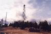

Muller, Mt.
Elevation: 3748 ft Prominence: 2598 feet (Rank: 75th out of 144)Mount Muller (map) is on the north side of the Olympic Peninsula, and is the high point of the long east-west ridge separating Highway 101 and Lake Crescent from the Strait of Juan de Fuca.
"We tried to take the short route to Muller which Martin mentions below as it seemed like the fastest option. However, the 3040 road has now been been bermed and decommissioned. I've run across a fair number of abandoned or overgrown roads where several hundred feet on both ends have been torn up to keep vehicles out but none like this. The really bizarre aspect of the way the FS dealt with this road is that not only did they block off the ends but they dug up the roadbed for a good six miles between the FS 3067 junction and the FS 3068 junction. Then they dropped seed and hay over the while length as well. So this roadbed now consists of a sort of mushy gravel with an uneven surface such that it makes for slow walking and it would be terrible to bike on. I found it easier to walk on the side of the road in the brush where the ground was at least firm. Aside from the annoying surface, the berm location also forces an additional five miles round-trip of road-walking on the approach if you were to walk from the FS 3068 junction so I would recommend skipping Martin's route given the changed road conditions.
"Because we had tried to get up FS 3040 from the East and then the West we wound up at the junction of FS 3067 and FS 3040 with the clock ticking down due to the short November daylight. So I suggested a route using a short bit of the road and then a connection with the ridge trail coming down from North Point. This actually turned out well. We hiked the old road for 3/4ths of a mile until a point where the ridge comes to a very low saddle. We easily gained the trail as it is only maybe ten feet above and fifty feet South of the road. From here we just followed the ridge trail all the way to Muller. There was one section as we dropped down from 3480+ where it was a bit overgrown but it was no problem to follow it. A brief side trail which is signed leads you the last bit up to the very top of Muller. On the return we went to the four way trail junction a couple miles West of Muller. We decided to drop down to the road due to impending darkness as roads are often easier to walk with headlamps than trails. As mentioned before though, the road makes for some lame hiking so I strongly recommend against this.
"The ridge trail actually was through pleasant forest for the most part and in some areas it is out in the open. This yielded views of Olympus, Muller, Lake Crescent and occasionally out to the Strait of Juan de Fuca. The ridge trail is probably at least as scenic as the standard loop route from the South which I suspect stays mostly in the forest. While the net gain on our route is a lot less, there are a lot of ups and downs on the trail and so there is probably nearly as much gross gain as the loop route so overall it is probably about ten miles and 2500 feet of gain." --Eric Noel, November 16th, 2008
The shortest way to bag Muller would be to take FR-3040 off of Highway 112 on the north. From this point you should be able to find a 0.5-mile-long connector trail that leads up to the ridge and the Mt. Muller Loop Trail; from there just follow the trail along the ridge two miles east to the summit.
A funner option is to do the entire 13-mile loop trail on a mountain bike. The trail is well signed and maintained, and it has a good grade and surface for riding. To find the trailhead, drive Hwy 101 about four miles west of the west end of Lake Crescent and look for a big brown sign pointing out the turnoff for the Mount Muller Trail. The trailhead is about a quarter-mile north of the highway, elevation 1050 ft. The trail, not shown on most maps, ascends north to the ridgetop at the point where the aforementioned short connector from FR-3040 joins, then heads east for two miles to the summit and another 1.5 miles east before dropping back down to the south. The trail continues along the valley floor two miles back west to the trailhead (Hwy 101 trailhead), or you can find your way over to the highway and ride it back to the start. On my visit there were only a few tiny snowpatches on the trail. I've been told there are fine views of the Olympics and the Straits from Muller, but none were to be had on this day. --Martin Shetter, May 19, 2007
Natapoc Mountain
Elevation: 4204 ft Prominence: 2124 feet (Rank: 120th out of 144)Trip Report from June 2006 (Dean Molen)

North Mountain
Elevation: 3840+ ft Prominence: 2200 feet (Rank: 109th out of 144)A dedicated North Mountain has been put up on Summitpost. Click here.
North Mountain (map) is a mountain and it is north of Darrington, the sizable town in the vicinity. Darrington is a logging town and North Mountain's many board feet of lumber no doubt get processed there. North Mountain is an odd bird for inclusion onto the 2,000 prominence list. It is plainly visible to the north as you drive Highway 530 east into town. The mountain generally is very green and uniform save for an ugly clearcut patchwork on the lower slopes. Looking at this mountain, one would never guess it has 2200 feet of prominence. But it does, owing to the low saddle at Texas Pond 3.5 miles north of the summit. The North Fork Stillaguamish River tumbles along North's western base while on the east the mightier Sauk River flows. And with this, North Mountain exists as a sort of lesser isle of the coniferous archipelago that is Logger's Island (see the second paragraph in the Overview on this page).
The top of North Mountain is comprised of two summit points: a northern 3,824-ft top with a lookout and a southern 3,840+ top. The former provides a good all-round viewpoint and a good road leads all the way to the top (but you can't drive the road necessarily due to a gate). The latter really only has views to the east and north. It also has going for it an odd subsidence about 50 yards south of the summit: an open area of rocks appears to be sliding or dipping eastward like a fault scarp.
EN: "I drove this mountain after work on a weekday in September 2004. This would have made it my second P2000 in Washington. The only problem is that I didn't realize until later that the highpoint was on the forested area to the south and not at the lookout area which was what I visited. With my conscience nagging at me since then, I was able to talk Greg into doing this peak after we had finished with Dock Butte. We drove most of the way to the top but were sadly blocked by a gate with an attached info notice. Apparently this road is closed as of 4/21/07 right here. You'll note that the map shows another road right at that location, this is a grass and dirt spur road to the right, more on that later. The posting invokes whatever legal reasoning they have and given that they posted a legal notice and map rather than just locking a gate I would guess that there is a good chance this is a permanent or long term closure.
"We took the obvious option and hoofed it up the road to the lookout. This road is in good shape and could be biked since it can't be driven [the entire gravel road approach is in good shape and passable to passenger cars]. It's about 1.25 miles one way to the lookout from the gate. I was rather annoyed at having to walk this good road that I had driven before and thought that walking this road kinda sucked. After reaching the lookout, we climbed it because that is about the only way to get a view above the trees. We could see the forested area to the south. We dropped from the lookout road off the edge to the south and started bushwhacking. The terrain was not steep at all but mostly dense young trees, dead branches, a little slide alder etc. In time we hit the remnants of an abandoned undriveable road that went North South. It was quite overgrown with branches but it was better than the forest, at least in places. We followed this and some white flagging, continuing on to the south. Eventually the road got worse, pretty bad and we followed the path of least resistance in the right direction while trying to stay near the ridgetop. The flagging was still spotted here and there which was of a little bit of comfort since I'd underestimated this and we hadn't even brought a map, compass or GPS. In time we reached what seemed to be the highest ground, at a little spot where we had a view of a little ravine which I believe is the sliding escarpment that Paul mentions. It was forested here but open enough to see and there did not appear anything higher around. We were gonna angle NW and try to hit the good road there and cut off some distance but the going looked lousy. As the terrain was sort of drawing us back north anyway, we decided we should maybe just go right back the way we came rather than venture into the unknown brush to the west. So that's what we did, following pretty closely on our ascent route. We hit the abandoned road and followed this all the way back. At one point it appeared to be fading out but it quickly improved again. While still brushy, this is definitely the route you want to take most of the way. Eventually this verdant verde viaduct spat us back onto the lookout road about where the words "Lookout Tower" are written on the map. If you are walking the road on the way up, look for a fairly indistinct indentation in the brush and a bit of white flagging for this path. Upon reaching the road I was absolutely ecstatic at the prospect of walking this brush free zone which before had seemed a hot, boring and tedious roadwalk. And so we did walk it, back to the car.
"The brush is fairly unpleasant. It's class one basically but you need to be a little bit careful that you don't bash yourself right off the ridge edge which did have dropoffs in some places especially on the east side of the ridge. But really this "climb" is sort of in the Cascadian category of easy but unpleasant. No tricky crux to stop you, but a little bit of suffering will be required. As mentioned earlier, there is one other possible approach. You could try to drive that dirt and grass road that goes east from the gate. It may not last long and it may require 4WD, I just don't know since we didn't try it. Conceivably though this could get you up to about 3680 if you could drive it to the road end on the map. If driveable to the road end shown on the map it would perhaps be a slightly shorter off-trail distance than our route and it cuts off the road walk portion of the trip. In your wildest dreams, you might even hope that the lumberjacks have punched the road even closer to the summit than is shown on the map. On the other hand, you'd have to fight up and down through the brush while our route was more flat and we did benefit a bit from the abandoned roadbed. If I were to do this again I would try driving that spur road just in the hopes of getting lucky and finding that I could get even closer than the endpoint of this road shown on the map. But barring that unlikely bit of good fortune, I'd be inclined to repeat our exit route. Long pants and shirt are recommended and gaiters might not even be a bad idea. Going up the lookout is a good idea, in part to get a view of the true summit and intervening terrain. Also, it is worth visiting the lookout because the view from there of Darrington area peaks like Whitehorse is frankly about the only redeeming feature of this peak. Given the low elevation and relative accessibility of this peak, I would definitely consider it as a winter hike option. I don't think there were any gates until the one at the location noted above so you could drive to the snowline. Road are always more pleasant to snowshoe than walk in my opinion. A decent snowpack might put you above some of the brush, plus it wouldn't be leafed out. So I would strongly consider that option if I were to do this again, which I sure as hell won't."--Eric Noel, July 14, 2007
North Baldy
Elevation: 6173 ft Prominence: 2173 feet (Rank: 114th out of 144)North Baldy (map). PK: "I was stymied on the approach road by snow at around 4,600 ft. But this was expected. I couldn't get up to the ridge road on the south so took to one on the west slope. I parked here (c. 4600 ft) and immediately took a nice overgrown logging road steeply upward toward the summit. I came to another better (but snowy) road and began to plunge through the snow too much, so I left it for forest. The final south ridge to the summit was nice open grass. A great viewpoint--especially for snowy peaks in northern Idaho. Maybe 70 minutes to get up. I can't remember. For the return I dropped off the west side back to the road. That was okay but further beelining found me knee-deep in unconsolidated white muck among brown brush. Now I know why you never see bees playing in the snow." --Paul Klenke, April 25, 2005
DM: Ken Jones and I took the Mill Creek road up to Pyramid Pass, where we turned north (signed) for the lookout. It is evident from the moment you leave the pavement that active logging is still going on in this area so weekdays may not be the best choice if you don't enjoy meeting logging trucks on narrow roads. It is a bit over ten miles to Pyramid Pass and the key is to just stay on what appears to be the most traveled road, as you always take the uphill roads that aren't spur roads. It is roughly 4 miles to a saddle where anyone without high clearance and 4-wheel drive should park and walk. The road from this point on is NASTY like driving up a bouldery streambed. I managed to drive my Tacoma truck up to the top but I was never comfortable with what I was attempting. If it hadn't been so miserably cold I would have walked it from the saddle.
My odometer showed 14.8 miles from the pavement to the top and it took about an hour of driving time. --Dean Molen, June 9, 2007
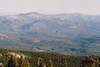
Old Dominion Mountain
Elevation: 5773 ft Prominence: 2373 feet (Rank: 95th out of 144)Old Dominion Mountain (map). This is a peak that can be driven all the way to the top once the snow melts away. It is seven miles east of Colville in the northeast part of the state.
PK: "In the morning while car repairs (see Snyder Hill below) were to take place I climbed up the behemoth looming to the east (Old Dominion Mountain). I got a ride from a mechanic from Colville to the base of the mountain here (c. 2900 ft) and began hiking up the tapeworm road on that side. The road shows an end at ~4,200 ft but it actually goes farther. New construction has extended it all the way around to the north side of that ridge at ~4,600 ft above White Rock Canyon. Oddly, the road construction ended abruptly halfway across a steep rocky face. If they intend to go farther then it'll become even steeper with much blasting necessary. At any rate I had to climb up the mossy rock (Class 3) to regain the ridge (I'm not going back that way, that's for sure). I came upon the National Forest boundary and soon thereafter lots of trees with blue bands spraypainted around their girths about 5 feet up. These painted trees continued on for the rest of the ridge, which I took to the summit road that crosses it. I followed the road a short distance then went cross-country for the final 400 vertical to the top. Another good view summit. A thick-walled building surrounded by stone with an equally-thick door was the only interesting thing there (there is no lookout tower as Topozone intimates). It looked like a fall-out shelter of sorts but I later figured it was a defunct radio facility building. I think it took about 3 hours to climb up.
"For the return I descended straight off the lower SW Ridge and was back to my starting point in not much more than an hour. With a hitchhike I was able to get back to my fixed car ($200 bill) by 1:30PM. This gave me enough time to finish the day with one more nearby 2kP peak." --Paul Klenke, April 28, 2005
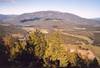
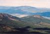
Prophet, Mt. (no info)
Elevation: 7640+ ft Prominence: 4000 feet (Rank: 18th out of 144)No information yet.
Rattlesnake Mountain
Elevation: 3480+ ft Prominence: 2520 feet (Rank: 80th out of 144)Rattlesnake Mountain (Map) is the name for the long, high ridge south of North Bend. The ridge forms the highest points of land in the Raging River drainage on its south side. Rattlesnake Mountain's summit is the highest summit west of the Cedar River. This includes all of the peaks in the so-called Issaquah Alps (Taylor Mountain, Tiger Mountain, Squak Mountain, and Cougar Mountain). There is a new/renovated trail to the highpoint from the east from a continuance of the Rattlesnake Ledges Trail. Allow no more than two hours to make the summit from there (roughly 1600 feet of gain). Roads can also be biked from the west (from the Raging River drainage) but these are longer.
DM: "The best way to hike this mountain is via the Rattlesnake Ledge trail. See the summitpost page for Rattlesnake Ledges information on access and how to get to the ledge area. Continue on up the trail past the ledge(s)for another 2.4 miles and an additional 1500 feet of elevation to get to the highpoint which is next to a tower. A benchmark is found nearby and, to be safe, check out the two or three spots that could vie for the highest spot. You won't find the trail on any map of the area since the trail is a recent addition and the recipient of quite a bit of work. Nice signs and other touches impress one as you follow the trail upward. Near the highest spot are a couple benches and one looks down on North Bend. Figure on a 2-3 hours up. 8-9 miles roundtrip with 2600 feet of elevation gain."
Red Mountain
Elevation: 5880+ ft Prominence: 2560 feet (Rank: 76th out of 144)Dean has now put up a dedicated page for Red Mountain. Click summitpost here.
A trip report for a snowshoe ascent can be found at NWhikers.
EN: "After seeing the scenery in the above report, Red Mountain moved up my to-do list for this year. With a trailhead that is accessible in May and a convenient location partway between our respective homes, Dean and I decided to hook up for a try at this peak. Originally, I was hopeful that we might even be able to drive a road that snakes up the north slope of the mountain to approximately 4000 ft and then traverses east for a ways with the trail meeting it. That starting point would have given us an easy day. That plan didn't last long as we hit snow on the road just past the lower trailhead which is located at about 2600 ft. It looked like this was going to be a snow hike. So we parked there and headed up the signed trail through patchy snow.
"For the first bit the trail was easy to follow with a mix of bare trail and patchy snow. We soon hit a junction with a former roadbed not shown on the map at around 3100 feet. This area has seen some selective logging in the past. The trail became fainter and we lost it for a moment. I believe the trail forks here and the main trail crosses over to the other side of the creek. There was snow here so we lost the trail. We saw no bridge across the creek though we didn't look very hard. There was more vegetation down there in the drainage too so it didn't look too appealing. So we elected to take the right fork (we never really saw the split) which was really more of a bootpath. This path stayed more on the ridge and while we were generally able to follow the path there was a bit of light brush and places where the trail seemed to disappear. We eventually hit the unmistakable road which crosses the trail at about 3800 feet. With the snow cover we were unable to determine if this road can and is still being used at all. Above here the terrain looked consistently snow covered. We could have gone left on the road for a few hundred yards and then tried to go up the gully where the trail is. But the snow slopes right above us looked moderate enough that it would make a decent route so we went slightly right on the road and then up the slopes. This was typical forest and the snow was hard but not really icy so it provided us quality footing for the ascent. It was consistently steep. We needed to gain about 2000 feet in one air mile. We headed up slope for a bit and soon the northeast ridgeline came in on climber's right. We stayed pretty much on the slope just on the south side of the ridgeline for maybe 1000 feet of elevation gain in the forest.
"At perhaps 4800 ft the trees started to thin out to open slopes and the snow got softer. Clouds were moving in and out quickly with light snow but nothing that had us worried at all. We were sinking in a bit here but not horribly so. If it had been flatter then snowshoes might have been in order but it was steep enough that we never pulled them out and soft enough that the crampons and ice axes stayed our packs as well. The grade seemed to increase a little bit the closer we got. Or maybe I was just getting tired. There really was no navigation needed, we just stayed left of the ridgeline and that went right towards the top. When we were maybe three or four hundred feet below the top it become obvious that what we were seeing was the north and south summits. We headed left towards the south summit as reports indicated that was the higher of the two contours. We summited but I thought we hadn't, that the north summit looked higher. Nope, the south summit was clearly higher once I looked at it from the other side.
"We didn't stay at the summit for very long, as we had taken a while to get up this mountain. We headed down and the first thousand feet were fairly easy through the soft snow. Ice axes out but the snow was soft enough that were in control. Then we hit the forest. The going became slower as the snow was harder making for worse footing. Plus we had to weave in and out of the trees which slowed us down. This became a bit tedious pretty quickly. But we plugged away and were at the upper road in due time. We found the jumping off point and Dean skillfully led the way back down the same way through the brush where we eventually hit good trail for the final bit. All in all a good trip. The trail was a bit less maintained than I would have guessed but I suspect the gully trail may be in better shape. The upper portion of the mtn is quite pretty and features expansive views of the area. There was no real tricky obstacle or scrambling to be done. Just up up and up the snow. We took snowshoes, ice axe and crampons but only really used the ice axes on the descent. With firmer snow though we would have used crampons. I know others have used snowshoes on this trip but it felt a little bit steep to me along our route for snowshoes. I'm told this can be done in three hours, it took us a few more minutes than that for our trip. Some of the other mountains on this page are not particularly scenic nor are they interesting climbs. This mountain is a good one in both of those regards." --Eric Noel, May 4, 2007
 |
 |
Rock Peak
Elevation: 3320+ ft Prominence: 2000 feet (Rank: tied for 142nd out of 144)Rock Peak (map) is the dumb official name for this, the highest and quite unrocky summit of the twisted-like-tree-moss mess of ridges and valleys at the extreme southeast corner of the Olympic Range. The island of low elevation ridges is bounded by the Skokomish River on the north and east and the Satsop River on the west. The south drainages of this island flow south to the Satsop River thence the Chehalis River. Rock Peak, at 3,320+ ft elevation, only barely qualifies for this list with its exact 2000 feet of prominence (owing to the low 1,320-ft saddle immediately southwest of Spider Lake).
There are two 3,320+ tops making up the summit of this peak. The two tops are very close to each other and require only a 5-10 minute thrash (it's not that bad) to go between them. I don't honestly remember which is the higher of the two but I want to say the southwest top is the true summit. As stated, Rock Peak isn't very rocky (except for a short bit of Class 2/3 scrambling up an exfoliated rib at the (current) borderline between its clearcut north slope and uncut south slope. This scramble is on the northeast side of the northeast top. About the only worthy aspect of this summit is its great view to bigger Olympic peaks to the north, peaks like Mount Ellinor and Mount Washington.
The fortunate thing about Rock Peak is it is easy to drive to within a couple of hundred vertical feet of the summit. There are a myriad of logging roads snaking around these foothills of the Olympics. One of them (FR-2352) traverses sort of east to west. [The reported washout and boulder are of no consequence (gone?), thanks to KR.] In the process it goes past the northeast top at about 3,150 ft. Simply park on the somewhat narrow road and make a short climb up through a relatively new clearcut to the two tops. This will take about half-an-hour round-trip.
DM: Ken Russell just related his recent experience on Rock Peak and I share the info here:
"I just got back from Rock Peak. I think the new trees have closed in since Paul Klenke was there. I took more than an hour to tag the two summits. I took my level but something broke loose inside and I couldn't sight through it. I recommend parking at the wide corner on #2352 adjacent to the north side of the middle summit. There is a large rock face beside the road. I chose a route and scrambled up to the right of the rock face. I traversed to the West summit and then went straight down to the road from the saddle."
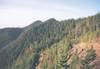

Rogers BM
Elevation: 5775 ft Prominence: 3015 feet (Rank: 52nd out of 144)Rogers BM (map). This mountain is more or less drivable to the top. Road 500 on the south and southeast should get you fairly high on the east side thence to the north ridge. But there is a route from the west side too...
PK: "I had initially intended to do this 2kP peak from the east side but my itinerary revision was now leading me past the west side. I had been warned of the nature of the folks in that neck of the woods, but tow truck drivers (see Snyder Hill below) often spin yarns or make tales more dire than they really were to keep the dialogue going in the cab. So when I initially took a wrong turn on the way up to the Van Stone Mine (ugly scar below the west side of the peak) and found myself at a trashy row of houses I began to pucker. Fortunately, a nice gentleman came out of his front door with nothing long and cylindrical in his hands. He gave me the correct directions to the road up the mountain. I took these directions to a nice car camp here (c. 4600 ft). The next morning was cold (~35F). I walked the road most of the way to the saddle and contemplated doing Mt. Rogers too but seeing how lame it looked as a destination I opted against it. I found the trail and took it toward the 2kP summit. Some good views depending on the direction. For the descent I went straight off the west side. No problems. The easiest thus far. And to think this was one of the 2kPers I was worried about most (I'm not sure why). Back in my car, I rushed down the road avoiding the crossfire and ignoring the local cult membership billboards. One more 2kPer to do and I'm going home." --Paul Klenke, April 29, 2005
DM: "The west side route Paul describes above is now gated and locked. We tried every road over there but no luck. However, the good news is that they cleared the log blocking the road beyond the horse camp on the east side and you can drive all the way to the trailhead. A great trail awaits you. 2.5 miles and 1100 feet. Four of us did it together: myself, Grant M., Bob B., and Duane G." --Dean Molen, June 16, 2007
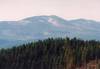
Ruby Mountain
Elevation: 7408 ft Prominence: 3888 feet (Rank: 21st out of 144)Redwic has put up a dedicated SP page for Ruby Mountain. Click here.
Trip Report for a winter ascent in January 2005 (Paul Klenke)
Silo Mountian
Elevation: 4150 ft Prominence: 2430 feet (Rank: 90th out of 144)Silo Mountain (map) is an unnamed peak on the western fringes of the Cascades near Mount Vernon. You can find it on the map just to the east of Haystack Mountain, from which the Silo association was surely derived. Like most of the other sub-5000-ft peaks in this part of the state, this is logging territory. The land is the property of Longview Fibre Company and the tree farm roads are gated, as almost all private timber land is these days. Fortunately, the signs near the gate indicates that the land is accessible to the public for non-motorized recreation on the weekends only. Based on the lack of trash or fire rings that we saw on our ascent, I would assume that the gate is never opened to the public even during hunting season.
We parked at this gate at the very unimpressive elevation of 150 feet above sea level. Ken had suggested bringing bikes and, while I was not sure this would be worthwhile beforehand, it turned out to be the correct choice. The road is in very good shape for biking with a good hard-packed dirt surface. It gains elevation at a modest but consistent rate--never steep but also never flat or downhill on the ascent. We pushed our bikes the whole way up but I can imagine that if one were more of a bicyclist than either of us, he/she could ride up this road. The ascent is very simple, just stay on the main road until the junction marked at 2952 ft. We parked our bikes a little bit before this junction as the snowcover was setting in with consistency. From the 2952-ft junction you'll just switchback up the ridge until reaching the 3735-ft saddle near Haystack.
From that saddle you want to continue on the main road, which now extends closer to the peak than is shown on the map. You'll get a few glimpses of the forested top of Silo ahead. Soon a fork will be reached as you approach the 4080+ knob to the west of Silo. Go left and as you round the corner you get a good look at the final hike to the top, which is 150+ vertical feet and no more than a fifth-of-a-mile away. The road soon reaches another junction a few yards north of the saddle between the 4150 summit and the 4080+ knob. Here we elected to go right for approximately 100 feet and then go left up the ridgeline as this looked a bit flatter than just heading up the slopes we could see. This turned out to be bad brush of tightly spaced young trees with downed logs to crawl over. We made it but you absolutely do not want to go that way. Instead, the better route is to go left at the last road junction and just go up the steeper but much more open slopes on the NW side of the peak. The top is fairly open regrowth without a distinct highest point.
Our descent was fairly uneventful. We took a pass on bagging Haystack Mountain as we'd had enough off-trail for the day. On the way down, we were in a very thin snow layer for much of the first 1000 vertical feet of descent. Once reaching the bikes we bundled up and glided down the road the entire way on our bikes. The round trip was 15-16 miles and 4000 feet of gain which we did in about 7 hours. I'm a slow hiker but our pace was pretty brisk considering my speed and the fact that we were pushing bikes uphill. The terrain the road slithers through is boring and ugly clearcuts or replanted land. You do get views from along the road, especially of Twin Sisters and the other hight-prominence peaks around Bellingham, but there are no views from the summit.
Silo is for peakbaggers only unless you just want some exercise. I highly recommend taking a bike. The corollary to that is that to get utility out of your bike you don't want a really low snowline so maybe the dead of winter is not the time for this peak. But you won't want to burn a summer day on this ugly duckling either. Fall or Spring would be the right time. --Eric Noel, November 24, 2007
Snyder Hill
Elevation: 5440+ ft Prominence: 2480 feet (Rank: 83rd out of 144)Snyder Hill (map). PK: "After Abercrombie Mountain there was still time to tag the 2kP peak to the SSE (Snyder Hill). I drove up the logging road cutting up the steep slope from the west shore of Sullivan Lake. Based on my albedo observations from Abercrombie I knew I wouldn't be able to drive all the way to the highest roads just below the summit. Once again, a shaded stretch of road stopped me, this time here (c. 3750 ft). Easy road walking got me to where it crosses Sand Creek at 3,920 ft. For a dirrettissima assault I took the eastern of two overgrown roads leading up the creek. The road began with windfalls and ended with mushy ground. At 4,240 ft I took a steep "spur" left through a clearcut to meet the regular road due north of the summit. Leaving my unneeded pack and snowshoes behind, I took to climbing a minor rib in the ravine at the corner there. Too much windfall made it less than enjoyable but the summit was attained in good order. However, this was a boring affair. If it weren't for the new benchmark there (placed in 1992) with "Maitlin" stamped into it, there wouldn't be anything to see, for the summit is completely enveloped by xylo-denizens. Nope; no fenestrations through the forestation.
"When I got back to my car I was sure glad I had turned it around to face downhill. I always do this anyway just in case I have to roll it for a compression start due to a dead battery. Well, in this case my battery was fine but the right-front CV joint was dead. Like the three or four that had come before it, it had pulled out of the transmission thus rendering my drive train powerless. I was glad I had turned my car around because I was able to coast the 2.8 miles down to Lake Sullivan Road. It would have been interesting seeing a tow truck tug me out of that tight spot up the logging road.
"A forest service guy stopped by and I told him my predicament and that I would sleep there in my car for the night then walk the 1.5 miles to the district ranger station at the north end of the lake to deal with towing issues in the morning. He told me the Homeland Security/Border Patrol guys would be paying me a visit during the night. They never showed up (until the next day) but a Sheriff's deputy did at bedtime. My name was apparently laughed across the scanner airwaves that night: 'This is Deputy Peterson checking in. There is some peakbagger here at Lake Sullivan going by the name Paul Klenke. He's driving a piece of shit Honda with a busted CV joint. He's not a terrorist; just a loser.'
"I eventually got myself towed to Colville (100 miles roundtrip for truck; $175 hopefully to be reimbursed by my insurance company) where I would have to wait until about noon the next day to get the new joint put in. Ironically, it had to be shipped from Seattle via UPS. If I had known it was going to go out I would have brought it over myself thereby eliminating the $8 freight cost." --Paul Klenke, April 26, 2005


Storm King Mountain
Elevation: 4750 ft Prominence: 2230 feet (Rank: 106th out of 144)Storm King Mountain (map) is the highest point in the small range east of SR7 between Elbe and Morton and surrounded by the Tilton River on the west, Mineral Creek on the north, Mineral and Gallup Creeks on the east, and the East Fork Tilton River on the south. This is private timber land, but happily the West Fork Timber Company allows hikers/bicyclists on their roads, making this peak accessible to the public. It may also be possible to get permission to drive the roads while the gates are open (they were open on September 22, 2007, but this is the first time I’ve seen them open) by calling the company at 360-446-3813 during business hours.
Grant Myers and I parked near the gate on the north approach to the peak here, and proceeded south on our mountain bikes. At the 5 mile post is a junction. Turn right and cross Mineral Creek, heading south up Gallup Creek. At this junction turn right and head up the switchbacks toward the peak, your eventual target being here, where you’ll find an overgrown track heading up the ridge toward the summit. This track peters out after a short distance, but the bushwhacking is not bad near the ridge line. Near the top the way opens up for the last couple hundred feet or so. We were in fog, so had no views, but I’m sure that with visibility the views would have been terrific. There’s a small building and some sort of radio facility on the summit. --Bob Bolton, September 23, 2007
Ten-Four Mountain
Elevation: 4384 ft Prominence: 2744 feet (Rank: 65th out of 144)Ten-Four Mountain (map) is the unofficial name for the highest point among the mass of ridges which are somewhat detached from the main Cascade Front in the vicinity of Monroe. The massif is simply a logging mecca with a web of roadways and a patchwork of clearcuts. The massif is visible from Seattle. It is the massif's logging aspect which gives Ten-Four its name, good buddy.
The Ten-Four highpoint is about five miles due west of the familiar hiking destination of Mt. Persis. And, by virtue of the low 1640-ft saddle between the two peaks, the highpoint attains a respectably large prominence. This was my 52nd of the 144 2,000 prominence summits in the state.
As a viewpoint, though, Ten-Four is all sixes and sevens. There are no views from the highest point, which is a choke of large trees. This is not old growth territory and the trees are rather large, so maybe the summit is due for its next shave. Until that time, you will have to take in views where you can find them (probably at one of the many logging roads).
There is more than one way to climb this peak and roads offer access to a slingshot's hurtle of the summit. A route from the northeast from Proctor Creek is feasible (taking the good road to the saddle south of Haystack Mountain then SSW up the valley to the Duffey Lakes, whereupon some amount of cross-country up steep hillsides should be expected). This would be the hard way. The easier ways are from the west. There is a road here to Airplane Lake. There is a gate near that turn off. If it's open, you can drive to within a short distance of the lake. The last few hundred yards are quite steep and might stop all but the 4WDs out there. A bike is handy from here (and especially from the aforementioned gate, should it be locked. From the outlet of the lake, take an old road (now rocky) WSW to the ridge crest about two miles west of the summit. Once on the crest, simply take the logging roads back east on the south side, taking successively higher roads as you arrive at them, until you are just below and short of the summit. A hundred or so yards of brushy, annoying regrowth bars efficient access to the tall trees and summit beyond, but you can force your way if you have the resolve, which you probably will if you've got this far.
PK: "The road to investigate is the one that leads up past Pt. 1928 thence to Airplane Lake (3,060 ft). Well, the gate was open right at the main road. Well if the gate's gonna be open I'm gonna drive the road. The road goes past a new green cell tower on the left. After narrowly missing plowing headlong into three women and four llamas, I carried on about 7.5 miles to a steep, rocky section of road that I couldn't get up (c. 2,500 ft). Parking there and seeing my good fortune that the road was open (one of the llama ladies said the gate has been open a lot recently), I decided I'd give Ten-Four a go from this side. I had my USGS map and my bike. The road ends at Airplane Lake. You could get there with a 4WD--especially one with higher clearance. The lake itself was in the fog. I could hardly see it even though it was right in front of me.
"From the lake's outlet, a 4WD road leads WSW to the ridge crest above next to a radio facility but I never saw any towers there. Another nice thing was the fact that I had climbed above the cloud deck. I was now in the blaring heat. Once on the south side of the ridge, I was able to bike in a hot sweat most of the remaining 1.7 miles to the end of the uppermost logging road (c. 4,000 ft) a quarter-mile west of Ten-Four's summit. Ah, so close yet so far, for in between the two was a few hundred yards of that brush we all can't stand (even me): the type of brush that sets up in logging regrowth areas. If it's not the tight spacing of small conifers it's the stickers, alder, and sundry other scrap wood, etc.. Fortunately, this didn't last even though it felt like it took an eternity to get through. The last several hundred yards to the top is under the big trees (land within the National Forest) so the brush is minimal (mostly small conifers). The summit (Pk 4384) is not a worthy destination unless you're a peakbagger--specifically a 2000P peakbagger. There are no views unless you hunt for them (a good promontory about a hundred yards east provides respectable northside views from Pilchuck all the way around to Index/Persindex).
"I left a make-shift register by way of a white film canister and a long strip of paper torn from my "Gold Bar" Quad map. I left the register five feet above ground wedged between two trees at the summit, which consists of three trees atop a root tussock.
"It took me 2 hours to get up from the 2,500-ft level of the road to Airplane Lake (about 0.7 miles before the lake). With the nice ride down except for the very rocky 4WD road (walked that part), I got back to the car in an hour, but not before stopping at the lake to take some pictures of a man unsuccessfully angling for trout. It's a pretty lake, really. Even the trout were jumping to get a look at it." --Paul Klenke, July 25, 2004
EN: "I set out with Dean and Ken with hopes of an easy day on Ten Four. Ken had scouted the road Klenke suggests a few days earlier and the gate was open and driveable at least to a spot that was not that far from Airplane Lake. He had also talked to a local who claimed that someone had recently locked the gate open. This left us thinking we would be able to drive fairly close and the gate would be open. We were more concerned about getting locked in in the evening than getting locked out so we left at 6AM which was a little earlier than was really needed for the hike we intended to do. After making the short drive we arrived at the gate where we were annoyed to find that it was now locked shut. Blah.
"Well, now we had to decide on an alternate approach. We weren't going to use the road from the gate as that was a long ways to go, at least 20 miles round trip. Ken had also heard that there are equestrian trails leading south off of Mann Road to the east of the Ben Howard Road gate. Those trails would entail 4000 feet of gain and a fair amount of roadwalk but it also offered hope of an all trail/road route of a reasonable distance. However, we really didn't have any info about these trails and no idea whether they were going the same place we were. So we decided to at least try the route from Proctor Creek.
"As expected, the Proctor Creek Road route was gated here. So we headed off and made solid progress on our excellent but gated road until we came to a fork where we had to choose our route. One of our two options was to take the road to Duffey Lakes and then ascend the gully that hits the ridge south of Point 4228. Every other way up from Duffey Lakes looks very steep, with cliff potential. The brush we were seeing made the idea of going up a drainage not so appealing. So we went with choice B.
"The idea with this route was to continue westerly and round the next ridge. The map then shows a gap in the road network but in fact we found that the road connects, albeit in a rockier less driveable form by this point. We had no trouble getting to this road junction. But when we reached the right spot we were disappointed to see that this road was quite overgrown with slide alder. We thrashed our way through this; it was unpleasant but not awful. Soon we decided it was time to head up the slope to the south, first it was easy going through small dense trees but then we came out into the open onto some brushy areas mixed with talus. The talus was stable, though being careful with footing slowed us down. The brush was not fun. Eventually we made it to approximately 3400 ft onto the ridge that is east of Haleyon Lake. This section was fairly gentle for a bit with open forest and patchy snow. The ridge soon merges into slope and the slope was getting moderately steep in places. We ascended on various snow corridors, occasionally busting through the snow as it thins out with snowmelt. In time we traversed a bit left as the map showed this as a little bit flatter and we ascended slightly left of the faint gully shown to the east of the summit. From there we walked a few hundred feet up to the forested summit. Dean brought a brand spanking new jar of Taco Bell fiesta salsa to leave as a register for future prominence baggers; we did not see Klenke's register. We relaxed for a bit, and then headed down the same route the entire way. The short descent on snow was not bad actually, though the weak snow made me nervous in a few spots. Deciding to retrace our route, the only navigational issue that we really had to be careful with was exiting the gentle ridge at 3400 ft at the correct point to enter the talus field. After that we scratched our way through the brush and then walked the somewhat boring road back to the car.
"Overall this is definitely a peakbagger's peak. There was no trail, it was either roadwalk, offtrail, or snow. I wouldn't say the peak is butt ugly, besides some of the clearcuts at the base, but it's not particularly pretty either. The Duffey Lakes basin looked from a distance like it might be a bit more scenic. Nonetheless, it is always fun just to be hiking and it was good to puzzle out a way to this summit in spite of the moderate obstacles placed in front of us: two gates, some brush, some crappy snow, and a little bit of steepness. Ice axes and poles were used, no snowshoes and no crampons although if the snow had been harder crampons would definitely be needed.
"As far as which route is recommended here for future visitors, I'm not sure what I would suggest. I have no doubt that Klenke's route is the easiest on the ground. But if the gate is locked then you'd likely have to bike it and it would be 20+ miles. This is a private road and a sign warns that it may be gated at any time, however, there were no No Trespassing signs so it seems to be permissable but subject to the whims of the gatekeepers. Even if the gate is not locked, you take the risk of getting locked in which could be a big problem. The equestrian route we bypassed might be more pleasant and while it is at least as long with more gain than our path, it would probably be faster if you were able to efficiently connect those trails to Ben Howard Road. As far as our route, it worked for us and there was no particular significant obstacle that would really stop a person who wanted to go this way. But it would be better in April or March I think with more snow. Although, you'd certainly have to be careful on the last slope for the avalanche potental. In summer, I sure wouldn't want to go our way. You'd be veggie belaying yourself up some steep slopes at the end. In spring or perhaps winter, I think it would work but not later than we did it as the snow is not going to be there much longer. I certainly wouldn't describe it as an ideal route and the brush kind of sucked. But in the end it worked for us and could work for you if you don't want to risk the Airplane Lake gate or bike it." --Eric Noel, May 12, 2007
 |
 |
Three Fools Peak
Elevation: 7920+ ft Prominence: 2440 feet (Rank: 87th out of 144)Three Fools Peak (map) is easily accessible from the Pacific Crest Trail north of Harts Pass. At age 16 I joined my uncle and aunt for a round-trip backpack from Windy Pass to the border. In those days a passenger car could with some difficulty navigate the roads all the way into upper Indiana Basin, and we parked quite near the pass. I don't remember much about the hike, but the Three Fools Peak climb sticks out in my memory. We had camped at Mountain Home Camp, and that evening my uncle kept talking about climbing Three Fools Peak in the morning. At that stage in my life I was not the least bit interested in such endeavors, so I made it clear that I'd be waiting for them in camp. I wasn't about to be the third fool on that mountain. However in the morning they encouraged me heartily to join them on the climb, and I finally relented. Of course I've never been sorry since, especially when I discovered that Three Fools Peak is on a list I'm working on.
"The route on this peak is obvious. From our camp it was an easy ascent of Lakeview Ridge to near the summit, then up the summit ridge." --Bob Bolton, May 14, 2007
Tumwater Mountain
Elevation: 4480+ ft Prominence: 2320 feet (Rank: tied for 97th out of 144)Tumwater Mountain (map) is the highest point of the long divide between the Wenatchee River on the west (in Tumwater Canyon) and Chumstick Creek on the east. The mountain is merely a long ridge with forested crest and is plainly visible rising to the northwest of Leavenworth. The highest point is an interesting combination of boulders some thirty feet high that require exposed Class 3 climbing on the northeast side to gain the top of. Climbing down is probably harder than getting up. A summit boulder scramble such as this is common in the Cascades. But in this case it seemed out of place in such a forested setting.
The easiest way to climb Tumwater Mountain is via the road (Ranger Road) extending up its northeast side from the town of Leavenworth. The road is steep but drivable at least for three miles to a meadowy area at c. 3,400 ft about 0.8 miles north of the summit. From here the road gets considerably more steep and rutted. A cross-country uphill bushwhack to the crest from wherever you stop on the road is not too bad (BW2 at most). One hour up and half-an-hour down from the meadowy area. The boulder scramble at the top takes less than a minute (no technical gear necessary).
Of further note: a fantastic view of Drury Falls (map) can be had from near the summit of Tumwater Mountain. You have to walk a couple of hundred yards southeast along the ridge from the summit boulder in order to get the view as trees obscure it from the boulder itself.
DM: Before the snow melts, the road will be gated and you will need to walk the entire road so plan on the additional mileage, elevation gain (3000 feet overall) and time. A good conditioner and you might need snowshoes higher up.


Tunk Mountain
Elevation: 6053 ft Prominence: 2013 feet (Rank: 140th out of 144)Tunk Mountain (map) is yet another mountain that can be driven all the way to the top, although if you visit during hunting season you may grumble at the convoy of slow-moving large pick ups. The roads can be muddy and rutted, making the molassis-like movement even more annoying. But then again the larches on the mountain will be a beautiful bright yellow at that time. There is a lookout at the summit.
PK: "It's an easy to get to summit in summer but a little harder when it has been raining and the autumn hunters have muddied the steepish road. From SR-20, I drove about a mile-and-a-half south on Aeneas Valley Road to FR-3010 on the right. The road follows Peony Creek for a couple miles until arriving at the FR-3015/FR-3010 junction. I must have passed four slow hunter trucks by this time with another four passes to come before the top. Man they are everywhere like flies on dead deer at this time of year. Anyway, about 2.1 miles past the aforementioned junction is FR-200 one wants to take to the top. 1.7 miles farther on past some "almost" spin-out steep, muddy segments, another junction was reached. I again went straight (obvious). In 1.4 more miles the summit turnaround was reached. There is a lookout there and sundry other buildings. Still socked in so no views. The lookout would have a 360 panorama but tall trees below would obscure some views. There are some rocks and funky switchbacks on the road (not to mention the mud) that had me concerned but my front-wheel drive managed to make it. The downhill was also sketchy for a couple of the steeper bits. I couldn't get carried away with my speed." --Paul Klenke, October 17, 2004
Walker, Mt.
Elevation: 2804 ft Prominence: 2044 feet (Rank: 134th out of 144)Redwic has now put up a dedicated page for Mount Walker.
Click summitpost here.
Mount Walker (map) is a low elevation peak of the Olympic Range located just to the west of the Hood Canal. It's an easy peak to find on the map as Highway 101 tracks along the shoreline for most of the way north from Hoodsport but finally has to turn inland and over Walker Pass as it approaches Mt. Walker. Despite its measly 2,804 feet of elevation, a low key saddle at Walker Pass gives it the requisite 2000 feet of prominence needed for inclusion on this page. The mountain formerly hosted two different fire lookouts for use by the nearby Hood Canal Ranger Office. The lookouts are now gone but the views which caused the USFS to site them there still remain. Or so they say, I had only a fine view of clouds and more clouds on my visit.
Like many other low elevation peaks on this list, Mt. Walker has a road snaking all the way to the top--presumably for the original purpose of accessing the lookouts. The Forest Service has turned this into a public viewpoint due to the close and easy access from Highway 101. This in turn has made it moderately popular. A good dirt road passable to any car makes it from the highway to the summit in 4 or 5 miles. However, unlike most of the other mountains on this page with roads to their summit, this one also features a trail for those who prefer to earn the summit with a little more leg work. In winter the road is gated and peakbaggers must indeed become walkers if they want to enjoy the summit. The trail is about two miles each way with about 2000 feet of elevation gain though second growth forest. The road could also be walked (or biked) with the same elevation gain but the round-trip distance would be more like 9 miles instead of the 4 miles by trail. Either way, this is a peak which can easily be done in winter when more desireable alpine summits are hiding under their blankets of snow.
Whacme Mountain
Elevation: 3087 ft Prominence: 2727 feet (Rank: tied for 66th out of 144)Whacme Mountain (map) is the supposed highest point (see Eric's info below) of the sprawling uplift of forested (and mercilessly logged) terrain north of Anderson Mountain, the true prominence winner among the Bellingham Alps. The name Whacme, which is unofficial, comes from a combination of Whatcom (Lake Whatcom is on the west) and Acme (the little town/stretch of homes to the east).
EN: "There are two potential problems with climbing this peak. The first is access, more on that later. The second problem is figuring out where the summit is. There are some other peaks with multiple possibilites for summits but usually the sub-summits are much closer to each other. But in this case, just as for Elbert/The Rockies and Fury/Luna, there is a gap of several miles between the possible highpoints and of course the highest point would be the one which holds the 2000+ feet of prominence. Is it Whacme or is it the SW summit or even the NE summit of Big Foot Hill? Dunno. I figured I'd have to do both Big Foot Hill(s) later but for now I'd start with Whacme which has the highest spot elevation. While climbing Lookout Mtn a while back I had noticed that there were power lines heading up from Lake Whatcom to the ridge right by Whacme and that there was a service road that headed quite close to the summit. Not exactly an ideal route but it would do. I then saw on my Benchmark Atlas that there was a public TH there so that was encouraging. I figured I'd give this way a go and hope that the snow and the weekend meant no loggers would be around.
"On Saturday I made the trek up I-5, getting off at Exit 253, turning right, and then left onto Lakeway. After that you want to Turn on to, E-lec-tric Av-en-ue, and then you take it higher. From that point on that damn song was stuck in my head. Such is the suffering of those who grew up during the 80s. Anyway, you can only turn left onto Electric Ave and then after a few miles it becomes Northshore Drive. Follow this all the way to the well signed turnoff for the Lake Whatcom TH #2. As you enter the trailhead parking lot go left and park in the smaller lot.
"The powerline road goes off straight ahead past a yellow gate that can be seen from the parking lot but the more pleasant option is to take the trail heading off to the left from the parking lot. This trail soon meets up with the road and after that I hiked roads virtually the entire way. The road weaves around the powerline towers with some patches of pleasant forest sprinkled in with open areas along the ridge and the clearcut powerline right of way. I was able to drown out the electric hiss with my iPod which made the hike a bit more pleasant. For a road it seemed to gain elevation at a good grade as it gains 2000 feet in a bit over two miles. At about 2300 feet the powerlines and the road make a swing to the right and the grade flattens out. I continued on until reaching a four way junction. The road I had been following bent to the right and there were two spurs to the left. I took the second of the two as the map showed that road going closest to the summit.
"After a few minutes I passed a creek and immediately came upon a red gate with a sign saying vehicles were prohibited and that access was by written permission only. The property beyond belongs to Sierra Pacific Industries. I later learned that they have or at least used to have an office in Bellingham on Y Road from which recreation permits can be obtained. I'm not sure of the address or phone number but I'll try to find out sometime soon. Had I known about this in advance I would have gone legal, but it was a bit late for that and I felt that walking their roads to a summit was pretty harmless so I continued on. If you do the same, it's your responsibility. Anyway, this road soon came to the summit spur on the left heading uphill. I took that spur and followed it past the clearcuts all the way to the summit. Surprisingly there was hardly any snow even at the summit. The summit is a flat area with overturned dirt and stumps galore. I picked the highest stump and called it a peak. Good views can be had in most directions due to the lack of trees and the you'll want to look in the distance cause this one is quite ugly. At this point I was starting to have some regrets about just bagging this peak. There looked to be a good road heading north for several miles at least towards Big Foot Hill. No snow either which was not what I expected. With an early start and a bit more planning, and by bringing my bike I could have combined these two. As it was I really didn't feel like a twenty mile day of roadwalking until well past dark. So I turned around went back the way I came. The return was rather boring frankly. Round trip was around ten miles and maybe 2700 feet elevation gain. The first 2000 feet of gained seemed steepish for someone like me who doesn't get on my bike very much. But it would be doable and a bike would be great on the flat areas near the top and for the descent. This would be an OK exercise option if you lived nearby but otherwise the powerlines and the clearcuts make it pretty much a trip only a peakbagger would love."--Eric Noel, February 10, 2007
White Mountain
Elevation: 5600+ ft Prominence: 2450 feet (Rank: 85th out of 144)White Mountain (map) is a short climb via the bovine highline. The matrix of cow tracks will make your head spin. But, as they say, all cattle roads lead to white broken china. Expect 15 minutes to hike up with 800 feet of gain from the road cutting across the south side.
The highest road is accessible from the SSE and the west. For the SSE approach from the sleepy riverside hamlet of Curlew (not on the map), take FR-2113 to the junction at 3,640 ft just north of Little Goosmus Creek. Go left and curl around to the south side of the summit. For the west approach, use Catherine Creek Road (there may be private property issues; I can't remember).
Note: the 2000-ft prominence summit is the 5600+ point half-a-mile east of where it says White Mountain on the map. Don't go to the wrong point.
Whitestone Ridge
Elevation: 4760+ ft Prominence: 2000 feet (Rank: tied for 142nd out of 144)Whitestone Ridge (map) barely makes the 2000-ft threshold, but it does and so therefore here it is on this page. It's not the dumpiest peak on this list, but it's not the prettiest either. All in all, Whitestone Ridge is a long, north-south ridge located inside the peninsula formed by the Columbia River where it makes a tight bend from traveling south to west. The Spokane River joins the Columbia here and together they form a lake (Franklin D Roosevelt Lake) backed up by the Grand Coulee Dam. The nearest sizable town is in fact Coulee Dam and an approach from there would be the quickest if coming from civilization to the south.
The south end of Whitestone Ridge is terminated by 4090-ft (610P) Johnny George Mountain (whoever Johnny George was he must have been remarkable). Along the ridge leading north threre are three more prominence summits: Pk 4288 (648P), Pk 4622 (582P), and Pk 4760+ (2000P). The last of these is the topic of this section. This particular summit sometimes goes by the name Whitestone Mountain (Benchmark mapbook, for example) but I'm not sure why. Nowhere on the map does one read "Whitestone Mountain." There is a high road on the massif that leads over or fairly close across all of the above peaks.
To do the highpoint of Whitestone Ridge, the most expeditious route is from the north. A road leads all the way to the top where there is a lookout. In early season snow may cover the road. (In fact, on April 3, 2005 I was disappointed to find a pile of old snow across the road way down at the bottom of the mountain, meaning I had to walk all those miles instead. And where was my bike, anyway?) The road to the top junctions off of Silver Creek Road in Friedlander Meadows (South Fork Ninemile Creek). The junction is maybe half-a-mile northeast of the dirt road that leads south down the meadows. The elevation of the junction is 2,400 ft. Almost immediately after crossing the creek the road wyes. The road to the right is the better of the two. It is bermed in places but should be drivable (or was back in 2005). The summit is about 4 miles up the road. There is a moderately interesting cliff near the lookout.
EN: "Dean and I tried to hike this in April and were stopped by downed trees, unexpected snow and because of that we ran out of time. So I returned recently to finish off Whitestone and I was fortunate enough to find the correct driving route free of downed trees and the only gate wide open. The traditional road to the lookout which comes straight in from the NNW is now bermed at the base. Even with 4WD you could not make it over this berm though an ATV may be able to. Instead you want to continue on your only other option from that junction and that road heads east for a while and then switchbacks to the west to eventually meet up with the old lookout road. They likely switched the preferred road as they had to spruce up the other one anyway for recent logging taking place in the area. Right after the two roads meet there is a gate which was open on this Friday morning but it is probably closed when the lookout is unoccupied. I continued on and was able to drive to the lookout. This road is fairly decent though a little bit rough so it is probably best to take a truck rather than a passenger sedan for this. There is also a road shown coming in from the SE but Dean tried this and was not able to get close to the summit in his 4WD truck. You could probably hike or snowshoe either road pretty much year round- the old road is shorter so better for walking or snowshoeing- but you have to drive over a 3200 foot pass on the Silver Creek Road to get to the Northern base of the mountain so that would be the limiting factor." --Eric Noel, September 28, 2007


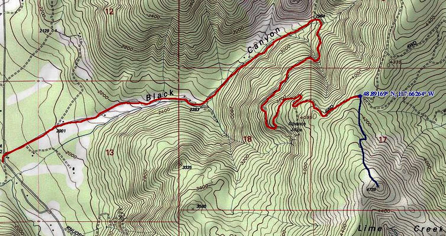
Whitmore Mountain
Elevation: 3920+ ft Prominence: 2160 feet (Rank: tied for 116th out of 144)Whitmore Mountain (map) is a moderately forested summit in the southwest part of the Okanogan. The mountain is closely north of the Columbia River and southeast of Omak Lake. It has a lookout at the top but it is not open to the general public. On the whole, the mountain is hard to get to. But at least the climb/drive up it is easy.
DM: From Brewster, head north on US 97 to past MP 266 and watch for a road on the right called Cameron Lane. This road is paved and heads uphill before it turns east. As you follow Cameron Lane, you will run out of pavement before long and find yourself on a good gravel road that meanders its way eastward.
Eventually Cameron Lane will turn north and you'll pick up Greenway Rd, an unmaintained road (according to the signs) that will continue your journey eastward towards Whitmore Mountain. Stay alert as the road descends down a grade for range cattle . A road northward will be passed but continue straight until you come to a paved road, which you will cross and stay on a dirt road which is now the Saddle Horse Road. Continue to where you will see a sign for the Whitmore Lookout and turn onto that road. (Topozone Link) It is 32 miles from US 97 to this turnoff, most of it on gravel or dirt roads. It is then another 8 or 9 miles to the lookout. Plan accordingly.
Proceed up the Lookout road a short way and you'll come to a fork, with the road on the right seemingly the lesser used one, go left here The road will twist and turn as it gains elevation. The next junction meets a road coming in from the northwest but stay right at the junction as you now will be heading on the road that takes you to the lookout. The highest point is a rock complex just to the left of the stairway of the lookout tower. No benchmark was noted. The lookout is manned during the fire season and is part of the Colville Indian Reservation lookout system.
EN: This peak as well as the roads approaching it are on the Colville Indian Reservation. At least some areas of the reservation are open to public recreation and there were no signs regarding trespassing or prohibited entry along the route above. There is a certain political history associated with outsiders on land belonging to tribes that lingers to this day, so tread lightly and politely if you should chance across any locals. There were also no gates to impede the drive; only cattle momentarily blocked the way. All of these roads were in good condition so it is likely this road could be driven in a standard passenger car provided that there is no snow on the road.
PK: "I climbed this peak via a short crosscountry trek from a rough road on the east. But I see now from the above descriptions that Whitmore can be driven all the way to the top. What I did was approach from Indian Road 54 up Smith-Condon Creek. Turning right (south) on the road junctioning off at 1740 ft, I went right at the ensuing wye by the long lake. After two switchbacks I found myself traveling around the east side of the mountain. I had hoped to use this road to circle around the mountain to the road leading to the top. But instead I found myself at a bermed dead end here where only ATVs could proceed on. I located a short spur (somewhat steep and overgrown) leading north to the saddle just west of Pt. 3213. I drove the road about half the distance and did the rest on foot. At the saddle I turned left, crossed an old fence or two, and just kept winding my way up to the top, crossing the summit road near Pt. 3695 in the process. The climb up probably took about 30 minutes." --Paul Klenke, April 3, 2005
 |
 |
 |
Redwic - Jun 13, 2009 8:13 pm - Voted 10/10
Mount Walker Page CreatedFYI- Mount Walker is not necessary to be on this SP page, anymore, as I just created the Mountain page for it. But you can decide what is best to do in regards to its mention. http://www.summitpost.org/mountain/rock/521239/Mount-Walker.html
EastKing - Jun 21, 2009 10:04 pm - Hasn't voted
Amabilis Page Now CreatedI just created the Amabilis Mountain Page.