-
 7504 Hits
-
 83.69% Score
-
 17 Votes
|
|
Mountain/Rock |
|---|---|
|
|
62.07209°N / 6.65746°E |
|
|
Sogn og Fjordane/Møre og Romsdal |
|
|
Mountaineering, Scrambling |
|
|
Summer |
|
|
5016 ft / 1529 m |
|
|
Overview
Hornindalsrokken 1529 m
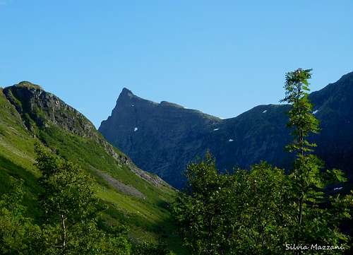
Sunnmørsalpene, the Sunnmøre Alps, are one of the finest mountain ranges of the whole Norway, known in reason of their stunning peaks surrounded by deep fjords. Hornindalsrokken 1529 m, in the heart of Hjørundfjorden, is one of the highlights, a wonderful peak showing a sharp unmistakable profile. The mountain is known to be one of Norway's most attractive peaks and it’s just impossible not to notice it! Located in the Nordfjord area, near Hornindalsvatnet, the deepest lake in Norway and in the whole Europe, Hornindalsrokken is shared between the two counties of Sogn og Fjordane and Møre og Romsdal.
Moreover Hornindalsrokken, which is also called Honndalsrokken or simply Rokken, is triple divided amongst three municipalities: the Hornindal municipality in Sogn og Fjordane county and the Stranda and Ørsta municipalities in Møre og Romsdal county. There are different ways to climb the peak, anyhow the easiest ones are from the Sæterdalen (Sætervalley) in Hornindal Kommune or from the Kjellstadalen ( Kjellstad valley) in Stranda Kommune. Both of these are accessible from RV 60 between Grodås and Hellesylt. The third option is via Tyssenaustet from Bjørke. In the previous chapters it will be described the itinerary starting from Horndøla Bru, across the Sæterdalen.
Getting There
The starting point to climb across the Sæterdalen valley is the locality of Horndøla Bru, located along the highway RV 60 between Grodås and Hellesylt. Once this point has been identified, leave the main road and drive for about 1,5 km along a toll road) up to the farm of Hornindalssætra. You can leave the car on a parking lot on the right below Hornindalssætra.
Hornindalsrokken Normal Route across the Sæterdalen
Hornindalsrokken Normal Route across the Sæterdalen
Summit altitude: 1529 m
Difficulty: Easy scramble on rock, then snow slopes and an airy finish
Vertical gain: 1150 m from the hamlet of Hornindalssætra
Exposure: various
Starting point: parking lot below Hornindalssætra
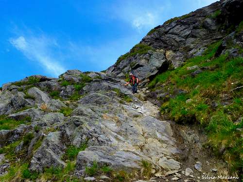
A great outing up a wonderful peak, with a spectacular summit view and less difficult than it may seem. Indeed the West wall appearing right in front of us during the approach trail seems very difficult, but a cunning itinerary that doesn't directly climb the wall, rising on a rocky gully, allows to get a shoulder on the easier eastern side. The route anyhow is steep with some loose stone in the gully, so it requires attention. It follows a snowy ground from the saddle between Hornindalsrokken and Lidafjellet, where an ice axe might be useful.
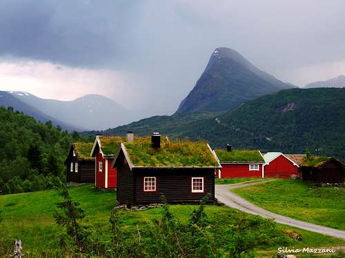
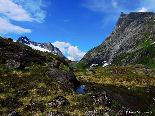
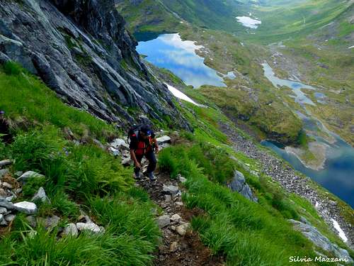
From the parking lot continue up to the hamlet of Hornindalssætra following the gravel road. Here on the left you will find a forest road signed "Hornindalsrokken" up the Sæterdalen. Take this trail heading North on the left side (right orographic) of the valley and follow it, leading towards two small lakes, Blåvatnet and Store Luka. The stunning peak with its steep and impressive West wall is already well visible from the approach trail along the valley. Nearby the first lake the road disappears and a trail with red signs takes its place, crossing the drain and leading on the west side of the second lake. Once getting the Northern end of the lake, the trail heads to the left.
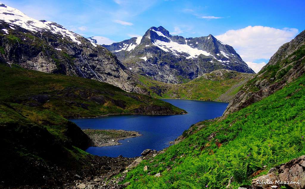
Here it starts the steep climb up to the saddle between Hornindalsrokken and Lidafjellet. The path at first traverses along the West side, leading to a long rocky gully which surprisingly allows to rise on the steep slope of the peak without great difficulty. Some care should be taken, in particular due to some loose stones that can easily be set in motion.
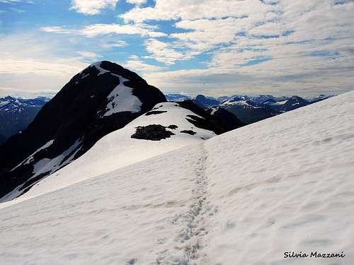
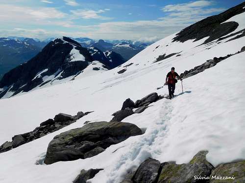
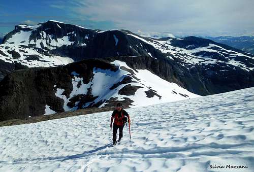
At the top of the wall the climb becomes less steep, ending on a wide and often snowy saddle between Hornindalsrokken and Lidafjellet. This saddle gives access to the East side of the peak, which must be crossed. After getting to the saddle, turn to left and cross the slope of snow that is most likely there. This area is relatively flat, so the ice-axe actually is not necessary, but it could be very useful along the subsequent snowy slopes that give access to the summit ridge. During the crossing the summit of Hornindalsrokken is up to the left, but the Normal route continues further to traverse along on the East slopes leading onto the North-East ridge.
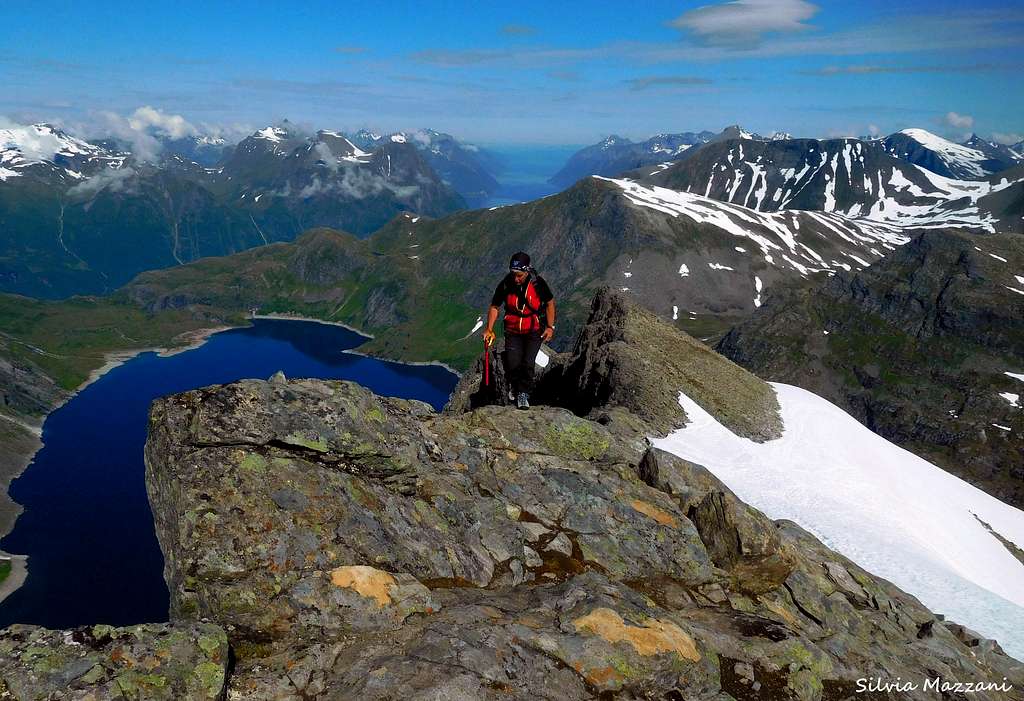
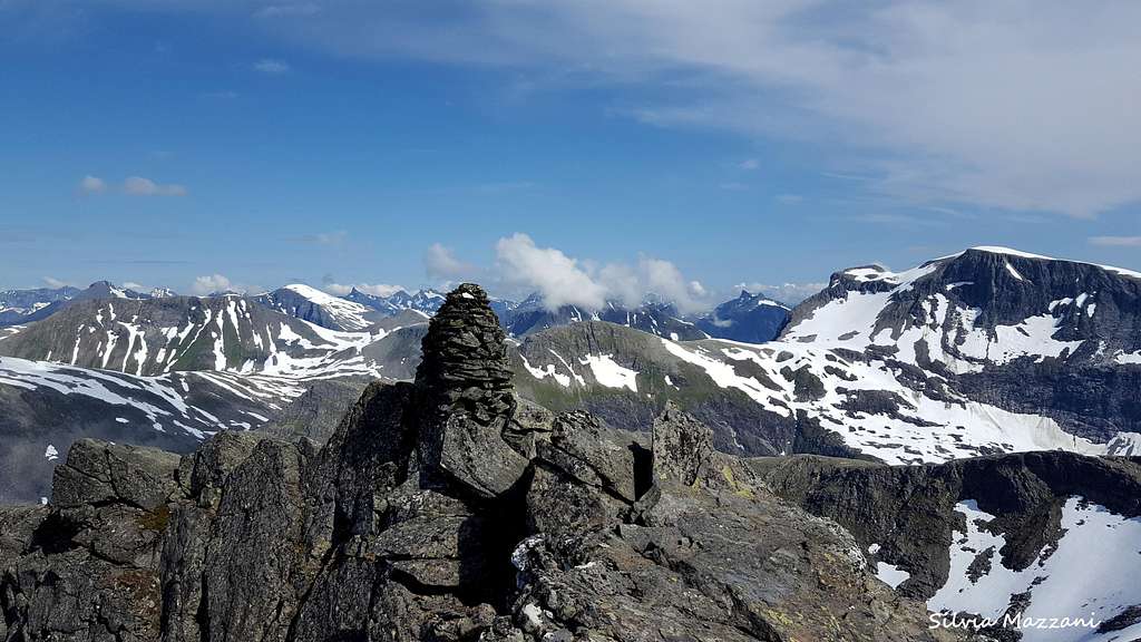
As you come close to the NE ridge, head to left climbing a steep slope, shorter than the previous one, but much steeper, so an ice axe could be useful. When you get the summit ridge that runs near the vertiginous West face of the peak, head to left (South) and follow the spectacular ridge of boulders leading to the breathtaking and airy summit, which is marked by a cairn.
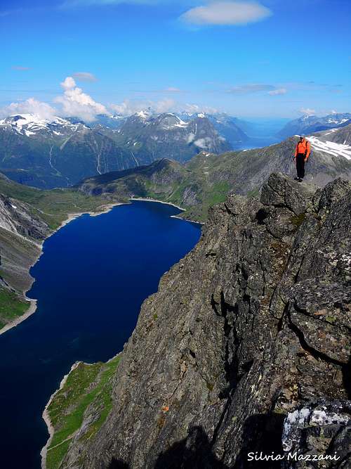
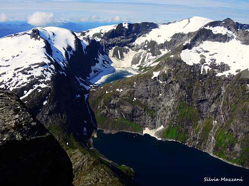
The summit view towards the majestic Kvitebba just in front and the dizzying West wall overlooking the Tyssevatnet below your footh are quite impressive!
Descent: same way as the ascent
Red Tape
There are no particular restrictions in climbing and hiking.
The Sunnmøre Alps
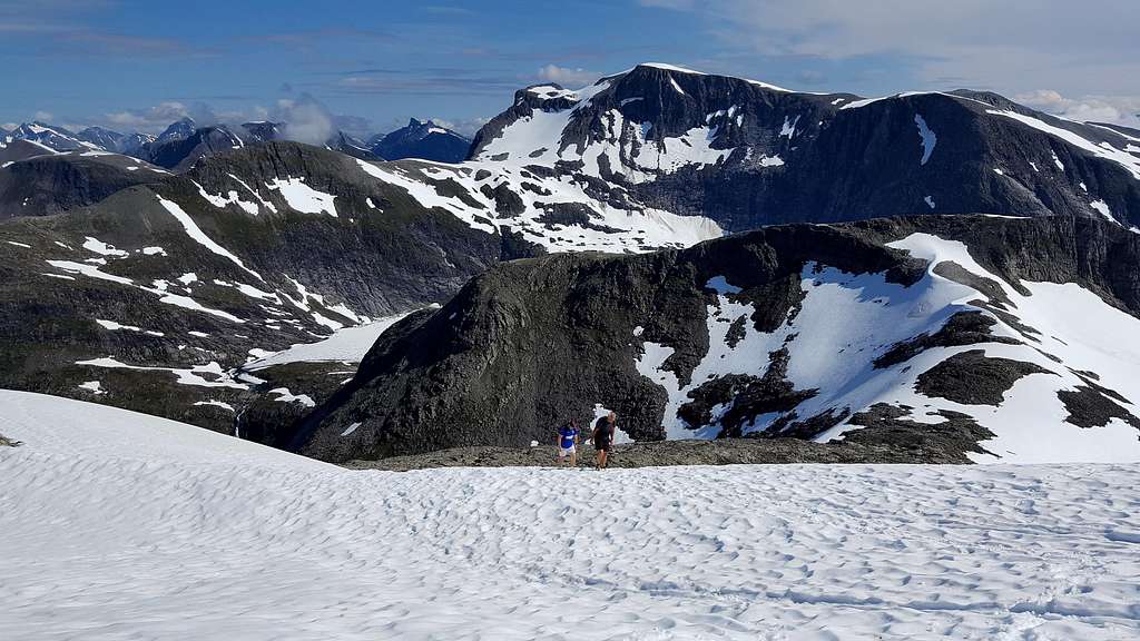
Sunnmøre is the Southern sector of “Møre og Romsdal” county, located on the West coast of Norway. The Sunnmøre Alps are characterized by a dramatic landscape and the peaks show long and sharp ridges. The highest summits of the area are located about 1600 metres above the fjords and the climb often starts by sea level, so the vertical gain is often remarkable. Kvitegga 1717 m is the highest mountain in the range. More info about here on SP: Sunnmøre
When to Climb
Best months are June, July, August and September. This ascent during the winter months is considerably more difficult and requires a lot of attention due to the avalanche danger on the route.
Where to stay
In this region, as in the whole country, you are allowed to put up your tent in the mountains, if you are in some distance from civilization there isn’t any further restrictions. If you are closer to the civilization the tent should at least be 150 metres away from the nearest house.There are also a few campsites in the area and plenty of hotels and other accommodation possibilities.
Meteo
External Links


