Need for East Meaden - June 28th, 2014
Four days in Colorado and not one peak even over 13,000 feet…practically county highpointing in Florida relative to local standards.
An extended weekend to the Mile High State demanded more than my usual share of podcasts and sports radio, so I downloaded a bunch of episodes of Bill Burr’s Monday Morning Podcast. A great decision that I still listen to on commutes, though an acquired taste that I was had to get used to while pulling into Steamboat Springs around 9 in the morning following a long drive through Vernal and the trans Wasatch-Rockies outback.
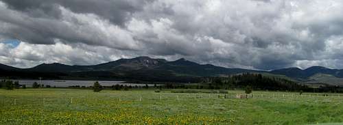
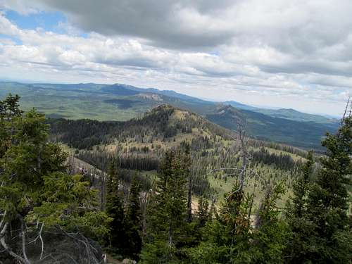
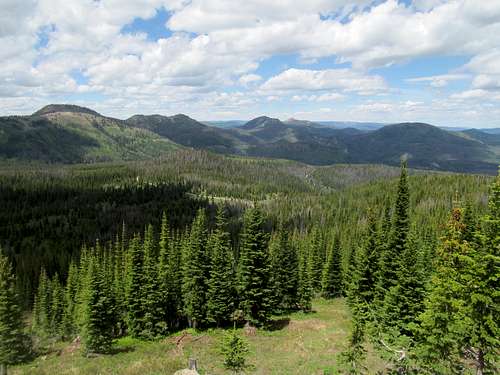
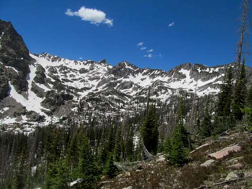
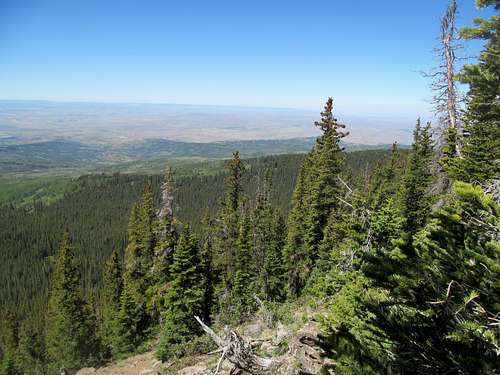
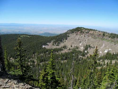
Greg had been hankering for a Colorado trip for a few months now, wanting to knock Zirkel and a couple Elkhead peaks off the list. He had two days, I took two additional off from work, and an early start from Salt Lake Friday night put him in position to snag Black Mountain outside Craig Saturday morning the same time I drove past it into Steamboat. My plan was to get Craig on the way back Tuesday, which meant slogging through the heavy town traffic traffic towards the forest roads leading to East Meaden Peak, also known as McFaddin Benchmark, also known as Sand Mountain North, and regardless of nomenclature the highest peak of the Elkhead Mountains, a prominent range featured here on SP thanks to the efforts of Scott P.
The plan was to meet somewhere on East Meaden; as Greg was still on his way when I turned off the forest roads, I figured I’d park low and get an extra workout while avoiding the treacherously rough dirt roads circling down into the Elkhead backcountry. I parked at the junction of FR 480 left county road 42. Seeing many long and unnecessary switchbacks along 480 before it eventually wound up at the trailhead at the end of 480a, I decided to utilize my GPS and straight shot as much of it as possible to the end of the road.
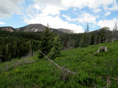
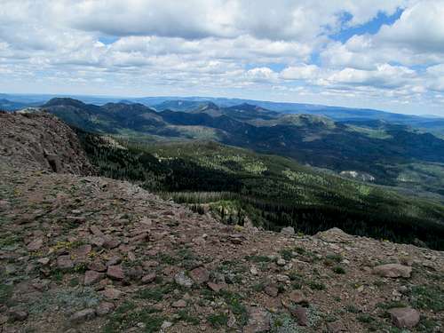
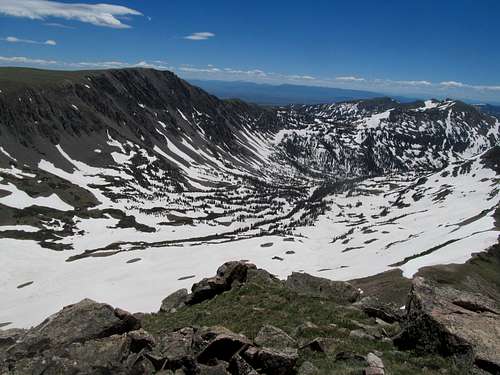
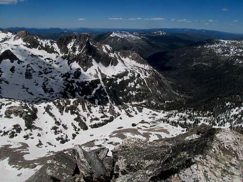
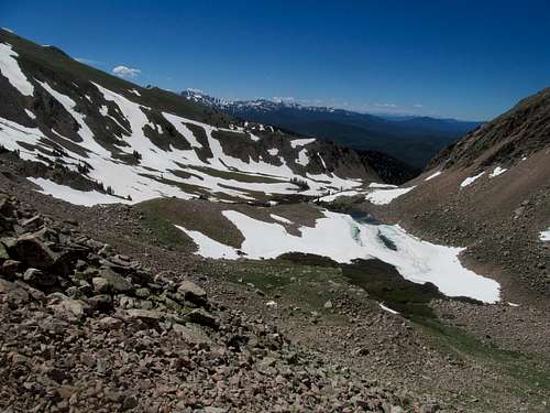
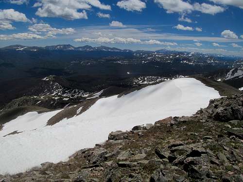
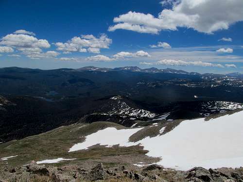
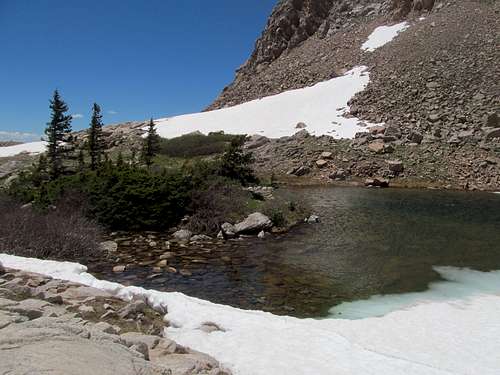
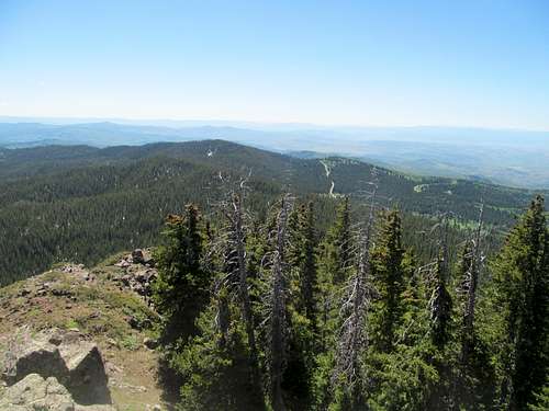
It was easy bushwhacking for the most part with a couple mildly steep parts, good views of the peaks from afar along the way, and I followed a drainage perpendicular to the trailhead and the Sand/East Meaden saddle directly to the small parking lot.
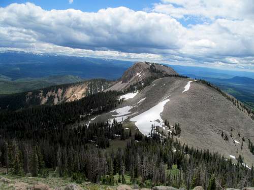
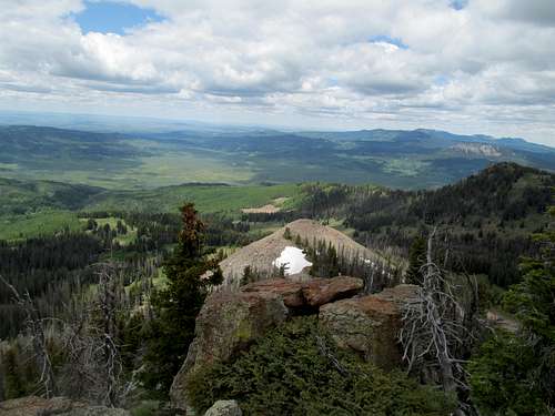
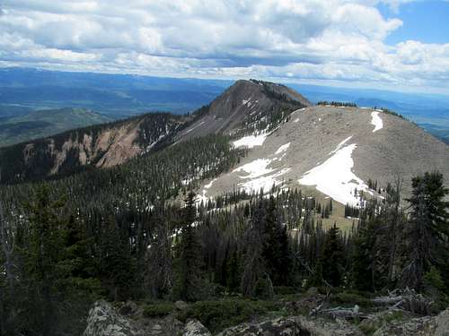
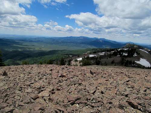
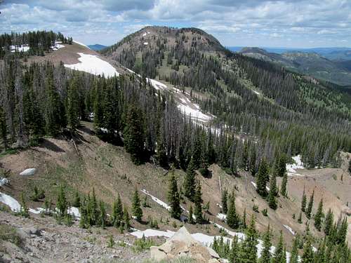
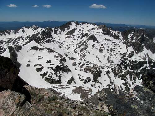
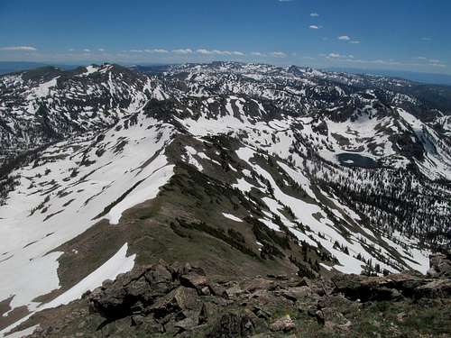
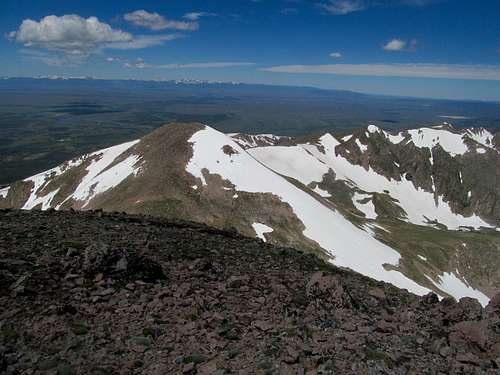
A trail follows southwest towards Sand but the highpoint lacks a trail so I followed the first drainage directly up to the East Meaden/Sand saddle, and continued up the steep but basic terrain to the summit, which was actually a long brush and boulder chocked ridge.
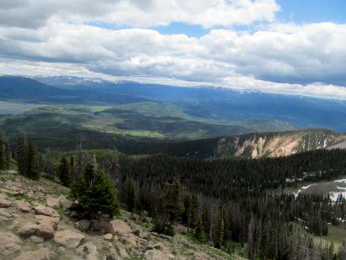
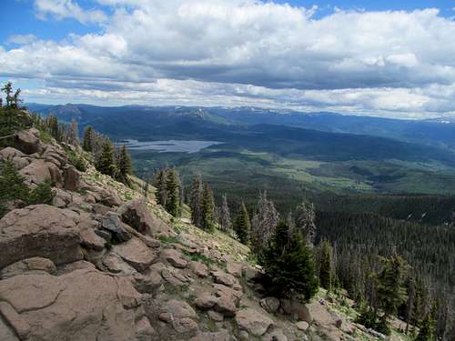
I traversed both ends to get a good grasp of the views in each direction, and given a furious and unrelenting north wind, was hard pressed for creature comfort the entire time.
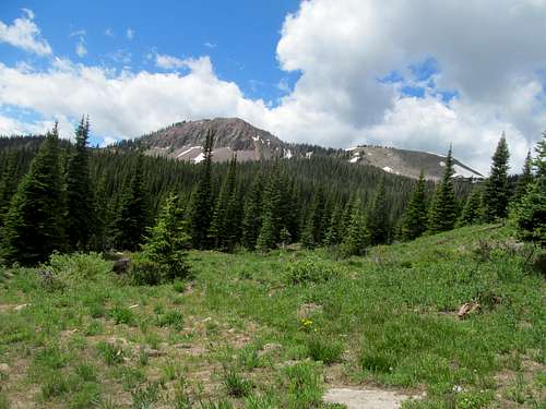
It had been around 3.5 miles from my parking spot to the summit; great views, great peak, great range and, with some extra time knowing Greg had just arrived in the area, I swung south for Sand.
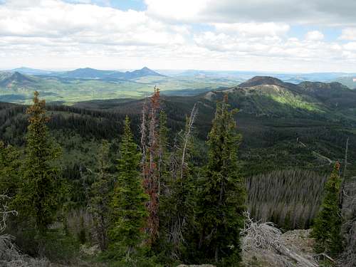
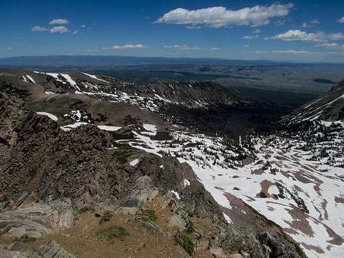
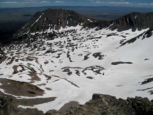
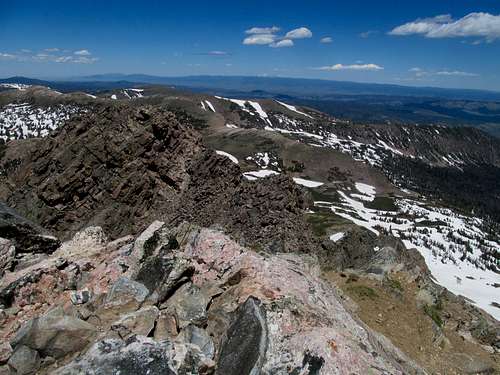
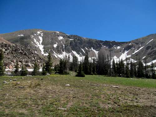
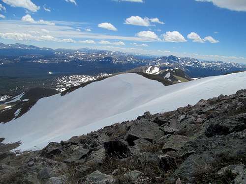
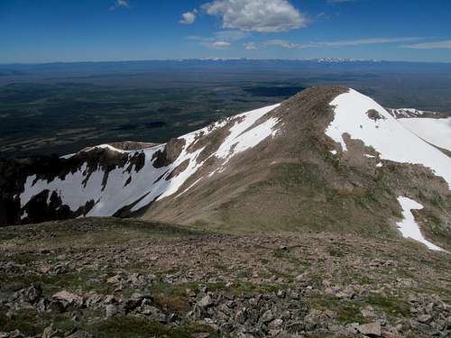
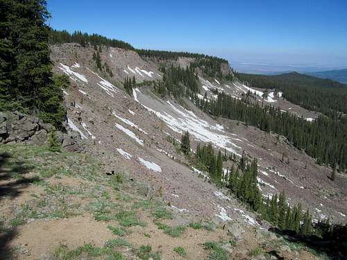
The initial climb up from the saddle was pretty easy, but the traverse through the small minor summits and the woods leading up to the final summit plateau gave me my first taste of slushy kneedeep late June post-holing.
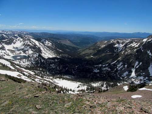
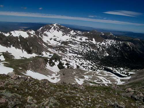
I enjoyed the views, similar yet different from its northern neighbor; Sand in particular gives you a good peek at an odd chalky badlands canyon adorning its eastern flanks.
I tried following the actual trail down but lost it amid wading through piles of snow through the wooded areas. Once I found a meadow outside of the woods the descent improved.
Eventually after a few more postholes and mud-raking I made it back to the trailhead.
I followed 480A this time, where I bumped into Kadee, who had been hiking around Sand. We went back to their car parked on the north side of East Meaden, where Greg had straight shotted it up to the top, then hitched a rocky ride down in their 4Runner to mine.
Zirkel Torture - June 29th, 2014
I followed Greg and Kadee up some back roads to a camp spot in a burn area a few miles off the main Slavonia road. Pretty views, and lonely for Colorado, and I was thankful for having a small semblance of cell phone reception and a flat spot to park my 4Runner/camping bed.
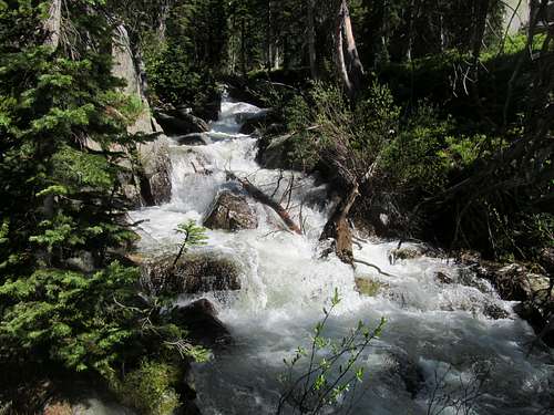
I had been skeptical about Greg’s plans for Zirkel seeing as NOAA showed full snowpacks in the weeks and days closing in on our trip. Apparently the Steamboat area is the snowiest in all of Colorado, and we were about to learn firsthand, even on the verge of July. The stream crossings are a concern on this hike too, and I was none too comforted by sights of the pretty but raging Elk River on my drive in.
I left camp first so that I could get to the trailhead and catch up on a few minutes putting my boots on while Greg and Kadee packed up camp. Thankfully they were keen enough to notice the hiking sticks I had left behind and cheerfully brought them along to the Slavonia trailhead. It was crowded, but most people were going for Gilpin Lake or other destinations, and many had reported difficulty on the crossings for Gilpin as well as Gold Creek to the south, the latter in even worse alleged condition.
The crossing was bad, rushing water with great force and like most barefoot river crossings, made worse by the painfully rocky creek bed and the melt water, as well as knowledge of its still frozen relative awaiting us further up the mountain. (On a sidenote there is an alternative to fording Mica Creek to be found to the left of the ascender’s trail, which we found on the way back).
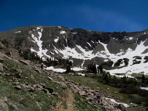
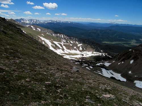
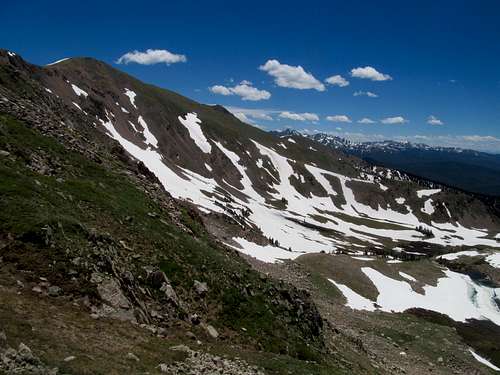
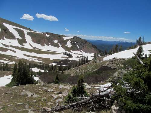
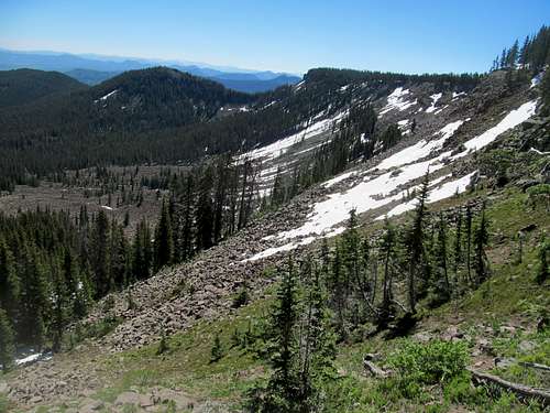
After that, a basic trail hike until reaching the upper basin, where it swung right for Gilpin Lake. Here we departed the trail in boggy meadows and waded around in a general northeasterly direction, both following our waypoints as we quickly entered snowy conditions under the higher elevation tree cover.
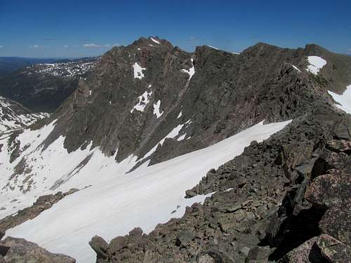
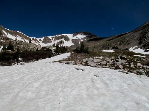
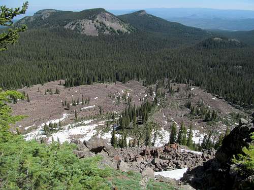
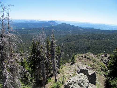
The goal like most other route descriptions was to make it to Point 12,006, and we gained elevation steadily after finding a good non-boot decamping crossing of Gold Creek near some pretty pebble-ly cascades. Some of the worst postholes were to be had here until we reached an upper basin, finally over most of treeline and open views of the ridges spanning from 12,006 to the northeast and south towards Gilpin Lake. Greg opted to take the direct route, ascending steeper snow straight for 12,006, while I found that, oddly enough, detouring southeast allowed me to traverse the northwest facing slopes, which had much less snow cover than the southwest slopes in the area. (My best guess is that so close to and past the summer solstice, the sun comes in from the north in the afternoon, explaining why the southwest slopes were neglected).
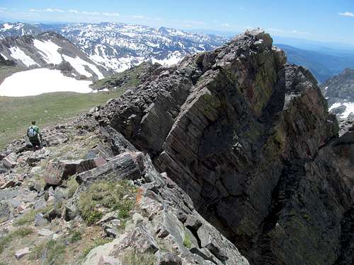
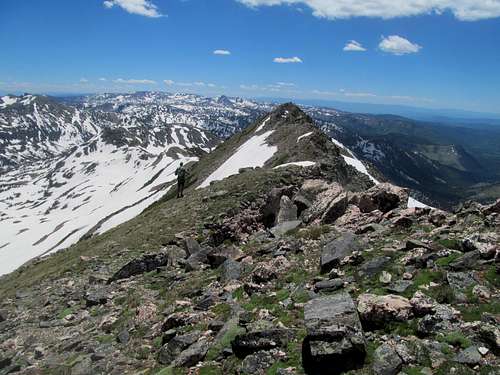
A few snowy sections but I was able to make it to the ridge crest through mostly snowfree terrain, though steep and sometimes brushy or composed of that special pain in the ass loose packed dirt. The traverse north to 12,006, where Greg was patiently waiting, was longer than it looked, but the views breathtaking in every direction.
But the wind, oh the (north) wind, it whipped through fast and furious into the bone, and fortunately I was prescient enough to stow my Elmer Fudd hat under a rock once I met up with Greg below 12,006 and started the steep walk up to the subsummit.
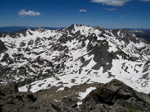
It doesn’t look like a long ways to the summit from here on a map, but reality was different, especially with the maybe 60 mph winds in your face every step the rest of the way. So that sucked, as did the initial narrow and rocky traverse, as did bits and pieces of snow blocking the way, as did having to lose a few hundred feet to reach Zirkel’s base.
I wasn’t really having it today with the elements and found it mind bottling how Greg paced his merry way ahead, but eventually caught up with him at the top after some minor (and thankfully wind protected) scrambling. Great views if you could find a rock or something to hide from the wind, tough to stay upright and try to take pictures though.
More suckage on the traverse back, especially having to reclimb slushy posthole snow traversing to 12,006.
The wind made the experience every bit as dreadful as the views were delightful, and while I was happy at the prospect of dropping back down into the woods, the long glissade that Greg gleefully looked forward to gave me some distress.
We dropped immediately upon reaching the base of 12,006.
As usual Greg raced ahead, or down on this occasion, while I took my ass freezing slide in short spurts, agonizing gliding over bumpy snow and terrified and stopping myself whenever I took off towards a higher velocity.
The rest of the descent easy, and the bonus was that with both of us not looking forward to fording Mica Creek, we both opted to explore options to the right (slightly upstream) to see if there was a narrower alternative. Several false hopes were dashed as we stared at possible crossings requiring some risky leaps of faith over the treacherous creek when, upon giving up then starting my way back left (south) towards the trail as Greg pondered life (or more likely several limbs) at a jumpy crossing, I found promising terrain. Through brush and deadfall I saw some side currents on our half of the stream separating it with a small “island” cutting through Mica Creek. Getting there, I spotted something even better than the narrower jump I was hoping for…a small but wide enough system of downed logs spanning the entire length of the crossing. I shouted to Greg and we made it across dry, then continued swinging left until we returned to the trail.
Dodging mosquitoes we got back to the trailhead, where we learned that the trail to Gilpin Lake was just as cruddy as the basin where we left the trail; Kadee had tried to hike there but said once trail started ascending to the lake’s bench it disappeared and the only option was steep postholing. So I was glad we opted not to circle around and hit Gilpin Lake on the way back, a possibility I had mentioned to Greg when initially scouting the route.
Greg and Kadee were going home, but I still had two vacation days. I gassed up and got some food and coffee in town, and for the first time this summer, washed myself off at Strawberry Hot Springs in preparation for more “camping”.
Stark Raving Clark - June 30th, 2014
Clark Peak was next on my agenda, and I found a mountain pass off US-40 just east of Steamboat to park the 4Runner where I could get cell service as I slept in the back of the truck once the temperatures cooled down.
North Park is a strange and barren place, larger than most Colorado valleys with the exception of the San Luis, harboring more distant than usual views of the bordering ranges and to my chagrin, sparse cell coverage. I took some county back roads to make it towards the Michigan Reservoir area of State Forest State Park, and started walking up the dirt road leading to the upper trailhead for Jewel Lake.
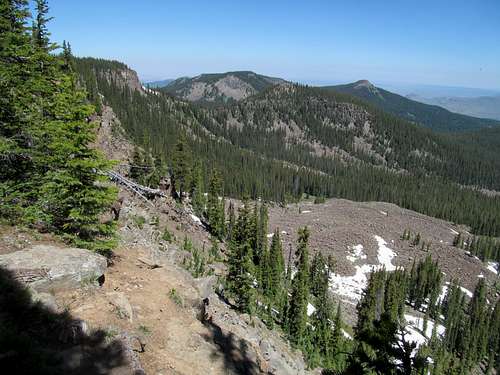
The trail from here was pretty good, gentle as it wandered through the woods, traversing mild switchbacks until it reached a small talus field. Things got slightly tricky here; the trail actually switchbacks left, returning to the woods before passing the talus further above, but not knowing this, I crossed the talus and proceeded to wander upwards looking for a trail that wasn’t there.
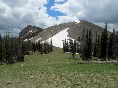
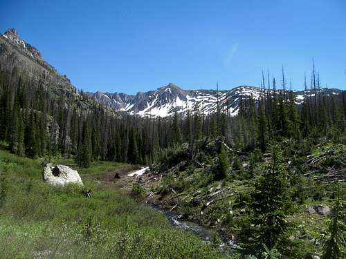
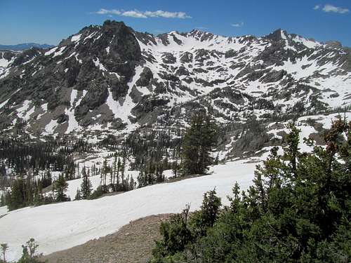
But the terrain, while mushy from the fresh snowmelt, was generally in good shape, and eventually I met up with the half snowcovered trail on the approach to Jewel Lake in the upper basin. Fantastic views of the cirque formed by Clark and its neighboring peaks, but the one downside was that half frozen Jewel Lake wasn’t much of a gem to behold.
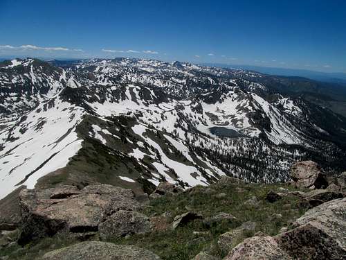
It was cold here, and the wind was suddenly bonechilling out of the trees, a north/west that somehow found its way around to follow me up the drainage and batter me from the south, making what should’ve been an easy ascent a battle every step of the way. I fought for every inch and foot against the wind howling down from the saddle north west of Clark; the standard route ascends Clark from the Saddle, but I decided to try and straight shot it a few hundred feet below the saddle southeast directly towards the summit.
Further down I had been able to find occasionally respites in small sheltered spots in between slopes or shielded by larger rocks, but up high any of the many strong gusts threatened to dub me Dorothy and blow me clear into Kansas.
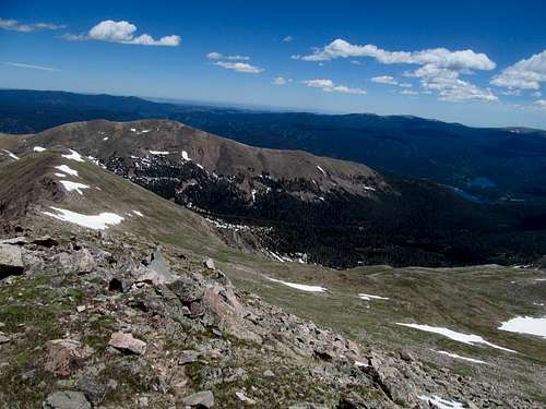
And after three years spent gallivanting on the other side of the Intermountain West, it amazed me that I could stand on a summit and stare out towards Kansas past endless fields and prairies. Hundreds of peaks since my move west, I had finally made it back to the Great Plains. To the south and southeast I could distinguish all the ranges of RMNP, and glimpse north towards the Snowy Range and even Laramie Peak near Casper.
I hunched and ate a granola bar on the sheltered east side of the summit, occasionally braving the wind for a few unbalanced seconds at a time to take pictures, then did my best to scurry down in one piece.
Never was I happier to get low, and I even found the right trail on the way down after ambling about the frozen lake and enjoying my newfound midsummer warmth.
Back in Black - July 1st, 2014
After two nights spent in the purgatory of “camping” I finally had my one night to go crazy in Steamboat. Hotel, shower, shave, then dinner and happy hour at a Mexican Restaurant before winding down the night drinking great beers at the Steamboat Brewery, discovering this new concept of late night happy hours, and chatting with locals and tourists alike.
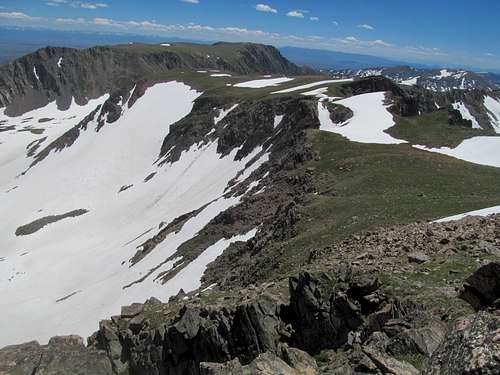
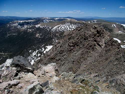
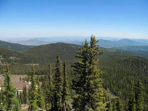
A mild headache greeted me as I drove back west towards Craig, detouring north to hit the well groomed roads leading to the Black Mountain trailhead…one last Elkhead P2K to conclude the trip. The trail was pretty basic leading towards the plateau top, though the late start meant uphill in an already stifling mid afternoon heat.
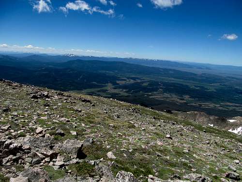
Upon reaching the summit plateau I skipped the eastern summit and its lookout, instead trying to hit up the highpoint waypointed in my GPS. It wasn’t obvious, so I walked around the general area to ensure that I had more probable-than-not walked the exact HP, then continued westwards, taking in some views across the south rim and hoping for more west towards Dinosaur and the Uintas.
The terrain had gotten difficult since leaving the easternmost point of the plateau, and much of the rest of the upper traverse was deep, wavy and constant up and down through mounds of snow, sometimes solid, sometimes deep and posthole inducing.
The trail appeared and disappeared in spurts, and while I managed to grab views north, with the USA Belgium game coming up later in the afternoon I didn’t really have time to venture too far beyond the western summit and its radio towers.
I circled around the north rim on my way back, enjoying the views of the summit cliffs and the talus below, and found myself to my chagrin ascending a hundred feet or so back towards the rim, where the mostly flat trail and not at all flat snow above it took my back to the eastern lookout.
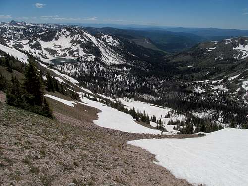
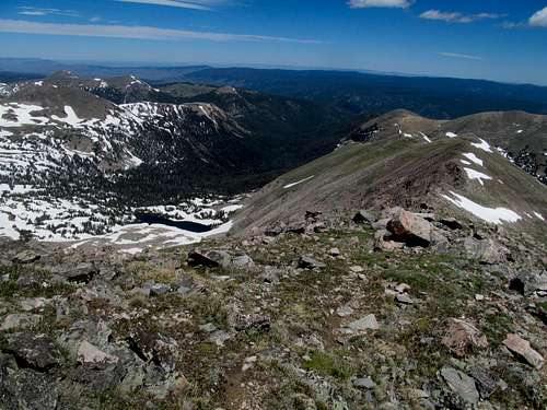
Beyond, I glimpsed views of Sand and East Meaden and Zirkel, triggering memories of the last three days, and jogged down the trail in the afternoon heat. The standard route to the top was 6 miles round trip, but in my effort to tag the west summit and burn off some calories from the previous night I had tacked on three additional.
Speeding back I managed to make it to the Dinosaur Bar and Grill in its namesake town just in time for kickoff, or whatever they call it in soccer. My newly burgeoning tolerance for the sport, as well as fear of missing out on what was now a cultural phenomenon back home, led me to barge into a redneck biker bar and ask for the soccer game. But who can argue against USA USA??? Well the Belgians could, and despite not really being a real country (come on, they used to be part of France, and Holland, and Austria, and Spain, and God knows who else) they beat us fair and flopping square, giving me enough time to make it back to Salt Lake before the sun set on another ample posthole-laden July summer’s day.
Comments
No comments posted yet.