Longest Day of the Year
It was a long day at work delivering pizzas, and the manager finally gave me the okay to go at about 8:50. I rushed home, threw on nylon clothes, and grabbed my pack so I was ready to go when Nate showed up soon after 9. Thus equipped did we set out on the most dangerous part of our journey: crossing the Cascades at night on Highway 2.g
We only exposed ourselves to this stupid danger for one thing: the West Route of Dragontail Peak, the second highest peak in the Stuart Range, second only to the magnificent Mount Stuart itself(Long may he reign).
After that terrifying experience, we arrived at the Stuart/Colchuck Lake trailhead a little past midnight, immediately threw our sleeping bags and pads in the back of Nate's truck, and did our best to sleep for our big push the next day. Unfortunately, the sleep was poor, but at least the glittering, cloudless sky of stars overhead reminded me why I was here in the mountains.
The alarm went off at 4, somewhat less than 4 hours later, and I rolled out of bed to 2 cups of instant coffee, an apple, and a peach. We grabbed our packs and poles and were on our way.
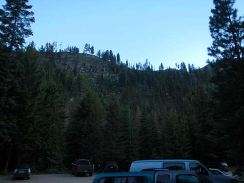
![Morning at the trailhead]() The sun's almost up! The Colchuck Lake trailhead at 5 AM, as we set off.
The sun's almost up! The Colchuck Lake trailhead at 5 AM, as we set off.Approach Hike
We felt fairly energetic, and the cloudless night had allowed excess heat to drift off into space, so the morning chill let us move quick without sweating. Thus we made fairly brisk progress up the moderate, 4 mile, 2000 vertical approach to Colchuck Lake, threading through the lovely lodge-pole pines. The trail, though sometimes loopy, was otherwise friendly, and even after taking a break to study our route in the distance and take a compass sighting on the mountain, we arrived at the lake less than 2 hours after leaving the trailhead.
![Approach hike to Dragontail]() The sun rises on a lovely valley.
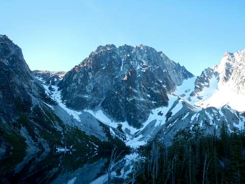
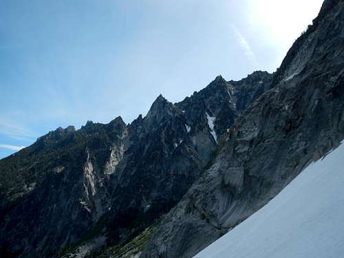
The sun rises on a lovely valley.![Dragontail in the distance]() The intimidating North Face looms in the distance. Our route is up to the Colchuck Col on the right.
The intimidating North Face looms in the distance. Our route is up to the Colchuck Col on the right.Doesn't look too far to the top!
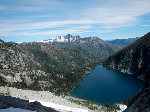
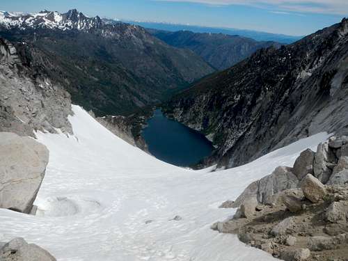
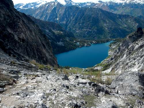
![Dragontail Peak looms over Colchuck Lake]() The magnificent North Face stares us down from across Colchuck Lake. Our route goes up to the gap on the right, Aasgard Pass sits on the left.
The magnificent North Face stares us down from across Colchuck Lake. Our route goes up to the gap on the right, Aasgard Pass sits on the left.We took advantage of the luxurious toilet facilities in this most heavily used of areas, and started our trek around the lake. When we reached the other end, in the giant boulder field where the trail disappears and turns into strenuous scrambling, we sat down to take a break. I'd felt good most of the approach hike, but by this point was feeling nauseous, and wobbly in the legs. The wimpier part of me pointed out that a 4 mile hike to, and mile hike around this large lake would be an adequate day hike in most circumstances. This part of me quaked at the sight of the North Face above us.
But my more determined half was inspired by the cragginess of this area and this peak, and pressed on.
![West Route]() We shall storm the gap in their defenses!
We shall storm the gap in their defenses!
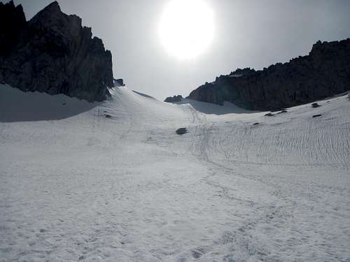
We followed part of the standard route traverse up to Aasgard Pass, jumping from boulder to boulder, then schwacking through trees, before we decided the time was right to set off directly up the scree to our route.
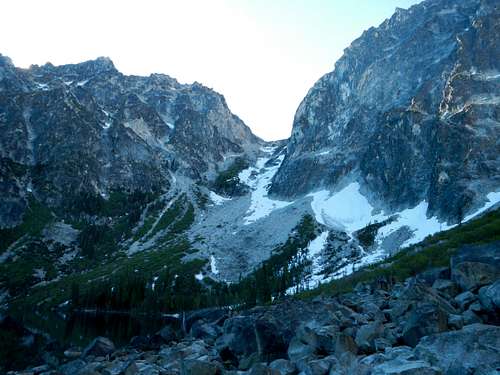
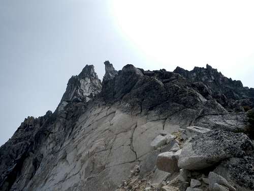
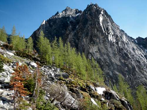
The West Route
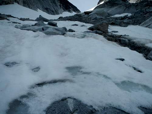
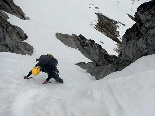
The first part involved scrambling up horrible loose rock crap, taking care not to knock any down, and just carefully slogging upwards. When we reached the snow, the snow was firm enough we took the time to get out ice axes and crampons. The map said this route went over the Colchuck Glacier, so even though it didn't look crevasse-y, I thought we should rope up, as much for practice as for anything else. (And indeed, we saw no crevasses on our route, as well as some guys ahead of us with no rope or anything)
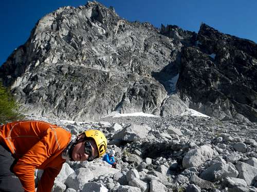
![Setting off]() Nate giving me a belay as we stretched out the rope.
Nate giving me a belay as we stretched out the rope.![Eagle's Head]() This gendarme looked like the head of an eagle, or maybe a snake.
This gendarme looked like the head of an eagle, or maybe a snake.![Happy Clouds]() Happy clouds!
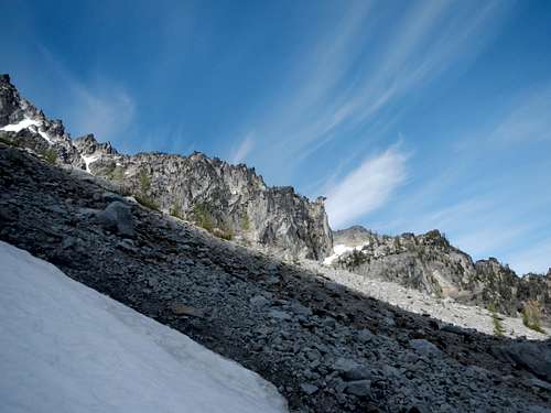
Happy clouds!![Stuart Range]() Craggy region, this
Craggy region, this![More Stuart Range]() The weather conditions were indeed satisfactory.
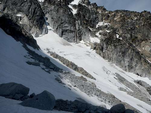
The weather conditions were indeed satisfactory.![Colchuck Glacier]() I knew there were crevasses somewhere!
I knew there were crevasses somewhere!![Ice]() The snow was firm in the shade, especially when it was ice.
The snow was firm in the shade, especially when it was ice.The terrain was fairly steep, and the snow firm. The slope was in the awkward angle where it's not steep enough for front-pointing, but you can't just walk up, so I traversed back and forth to get in the side of my crampon. While I rest-stepped and set a rhythm for my breathing. After having eaten something from our break down at the lake, I was feeling much, much better, and I felt this was going to be easy. Nonetheless we stopped for a quick snack above each next rise, taking advantage of the long day, until finally we gained Colchuck Col some minutes before noon.
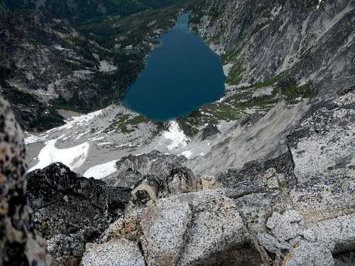
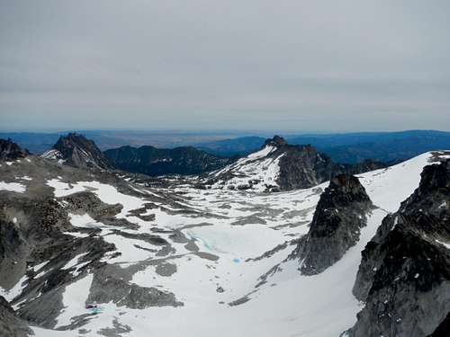
![Colchuck Lake]() And down below us, the lake slumbers
And down below us, the lake slumbers![Colchuck Peak]() Colchuck Peak, not far away now
Colchuck Peak, not far away now![Dragontail North Face]() Dragontail, why the long face?
Dragontail, why the long face?![Dragontail Summit]() The summit's up there somewhere!
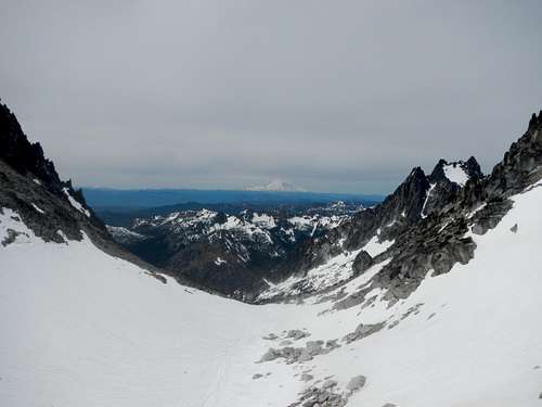
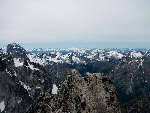
The summit's up there somewhere!![Mount Rainier]() Rainier, which looks huge from whatever angle, no matter how far away you are.
Rainier, which looks huge from whatever angle, no matter how far away you are.
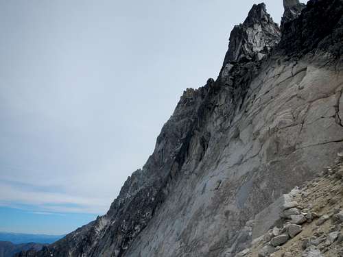
The terrain on the other side of the col was more steep loose rock over a moderate cirque. I coiled the rope, and we set down it to find our couloir. This was the point cited by our beta as being the most sketchy, and indeed was somewhat sketchier than the rest of the route so far, so we tried pitching it out for a while with pickets. Eventually, the snow got too thin for that, hitting rock after just a few inches, so we dispensed with the pleasantries and continued roped up but nothing more, for all the good that would do.
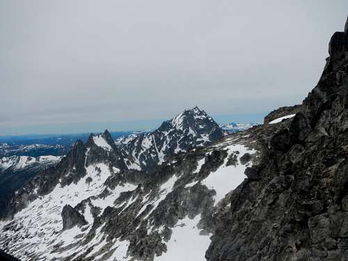
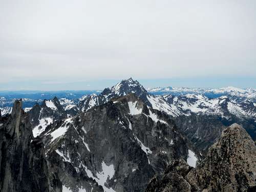
![Stuart]() Stuart Peak looms over little brother Argonaut
Stuart Peak looms over little brother ArgonautThe beta cited this part as sketchy, but I felt plenty comfortable without pro. The snow conditions were excellent for self arrest, and even if you failed, you'd go over some rocks and get beat up a bit, but then simply end in the cirque. We weren't cheating death here, just traction, perhaps.
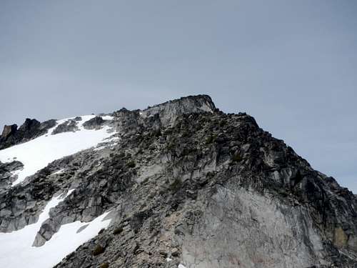
Going up the couloir, I felt intimidated because I knew this was supposed to be the tallest mountain in the immediate area, and I could see one much taller. It was only when we got to the summit I realized this must be Stuart. I've seen many pictures of its other side, where the famous North Ridge is, but I'd honestly never seen this side, in many ways even more impressive. It shoots up like a rocket!
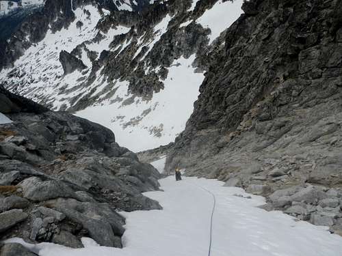
![The couloir]() The couloir, not all that scary
The couloir, not all that scaryNo, the real sketchy part came after the top of the couloir, when we put away our rope, prusiks, crampons and all before taking a good look at what was immediately before us.
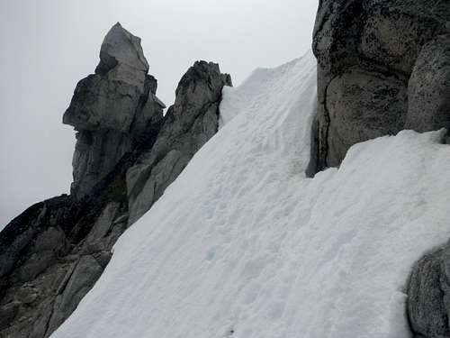
Most of the route ahead was easy, but to descend into the summit bowl we needed to descend a scary ramp of snow, at least 60 degrees, with a poor to non-existent runout.
![Scary Snow]() Now THAT'S sketchy!
Now THAT'S sketchy!
Nate had an ice tool as well as his ax, so he descended first, kicking steps for me. We were super careful, the runout being maybe just hitting the rocks, but almost certainly just vaulting over them and going over the cliff. If we were smart, we would've looked at this beforehand, and set up a rappel off a sling, picket, nut, anything! If we were even smarter, we would've just left the rope and used it for getting back up on the descent. But none of these we did. We'd been on the move for almost nine hours and I was sucking wind due to altitude, which might have affected our judgement. Soon the angle eased and the runout improved, and we simply scrambled to the summit by 2:30, after nine and a half hours of ascent.
![Wow]() That's what we went down
That's what we went down![Tender footing]() Dragontail's North Face falls away beneath me from the summit
Dragontail's North Face falls away beneath me from the summit![The mountains]() The mountains
The mountains![The Enchantments]() The ever-popular Enchantments
The ever-popular Enchantments![More mountains]() More mountains
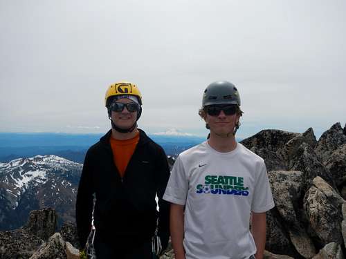
More mountainsAt the top we met a friendly man named James. We played leapfrog with him the whole way down.
![Celebration]() James took this celebratory picture
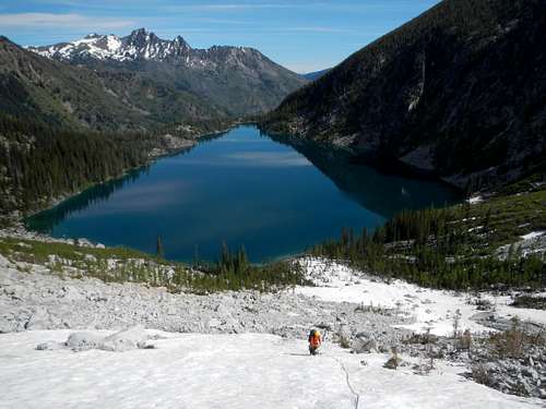
James took this celebratory pictureAfter hearing from James the horrible shitty rockiness of the Aasgard Pass route he came up, we noodled on the summit for a while before deciding against our original plan and deciding to descend the West Route instead. We followed James back, and looked at many routes, but all involved either rappels or that creepy runout-less snowslope, so instead of roping up and picketing it, we simply decided, with James, to go back and go down the Aasgard route.
We glissaded and plunge stepped delightfully down to the Enchantments, where the ugly part started.
![Dragontail East Route]() Fun to descend!
Fun to descend!![Aasgard Pass]() Not so fun to descend...
Not so fun to descend...This stuff took about as long getting down as it did getting up. Not only did we have to be careful not to get sliding on rocks, knock rocks down onto people, etc, our knees had to take a brutal thumping. Even with trekking poles stretched out long, we struggled.
![Dragontail Again]() The North Face zooms upward
The North Face zooms upwardWe got most of the way down the pass to find we'd run out of water. I'd brought 3 and a half liters, plus 3/4 of a liter I drank at the trailhead, but it wasn't enough. James helpfully volunteered to pump for us, which we gratefully accepted.
![Pumping]() Nate looking thrilled as James pumps
Nate looking thrilled as James pumpsThe brutal descent of Aasgard took hours. On flatter ground, we again faced the boulder-jumping and tree-schwacking section, more punishment for our knees, and we were back to the end of the lake.
By this point, the trail, even the unruly one around the lake, felt like walking on air, and we cruised around the lake. The last 4 miles from the lake to the car, evening was setting on. I didn't want to have to use headlamps, and I wanted back anyway, so the pace got faster and faster. The trees, unfortunately, held the heat of the day, and we sweated like we didn't on the way up. By now, even the loopy ups and downs felt oddly easy. I was pretty tired, but when we reached uphills we just cruised over them without breaking pace, and seemingly without even much increased effort. Perhaps the strain of effort simply didn't shine through my chafed shoulders, hips, and feet, and my brutalized knees.
I led faster and faster til I was almost running, when Nate suggested we slow down to avoid sweating too much when we were out of water and dehydrated. He was right.
I lost sense of time. The descent of the approach felt way longer than the ascent.
And finally, a few minutes after 9PM, we reached the truck once more. This was the longest day of the year, and we used every drop of it. We left the trailhead about 15 minutes before the sun rose, and got back just a few minutes before it set, leaving it at somewhat over a 16 hour day.
After pizza and brats in Leavenworth, we set off onto the really even more dangerous part of our journey: crossing back over the Cascades at night on Highway 2, while being exhausted from a long hike on 3 hours crappy sleep.
Interestingly enough, though I was tired, I was still pumped about the adventures of the day. Even as we were leaving I began to miss the mountains and plan my next outing. The north face of dragontail had inspired me through its many jagged climbing lines. Surely, the first adventure of many in the Stuart Range.


Comments
Post a Comment