
-
 14106 Hits
-
 82.95% Score
-
 16 Votes
|
|
Mountain/Rock |
|---|---|
|
|
38.89192°N / 122.29026°W |
|
|
Yolo |
|
|
Hiking |
|
|
Spring, Summer, Fall, Winter |
|
|
2868 ft / 874 m |
|
|
Overview
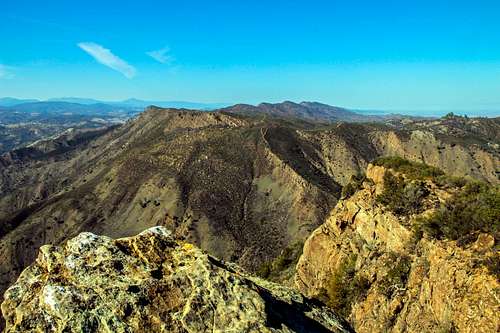
Blue Ridge north view from point 2,631'
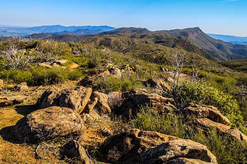
The best views extend out across the Central Valley (when it's not hazy), north along the spine of the Cortina Ridge and northwest across the Cache Creek Wilderness to the higher peaks of the Mendocino National Forest.
The major peaks that are visible are: Mt. St. Helena to the southwest, Cobb Mtn. and the top of Mt. Konocti to the west, Goat and Snow Mtns. northwest and St. John Mtn. to the north.
A brief side trip to the right of only a few minutes to point 2,631 when you get to the top of the ridge yields impressive views down into the canyon and across to Glascock Mountain.
This is a very enjoyable day hike with outstanding "top of the world" views.
This is a very enjoyable day hike with outstanding "top of the world" views.
The trail is 8 miles round trip with 2,300' el. gain![Cache Creek Canyon an Glascock Mtn.]()
Cache Creek Canyon from the trailFrom the north: From the junction of Hwy. 20 take Hwy 16 south 9.4 miles to the Cache Creek Regional Park parking lot on the right.
From the east: From Interstate 505 at Madison take Hwy. 16 29 miles west northwest to the Cache Creek Regional Parking lot on the left.
Park in the lot or outside the lot. The parking lot says a day fee is required but the box to drop the payment was dismantled and apparently not enforced as of Mar. 15 '14.![Blue Ridge Trail to Fiske Peak]()
Fiske Peak from the trail ![Sign at Fiske Peak trail head]()
Trail head sign ![Bridge across Cache Creek]()
Bridge across Cache CreekFrom the parking area walk left along the lower road by the creek about a quarter mile and cross the old concrete bridge. There is an old rusty "Blue Ridge" sign just across the bridge that points to the left. Follow the road above it a few hundred yards around the creek bend to the trail head sign for the Blue Ridge and Fiske Peak. The trail starts out under trees and then rises steadily coming out on an open subridge then contouring the steep east side of the Blue Ridge where it becomes more rugged and rocky. It then curves around the north end above Cache Creek before switchbacking up the east side of the ridge to the top of the with point 2,631' just to the right. Fiske Peak is obvious a little over half mile to the south.
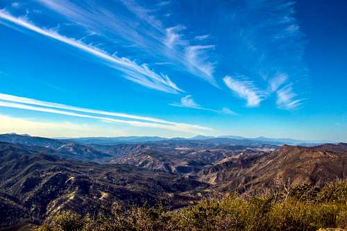
For more info on this hike see Bob Burd's trip report.![North from Fiske Peak]()
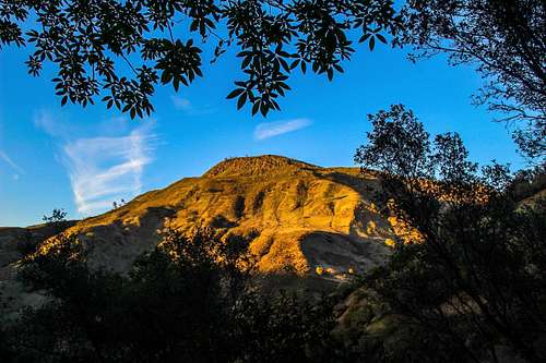
North from Fiske PeakThe Blue Ridge is on BLM land. No fees are required for the hike. The Cache Creek Regional Park parking lot fee box (6.00) is dysfunctional as of Mar 15 '14. There is plenty of random parking outside the lot anyway. ![Sunset on Glascock Mtn.]()
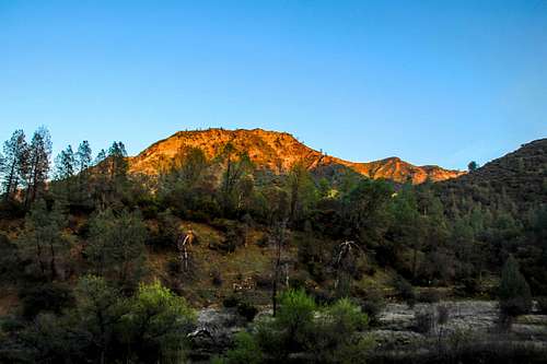
Sunset on Glascock Mtn.Year round. Spring, winter or fall is probably best. It can get upwards of 100 degrees in summer. Snow could be encountered along the top of the ridge in winter. During a heavy rainfall season the concrete bridge across the creek could be threatened with high run-off.![Alpenglow on the Blue Ridge]()
Last light on the Blue Ridge from Cache CreekClick here for several sites concerning camping in the area.![South along the Blue Ridge]()
South from Fisk PeakClick here for the current weather and forecast for Rumsey Ca.
Getting There
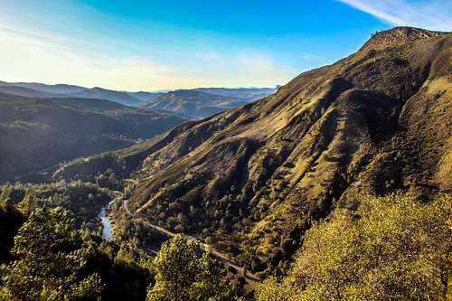
Cache Creek Canyon from the trail
From the east: From Interstate 505 at Madison take Hwy. 16 29 miles west northwest to the Cache Creek Regional Parking lot on the left.
Park in the lot or outside the lot. The parking lot says a day fee is required but the box to drop the payment was dismantled and apparently not enforced as of Mar. 15 '14.
Route

Fiske Peak from the trail

Trail head sign

Bridge across Cache Creek
For more info on this hike see Bob Burd's trip report.
Red Tape
North from Fiske Peak
When to Climb
Sunset on Glascock Mtn.
Camping
Last light on the Blue Ridge from Cache Creek
Current weather a 5 day forecast
South from Fisk Peak
Jesus Malverde - Mar 18, 2014 5:47 pm - Hasn't voted
additional infoGreat views for little effort. On a clear day: Mt. Shasta all the way to Ebbetts Pass In addition, there is Yolohiker.com's page on Fiske: http://yolohiker.org/trails/knoxville/blue_s/index.html Noondueler, thanks for creating a page for this one and other Lake County peaks!
Noondueler - Mar 18, 2014 7:07 pm - Hasn't voted
Re: additional infoThanks JM! I moved up to the Cobb Mtn. area recently from Marin so probably see more Lake County stuff soon enough.