
-
 3719 Hits
-
 0% Score
-
 0 Votes
|
|
Route |
|---|---|
|
|
69.73500°N / 18.59440°E |
|
|
Hiking, Scrambling |
|
|
Summer, Fall |
|
|
Half a day |
|
|
Class 3 |
|
|
Approach
Follow the directions on the main page to find the trailhead. Trails in Norway are not constantly maintained, and are usually only marked.
Route Description
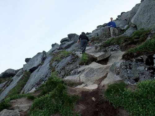
Hard to believe but a week after this photo was taken, a couple was stranded on Blåmann for 22 hours in fog because they couldn't find the way down. As you can see in the photo, the use path is clearly evident.
Continue following the path to a copse of trees, then up steeper and left. From here the paths diverge a bit, the one closest to the cliffs is the easiest to follow. Traverse under a series of cliffs until reaching a break. Ascend through this small gap to the upper slabs. Pick your way through the slabs, it should never be harder than third class. As the summit draws near, a path becomes visible again, with a small chimney, and more short third class steps.
Follow the route for the descent. It can be tricky to find the gap from the slabs to the path traversing below the cliffs. See photo for the cairn marking the way. It's important to find this gap, as all the slabs steepen into cliffs after this point.
 |
Essential Gear
Just boots and clothes for the weather.
Miscellaneous Info
If you have information about this route that doesn't pertain to any of the other sections, please add it here.