
|
|
Route |
|---|---|
|
|
39.16031°N / 106.56037°W |
|
|
Hiking |
|
|
Summer, Fall |
|
|
Half a day |
|
|
Class 2 |
|
|
I |
|
|
Approach
The first goal of this route is to get to the top of Lost Man Pass. The most direct way to do this is to start at the trailhead at the Roaring Fork River, this is the upper (east) trailhead described in the “Getting There” section. From the trailhead, travel north along the trail that goes to Independence Lake, this is Lost Man Trail (Lost Man Loop). Not far past the trailhead you will come to a fork in the trail, one trail goes to Linkins Lake, the other to Independence Lake and beyond, this is the trail you want to take. Follow the trail as it roughly follows the Roaring Fork River upstream to Independence Lake. At the lake you will see Lost Man Pass above you, keep following the trail up to the top. The top of the pass is two miles from the trailhead. Elevation gain, trailhead to summit of mountain: 1,880 ft.For a longer approach hike start at the lower (west) trailhead across from Lost Man Campground. Follow Lost Man Trail as it roughly follows Lost Man Creek up to Lost Man Lake—the pass of the same title is above. The Pass is about six-and-a-half miles down the trail from the lower trailhead. This route adds about a thousand feet to your elevation gain.
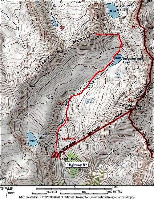
The East Ridge Route from the upper (east) trailhead of Lost Man Trail.4.8 miles roundtrip, 1792 ft. vertical gain
Route Description
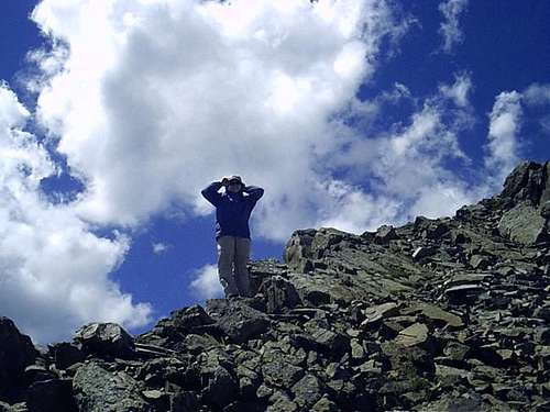
On Lost Man Pass, head west. You will come to the bottom of the east ridge of the mountain. Ascend this talus-covered ridge to the summit. Climbing the ridge is pretty straightforward, in a few spots you might put your hand down for added balance, but otherwise the going is pretty smooth. On the small summit you will find a large cairn with the summit register underneath.
Essential Gear
Without snow, no special equipment is required.With snow, an ice axe or trekking poles would be a good idea.
Be sure to bring the standard outdoor essentials.