
-
 3621 Hits
-
 75.81% Score
-
 6 Votes
|
|
Route |
|---|---|
|
|
39.73358°N / 106.32538°W |
|
|
Mountaineering |
|
|
Summer, Fall |
|
|
One to two days |
|
|
Class 3/4 |
|
|
Overview
Gore Range is a rugged and difficult range - even more so on its Eastern side.This route will lead you into the isolated wilderness area of the Black Creek headwaters.
You will see beautiful and pristine places, but getting to the summit of Peak F requires a long and arduous hike/climb - a mix of bush whacking, scree scrambling and snow climbing.
You will gain in total 5200 ft from Piney Lake to summit Peak F (you will loose 1200 ft when descending the Eastern Slope of Kneeknocker Pass which have to be regained)
Climbing Peak F / G from the East requires a commitment of two days
Route
Hike from the Piney River Ranch to the point where the trail meets the river, close to where the Piney River starts tumbling down a series of waterfalls.
100 yards (approximately) down the path you will see a cairn to your left, marking the turn off of a hikers trail leading up to the basin between Mount Powell and Peak C.
Trail is often overgrown and not always easy to follow. Just stay north of the creek until you reach the beautiful basin below Peak C and Mount Powell.
Cross the beautiful basin and hike on a steep trail up to Kneeknocker Pass, marking the lowest point of the ridge connecting Mount Powell and Peak C.
The trail ends here - from here until your return to Piney Valley it is very unlikely that you will see another soul.
The East slope of Kneeknocker Pass is most likely snow covered deep into summer(snow layer was at least 10 ft deep in July 2009) - time to get your crampons and ice axe out.
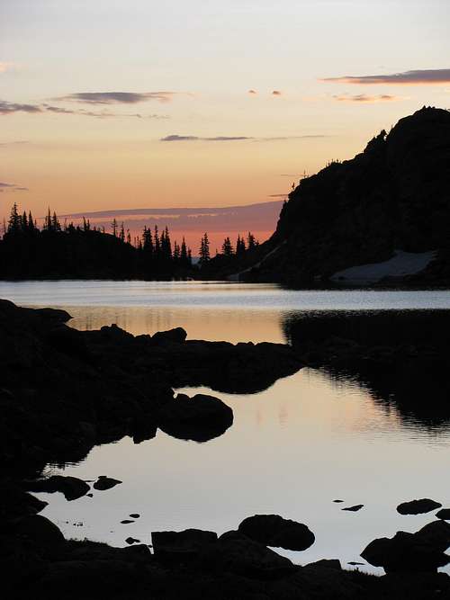
Climb downhill on the snowfield until you are right below Dwarf Pyramid.Hike/scramble up a small creek valley joining in from the south - from the crest you will see Bubble Lake below you - a good spot for a bivouc.
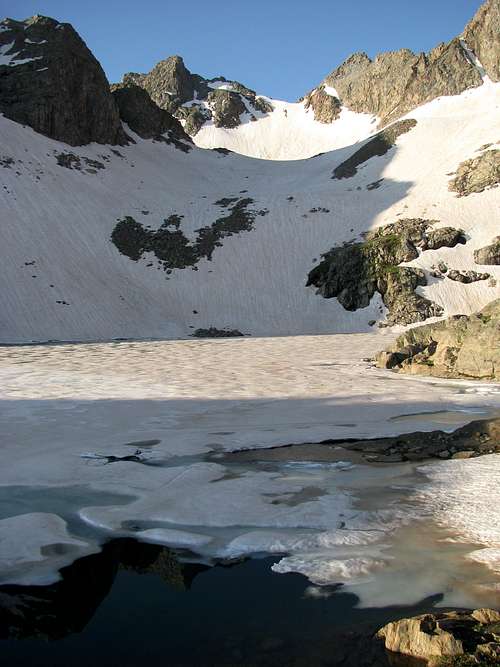
Hike along Black Creek uphill to another nameless lake at 12,000 ft - lake is solid frozen deep into the summer. Time to get your crampons on again.
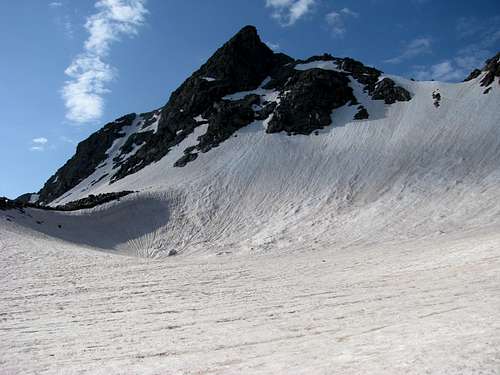
Climb up the snowfield (which is actually one of the last glaciers in Colorado) in direction of the obvious deep notch between Peak G (left) and Peak F (right). Evaluate snow field conditions carefully, I have seen massive snow slides in early July.
Snowfield steepens considerably on the last part below the notch.
Notch itself gives easy access to Peak G , but no easy access to Peak F (blocked by a cliff requiring a class 4-5 climb)- you have to scramble up a pretty treacherous snow/earth/rock band on the far right side of the snowfield (separated by rocks from the main snow field) to gain the summit ridge of Peak F.
Once on the ridge it is a fun and short Class 3 climb on solid granite to the summit.
Easiest way back to your car is the tedious descent down the gully right below you, back to the valley bottom of Piney River. From here the Piney River Trail gets you back to your car (trail is on the Eastside of the creek -some maps show the trail running partially on the Western side of the creek - this is incorrect, don't cross the creek)
Mountain Condition/Essential Gear
Climb is only feasible from late spring to fall - during the rest of the year you would walk for hours through avalanche area.
Snow slides can be a threat on the glacier into the summer - I saw massive snow slides in early July 2011 - evaluate the situation carefully before you start climbing.
You will be in the middle of nowhere - probably only a handful of people visit this area every year - it is a long way out the moment you cross onto the East side of the Gore Range.
This is a pristine area - tread lightly and keep your impact as low as possible.
Bring lots of DEET - otherwise you will be eaten alive my moskitos in the swamps of Piney Valley
Helmet, ice axe, crampons are absolutely essential - hiking sticks are a great help on the loose talus.