
-
 9170 Hits
-
 85.36% Score
-
 20 Votes
|
|
Mountain/Rock |
|---|---|
|
|
38.12970°N / 107.539°W |
|
|
Hinsdale |
|
|
Hiking, Mountaineering, Scrambling |
|
|
Spring, Summer, Fall |
|
|
12742 ft / 3884 m |
|
|
Overview
Dunsiname Mountain is an interesting and impressive peak located in the Cimarron Range of San Juan Mountains. The mountain does not reach 13,000 feet, which makes it a less popular destination for some, but if offers excellent scrambling and even the easiest route up involves 4th class exposed scramble. The views from its summit are majestic! Dunsiname appears unpenetrable from most directions, and the peak has been on my list for a while.Guide to Colorado Mountains with Robert Ormes (sort of a bible of Colorado mountains) provides a brief description: Start about a mile south of the Owl Creek turnoff on the West Fork Cimarron Road. An old logging road takes off east across the creek but faces away in less than a mile. Bushwhack to the Dunsiname-Turet Ridge saddle and head up the north ridge. At the first cliff band, scramble to an out-sloping ledge and find a slight break about 40 feet to the west of the ridge. The route is steep, loose and exposed here and may require a rope belay. Traverse south on scree below the upper cliffs to reach a straightward scramble leading to the summit.
Colorado Rank: 824
Parent Lineage: Precipice Peak 13,144 feet = 4006 meters
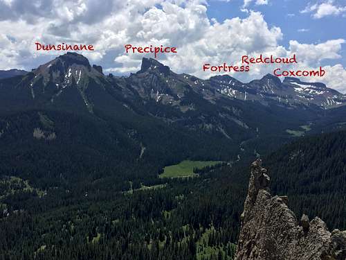 Overview of peaks as seen from Chimney Rock | 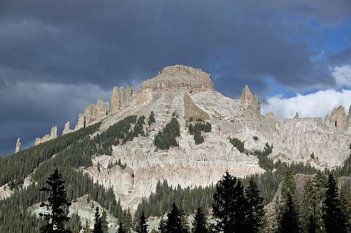 Dunsinane Mountain |
When one studies the map, a dream may come into your head about a possible combination with other peaks along the ridge, forget dreaming and in reality, Dunsiname does not connect well with other peaks. If you are fit you can do both Dunsiname and Precipice in one day, but both expect to climb as separate peaks.
Nearby Peaks: to the north lies Turret Ridge - the most difficult 12er in Colorado with the easiest route rated as loose and scary 5.9, and to the south lies a line of finely shaped 13ers: Precipice, Fortress, Redcliff and finally Coxcomb.
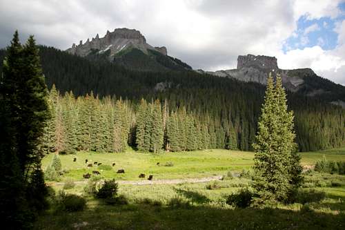
And right across the valley floor with West Fork of Cimarron Rive are majestic Chimney Rock and Courthouse Mountain.
Getting There
Road to Owl Creek Pass
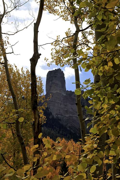
Chimney Rock as seen from your drive in
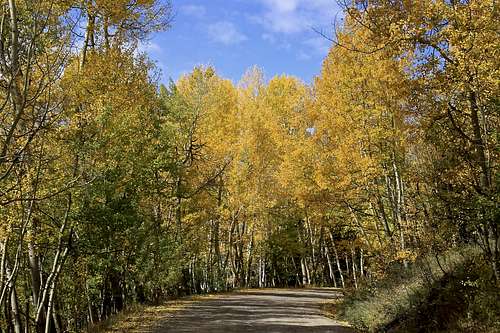
There are two ways to access the upper West Fork of the Cimarron River. One comes in off US 550 from a little north of Ridgway and the other comes in from US 50 and goes by Silver Jack Reservoir. This is a well kept graded dirt road passable by passenger vehicles. It is very popular in the autumn when aspen are changing colors.
From US 550 turn east onto Country Road 10, well marked for Owl Creek Pass. Stay on CR 10, eventually you will turn onto CR 8. A little further up the valley, the road makes a sharp switchback and begins gaining elevation more seriously through open scrub oak terrain. It takes about 45 min to drive to the top of Owl Creek pass. Consider stopping at the “True Grit” meadow with nice views of Courthouse and Chimney Rock. True Grit film from 1969 with John Wayne was filmed here.
At the top of Owl Creek Pass, there’s a small, unofficial camp area on the north side of the road. Continue down east to the first turnoff you see, less than a half mile from the pass. The turn off is well marked for the West Fork of the Cimarrown (=FR 860). Drive up this usually good road that offers several possible campsites all the way to the Courthouse trailhead (about 1.7 miles from CR 8). A short distance past the trailhead, passenger cars will need to stop. The main road veers to the right and becomes much worse.
If you have 4 WD with good clearance, continue south up the road as it goes up a steep, rocky section. in 0.75 miles, it drops down a little and makes a sharp left to a ford of the West Fork. There are some good campsites here. From the stream crossing it is another 0.7 mile to the trailhead. It is the end of the road.
If coming from Gunnison by way of US 550 turn south on County Road/Forest Road 858 that goes to the Silverjack Reservoir. It's 22 miles on a graded, dirt road.
Route
North Ridge: the approach to the North Ridge is not long, but it does take some time since there is no established trail and it is steep. The goal is to either reach the saddle between Turret Ridge and Dunsinane Mountain, or (and this is what we decided to do since we were camping just below Dunsinane's west side is to bushwhack up the steep western slopes, which are covered with a thick forest and many fallen trees. Crossing a West Fork of Cimarron Creek was not a problem although there is no bridge and the water was high (I took my shoes off and waded through, the water reached above my knees, July). We found a forested ridge, which we basically followed all the way to the "gates" and many beautiful looking pinacles. The going was relatively easy, forest lower down and grassy areas higher up. The scree section was very short. We passed through the gates (see photos), and found the way (several options) to the North Ridge.It did appear that the route lower from Turret's/Dunsinane saddle was easier and less steep.
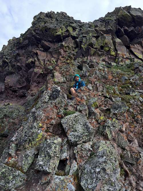
Above the pinnacles, the ridge becomes more narrow and steep. It almost appears un-penetrable, but if you look up, you will find some fixed slings (July 2017) and weakness in the wall. The rock appears relatively stable at steeper sections. Carefully climb up testing the holds, this is the crux and class 4 climbing. We did not use rope. It is very exposed here and a slip here would not end up well. Above the steep cliff keep bypassing another set of cliffs of the main peak. Walk along its western side south, you may see an occasional small cairn here. After nearly by-passing the main summit, there is a weakness and relatively easy way up, mostly class 2-3. We were inpatient and climbed a pretty steep cliff to summit, and found much easier way on our way down.
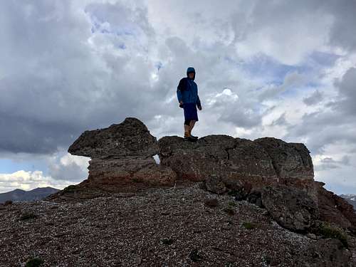
Enjoy the views. The summit is relatively large. I did not find any summit register.
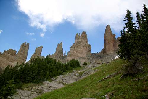 Gates of Dunsinane - your obvious destination | 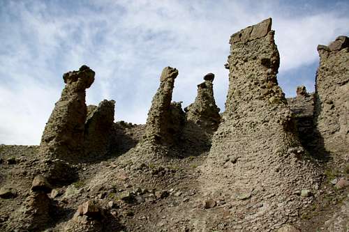 Pinnacles - Dunsinane Mountain (find your way through) |
 Gates of Dunsinane and pinnacles above | 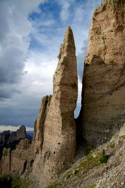 Pinnacle Dunsinane Mountain, Turret Ridge in the background |
 Short class 4 section | 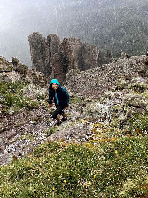 Dunsinane Mountain |
 Dunsinane Mountain - summit with fresh hails | 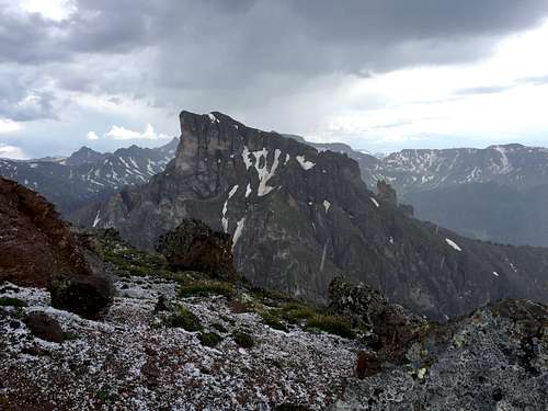 Precipice Peak as seen from Dunsiname |
Red Tape and facts
Dunsinane Mountain and Precipice Peak
Wilderness rules apply here: ALL VISITORS PROHIBITIONS:
1. Entering or being in the restricted area with more than 15 people per group, with a maximum combination of people and
stock not to exceed 25 per group.
2. Camping within one hundred (100) feet of any lake, stream, or National Forest System Trail.
3. Building, maintaining or using a fire, campfire, or wood-burning stove fire:
a) within one hundred (100) feet of any lake, stream or National Forest System Trail.
b) above treeline.
4. Storing equipment, personal property, or supplies for longer than seven (7) days.
5.Hitching, tethering, hobbling or otherwise confining a horse or other saddle or pack animal: 1) in violation of posted instructions, or 2) within 100 feet of all lakes, streams, and National Forest System Trails.
6. Possessing a dog which is not under control, or which is disturbing or damaging wildlife, people, or property.
Note: the term "under control" is defined as the dog being leashed, and/or under direct verbal control by the
dogs owner or handler at all times.
7. Shortcutting a switchback in a trail.