

-
 16093 Hits
-
 81.18% Score
-
 13 Votes
|
|
Mountain/Rock |
|---|---|
|
|
47.34119°N / 113.84683°W |
|
|
Mountaineering |
|
|
Spring, Summer, Fall |
|
|
8777 ft / 2675 m |
|
|
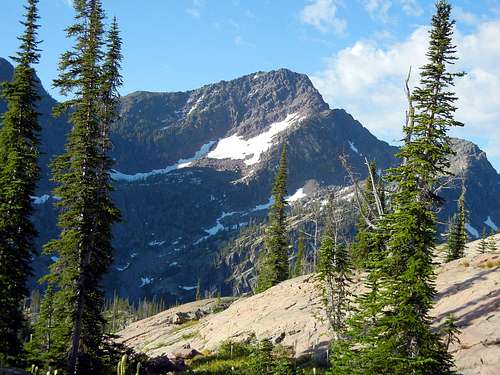
Daughter of the Sun from the north.
Overview
“Daughter of the Sun”. Just the name is enough to instill a desire to climb the peak. Add to that its reputation as a somewhat elusive summit along with its position on the eastern edge range that provides fantastic views of the high Missions and you have a very enticing objective.Scrambling the last bit to the summit involves a little Glacier Park Class 3 / 4 rock among the summit blocks and up the highest of those. Getting to the summit blocks by even the easiest of routes involves travel over large boulder fields, loose talus, scree, and / or through some fairly nasty thick scrub subalpine fir and whitebark pine.
Views from the summit are quite rewarding with almost all of the major peaks of the Missions visible.
Getting There
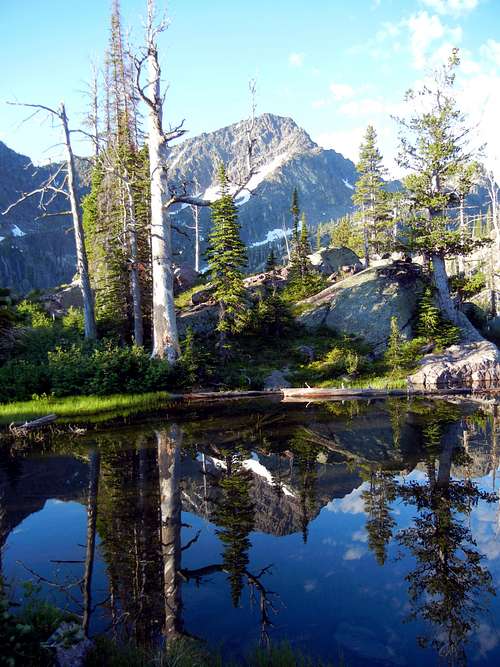
Daughter of the Sun relfecting in Lagoon Lake
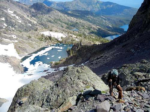
For the west, north, or northeast ridges, the most logical approach is via the Glacier Lake / Turquoise Lake Trail – USFS Trails 690 and 708. The trailhead is accessed by the Kraft Creek Road (USFS Road 561) which leaves Highway 83, 37 miles north of Highway 200 or 51 miles south of Big Fork, MT from Highways 35/209. Then 11 miles of good gravel road takes you to the trailhead. The way is well signed. There is ample parking and a potty house.
The road end with marked campground as shown on the USGS topographic map is no longer valid. The trailhead parking area now lies ¾ mile east of this old road end and no formal campground exists. You start out walking along the old road until it transitions into the trail. It is six miles from the trailhead to Turquoise Lake at the base of the peak.
The southeast ridge can be reached from Crystal Lake which has two main access trails. The shortest approach is on northern piece of USFS Trail 351 that leaves from the vicinity of Meadow Lake. This trailhead is accessed via USFS Road 79 – the Lindbergh Lake Road which leaves Highway 83 about 35 miles north of Highway 200. We have not used this road. It looks to be about 11 or 12 miles to the trailhead. The bad part of coming this way, you would travel downhill to Crystal Lake, dropping about 1000 feet in about 2 miles.
Trail 351 continues past Crystal Lake, eventually connecting to trail 34 to the south, which ends on USFS road 906. Coming into the lake from that way looks much longer than coming in from the north, with more vertical gain and loss.
Trail 490 accesses Crystal Lake from the south end of Lindbergh Lake, but it must be reached by boat.
This ridge has also been approached by climbing over the top of Lindy Peak and traversing from there. Lindy Peak is most often climbed from the Glacier Lake / Turquoise Lake Trailhead. Total distance one way about 5 miles with a lot of up and down.
Views - Enlarge for detailed captions
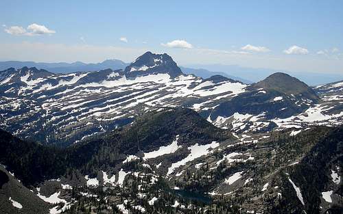 View south to Gray Wolf from Daughter of the Sun View south to Gray Wolf from Daughter of the Sun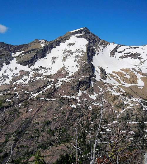 View west to Mountaineer Peak from Daughter of the Sun View west to Mountaineer Peak from Daughter of the Sun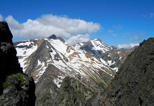 View N / NW to McDonald & Glacier Peaks from Daughter of the Sun View N / NW to McDonald & Glacier Peaks from Daughter of the Sun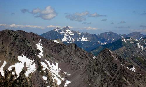 View NW to Calowacan from Daughter of the Sun View NW to Calowacan from Daughter of the Sun |
Red Tape
The mountain and trails are in the Mission Mountain Wilderness and wilderness rules apply, but no permits are required. There is no camping allowed at Glacier Lake.Routes Overview
West Ridge / Daughter of the Sun
CLIMBERS GUIDE TO MONTANA, by Pat Caffrey (out of print) states the following:
“Daughter-of-the-Sun Mountain 8777 [C] Southeast ridge. The northeast ridge is brushy and requires some route-finding. The west ridge is begun from Turquoise Lake. Follow it on up, then traverse to a large draw on the south side of the mountain which goes up to the southeast ridge near the summit. Note: All routes eventually merge with the southeast ridge. Near the actual summit, thread through some house-sized blocks. The way is tricky, but you should enjoy solving the problem.”
The [C] rating in this book is defined as Class 4.
The southeast ridge can be attained from Crystal Lake or cross country from Lindy Peak. See the getting there section. From Crystal Lake it would be at least 4 miles and 4000 vertical feet to the summit. Over Lindy Peak is about 5 miles with a lot of up and down.
The northeast ridge might be attained at its base near the west end of Glacier Lake and can be attained from Turquoise Lake. Note that this is a very long route and two parties that we know of which attempted to complete it in a day from the parking area were not successful. They ran out of time. A third party of two reached the summit in 7 hours from the parking area.
We climbed the West Ridge from Turquoise Lake and found the route to be roughly as described. See the route page.
The true summit is the westerly most of the large blocks on the crest.
Camping
There are USFS and private campgrounds in the Swan Valley.The campground shown at the trailhead on the USGS Quad no longer exists.
There is no camping allowed at Glacier Lake.
If approaching from the north and planning to camp near the mountain, there are very limited campsites at Turquoise Lake, a better choice is Lagoon Lake which has a number of nice spots.