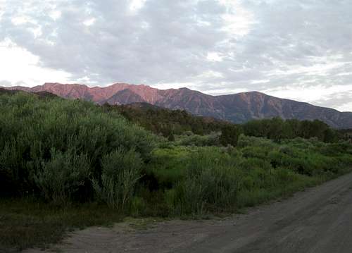
![Currant Mountain]() The Currant Range from near our campsite
The Currant Range from near our campsite
A little background
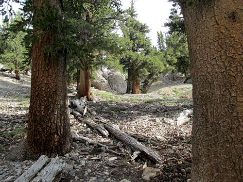
![Currant Mountain]() Our first car camp
Our first car camp
For the past ten years, I have been working to pick off the peaks listed on
the list that contains the 169 mountains in Nevada that have more than 2000 feet of prominence. Some of these peaks are easy since they have roads to the top but many are very isolated and don't even have trails. Oftentimes, the crux is just getting to the mountain as some entail miles and miles of dirt roads or mountain tracks. Some of the peaks see tons of visitors during the year and some see only a few in a decade. A couple interesting facts about this mountain is that it is on many lists, two of which might interest those who aren't into prominence peakbagging, the Great Basin list and the Las Vegas Mountaineering club list of 50 peaks.
Dennis Poulin and myself were both down to having only one peak in the state left that had over 4000' of prominence and that mountain was Currant Mountain.
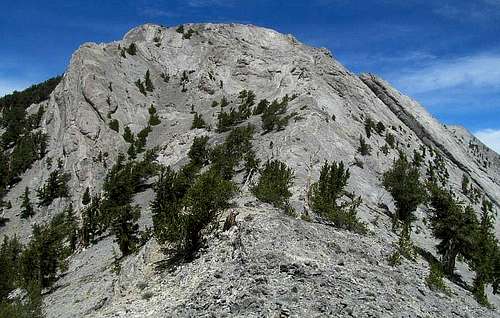
Currant Mountain reaches a height of 11,518 and with almost 4600' of prominence, it is the 16th most prominent peak in Nevada. It had been on our hit list for some time but every time previously we had been unable to access the mountain due to snow, electrical storms or excessive heat. Finally, we were able to find a time where we both could join forces and go after this one once again but even then we had to contend with heat and electrical storm possibilities.
![The road in]() Turnoff
Turnoff
Day one - The false start
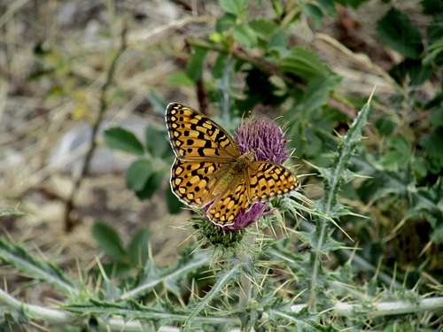
![Currant Mtn]() Beauty on a thistle
Beauty on a thistle
Dennis made the long trip down to Ely from Medford Oregon and I the not so long trip from Lehi Utah. Interestingly enough, we both arrived in Ely about ten minutes apart and from there we headed for a place to car camp for the night. We found a place about ten miles in off of US 6 and settled in for the night. In the morning, we made our way to what most people use as the "trailhead" at the 7800 foot mark. From there, we hiked up the jeep track about a half mile to where a switchback occurs and then we headed away from the switchback on what is referred to by many as the "Gerry Roach route". I won't go into detail here on the terrain we covered but suffice it to say that not long after we left the switchback, my stomach was doing flip flops and giving me a lot of discomfort. About two hours into the hike, I knew I had a big time problem and wasn't going to be able to go much further and it was the kind of stomach distress that a good riddance would resolve. At first I thought it might be due to the heat since I was already sweating like crazy as even at 7 a.m. it was hot. Finally, I notified Dennis that I was having a problem and we stopped to discuss the options. I recommended that he continue on as I didn't want to keep him from getting to the summit but he would have none of that. He said he wasn't going on without me and we would go down and see what the morrow would bring. That alone speaks volumes for why I value his friendship and in the ten years I've known him, we've probably hiked/climbed over 200 mountains together, in almost all of the western states.
After getting back to the vehicles, I still was having a lot of stomach problems but couldn't get anything to happen. I figured I might have picked up something from one of my grandkids (24 hour flu) or maybe something I ate the day before. I figured if I could just get relief that things would get back to normal and yet I couldn't get anything to happen until I elected to drink a V-8 juice. It was a shame to waste a good can of V-8 juice but then again, the results were well worth it. I'm sure that is more information than most anyone needs but it was like someone threw a switch for me. Immediately I felt better and was now encouraged that tomorrow would be a better day.
We had noticed on our walk down the road that the road wasn't in bad enough shape that we couldn't drive both our vehicles up it to almost where the switchback was and proceeded to do so. We found a spot off the jeep track that allowed us to car camp and proceeded to spend the remainder of the day talking, resting and watching a thunderstorm that rolled in about 3:30.
Day two - The summit at last
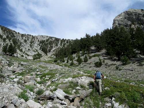
![Currant Mountain]() The basin at 10,000'
The basin at 10,000'
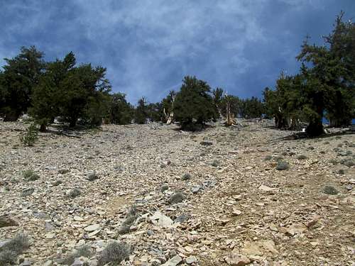
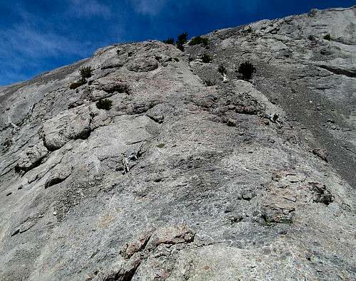
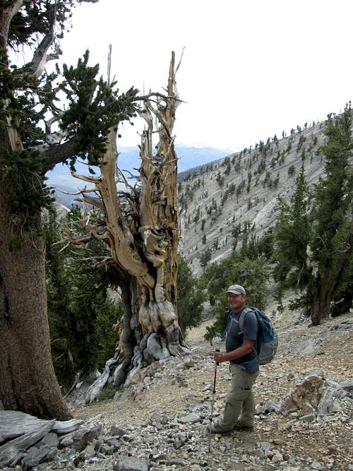
Getting an earlier start, we left our vehicles at 5:30 a.m. and headed up to where we left off the day before. It took us half the time to reach our highpoint of 9675 and continued on up to the basin that sits about 10,000'. From there we made our way to the steep slope that has a magnificent bristle-cone forest on it but found out that the slope was very slow going due to the angle and the looseness of the scree. We tried to use the roots of the trees as a "ladder" of sorts and even then I found myself taking two steps up and sliding one step back down. I was remembering Streeyrs words at this pont. He said "The route is steep and slippery. No ropes are required, but it’s a steep slope. I was nearing my limit on this one. " The Bristle-Cone trees helped as generally the scree around them was a bit more stable and you could grab a moment of rest under their shadows. The trees wee really some of the most remarkable ones that I've seen and Bristle-cone trees though are a wonder to behold. These trees are often well over 2000 years old and generally only are found at high elevations in the Great Basin of around 10,000 feet. Most of my favorite Nevada mountains and some in Utah have these priceless trees on them. But back to the climb through them and that terrible scree.
It was not only tiresome and energy sucking, it made for slow going. It took us (more me than Dennis) as long to get to the saddle at the top of the slope, a gain of over 1200 than it did to gain the previous 2200 feet. The difficulty of the loose scree had about taken my 74 year old legs out and I mentioned to Dennis that I didn't think I had the legs left to do the final effort.
Dennis, who knows my hiking abilities sometimes better than I do, said that he knew I had another 700 feet left in them so let's do this. He was right.
![Scree fest]() Steep scree
Steep scree
We dropped down from our saddle a couple hundred feet to another saddle at the 11000 foot mark and I felt re-newed energy and was excited about getting this summit.
![Summit ahead]() Looking up at the class 3 section
Looking up at the class 3 section
We started to make our way up the route that would lead us to the summit. After gaining a couple hundred feet, we came to a class three section that was handled by a nice cleft in the rock. After that it was a matter of careful foot placement due to some minor exposure and soon we had that section behind us. Then we found a steep spot that led over to a small tree that we had to get over and around followed by a short down climb and then it was up a really steep scree slope till we were on the west part of the summit ridge.
![Steep section near summit]() Steep section which required care
Steep section which required care
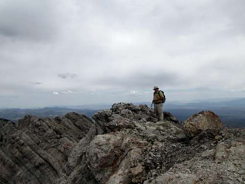
The summit ridge was a little airy but never difficult. We could see the summit and made our way over to it and found it marked with a cairn and just below the cairn a witness marker for the summit. Ater some celebratory fist bumps and walking over to look down the north side and the knifeedge that leads to Duckwater Peak, I snapped a few pics and headed back to check out the summit itself. which was marked by a cairn. The witness marker pointed to where the central benchmark should have been but we couldn't locate it. In looking through the cairn, we couldn't find the register either although Victor Zhou (summitposter castlereagh) who had been there just two weeks before us mentioned that he had found one and had left a note for Dennis and I to find. Alas, we couldn't find the register but obviously, we were a bit worried by the weather heading our way.The skies were threatening to the south of us and moving our way and we didn't want to be caught high on this mountain in a rainstorm let alone an electrical storm. So, after less than ten minutes on top, we were scurrying back down the route we came up and doing our best to get out of harms way.
![Currant Mtn]() Me heading up
Me heading up
![Currant Mountain]() Dennis on the summit Dennis on the summit | ![Witness marker]() Summit Witness benchmark Summit Witness benchmark | ![The view from the summit]() The view below the summit The view below the summit |
![Looking north]() Looking north
Looking north
Down the mountain
![Near the top of the scree]() Near the top of the scree slope on the way down
Near the top of the scree slope on the way down
After retracing our way back down the class 3 section (easy class 3), we made our way to the 11000 foot saddle and made our way back to the other saddle, a couple hundred feet higher. Dennis made short work of it while I plodded my way back up. He got a nice rest while waiting for me and soon we were dealing with the steep scree slopes back to the bottom of the little basin at the base. By the time I made it down, I had rolled my left ankle but not enough to stop me, it was just enough to slow me down. Eventually we made it back to our vehicles and we could turn our back on the mountain that we had wanted and let me tell you, it felt very very good. On the way down, a few rain drops hit us but the storm never made it to our area although we could hear thunder booming off in the distance. After getting back to our vehicles and changing clothes, we left this beautiful area and made our way back to Ely where we had a nice dinner at the Nevada Hotel before heading west towards Hamilton mountain, the next objective for Dennis and a nice rest day for me.
Would I climb this one again? Absolutely. It is a terrific mountain and I would be aware of the worst part of the climb, the bad loose scree of the bristlecone slope. A big thank you to Dennis for sticking with me and being willing to tackle it two days in a row.
Thanks to others for their information
This mountain is best climbed when you have gathered maps and information as provided by those who have gone before. I'd like to thank a few of them for their willingness to share their information and it helped us when we climbed this mountain. In no particular order, a big thank you to:
1. Richard Carey for his great
route photo and trip report as he posted on his own website. See that picture below.
2. Victor Zhou for his facebook pictures and information. If you are a facebook member, go to his page and go to albums to find his stuff.
3. Bob Bolton for sharing his route information with us in a personal letter.
4. Gerry Roach for originally posting his route on his webpage of SummitSight.
See that report with pictures and maps
HERE.
5. Moapa Peak (Harlan) for his
contribution to summitpost and his own web page.
6. The
Ascender for the 2007 article on the LVMC climb.
7. Streeyr (John H.) for his
summitpost page and pictures.
I've been studying this information for several years so when we got to the mountain, I felt I knew this mountain a bit better than most of the others that I've visited in Nevada.
![Route up Currant Mountain]() Richard Carey's route pic
Richard Carey's route pic
Climbing in Nevada - my experience
![Currant Mtn]() Me on the summit of Currant Mountain - Storm clouds in the background
Me on the summit of Currant Mountain - Storm clouds in the background
When I load up my truck and head for Nevada, I am often asked the question:
What mountains can you find in Nevada? Isn't Nevada just one big desert?
People don't comprehend that Nevada has more mountain ranges in it than any other state. Nevada is in the Great Basin and is truly a desert state but it is a remarkable place and the mountains are full of wonder and surprises.
In my ten years of venturing into Nevada, I have driven almost every paved road and a good portion of all the dirt roads as well. Its almost a requirement to have a high clearance vehicle with 4WD and a necessity to be as self contained. Good maps, GPS and communications are helpful. I prefer the Benchmark Nevada mapbook and I've found a cell phone range extender that works well with my Verizon phone. It is called a
Wilson Sleek and often allows me to have at least texting ability in areas where normally I get no reception at all. Check it out on Amazon. AT & T was not a good choice in Nevada and I changed from that carrier to Verizon when I discovered that Verizon worked better for me in Nevada. Dennis also uses one with the same good results although I have run into some who scoff at the idea of a range extender, the thing works for me and I don't go into the back country without it. Does it work all the time? No, but I have had communications ability in places where I didn't ever have them before. Just ask my wife. I also carry a 2 meter ham radio but with repeaters being so few and far between out in Nevada's back country, I find more success with the Wilson Sleek extender. I wish I'd had one years ago. It also works well for me in Arizona and Utah's western desert area.
I carry plenty of extra water, gas and two spare tires. I feel safest when there are two vehicles heading into the remote areas and always let someone know where I am going. With a second vehicle with me, I feel even better knowing that if my vehicle breaks down, I have help right at hand. Always be prepared with warm clothes, sleeping bags and emergency gear, and as I mentioned, be self sufficient. Gas stations in northern and central Nevada can be rare and often you will see signs that say 169 miles to the next gas. Believe those signs and always keep your tank filled when you have a chance.
I've found Nevadan's to be friendly and helpful and I always wave at passing vehicles on the dirt back roads and almost always get a wave back. I've found that studying Nevada history to be enlightening and often will stop and read the Nevada DOT historical signs that are found along most of the highways. The Pony Express trail and the California trails are also great to be aware of and where they were located and there are also many ghost towns and historic places to check out.
One thing you can count on (except during hunting season), is that most of these mountains you will have to yourself. It is extremely rare to meet another party of hikers or climbers on 90% of the mountains I've visited.
My favorite Nevada mountains
![Currant Mtn]() Some massive bristlecone trees
Some massive bristlecone trees
This section has nothing to do with this trip report but I thought it'd be interesting to see what my Nevada top 10 might be. I'd rank Currant near the top but here's my list.
1. Charleston Peak near Las Vegas
2. Matterhorn Peak near Jarbidge
3. Ruby Dome near Elko
4. Currant Mountain near Ely
5. Troy Peak near middle of nowhere
6. Arc Dome SW of Austin
7. Wheeler Peak in Great Basin national park
8. Spirit Mountain near Searchlight
9. Diamond Peak near Eureka
10 Dutch John Peak near Pioche
Other peaks that deserve honorable mention are:
11. Hayford Peak near Las Vegas
12. McAfee Peak north of Elko
13. Mormon Peak near Las Vegas
14. Bunker Hill near Austin
15. Pilot Peak near Wendover A rock slog, not an overly fun hike but a beautiful peak to behold from afar.
Boundary Peak east of Bishop Cal. Boundary is the state high point but it wasn't a peak that I thought deserved much attention since it is a sub peak of Montgomery Peak.
None of these mountains have a road to the summit and most require fair amount of effort to get to the summit.
Currant was my 141st prominence peak in Nevada and before the week was over, I had my number count up to 143. Ahead of me on the list are John Vitz, Dennis Poulin, Ken Jones and Gordon MacLeod.
Here's a great list.
My Nevada map as of July 12th, 2014 is below:


Comments
Post a Comment