
Comments
No comments posted yet.
|
|
Trip Report |
|---|---|
|
|
47.56526°N / 123.31617°W |
|
|
Jun 28, 2020 |
|
|
Hiking, Mountaineering, Scrambling |
|
|
Summer |
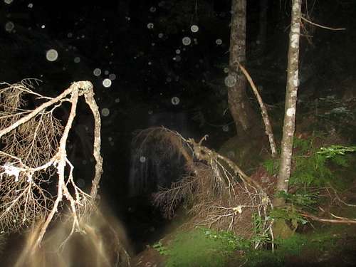
I arrived and parked just outside of the Olympic National Park boundary on Lake Cushman at 2:15 AM, and started at 2:30 AM on June 28, 2020.
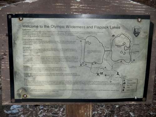
I walked past the Staircase Ranger Station and made my way onto the North Fork Skokomish Trail, hiking in the dark on relativley flat terrain for 70 minutes and 3.5 miles before I reached the junction between the deep Olympic wilderness and the Flapjack/Black/White Lakes trail.
The moderately steep hike to the lakes began here, and Madeline Creek and the bridge marked the halfway point on this trail. The sun rose as I neared the final turnoff point at 3.5 miles, left going to Black/White Lakes, right going to Flapjack. From here it was another half hour, and I reached Flapjack Lakes at 5:30 AM, 3 hours in.
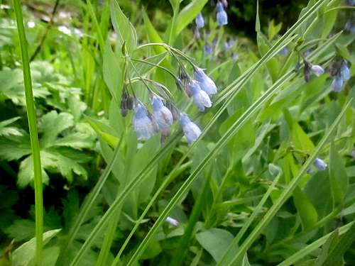
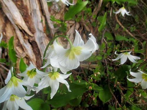
I took a short break before making my way to Gladys Divide, 0.9 miles in exactly an hour. Lots of beautiful wildflowers along the way, sadly I didn't see any black bears, which often visit the Flapjack Lakes.
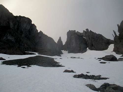
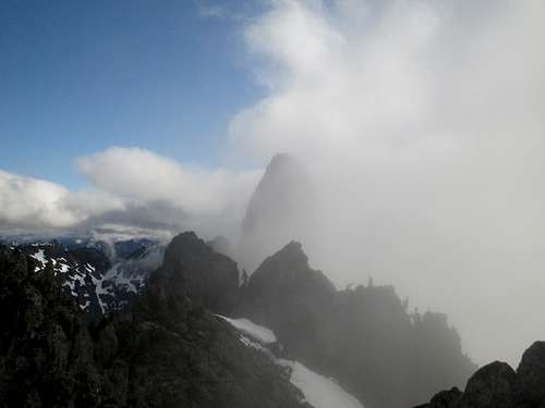
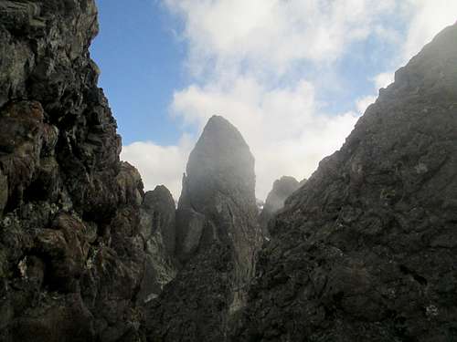
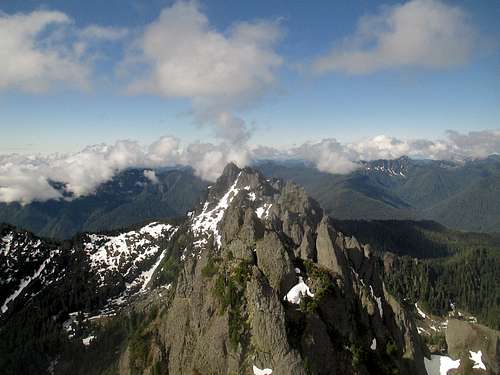
From here began the real tiring bit; crossing the lower talus and snow fields took an hour of 3rd class scrambling, and at this time of year crampons would've been helpful, luckily I had my ice ax. Real easy to twist an ankle, any time you're on a rock talus scree/field. Ascended up what I believe is Needle Pass, keeping just to the edge of the snow chute, slowly going up and down along the base of the Sawtooth. Rock is mostly good, better than Angeles but not as good as the Cascades, so there were a few Class 4 moves that scared the bajeezus out of me on the way.
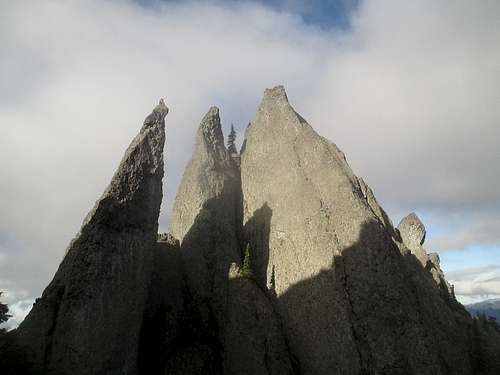
It took an hour and a half for me to reach the final southern gully adjacent to Cruiser, and there was a lot of sketchy Class 4 and low 5th oves I had to make, I tended to move on the eastern face of the numerous gulies and Sawtooth needles, honestly I probably made it harder than it has to be.
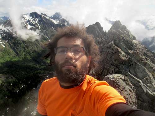
I began free solong the final 4th class gully and 5th class ~70-100 foot south corner/face of Cruiser, and successfully didn't die. Mountain Project says route runs 5.3/low 5th, I'd argue that whatever route I did was more 5.7-5.8, although there are only two bolts so there could be a lot of variation in rock difficulty rating. I strongly recommend the south corner route, especially if you're soling, unless you dare brave the west face, which looks 5.8-5.10 ish (Flapjack side) , and the east side looks even more basalt slabby, possibly 5.11 (the Mildred Lakes side)
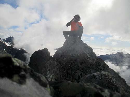
I summited at 9:30 AM, 7 hours from park boundary at Cushman to summit.
After a short rejoicing of living another day with a can of Pringles, I began the long journey back down with no aid or climbing equipment. I've learned over the past year that each time I free solo summit a mountain or rock route that is 5th class or even a 4th class scramble, I seriously put my life at risk. This was definitely the case on the descent from Cruiser. Strangely enough, the NDE I nearly had wasn't on the 5th class descent, but in the steep 4th class grass/loose talus gullies. I tried to downclimb these by way of using the rock chimney when I could, because the grass/weeds/talus would be a ~50-200 foot drop to death in some cases. The best way down is the north-south gully directly west of Cruiser, not the first gully which ends, but the second one. You start on the north end and make your way down, easily a 45-50 degree slope compared to the 70+ degree slopes on the other gullies, or just straight up downclimbing individual needle peaks of the Sawtooth, which one mistake would be a ~100-300 foot fall to death below. Anyways, it took me 3 hours to get down from Cruiser to Gladys Divide, a half hour back to Flapjack Lakes, and a more leisured 3 and a half hours to the car, passing numerous hikers along the Staircase loop and a few people making their way to Flapjack. Total time car to car was 14 hours, and what an exciting and terrifying experience in the Sawtooth during the Year of the Rona.