
-
 3419 Hits
-
 70.83% Score
-
 1 Votes
|
|
Route |
|---|---|
|
|
28.70550°N / 17.8445°W |
|
|
Hike and Scramble |
|
|
Half a day |
|
|
Walk-up-and-down |
|
|
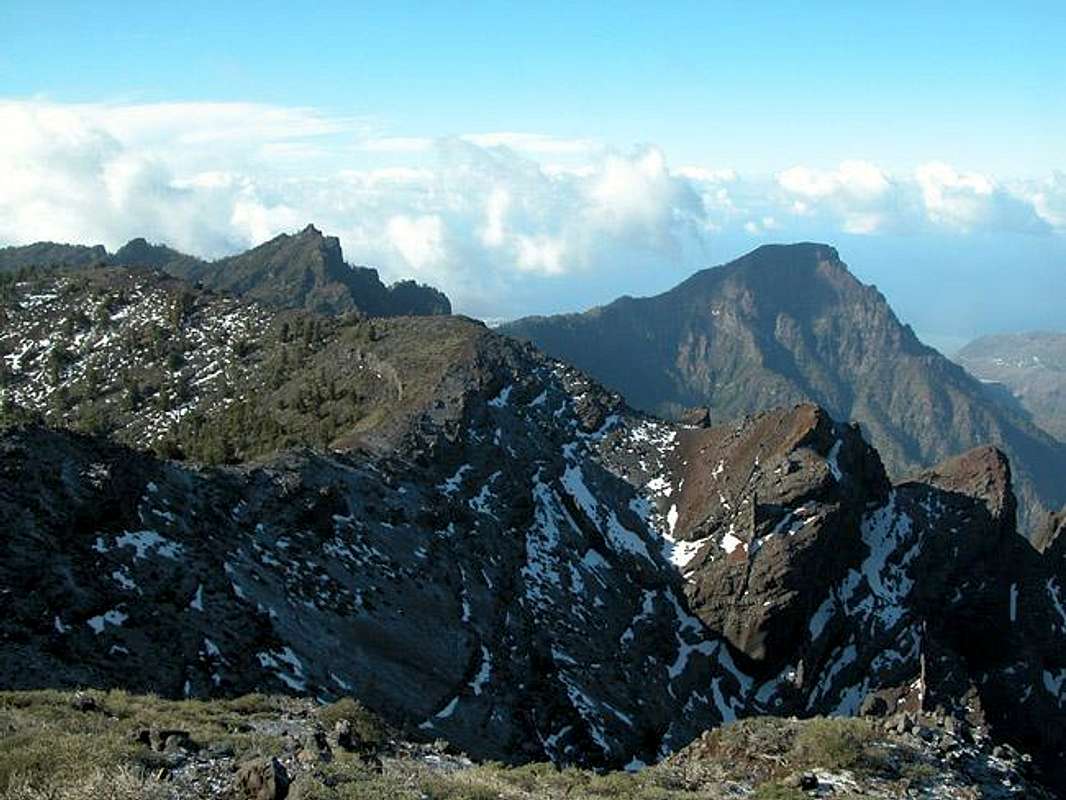
Approach
You'll reach the trailhead near Pico de la Nieve as described on the main page.Route Description
- Start altitude: 1900m
- Summit altitude: 2085m
- Prevailing exposition: west
- Type: 3h 30min
- Protection: marked
The crest trail ascent to Punta de los Roques starts at a parking lot on LP-22. Head westward along LP-22 for a couple of minutes before the trail turns to the left (south and starts climbing the lower slopes of Pico de la Nieve. You cross one of the beautiful Canarian pine forests at first and after 20min the trail lowers to the second (higher) parking lot. Pass it on the northern side but immediately afterward turn south on a slope traverse of about 1km.
The trail zigzags uphill for a couple of minutes before you reach an intersection. The left-hand trail leads to Punta de los Roques, the right hand trail leads directly to Pico de la Nieve. You can take both trails the former is the more direct and shorter one. However, it is a little exposed in the next section, which takes you to the crest and Ruta de la Cresteria.
Once on the crest trail turn south and start the climb to Pico de la Sabina. There are petroglyphs - rock drawings - by the Guanches, the original inhabitants of the Canarias just below the summit. The next stages take you to Pico de la Veta de la Arena and Pico del Cedro which the crest trail both passes on their eastern sides. Short ascent paths lead to the summits.
Now the trail lowers into Degollada del Río. Here a steep scree ascent to Punta de los Roques or rather the Rifugio de la Punta de los Roques starts. Once at the Rifugio you can scramble trail-lessly upwards to the summit of the Punta.