
-
 6087 Hits
-
 73.06% Score
-
 3 Votes
|
|
Route |
|---|---|
|
|
42.37520°N / 8.93380°E |
|
|
Mountaineering, Scrambling |
|
|
Spring, Summer, Fall |
|
|
Most of a day |
|
|
Class 3 |
|
|
Scramble, easy climb degree I. |
|
|
Approach
The route starts at Ref. de Ercu, 1667 m. For the approach see the main page.
Route Description
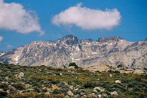
Monte Cinto
I shall describe the route as we saw it on April 26th, 1998. Part of the route was covered with snow which is certainly not the case during summer.
From Ercu hut we cross the creek and reach the foothills. Over a broad rocky shoulder we could follow a weak trail with stone markings, towards the top of the shoulder there were more and more soft snow and trails dissapeared (in summer you could certainly find them). The route should be marked, but here at the bottom, we could find no marks yet (only stone marks - cairns). Stone marks led us towards the left, where we enter a quite steep ravine, all covered with snow. On the top of it we saw a red arrow, surprisingly pointing towards the right, on a notch. But there every path ends. May be in summer it's here, where the path comes up. Now it's all covered with snow. So we return into the ravine and follow it, on the left side we see again some stone marks. Just below the top of couloir stone marks lead us left out on a ledge, but the passage is steep, below are almost vertical rocks. So we turn again, follow the couloir to the top and climb over some easy rocks (I.-II.).
Above the ravine is free of snow and stone marks indicate, that on return we could indeed go by the narrow ledge. Some 100 meters we did on easy terrain without snow (even weak trail) and so we climb a notch in the right ridge. But below the route goes again by the couloir - Couloir de Biccarelli. Partly we go by snow in couloir, partly by rocks left of it in an easy climb (I.). On the upper part we go again by couloir, tend towards left and reach a balcony, some 200 meters below the summit. The terrain is quite steep all around. From the balcony the rest of the route is clearly seen. We go up again and then a long traverse towards left is awaiting for us. below are steep rocks, but the snow on the traverse was just enough steep that the passage was comfortable enough. At the end of the traverse you climb some 50 meters and reach the main ridge. Only there some steps in snow came from the left. Following the terrain below the main ridge towards right and through a short, easy couloir you reach the summit.
Show a bigger map
Essential Gear
End of April we used crampons, ice pick and a short rope (we were 3 with a 13-year boy). In summer rope is not necessary, depending on the experience. Also chasing the trail should be easier in summer. From Ercu hut we needed some good 4 hours, but most of the ascent we had soft or "normal" snow in some parts we were dropping in snow a meter or so. In summer the ascent should take some 3 hours.