
-
 1818 Hits
-
 82.48% Score
-
 15 Votes
|
|
Mountain/Rock |
|---|---|
|
|
46.47785°N / 10.70529°E |
|
|
Hiking, Mountaineering, Scrambling, Via Ferrata, Skiing |
|
|
Spring, Summer |
|
|
9951 ft / 3033 m |
|
|
Overview
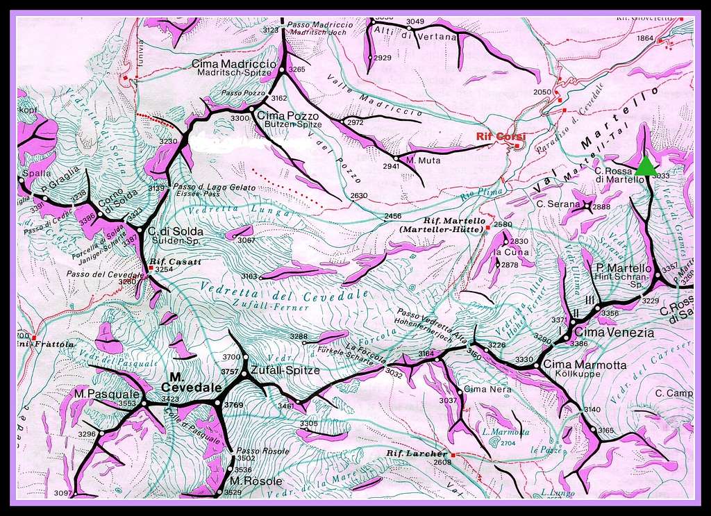
Cima Rossa di Martello - Vordere Rotspitze 3033 m
Cima Rossa di Martello - Vordere Rotspitze 3033 m (this latter is the Tyrolean name) - is a powerful pyramidal peak belonging to the Ortles-Cevedale group and located at the Northern edge of Punta Martello Northern spur.
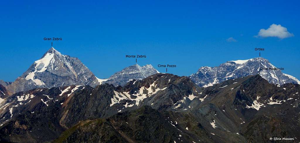
The mountain dominates the head of Val Martello and Lago Gioveretto and offers exceptional views over the most famous mountains of the group, such as the Gran zebrù, the Ortles, the Cevedale. It is an interesting destination, quite popular.
The first known ascent was by Jukius Payer with Johann Pinggera in 1878. However, the summit had already been reached previously by some topographers.
Getting there
Road access
From A22 Brennero Motorway exit Bolzano and follow the road 38 towards Merano and Val Venosta as far as Coldrano 672 m. Here leave the main road, turn to left and follow the road entering Val Martello (Martell Tal). After reaching the artificial lake of Gioveretto (Zufrittsee), proceed for the last short stretch of the road leading to Paradiso del Cevedale m. 2050 where the road ends (Km. 81 from Bolzano). There is a car park beyond which transit is prohibited, the "Hintermartell" car park, also served by buses. Nearby there is the Rifugio Genziana at 2051 m, the most convenient point of support on the route.
Cima Rossa di Martello Normal route
Cima Rossa di Martello Normal route
Difficulty: Alpine F
Difference in level: 1020 m. from Paradiso del Cevedale 2050 m
Exposure: West
A wonderful loop involving the climb of an easy 3000 m summit and an exciting return through a wild crossing between alpine lakes, waterfalls and glacial moraines
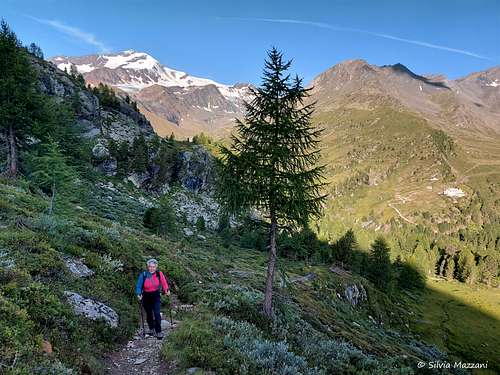
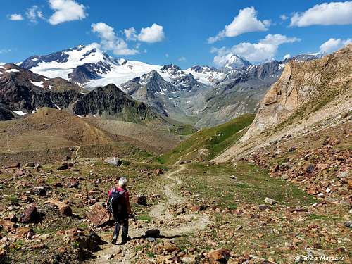
From the parking lot continue on foot, beyond the ban on transit, and cross over a bridge, taking the path n. 31 and entering the sparse wood. You soon reach a crossroads where you turn left following the signs to the Cima Rossa di Martello. The path is now steeper and rises into the sparse coniferous forest and a little beyond along the high pastures. The prairie then gives way to stony ground up to the Schönbichl 2636 m. You begin to see the surrounding mountains, among which the Gran Zebrù stands out. The path continues with a dense serpentine of turns and finally reaches an important crossroads near a rocky pulpit: we ignore the path 37A descending on the right and instead aim on the left to a large detrital gully coming from the top.
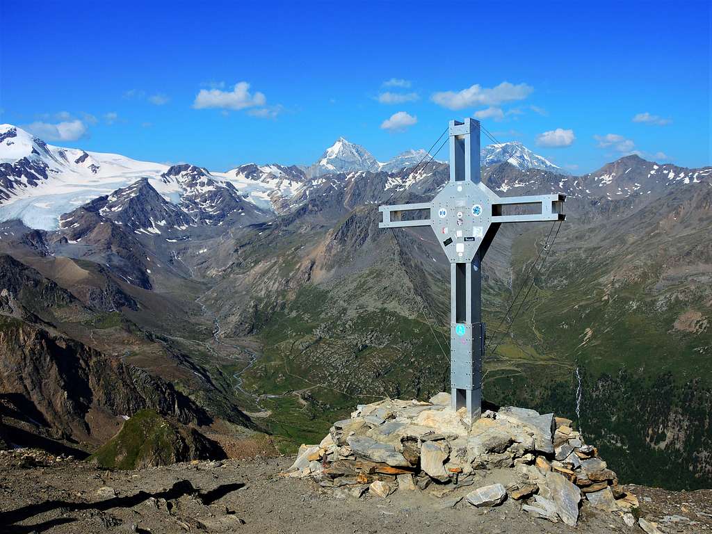
The steep climb inside the gully is aided by the presence of fixed metal ropes anchored on the rock wall on the right. At the end of the fixed ropes, a short last stretch on broken rocks gives access to the wide summit (big cross and summit-book).
Descent: reversing the same route or, definitely very advisable as it adds something more to the itinerary from a panoramic point of view and natural beauties, making a circular ring. The continuation of the itinerary is described below, in case you decide not to go down the same route as the outward journey, but to make the ring.
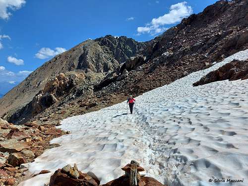
From the summit, go back down along the aided path to the crossroads, where instead of following the ascent route you must take the 37A trail that descends to an underlying saddle beyond which the path proceeds in easy ups and downs between snowfields that remain until late summer. The path follows partly detrital terrain and the path is facilitated by trail markers and some cairns of stones.
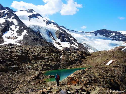
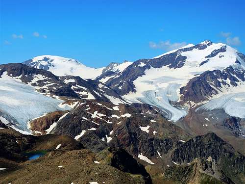
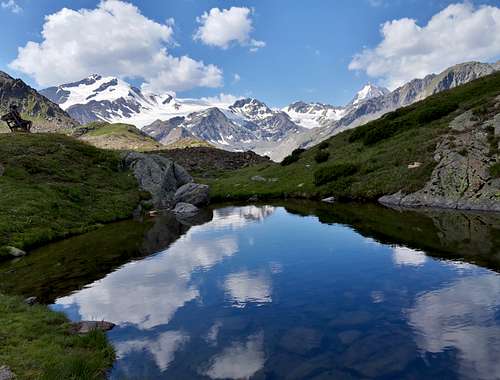
You reach a magnificent glacial lake, from which the outline of the Cima Rossa di Martello just climbed appears. We proceed among boulders and debris in a wild environment, reaching a short distance from a second glacial lake at an altitude of about 2900 m, a little larger than the previous one. Shortly before reaching the lake, the path descends to the right, then immediately to the left of a relief called Cima Serana. You reach a saddle to the left of the summit, beyond which you descend into a valley to a basin crossed by a stream.
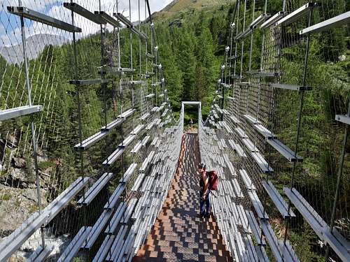
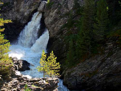
The path then runs along an ancient lateral moraine originating from a glacier that is now much more backward. The continuation of the path finally leads to the edge of another very impressive lateral moraine, which descends until you reach a crossroads where to the left you can reach the Rifugio Martello in about 15 minutes. Instead, proceed to the right (trail sign 37) along the pastures that lead to a small lake where the icy peaks located to the south are beautifully reflected. Now the route descends towards the large valley below, where a beautiful waterfall appears on the left. Once you reach the plateau below you can take path n.103 down to the "Bau", a dam that was built in the 19th century to protect against the devastating flooding of the glacial lakes. After grossing the dam we continue on the path 150 to the Rifugio Corsi (Zufallhütte). Instead of going down directly to the car park, an interesting alternative itinerary is offered along the path of the Rio Plima gorge. You cross the spectacular and scenographic suspension bridge, reaching the impetuous waterfall of the Rio Plima. We descend to the Panoramic Pulpit and to the various thematic stations of the Rio Plima Path, including the Panoramic Scythe, a semicircular balcony from which you can enjoy a splendid view of the valley. The path finally reaches a crossroads where you join the last part of the ascent itinerary, just before the bridge, to finally reach the parking lot.
Surrounding peaks
Red Tape
No fees no permits required. Cima Rossa di Martello is located inside Parco Nazionale dello Stelvio, one of most important National Parks in Italy. You should take care of nature as usual within the boundaries of all the natural parks. Free camping is not allowed and fires are strictly forbidden. The whole fauna and flora are protected. Don’t disturb fauna and peacefulness with every kind of noise.

When to Climb
The best period goes from the end of June to the end of September.
Accomodation
- Rifugio Genziana at 2051 m is the most convenient point of support on the route. Alternatively there other possibilities of accomodation along the Val Martello.
Meteo
Meteo Bolzano Alto Adige
Meteo Alto Adige
Guidebooks and maps
Guidebooks


“Prestigiosi Tremila del Sud Tirolo” by Hanspaul Menara – Ed. Athesia
"Ortles-Cevedale – Parco Nazionale dello Stelvio” by Gino Buscaini – Collana CAI-TCI Guide dei Monti d’Italia
Maps
“Ortles-Cevedale” , foglio 72 - Kompass 1:50.000 "Ortles-Cevedale" - Tabacco