
|
|
Route |
|---|---|
|
|
45.78857°N / 11.17565°E |
|
|
Hiking |
|
|
Spring, Summer, Fall |
|
|
Most of a day |
|
|
E |
|
|
Overview
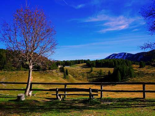
Monte Pasubio consists of a main massive peak, Cima Palon, and two minor rock formations called Dente Italiano and Dente Austriaco. Cima Palon 2232 m is the highest mountain in the Pasubio group, Vicenza Prealps. There are various routes to reach the summit, especially starting from Passo Pian delle Fugazze and from Bocchetta Campiglia. It will be described in this page a less famous and frequented itinerary, starting from Malga Chéserle on the Trentino side of the mountain.
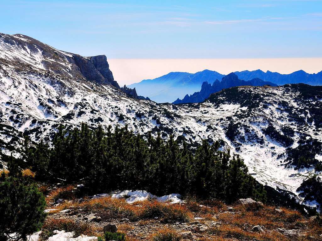
This itinerary winds through an uncontaminated and spectacular landscape, interesting also in reason of the numerous and significant remains of artefacts dating back from the Great War, as fortifications, tunnels and trenches.
During the battles of the First World War it was a stronghold of the Italian army that had firmly occupied the highest peak of the Pasubio group, Cima Palon precisely, very important from a strategic point of view in reason of its dominant position over the whole area of the fields of battle. The entire summit ridge of the mountain, consisting of Cima Palon, Dente Italiano (Italian Tooth) and Dente Austriaco (Austrian Tooth, where the Austro-Hungarian army had settled), was permanently garrisoned during the war and was a hot battleground.
Getting There
The ascents starts from Malga Chéserle which is reached from Rovereto.
Road access to Malga Chéserle
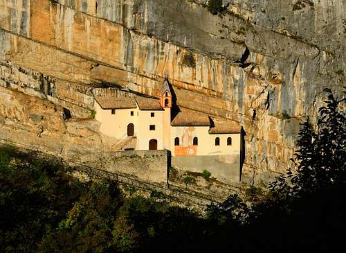
From Autobrennero A22 exit Rovereto Sud ant take the SS46 Vallarsa-Pasubio state road. After the interesting Eremo di San Colombano, leave the main road and turn to left on the road SS 50 following the signpost "Trambileno", "Giazzera" and "Rifugio Lancia". The road climbs up with some bends and forks, we always follow the signposts for the Rifugio Lancia and Giazzera. Once in the little village of Giazzera 1095 m we follow the signpost to the Rifugio Lancia. Here the road becomes narrow, even if it remains paved for about 3 km until reaching the plain of Malga Chéserle at about 1400 meters of altitude, where it becomes a dirt road and where it is possible to park the car in some parking lots.
Route Description
Summit quote: 2232 m
Difficulty: E
Difference in level: 800 m from Malga Chéserle
Time required: 7 hours round trip
Starting point: Malga Chéserle
From the car park follow the unpaved road (Path SAT n. 101) that continues towards the Refuge Vincenzo Lancia, with possible shortcuts that cut through the bends in the road. Along the way, ignore all the paths that branch off from the gravel road and continue along the path SAT 101 getting the enchanting pastures of the Alpe Pozze where it's located the Rifugio Vincenzo Lancia 1802 m.
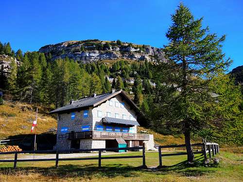
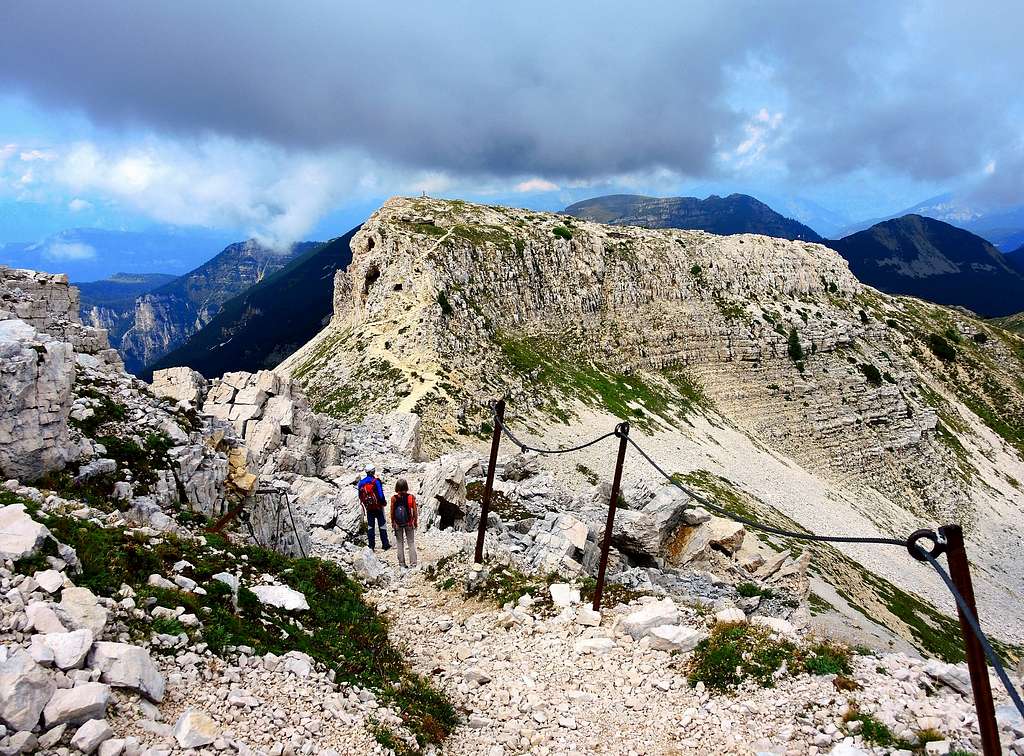
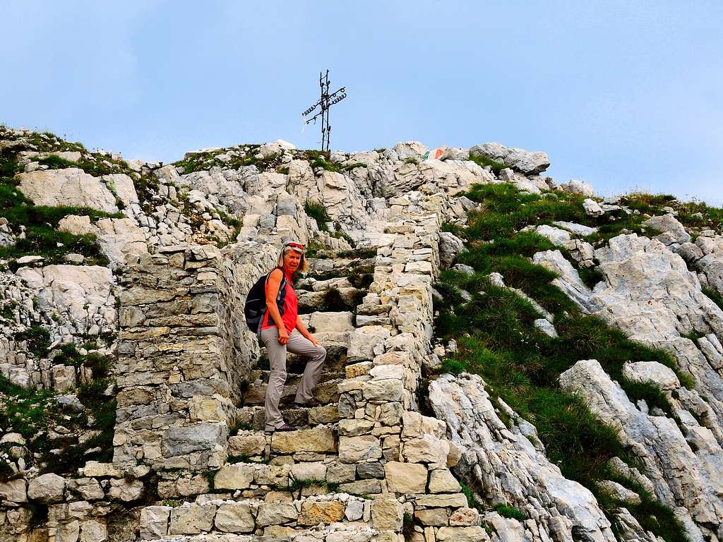
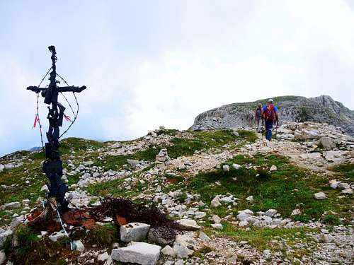
Reached the refuge we continue passing in front of the fine building of the hut along the path SAT 105 which continues horizontally and after a short distance heads to right. Alternatively without passing in front of the refuge we can take the path SAT 102. Both paths soon reach the Bocchetta delle Corde. Here we continue along path 105 (European E5, Sentiero della Pace) which goes around Monte Roite with a view of the underlying Vallarsa and the Carega Group. After a long stretch a little monotonous traversing in slight but constant ascent on the South West side of Monte Roite, we reach the Sella del Piccolo Roite 2111 m where we suddenly enter the heart of the Great War landscape with stone walls, tunnels, craters of bombs, remains of materials. The ascent to the Dente Austriaco is now beginning, passing by various Austro-Hungarian fortifications and galleries. Arrived in the summit-area we find a small cross, war trenches, plaques and an altar with crowns in memory of the fallen. Another cross, built with war remnants, it is located on the summit of the Dente, where right in front and very close it appears the Dente Italiano.
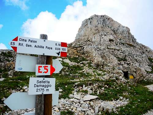
Descend along the path that leads to the Selletta dei Due Denti 2166 m. between the Dente Austriaco and the Dente Italiano 2220 m, in practice an underground citadel carved into the rock. We also descend from the Dente Italiano along a stone staircase and arrive near the Galleria del Dente. Not far away there is the Selletta Damaggio 2175 m between the Dente Italiano and Cima Palon, the highest summit of the Pasubio. From the Selletta Damaggio the summit of the Palon can be reached through a short ridge or alternatively along the tunnel Generale Papa, entirely excavated in the rock (necessary pile) exiting in the open air just near the summit.
Descent: reversing the same itinerary
Essential Gear
Usual mountain equipment and clothing
Hiking and scrambling scale
T - Turistico (Tourist): Itineraries on wide, clear and well worn paths, sometimes on mule tracks or gravel roads. The routes are never exposed, don't give any orientation problems and don't exceed 2500 meters of altitude. Suitable also for children
E - Escursionisti (Hikers): Itineraries on marked trails, even narrow and with possible steep and impervious sections. They are never exposed and don't give any orientation problems. They can tread different kinds of ground, such as forests, gravel, meadows, pastures, easy rocks, etc.). They form the majority of the trails that wind up in the mountains and require a certain habit to walk; you need equipment suitable for the altitude and resistant footwear with soles suitable for rough terrain
EE - Escursionisti Esperti (Experienced Hikers): Itineraries for hikers with experience and good knowledge of the mountain. Some of these paths may have exposed sections, however brief, which require firm foot and no dizziness. They require the ability to adapt to particular terrain, such as steep grassy slopes or stretches of rocks with difficulties that can reach the 1st degree of the UIAA scale. They can also reach high altitudes (3000 m or more). Sometimes they may include unmarked sections, requiring a good sense of orientation. Snow slopes are possible, however which can be overcome without specific mountaineering gear (rope, harness, crampons, ice-axe)
EEA - Escursionisti Esperti con Attrezzatura (Experienced Hikers with equipment - The same as EE, in addition these routes require the use of via ferrata equipment (lanyards, harness, carabiners, heat sink, helmet). This kind of itineraries range from the trails with short easy and not much exposed sections, previously equipped with fixed ropes and iron pegs, to the true and more difficult Via Ferratas climbing on rocky walls or on aerial ridges and ledges, previously equipped with long stretches of iron ropes, iron steps, ladders without which proceeding would constitute a real climbing. It is necessary to know how to use the technical equipment and have a certain habit of exposure and mountaineering terrains.
Red Tape
No fees no permits required. Cars are not allowed on the dirt road after Malga Chéserle.
When to climb
From May to the end of October
Huts and other accomodation
Bibliography
“Piccole Dolomiti – Pasubio” by Gianni Pieropan - Collana Guide dei Monti d’Italia, CAI TCI
"Sentieri Pasubio-Carega" - guidebook and map 1:25.000 - Sezioni Vicentine del C.A.I.