
|
|
Mountain/Rock |
|---|---|
|
|
46.01713°N / 11.02395°E |
|
|
Trentino Alto-Adige |
|
|
Hiking, Skiing |
|
|
Spring, Summer, Fall, Winter |
|
|
6010 ft / 1832 m |
|
|
Overview
Cima La Rosta 1832 m
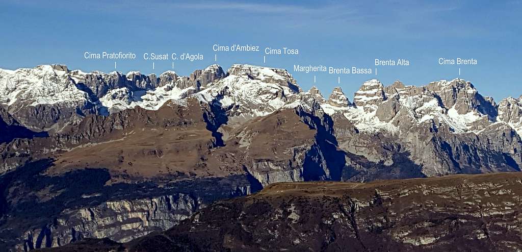
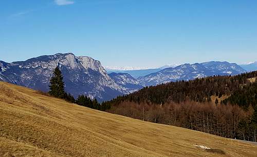
The Bondone Group is situated in the Southern part of Trentino and counts three main summits (Cornetto 2180 m, Doss d’Abramo 2140 m and Cima Verde 2102 m). Cima La Rosta 1832 m is a small mountain that is geographically part of the Bondone Group, located above the Piana delle Viote, towards which it gently slopes. It should not be surprising that the name "Rosta" has the meaning of "steep cliffs": in fact both to the West and to the north the mountain descends steeply in the direction of the Valle dei Laghi. La Rosta particular position - opposite to some of the majestic limestone walls of the Sarca Valley and more distant to the Brenta Dolomites - makes La Rosta a highly panoramic point.
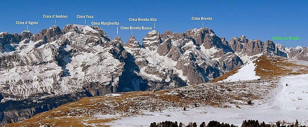
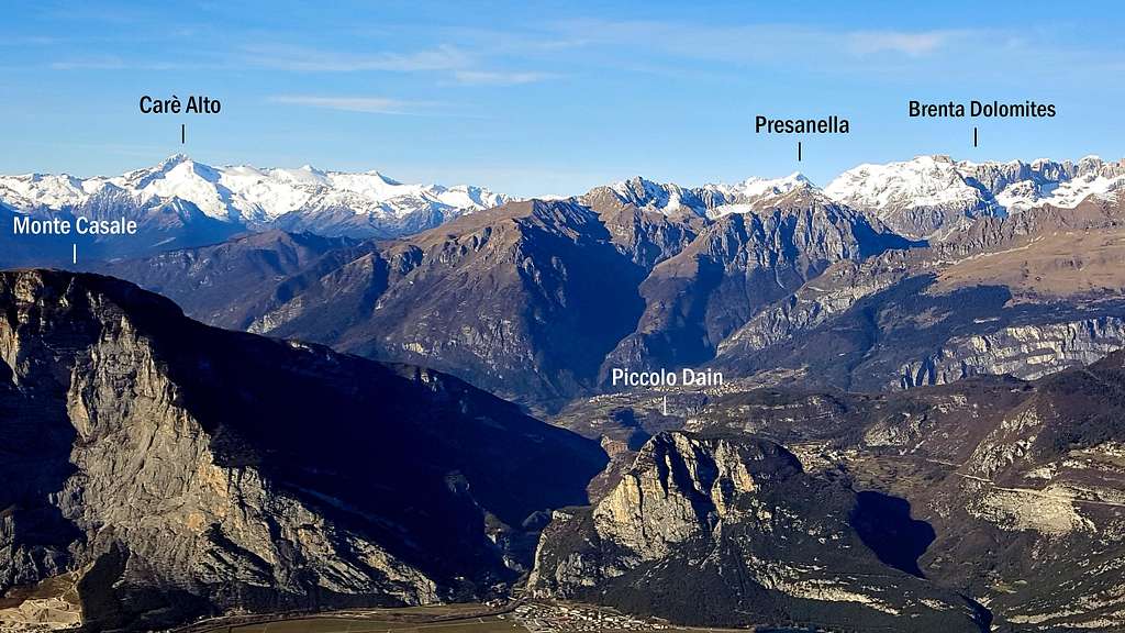
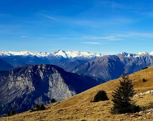
It's the last peak of the long ridge that starts from Monte Stivo and heads north to reach Monte Cornetto. Between this latter and Cima La Rosta is located the Bocca di Vaiona 1778 m. Already from this hill you can enjoy a breathtaking view over the Valle dell'Adige to the East and the Valle del Sarca, Valle dei Laghi and Brenta Dolomites to the West To the West the nearest peaks are the mighty rocky walls of Sarca Valley (Monte Casale, Piccolo Dain, Monte Brento, Cima alle Coste), then behind it follows the Brenta group and in the background the icy summits of Adamello-Presanella group and Cevedale. To the East Pasubio and Piccole Dolomiti. To the North the Dolomites and the icy groups on the border between Italy and Austria.
|
Brenta Group from La Rosta annotated autumn-pano |
Getting There
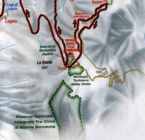
The starting point of the route is the nice Piana delle Viote 1539 m.
Road to Piane delle Viote:
- from Trento follow the SS45/bis toward Lago di Garda getting Le Sarche
- from Garda lake (Riva, Arco) follow the SS45/bis to Dro, here take the road SP84 to the Val di Cavedine and near the village of Lasino take on the right the SP85 toward Lagolo, pass the village of Lagolo and reach the Piana delle Viote del Monte Bondone 1539 m. Park the car before getting the Rifugio Viote.
Cima La Rosta round trail from Le Viote
Cima La Rosta round trail from Le Viote
Difficulty: E
Difference in level: 300 m.
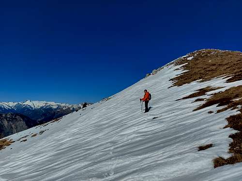
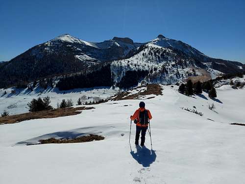
La Rosta is a beautiful destination, highly recommended and easy to climb even in half a day and even in wintertime, moreover very interesting for the variety of landscapes and the wonderful views.
Route description - The starting point of the itinerary is from a parking lot on the road coming from Lagolo towards Rifugio Viote, before getting the hut. At the beginning, we follow the signs of the path SAT 607 in the direction of Cornetto. We are in the Nature Reserve of the three peaks of Monte Bondone (Cornetto, Dosso d'Abramo and Cima Verde). The trail crosses the Viote plateau up the Val d'Eva, between La Rosta and Cornetto. There are several tracks on the plateau, but the direction to be taken is intuitive and doesn't pose any problems.
The trail is gentle-angled and soon you reach Bocca Vaiona 1778 m (path SAT 618), a wide saddle between La Rosta on the right and Cornetto on the left. From there you can already admire a broad panorama that goes from Lago di Garda to the Brenta Dolomites. Turn up to the right towards Cima La Rosta del Bondone, a grassy hill that borders the Viote plateau to the West, just in front of Monte Palon del Bondone. Follow the wide crest, reaching easily reach the top of the ridge and the summit (1 and a half hour from the start).

From the summit you can reverse the same route or alternatively follow the opposite ridge getting a track which descends on meadows and woods getting the road about one hundred meters to the North of the parking lot.
Summit views
Red Tape
No fees and no permits required
Nature
Monte Bondone Group is a small protected area. In winter the Bondone area is covered by snow, while in early summer, it is transformed into a carpet of colors, made up of millions of alpine flowers.
Hiking and scrambling grades of difficulty
T - Turistico (Tourist): Itineraries on wide, clear and well worn paths, sometimes on mule tracks or gravel roads. The routes are never exposed, don't give any orientation problems and don't exceed 2500 meters of altitude. Suitable also for children
E - Escursionisti (Hikers): Itineraries on marked trails, even narrow and with possible steep and impervious sections. They are never exposed and don't give any orientation problems. They can tread different kinds of ground, such as forests, gravel, meadows, pastures, easy rocks, etc.). They form the majority of the trails that wind up in the mountains and require a certain habit to walk; you need equipment suitable for the altitude and resistant footwear with soles suitable for rough terrain
EE - Escursionisti Esperti (Experienced Hikers): Itineraries for hikers with experience and good knowledge of the mountain. Some of these paths may have exposed sections, however brief, which require firm foot and no dizziness. They require the ability to adapt to particular terrain, such as steep grassy slopes or stretches of rocks with difficulties that can reach the 1st degree of the UIAA scale. They can also reach high altitudes (3000 m or more). Sometimes they may include unmarked sections, requiring a good sense of orientation. Snow slopes are possible, however which can be overcome without specific mountaineering gear (rope, harness, crampons, ice-axe)
EEA - Escursionisti Esperti con Attrezzatura (Experienced Hikers with equipment - The same as EE, in addition these routes require the use of via ferrata equipment (lanyards, harness, carabiners, heat sink, helmet). This kind of itineraries range from the trails with short easy and not much exposed sections, previously equipped with fixed ropes and iron pegs, to the true and more difficult Via Ferratas climbing on rocky walls or on aerial ridges and ledges, previously equipped with long stretches of iron ropes, iron steps, ladders without which proceeding would constitute a real climbing. It is necessary to know how to use the technical equipment and have a certain habit of exposure and mountaineering terrains.
When to Climb
All year round
Accomodation
In the vicinity there is the Refuge Viote at 1600 m of altitude. Otherwise the Valle dei Laghi and the close Valle del Sarca offer different kinds of accomodation.
Bibliography
"Valle del Sarca" map 1:25000 - Meridiani Montagne