Not all honeymoons entail beaches, warm water and margaritas. Sometimes they come wrapped in those neat little packages of mountain vistas, alpine lakes and cute, little furry things bouncing & barking among the rocks.
Our trip into the Weminuche isn’t a honeymoon per se, but more like an amuse-bouche to a larger, tastier course of two weeks in Patagonia in 2023. But I don’t think anyone will scoff at the opportunity to ride the narrow-gauge railroad or to spend a few days in the Colorado backcountry, even if it isn’t Chile.
This is my sixth trip riding the train, Regina’s second. At first, the train was novel and captivating. Then around the third trip, the magic started to wane and fade. I wasn’t particularly looking forward to it anymore. Riding the train became a means to an end. So much so, that I now distained it in lieu of other options; like sojourning down Purgatory Trail and Molas Pass hoping to find that excitement of ‘something new’ that I’d been missing. Riding the train shouldn’t be viewed as something that needs to be endured. It’s a cool fragment of Colorado’s history that, like many historical facets, is ensnared by the gravity of the early mining industry. I knew I needed to somehow change my tune.
I’m sitting back against the bench with Regina at my side sipping a coffee. I gradually switched to decaf a few weeks ago expecting there to be a few days of not being able to have my morning caffeine fix. Thus, eliminating caffeine withdrawal headaches while in the backcountry. That’s a surefire way to ruin a good day as Advil, Tylenol and such doesn’t do much good to remedy them.
Regina and I were relaxing to the jerks, bounces and quivers of the train as it rolled through the canyon. My mind was preternaturally calm as we watched the waters cascade, and the canyon walls float by. We were spending a solid week cocooned in Chicago Basin devouring a plethora of peaks. However, even with the rolling scenery and feeling the energy off some of the tourists seeing all this for the first time, my mind was calmly drifting to the history of the Animas and the ‘grit & tack’ those early pioneers must have had. I wondered about all those dilapidated and seemingly forgotten cabins at Needleton. I wondered why the Animas is sometimes colored yellow and wondered when it was considered too early to order a beer at the concession’s car.
I enjoy history. Especially when it’s in context with an upcoming trip. Take for instance, the name Animas River in Spanish translates into, ‘Rio de las Animas’ (River of Souls). Its earliest known use was in 1765 by the Spanish explorer, Juan Maria Antonio Riveria. He uttered this remark as his party crossed the Animas near present-day Durango. For some reason, the word ‘lost’ or ‘Perdido’ has been misconstrued into the name of the river. No one really knows why or when (possibly around 1886). But it’s been used off/on ever since.
History is a great reminder of what the ‘Old Timers’ were able to accomplish with significantly less than what we use today. It tends, for myself anyway, to put things a bit in perspective. Before we unload and start this trek up Needle Creek, let’s dive into several, dusty old tomes and look for some perspective.
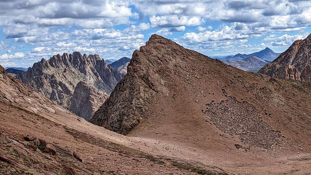
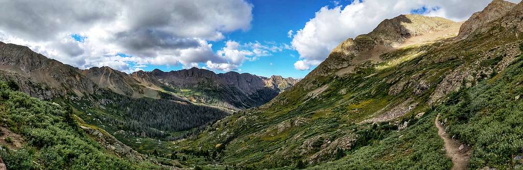
As something both novice and expert alike know quite well, accessing Chicago Basin is all about logistics. Because of its remoteness, there was little development in Needle Creek or the surrounding pockets like Columbine, Silver Mesa or New York Basin prior to 1877. Access was primarily had from the east via Vallecito Creek
A mixed scouting party (civilians, soldiers & guides) led by Lt. C.A.H. McCauley, located a route to Animas Canyon via Johnson Creek, so named after a member of the party, Miles Johnson. Said explorers also named other features such as: Grizzly Gulch, Mt. Valois, Grizzly Peak and McCauley Peak.
An interesting and somewhat humorous aside about the naming of Grizzly Gulch involves a particular member of the party. An older prospector (James Smith) was part of the scouting party and badly ‘rheumatic’. He supposedly suffered so much, that he often needed help in getting on his horse. One morning while the camp was lower down waking up, James Smith rode up one of the local tributaries looking for land to prospect. He slid off his horse and got started looking for gold. After a while, hearing movement in the brush not far from him, he looked up to find a sizeable grizzly bear ambling towards him. Not letting a pesky thing like rheumatism or arthritis get in the way, he outran the bear the mile and a half back to camp. When he reached camp, people saw what was chasing James and everyone scattered. Everyone that is, except Lt. Valois. He unsheathed his sword, stood his ground and waved it around yelling and screaming. It was enough to scare the bear away. Mount Valois to the southwest is named after him and of course, Grizzly Gulch is named thus.
In 1878, a primitive toll road opened up that coursed up the Animas. Once the canyon was accessible, commerce soon followed. In 1878-1879, developments arose in Elk Park, Cascade Creek and Needleton. The Shaw House, a local way station situated at Elk Park, offered overnight services and shelter to miners and travelers. Pretty much nothing exists of the structure now.
The small town of Niccora existed at the mouth of Cascade Creek but sadly, it too has been lost to the weight of time. And all those cabins you see at Needleton and up and down the river, those are the remnants of decades-old private property parcels going back to the turn of the century when a Mr. Webb built most of them hoping, like others, to turn a profit off miners and travelers.
The Denver and Rio Grande Railroad arrived in Durango in August of 1880. Later that fall, they began construction on a route going up Animas Canyon to Silverton. It was completed in July of 1882. Once the miners learned of permanent rails connecting Silverton, a trail was began coming down Needle Creek finally connecting Chicago Basin and the Columbine Pass area. Rail service was initially billed as a “scenic route” for travelers (wink-wink) but the majority of passengers were fur-trappers, miners and their load. It’s estimated that over the years, the Silverton-Durango connection transported roughly $300 million in precious ore.
As most of us know by now, the railroad has some new regulations concerning backcountry access for backpackers. Considering how restrictive it is (each reservation has a cap of 15 people with a maximum of 9 people disembarking at Needleton), I think we should all help each other out with attaining reservations). Hence, I came to know Scott & John who both posted questions to the horde looking for available spots the weekend of the 8/21-22. I reached out to them, invited them to join our little party and a few weeks later, we four were riding the train into the wild.
As an aside, I reached out to the railroad asking about the current restrictions. It turns out the restrictions are put in place by the Forest Service, NOT the railroad. The Forest Service is trying to spread out the number of backpackers visiting the wilderness by limiting the numbers each day. It seems not even as remote of a place as Chicago Basin or Ruby Basin can escape the increasing popularity of recreationalists.
At Camp
Needleton to Camp…
The train spilled its brightly colored contents onto the side of the tracks. Detritus of: REI, Patagonia, RAB, The North Face and Norrøna cluttered the easement. A few of us waited patiently as others passed out packs like communion wafers to the faithful. We weren’t a particularly chatty group but most did their part in helping to sort out the confusion. Perhaps it was because of the mileage everyone needed to hike. Perhaps it was because those miles would be suffered under the additional weight of 30-40 extra pounds. Or perhaps, no one was looking forward to doing the aforementioned in addition to gaining ~2,800 vertical feet.
Scott & John took off like Matchbox cars down the track. Everyone else followed like herded cats. Regina and I hung back and took our time. There’s a period of ‘on-trail adjustment’ that everyone endures. Some go through multiple ‘pack therapy’ sessions, some get lucky and come to an accord with their ‘monkey’ the first time and speed away. Regina and I found a good balance shortly after the Needleton Bridge. Speaking of which, the suspension bridge that we all use was built in 2008 replacing the older one which had deteriorated into a dodgy, dilapidated disarray of timber. It now spans about 105’ across the Animas.
Of course, part of that adjustment also includes the weight of hauling fluids: water, Gatorade, Red Bull, beer, whisky etc. But heed these words, the Animas River is a source you NEVER want to drink from regardless of charcoal or porcelain filter or UV; here’s why…
The upper Animas is contaminated by acidic runoff (mostly heavy metals) by abandoned mines such as the: Aspen Mine, Columbus, Blanchard Placer and Sandiago to name a few. A forensic trip up to the ghost town of Animas Forks shows the fingerprints. Closer to Silverton is the behemoth Sunnyside Mine, still leaching sulfides (iron, copper, zinc, arsenic, antimony) from its ample tailings into the groundwater. Even with dilution over the miles to Needleton, the volume is compounded. Some of these sulfides/metals combine to form iron pyrite (fool’s gold). When this compound is exposed to oxygen and water, it forms ferric hydroxide and sulfuric acid. The Fe (OH)3 is insoluble in water and precipitates out of solution thus, covering the rocks, riverbed and banks in a nice orange/yellowish hue. So again, don’t drink from the Animas.
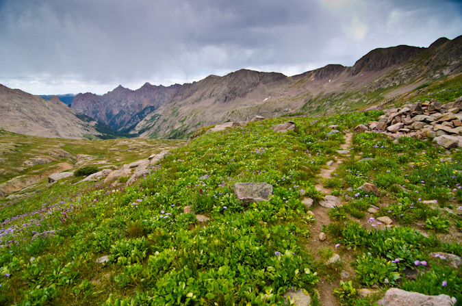
We stopped briefly at the bridge for New York Creek (9160’) to fill our Nalgenes and I found myself taking pictures of nearly everything: flowers, leaves, patterns in the trail from previous hikers footprints. I marveled at the white seeds hanging on to the dandelion’s apogee waiting to be set free. And for some reason, I looked up and stared at the high ridges thinking, “He who marvels at what’s underfoot, has the universe in his hands.” The thought literally popped into my head. It made me smile.
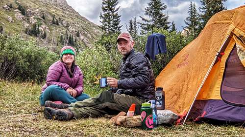
After hiking a total of 6.15 miles up the trail, Regina found a great spot close to Needle Creek at 11,000’. It was somewhat surprising to find this flat and open area considering how much of a revolving door the basin has been this summer. We dropped everything helter-skelter and proceeded to top off our Nalgene’s at the creek. Regina started to cook dinner while I set up our home for the next few days.
As nice as it would have been to head up and tag a peak or two that afternoon, we choose to stay put and enjoy our ‘living room.’ It’s a tremendous feeling sitting on the ground, feeling the willows brush up against you, physically spent and weary, borderline cold from the breeze whisking away ones sweat and getting drunk on the scenery. It’s not always about peak-bagging or trying to crush FK times. Sometimes it’s about un-connecting and appreciating the absolute void of minutiae that defines our lives back home in the city.
14-Needle Ridge
Day 2- 8/23 "Eolus puts up a fight"
This is Regina’s first time into Chicago Basin, it’s my third. The previous days march with 35-40lb. packs made for easy sleeping that night. We had climbing gear with us as I was keen on climbing Twin Thumbs, Needle Ridge and doing some recon on ‘The Spire’ for next year. But for now, the goal was the Eolus Group. With a decent enough forecast, we decided to sleep in a bit. We left camp at the ripe hour of 8:00 am.
“Twin Lakes Trail doesn’t fool around!” Regina said. But I knew better.
Under her breath was a rip current of F-bombs and things about other people’s mothers. But honestly, it is a steep trail, no bones about it. As we made syrupy progress up to Twin Lakes, I was scoping the slope out, envisioning it with snow and looking for suitable camp sites at tree line for an upcoming winter trip in January. So being preoccupied like I was, time went by fast.
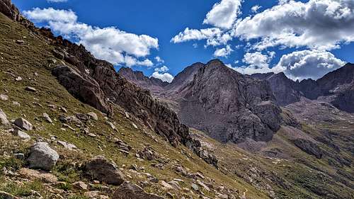
Colorado has no shortage of beautiful places that will take your breath away. It is in my 100% humble, factual opinion that Twin Lakes is among those places. While at the lake, we noticed the weather was starting to have issues and throw the occasional tantrum. Every 15 minutes or so, Eolus would lob dark gray ‘cloud grenades’ at us. So we took the left hand ramp and headed up the trail skipping the lakes. There would be time to stop & appreciate them later.
The trail hugs and traverses the lower south side bowl (of which I call Glacier Bowl as viewed from above). Quickly, the trail enters ‘Pika Town.’ If you’re anything like me, watching all those cute, furry brown potatoes bouncing among the rocks will turn you into a screaming little girl. This patch of basin is a veritable pika metropolis! I’m not sure how I even made it through to the other side!
Some cool little pika facts, when newborn pikas leave the nest, they never come back. Mom permanently kicks them out. But the youngsters don’t travel far. They leave and search out the talus for a territory that hasn’t been taken yet. Any pika colony you come acrost, most are related. But due to pikas being very territorial, some of their territories can be as large as a tennis court, they don’t tolerate intruders, even family. But they do bark to warn one another of potential threats.
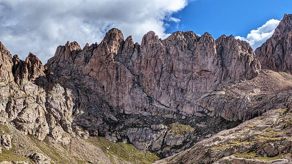
In no time, we found ourselves standing on the upper ridge facing Eolus most famous feature, ‘The Sidewalk in the Sky.’
The weather out west wasn’t looking good. The sky was full of dark, minatory paper sailboats floating on streams carrying pockets of rain and malice. One such tumor already scoured Chicago Basin and the Windom’s with a quick, ninja flyby temporarily soaking the lower forest.
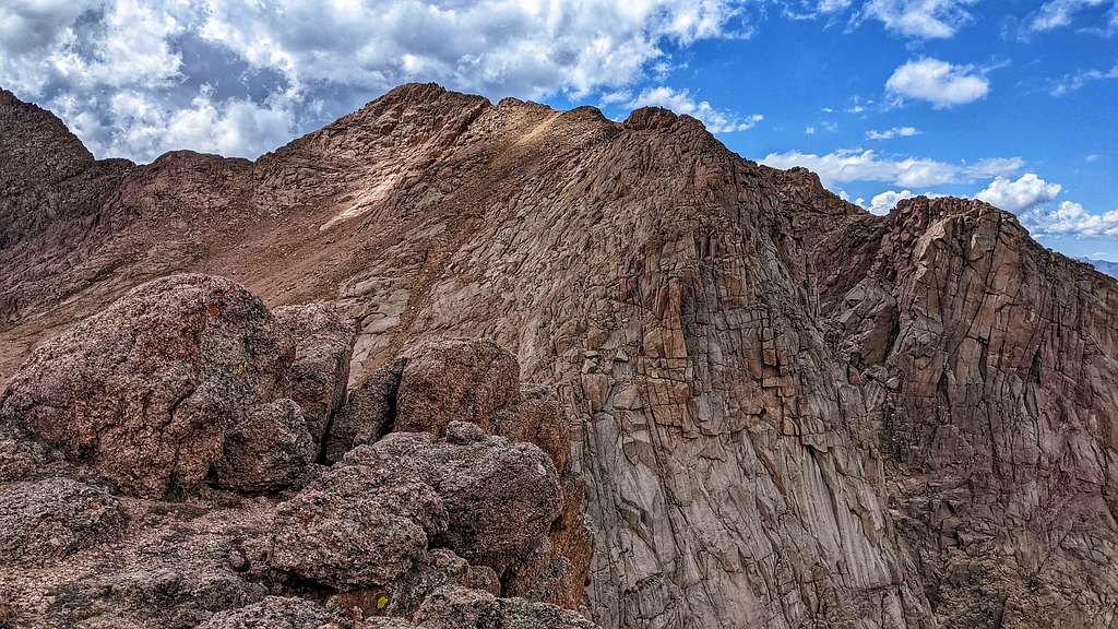
Full disclosure here, I’m 6’0”. Regina is 5’2”. I have zero problems with blocky ledges, blocks, ledges or ledgy blocks. Regina on the other hand, being rather height-restricted, does. I’ve learned that any climbing/scrambling grade to one person, can be very different to another. It’s a bit humbling to have expectations turned on their head in a sport where some things are just taken for granted. Regina struggled with the ledges. Add to that, the weather kept throwing dark blobs of cotton at us. But all was without merit. About 25’ below the summit, it rained on us for all of 2 minutes and grappled for 8.3560 seconds. She pulled and hauled herself up to the summit and we enjoyed the stormy views together. The register was soaked and the tube still had significant condensation in it. So I swapped it out with one of my own and fresh paper.
12-Windom and 18
I’ve guided people for years, helped others with routes and even had my own business for a few years. But I’ve never really given much thought to the plight that shorter people have while climbing or scrambling. I’ve read and come across the adage, ‘You always learn something new on every climbing trip’ so many times, I just want to throw up. But I have to say, truer words were never uttered. Hats off to you Mr. Anonymous.
On the descent, we took shelter on the leeward side of a sizeable rock and decided to wait for an especially vengeful-looking cloud to pass by. We took the opportunity to have lunch. After 15 minutes or so, the skies turned blue and we scrambled back up to the ridge to nab North Eolus. I don’t think these two mountains could be any different. The sharp, pink granite of North Eolus is a delight to scramble. And it turned out to be Regina’s favorite of the trip.
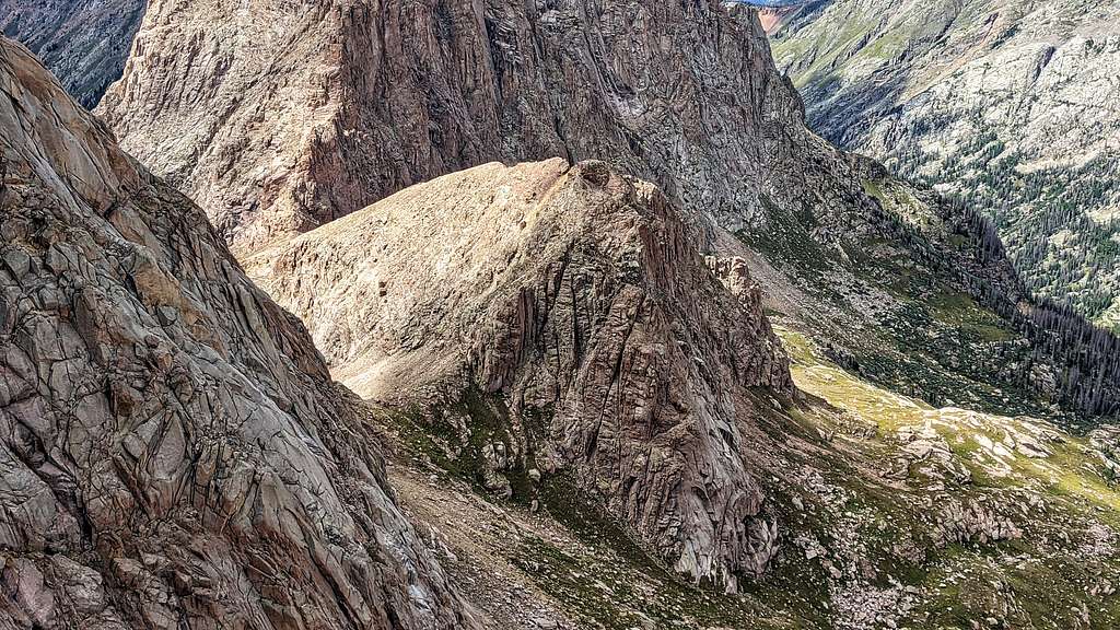
We descended to where we left her pack and we parted ways. I still wanted Glacier Point (13,704’), an unranked point. She descended the trail and I bee-lined it due east down the slope to the lower basin. It probably took me no more than ten minutes to descend. The scramble up to the summit equally went fast. The terrain was dirt and scree but with ample traversing, it was manageable. The summit was more like North Eolus. The views from the summit were incredible! It was a bit head-spinning to be looking down on Twin Thumbs Pass, Ruby Pass and Peak Twelve. North Eolus looked like nothing more than a higher ridge.
Unranked peaks don’t get the love they often deserve. Which is rather tragic considering it’s all based on a semi-arbitrary number. Why do people go out of their way to climb North Maroon Peak with only 234’ of rise? Or El Diente with only 259’ rise. Even the 284’ of rise that Glacier Point has makes it soft-ranked and certainly more worthy of visitation? I don’t know. I do know that one will often find themselves alone with all the solitude they can handle on these orphaned peaks and see the more popular mountains from vantages few get to see.
I quickly hiked down to ‘Pika Town’ trying my best to ignore their cute little barks. I was pretty sure Regina was still at the lakes and I didn’t want her to wait needlessly on my account. After I passed through the colony, I turned on the afterburners and ran back to the lake. She wasn’t there. She must have continued to hike down the trail. I splashed water on my face and head and continued to run/walk down the trail until I saw her far below near the Mt. Eolus Mine. Which by the way, yielded mostly silver during it’s time in operation. We hiked back to camp together.
It was a completely enjoyable day filled with new peaks and some repeats. The weather added a touch of excitement and of course, pikas!!
Day 3- 8/24 "This is a rest day?"
11-Twin Lakes Trail
‘Sweet!’ I thought. ‘Look at the sheer amount of things on this menu. My God, I’m in Heaven! Steaks, Fries, wings, milkshakes, Brussel sprouts…’ My eyes were as big as my appetite. But what’s REALLY weird, is as soon as I start to order the Bourbon BBQ Bacon Cheeseburger (medium rare of course), this super faint, almost dreamily quiet ‘Harry Potteresque’ music starts to play. Did I win the…
“Honey, you’re alarm is going off.” I hear Regina say.
‘Shit. I need to make this rude, intervening voice go away.’ I hear myself saying. ‘Expecto Patronum!’ I yell with a mouth full of French fries (like the ones served at Southern Sun Brewery in Boulder).
“Honey, your alarm. Please make it stop.”
“Ok, I’ll get it. I’m up.” I didn’t want that cheeseburger anyway.
We were going to take a rest day, take things easy and explore around a bit. While we were having breakfast, Regina suggested that we do Jupiter. After all, it’s only one peak.
“That’s right. It’s only one peak. It’s close, so mileage won’t be terrible. The weather is going to be amazing, so we can just take our time” I said. “I’ve been up it twice. Though, I don’t remember too much about it. I was up it once solo, and a second time with Britt, Kevin Pultske, Sarah Behernke and Gregg Gorrell to spread Steve’s ashes. Let’s go do Jupiter, you need it anyway.”
We packed our things up and headed out on the trail at the overly ripe hour of 11:00 am bound for Columbine Trail.
If one looks, there are actually quite a number of mines and tailings in the basin. On the trail as you wind up higher and higher towards Columbine Pass, there are two separate shafts you walk by. One in particular has the ruins of an old cabin next to it, acting like a cenotaph of past, broken dreams. This mine, if you brave the dark by headlamp, goes into the mountain at least a few hundred feet and branches out in multiple directions past the first turn. Ore cart rails and timbers are still there, as are old blasting plugs in the ceiling. This is the Little Jim Mine. It produced mostly silver with some gold and copper back at the turn of the century. On our way back down from Jupiter later in the day, I ventured into it as far as I could go and was in awe the whole time. I’ve ventured into a good number of mines in Colorado, Utah and Nevada and even got the rare chance to drive down into a working open-pit copper mine in Arizona. But this thing was absolutely incredible. To think men did it with nothing more than hand & chisel and small explosives.
The split for Jupiter is almost impossible to see off the main trail. You have to look for it by not looking for it. Like those damn eye-floaties that always elude your sight when you try and look at them directly, the trail for Jupiter does the same. But we found it and turned at the creek crossing.
Once on the trail, it’s easy to follow. But it doesn’t last long and eventually disappears into the meadow grass and flowers. All there is to follow, is the knowledge that one must keep ascending and the odd footprint trapped in the dirt to tell the way. It’s a steep ascent, but rather enjoyable.
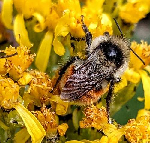
LoJ has Jupiter Mountain classified as a class 2+ mountain. I disagree with this rating. Even for myself, there were moves that had me reaching for holds, not hard mind you. But in my opinion, if one is actively reaching for holds and using their hands more than half the time which, the summit ridge necessitates, that’s not class-2. Add to that, the exposure along this short section would guarantee a disastrous outcome in the advent of a fall. If you fall on a class-2 trail, the worst thing that would happen is that you might fall on a bumblebee making for a bad day, for the bee. Difficulty is in the hands of the experienced I suppose.
We stayed on the summit for near 30 minutes and enjoyed the warmth. It was a gorgeous day with not a single cloud in sight. I think Jupiter has one of the better perches in the basin.
The descent went fairly quickly. Almost to the point where I don’t remember most of it. Though to be fair, I was scrutinizing the south ridge as it connects with Columbine Pass, trying to make out the route and see if it would go. There were a couple short, volcanic cliffs that looked like they could be by-passed but a gash in the ridge went all the way down into a fissure near the bottom of the slope. There was a mine there called the Black Horse (I believe). It looked formidable. Maybe next time I can go do some recon.
We ate two dehy. meals that night and enjoyed an amazing, Phlegethon light show of orange and red as the sun took its leave for the day.
Our stats for our easy, rest day came out to 5.92 miles and 2,833’-v-gain. Not too shabby!
Here's a video I took inside the Little Jim Mine on the Columbine Pass Trail
Day 4- 8/25 "Valois Throws us a Surprise"
North Eolus West
Honestly, I don’t know why Mt. Valois was on our radar for this trip. It’s nowhere near Chicago Basin and much closer to Vallecito Basin, Silver Mesa and Crystal Valley. It would entail miles of on-trail hiking and some boring class-2 ridge. Regina is focused on attaining all 250 San Juan 13ers, so she needed it (God bless LoJ for all its statistical beta-Thanks for a great website, John Kirk!). But the idea to do Valois was largely mine, so I’m at a loss on this one. I’m just glad I don’t have to go back for this monotonous bastard.
We left camp around 7:30 am under a heavy frost. It was cold. But thankfully, the 3.4 mile hike up to the top of Columbine Pass (12,680’) would put some warmth into our legs.
This was both our first time going to Columbine and it did not disappoint. Looking down onto Columbine Lake, the sporadic mine tailings and upper Vallecito Basin was smile-inducing. I don’t think too many people get the chance to see it. I do know some folks take the long hike in from Vallecito Reservoir, but man, with heavy packs, if one isn’t conditioned this would be a march from hell. We actually ran into a trio on our way back to Chicago Basin and they looked thoroughly worked.
Gaia Maps showed a trail that stays high paralleling the upper basin and ultimately ending at Trimble Pass. It’s a primitive trail that I don’t believe has a name. But it worked wonderfully as it didn’t lose all that much elevation. Most of it was a level traverse that crossed talus fields, high tundra and a couple of forgotten mines. I ended up building many cairns along its stretch as multiple portions of it were in the process of being reclaimed by nature.
We made Trimble Pass (12,880’) in short order. The running app, Strava recorded this section of trail at 1.7 miles; it didn’t feel like it. We had a quick snack at Trimble Pass and contemplated reversing course to go do Aztec Mountain & Kennedy. But being we put forth the effort to get this far, we surmised we would just suck it up and continue along the long ridge over Florida Mountain and to the far parapet of Valois.
The only thing of note of Florida Mountain and the long C-ridge was the presence of old mining debris. On a personal level, this made the long traverse at least somewhat interesting. Having already read about some of the mining exploits on Silver Mesa, Johnson Creek and the relatively untouched Florida River in Crystal Valley, I always think it’s a bit humbling to be walking/recreating through areas where 100+ years ago, men were doing the same thing but for their livelihood. These people did untold hard labor without the benefit of Gore-Tex, Down, fleece, etc. in the hopes of getting rich one day. I’m assuming most of these people were probably young, single, maybe on the edges of society that in the end, probably wouldn’t be missed in the advent of death. To be walking across their remains and litter so many decades later, I’ll never understand the depths these people went to for fame, riches or something else. I’m grateful to be in a position where my wellbeing isn’t dependent upon finding ghosts.
I made a mistake. As we were hiking along the ridge, we could see a very evident section of what appeared to be third class rock. Even from a distance it looked rotten. ‘Well, this is going to be interesting’. I thought. ‘It shouldn’t be too bad.’ The ridge opened-up nearer the craggy section and just kind of morphed into a west-facing slope. I kept an eye on what looked like a mellow ramp that led from this slope directly onto the loose section. I didn’t want to be doing any extra up-climbing or descending if it wasn’t necessary. And as luck would have it, I was able to hit the ramp directly, a bit of a surprise since the slope obscured it from proximity.
Florida Mountain is 13,076’. Mount Valois is 13,185. So what we gained in minimal elevation loss, we lost in time due to my blunder. The janky section seemed to take epochs to get across. Reason being, my gumby mistake was to traverse low along the ridge staying off the crest. I took this as a bit of a personal affront because I tend to pride myself on loose shit. I cut my teeth in the Elks back in the day, spent many years running RMNP and Longs Peak when I lived in Loveland and Estes Park and I would do laps to Hanging Lake when I lived in Vail back in the day. So loose stuff doesn’t bother me in the least. But holy Jesus in a chicken basket! Even I was cursing under my breath at this traverse. I can only imagine the ‘delightful’ time Regina was having. Most of the traverse consisted of balanced rocks ranging in size from beer kegs to Godzilla-sized beer kegs. The problem was that a lot of the boulders were sandwiched and pinched between others with basically nothing below them. Multiple times, I would stop before I hopped forward to look down and see nothing but perhaps 6’-10’ of darkness below me. I’m sure a Balrog lived down there somewhere, maybe a Pika Balrog even! A fall or dislodged boulder would yield disastrous consequences. I would go so far as to call this lower traverse reckless & dangerous. Because of this, the segment took far longer than it probably should have.
Eventually I started coming across small dirt patches. This meant the ridge was mellowing with terra firma underfoot. I linked these up and ascended to the ridge crest which was indeed mellow. Once there, the summit cairn only took us maybe ten more minutes. I collapsed to the ground like screw to a magnet. We shared the summit with a barbarian horde of butterflies and bees. But otherwise, we were glad to be there. The view down into Crystal Valley was quite good. I made a mental note to try and investigate it later at some point. I’m getting to the point where I’m starting to care just as much for backcountry, rarely visited basins and valleys than I am mountain tops.
On the way back, we choose wisely and stayed to the ridge crest. It was third class and significantly better, more stable. The trot back to the class-2 ridge to Trimble Pass seemed to take decades. But I did build a spindly cairn to mark the spot on the slope edge one would want to aim for to avoid unnecessary wandering.
Regina and I split up at the pass. She chose the lower path from earlier that granted easy passage back to Columbie Pass whilst I stayed high and continued over the ridge grabbing the unranked points, Silver Mesa, Bullion Mountain and an unnamed, unranked point at the ridge nexus to Aztec Mountain that we called, ‘Parseltongue Peak’ (13,120’). We called it thus because, when viewed from the south, there is a forked line of white rock/dirt on its upper south ridge that looks like a snake’s tongue. Since we just watched a Harry Potter movie the week prior, it felt deserved.
Most of this ridge is class 2. The summit of Silver Mesa had a six-foot drilling steel lodged into the summit cairn. If it wasn’t for the fact that this thing probably weighed 15 pounds or more, I would have taken it with me.
10-Bee
While descending Bullion’s North Shoulder, the ridge tightened and the rock went to absolute garbage. There was a fissure that extended from the lower eastern slope all the way to the ridge that created a gash. I dropped off to the west about 20’ and entered into the gash. Here, I carefully downclimbed another 15’ or so until I found a shallow but fractured chimney on the other side which provided a way back onto the ridge. The rest of the ridge was poor quality right up to below ‘Parseltongue’, but probably no more than 2+.
The plan was to descend the north ridge to a col located in the middle of some rotten spires & towers and then drop due east onto the scree and grassy tundra back to the trail. From afar, it looked rough going but nothing alarming. But looking at it from the summit, it was going to be problematic.
As I feared, the whole ridge was fractured, broken and resembled an old inner-city sidewalk that was in a losing battle with the underground tree roots. The dirt areas were worse as they were hardpan covered with kitty litter; so, zero traction. I tried walking duck (pied en canard) and alternated with French Style down a few feet but quickly gave up on that. I mantled back up onto the rock sliding on my stomach until I was on firmer bulwark again and weaved down staying on the spine avoiding the dirt.
I made it to the base of the first small tower and not wanting to chance anything past this, I gingerly made my way down the slope until I hit steep grass. Within minutes, I was back on the trail. After meeting back up with Regina at the pass, we made it back to camp by 6:30 pm. We decided since the weather on Thursday was going to be stormy and rainy (which it was), we would just pack out early in the morning and stay in Durango and possibly do something on Saturday closer to home. Needle Ridge and Twin Thumbs would have to wait till next time. But regardless, anytime spent in the Needles is a good time.
Day 5- 8/28 "What the hell is keeping this mountain up?"
Saturday, we decided to go scramble a peak super close to home, Three Needles. We've been meaning to go do it for sometime, but there's usually something else that tends to distract one. The road/trail up into Porphyry Basin is HIGHLY RECOMMENDED. This was a beautiful place and we ended up hanging out at Bullion King Lake for a while taking it all in. Lots of mines up there too (no surprise).
So. Here's the thing about getting to Three Needles Summit Ridge: DO NOT take the easy southern slope to the left OR the center gully. The correct ascent gully is just left of the summit (highest, most northern pinnacle). I ventured up the center gully thinking I could get to the ridge faster (which I did) then promptly found myself cliffed out. I tried climbing up into a tight passage for about 20' thinking it would lead to safer terrain but it didn't. I had to downclimb and backtrack down the gully about 50' and wrap to the left (as descending) to access the correct gully. Everything up there is stupid loose and hardpan dirt with scree. Poles are a good idea.
From the saddle, the summit is only about 180' more. There were no cairns (I built a few to guide the way) but at that point, it's simply a matter of taking the easiest way up. Attaining the summit of Three Needles was very satisfying. The views were incredible! This is a peak where, if you're not careful, a lot can go wrong.
*Encyclopedia Staff. “Animas River”
Colorado Encyclopedia. May 11, 2020
www.coloradoebcyclopedia.org/article/animas-river
*SJMA Staff. “History of the Chicago Basin Area”
San Juan Mountain Association. 2018
www.sjma.org
*Schmitt, L.J., Raymond, W.H. PDF File
Geology and Mineral deposits of the Needle Mountains District, SW Colorado
Parents refers to a larger category under which an object falls. For example, theAconcagua mountain page has the 'Aconcagua Group' and the 'Seven Summits' asparents and is a parent itself to many routes, photos, and Trip Reports.


Comments
Post a Comment