
-
 4866 Hits
-
 72.36% Score
-
 3 Votes
|
|
Mountain/Rock |
|---|---|
|
|
38.87691°N / 111.87599°W |
|
|
Sevier |
|
|
Hiking |
|
|
Spring, Summer, Fall, Winter |
|
|
6690 ft / 2039 m |
|
|
Overview
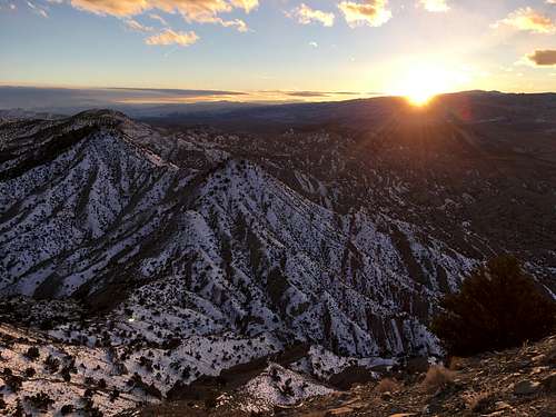
Carter peak is a small Desert peak outside the town of Salina, Utah. It is easily noticed as the pointed volcanic cone standing 1,500 feet above the surrounding desert on the south side of the I-70 between Salina and Richfield. It offers amazing 360-degree views of the entire Sevier Valley.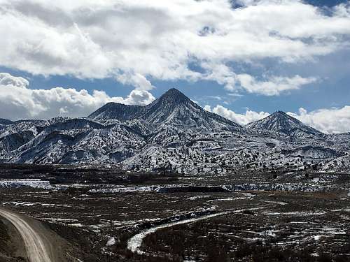
Fresh Coat
Getting There
From I-70, take the Salina exit and drive north to the main intersection in the town. Take West Main Street west outside of town. Make a soft left toward the town of Sigurd. About a mile after the fork, take a left onto Sage Flat Road. After an additional mile, take another left onto Lost Creek Canyon. Continue on this road under the freeway and around the peak to the south side. From there, you can spot the dirt road that ascends the south side of the peak. The other option is to park on the southeast flank and meander up the clay slopes.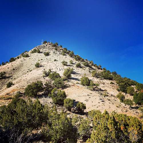
The Last Switchbacks
Route
The road to the summit is straight-forward but is impassible to vehicles the last couple hundred feet.Round-trip Distance: 2.8 miles
Elevation Gain: 1,190 feet![March View]()
March View
March View