Intro/Stats
Arrowhead (12660')
McHenrys Pk (13327')
East Glacier Knob (10225' and consolation prize)
11.2 miles RT, 5100' gain
Aug 29, 2009
From Glacier Gorge TH
Rocky Mountain National Park
Participants: Kim Luba (ripper333), Jason Walton (jwclimbs), & Kevin Baker
Slideshow
I was looking for another ridge traverse before the summer wraps up, but my usual hiking partners were busy this weekend. I posted an invite on summitpost for this hike late in the week and was surprised to get bites from Jason and Kim! I've been drooling at the chance to do the Northeast Arete on McHenrys with the jaw dropping cliffs and geologic features that you get to see up close and personal along the route.
I debated on car camping the night before or heading up to RMNP from C. Springs in the wee hours of the morning. I'm used to middle of the night driving and opted for that to avoid traffic as long as I could avoid hitting an elk, bear, or moose in the park! I arrived a bit late with no animal encounters and met Jason and Kim for the first time. Kim saw a huge elk just off the road, so glad I didn't run into it! Jason is an accomplished ice/technical climber while Kim is one of those insane ultra athletes, also a strong technical climber. I checked out her profile and noticed that she had dayhiked Rainier and later found out that she has raced in the Ironman! Jason and I knew it would be a tough task just to keep her in site, although I think she showed mercy on us and sandbagged the whole day.
Arrowhead: The Path of Least Resistance
We set out at 4:17am and headed up the now familiar Glacier Gorge trail, my third trip up it in the dark this year. We found the shortcut trail after a couple minutes of searching and made our way up to the Mills Lake junction. The shortcut trail is .4 mile from the trailhead just after a bridge, shaving off 3/4 mile. We made decent time up to Black Lake despite loosing the trail a couple times. A guy named Mark was along the trail and forgot his headlamp, so he hiked with us the rest of the way up to Black Lake. He was to meet his climbing partner there for a technical route.
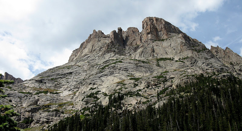
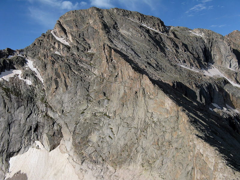
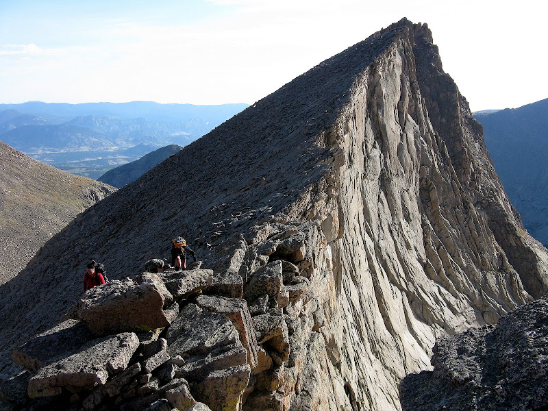
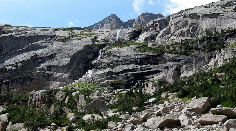
Our first objective of the day was Arrowhead, an impressive chunk of rock at the end of the Northeast Arete on McHenrys. We climbed the cool summit ramp route from Black Lake, which is primarily a test in finding the path of least resistance. It looks like there is no way to avoid technical terrain down low, but a hidden ramp keeps the climbing at 3rd class with good routefinding.
Arrowhead from Black Lake, taken on the descent. Most of the route is hidden.
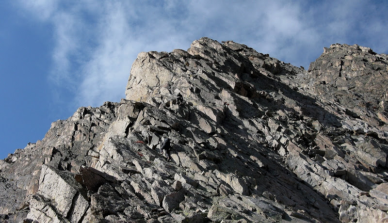
The route zigs up the face on steep grass and solid class 3 slabs.
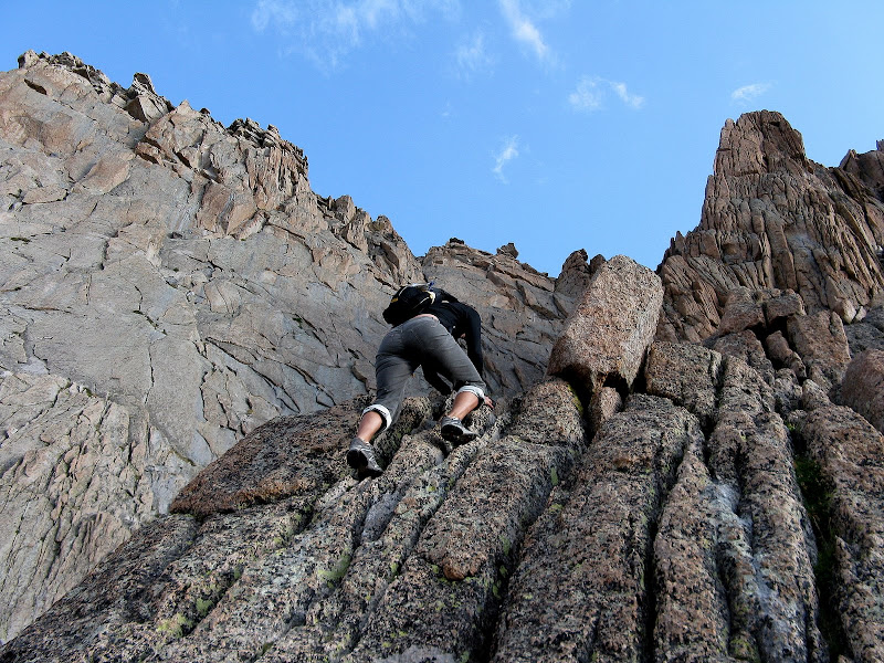
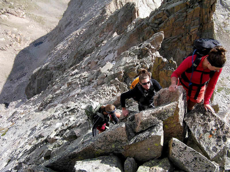
We stayed to the right of some black water marks heading at a bearing toward the summit, then contoured s.w. to avoid some cliffs on a lower ramp. At the end of the ramp you pass over or underneath a leaning rock that marks the spot to go up. Kim took a harder line up fissured cracks, while Jason and I took a more exposed but easier line around the corner.
Kim taking the direct route just past the leaning slab:
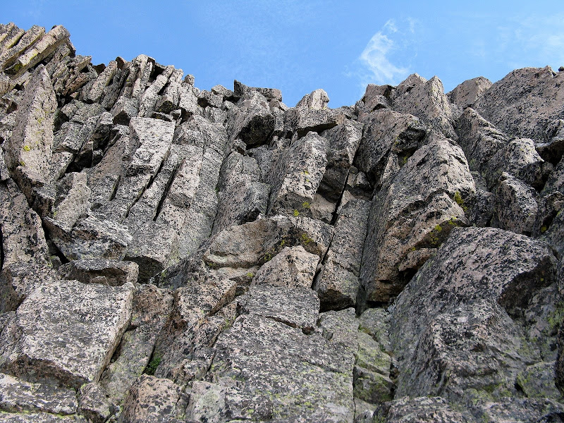
Once above this crux, the route is obvious as you ascend the summit ramp, as it wraps counterclockwise behind the summit.
The route wraps around this face:
We topped out at 8:30am and were surprised to see 3 girls top out on the n.w. face route just a few minutes later. We had seen them at the trailhead. Another guy topped out on the summit ramp route too while we were there and had plans of traversing over to Powell and Thatchtop, which is a tough traverse!
The Northeast Arete Scramblefest
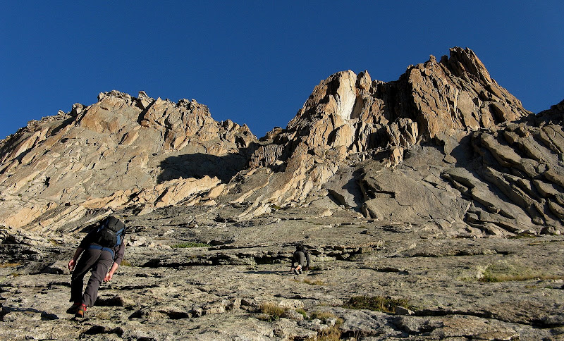
We hung around for awhile and soaked up the world class views at this spectacular perch. Next up on the agenda was the northeast arete route to McHenrys, which is an amazing traverse that few visitors to this spectacular park get to experience.
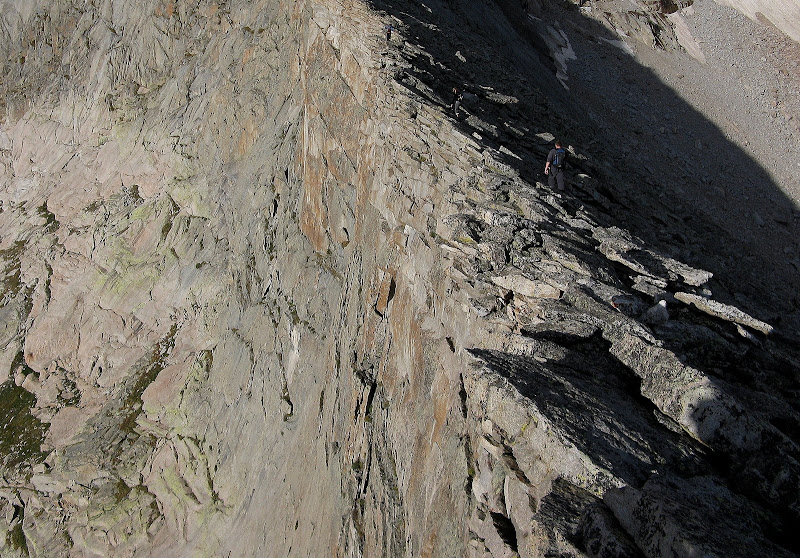
The ridge looks intimidating from afar, but the climbing can be kept at no harder than 4th class and is a blast if you're used to exposure. The exposure on the south side of the ridge is dramatic. The first part of the traverse is mostly an airy class 2 with some boulder hopping.
Jason and Kim on the traverse:
Anybody want to look over the edge of this leaning slab?
As expected, I fell behind Jason and Kim and ended up climbing with the girls we met on Arrowhead.
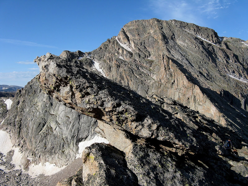
Descending from the dramatic summit of Arrowhead:
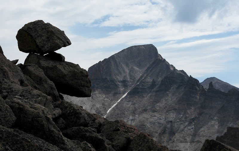
At the saddle I noticed a rappel sling marking the top of the airy 5.6 face route known as the Slab that the first ascent was done on. Looking back at Arrowhead you can see the unique face feature known as The Wave. What a sight to behold!
Above the saddle, the real climbing begins as you will ascend some 1107 feet in only 4/10ths of a mile!
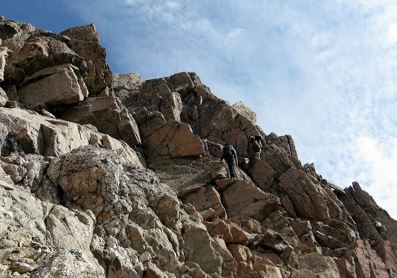
Can you see Jason and Kim?
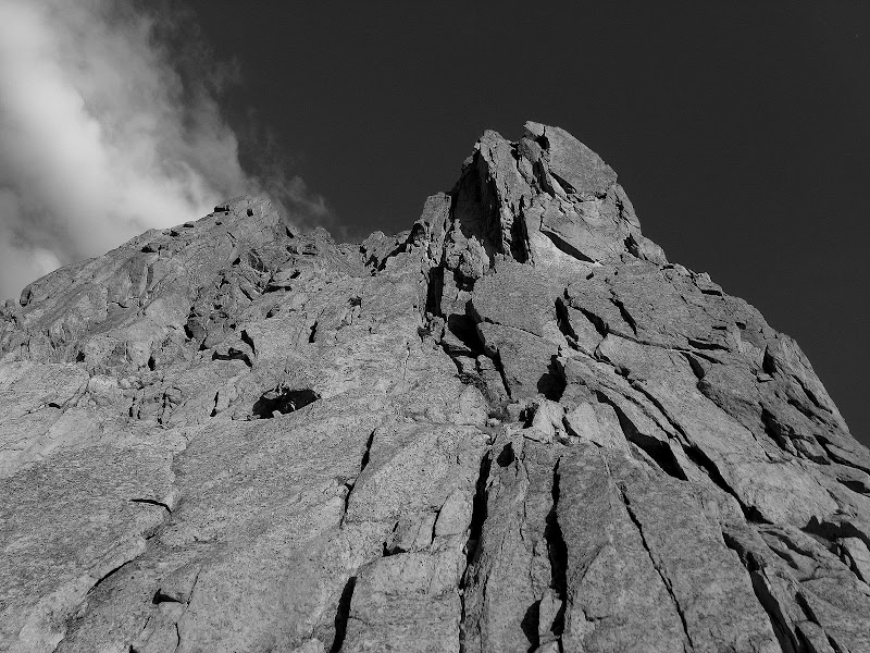
There are two gendarmes to deal with, which can be avoiding by skirting below on the right on steep slabs. Routefinding gets a bit harder higher up as we had to backtrack once, but in general you want to stay fairly close to the ridgecrest.
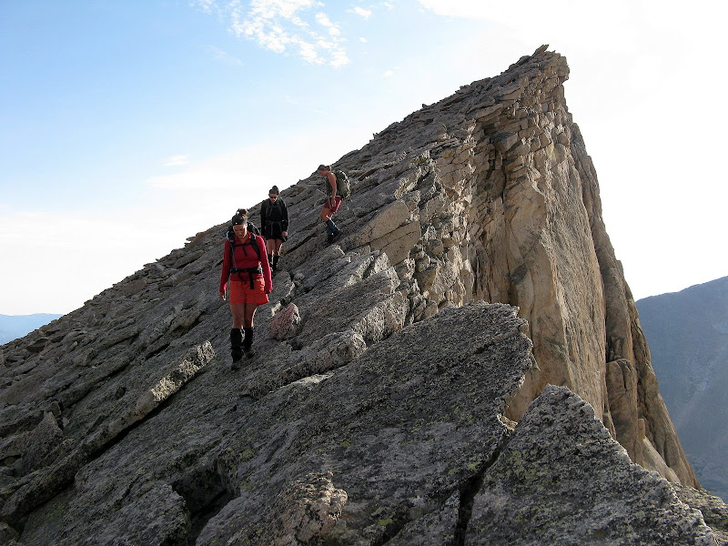
An exposed step on the ridge:
A loose gully on the right side provides 3rd class access to the flat summit area. We topped out at around 10am, stoked to complete such an exhilarating traverse! We didn't hang around for long, as there were some storm clouds to the east.
Stone Man Pass Descent & Bonus 10er
The standard route on McHenrys is from Stone Man Pass and is no easy task. It would be an additional challenge since we didn't climb it. We dropped down the ridge, which quickly turns into a 4th class affair. I spotted the gully on the south face that is cairned, and traversed over to it.
4th class blocks just above the cairned gully:
Jason and Kim stayed at or near the crest of the ridge, which has a few low 5th class moves and a purported crevasse in the rock that I didn't see.
Jason and Kim on the sportier line:
Once in the gully, we headed down to a notch which led us back to easy boulder hopping to Stone Man Pass. The skies were looking iffy, but it looked good to the west so we decided to head for Chiefs Head. Within about 5 minutes, we heard rumbles of thunder coming from behind McHenrys. It looked like the storm was backing up on us from the n.e., so we made a unanimous decision to bail on Chiefs Head. Guess I'll have to combine it with Alice next time!
Longs and precarious boulders on the ridge:
This turned out to be a wise decision, as it started raining and hailing just after getting below the steep slabs below Stone Man Pass. The descent of Stone Man Pass is tricky, made tougher by some wet, exposed slabs that I avoided. The gully below the pass was still filled with snow, so we skirted to it on either side. To descend this terrain with hail or graupel on them would be foolish.
The heavens unleashed for about 20 minutes or so, as we headed n.e. on grass and low angle slabs back to our Arrowhead ascent route. The sun came back out and we enjoyed a nice break soaking up the views.
Chiefs Head pokes out above the cliff bands above Black Lake:
It looked like another storm was developing to the west, but it didn't start down low until just after I finished the hike. We passed quite a few tourons on the way down, many of which were ill prepared for weather!
Just below the shortcut junction, I announced to Jason and Kim that I was going to hit ranked 10er East Glacier Knob just off the trail. They looked at me as if I was deranged, which I guess I am. Here you clearly see the difference between a route bagger and a peak bagger! We said our goodbyes and I busted up the steep slopes to this cool little summit. I went up some class 3 slabs and bushwacked my way underneath cliffs to the weakness on the north side of the summit.
It took about 25 minutes to get up there even though it's only 1/4 mile off the trail as the bushwacking was thick in spots. Excellent views of Glacier Gorge from this perch, but the lighting was bad late in the afternoon. I contoured n.w. from the summit back down to the trail, arriving back at the trailhead at 3:30. Another amazing day in RMNP despite the rainout!
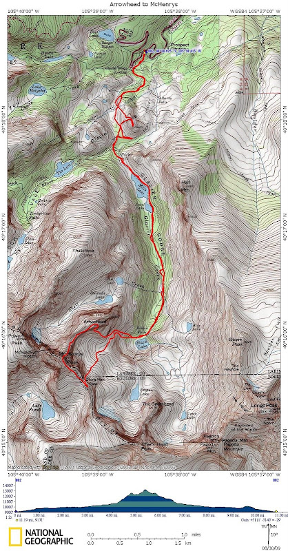
GPS track:


Comments
Post a Comment