Toggle navigation
Mountains
Routes
Images
Trip Reports
Forum
What's New
People
Areas & Ranges
Articles
Trailheads
Canyons
Huts & Campgrounds
Albums
Logistical Centers
Fact Sheets
Lists
Custom Objects
Gear
Plans & Partners
WELCOME TO SUMMITPOST
SIGN IN
REGISTER
Mount Mellenthin
Additional Parents
Image
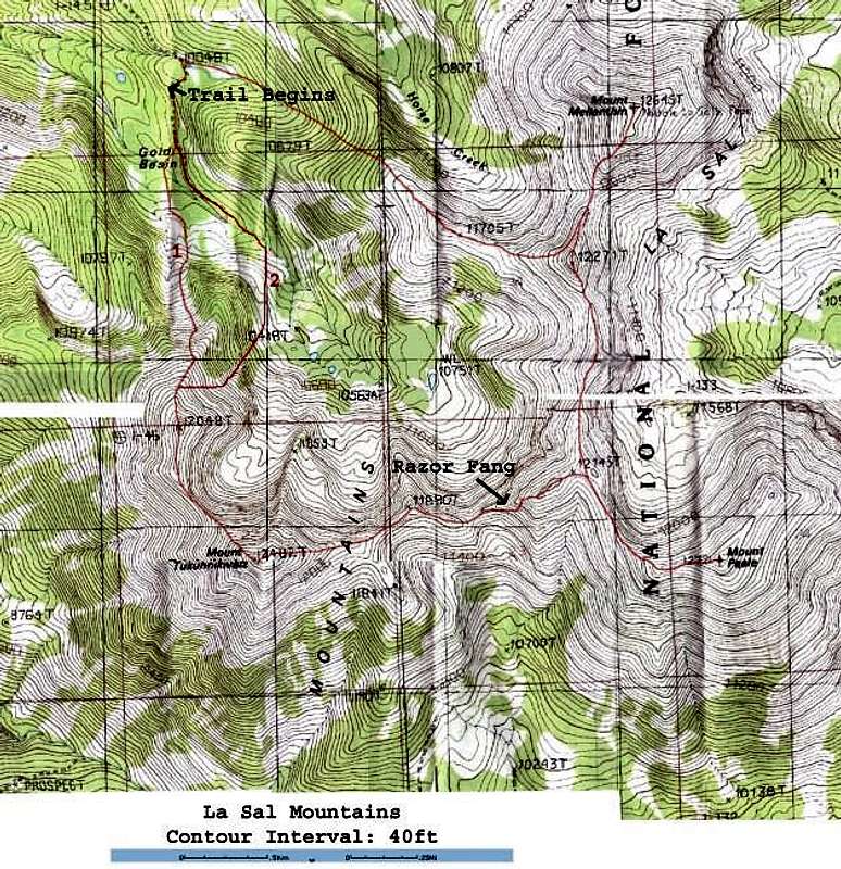
A topographic map with the...
View High-Resolution Image
A topographic map with the...
A topographic map with the Middle La Sal Traverse marked.
Uggh! Bad photo! This will be on my to do list for making a newer, better map!
« PREV
NEXT »
PellucidWombat
on
Oct 15, 2003 7:40 pm
Comments & voting
Other parents
Lat/Lon:
38.46330°N / 109.2332°W
Image ID:
30869
4705 Hits
71.06
% Score
1
Votes
Log in to vote
Comments
No comments posted yet.
to post!
Don't have an account?
Mount Mellenthin
(Mountain/Rock)
« PREV
Viewing
#33 of 40
GALLERY
NEXT »
PellucidWombat's Image Gallery
« PREV
Viewing
#1994 of 2324
GALLERY
NEXT »
Middle La Sal Traverse
(Route)
Loading....
×
You need to login in order to vote!
User Name
Password
Remember me
Forgot your password?
Log me out when I close my browser.
Keep me logged in all the time.
sign in as a user
Don't have an account?
Register now for FREE
Rating available
Suggested routes for you
People who climb the same things as you
Comments Available
Create Albums
Register Here


