|
|
Trip Report |
|---|---|
|
|
46.58468°N / 11.97127°E |
|
|
Sep 22, 2016 |
|
|
Hiking, Mountaineering |
|
|
Fall |
Which route?
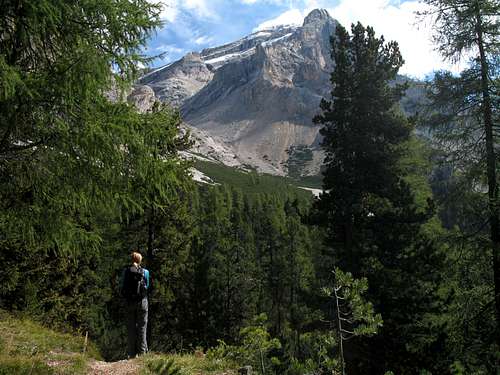
For several days I had been watching the Lavarela from various positions within the Badia valley.
With a summit at 3055m, the snow that had fallen the previous weekend was melting very slowly (if at all) and I was wondering just what the conditions would be like up there.
The weather so far this week had not been that bad for late September, cool with a mixture of sun, clouds and the odd rain or snow shower had meant we had grabbed routes where we could.
A cold snowy day up at the Lagazuoi hut, a warmer day on the Nuvolau ferrata only to be hail-stoned off the Averau ferrata that afternoon, a wet, murky day on Piz Boe.
So, I was waiting for a good forecast to have a big day.
Thursday was looking good.
“Have you seen the snow up there?”
We had been chatting to a guy from our chalet on the bus and I mentioned the Lavarela.
Using the pages of SP I had realised there is cable protected route rising up from the Col Medesc.
I reckoned that could be the quickest route up and down the mountain. Only trouble was, the cable protected part of the route faces West and is mainly in the shade.
Consequently, we could see that not much snow had melted from that part of the route.
“I did that route a few years ago”, he continued. “The rock slopes outwards all the way and is pretty loose, with snow on it as well it could be dodgy”.
He voiced my own fears, maybe that route wasn’t such a great idea in these conditions?
Later on, Marie and I looked at our options.
“We could walk in from Capanna Alpina, that’s what the guide book advises. Plus we could go up to do the Piz dles Conturines route as well although, that has a ferrata on it so we would need to take our kit”.
Marie was not so enthused.
“That looks a long way to walk in and I don’t fancy having to carry the extra weight just for that last bit”.
It was difficult to disagree.
Eventually we came to a decision – an early bus up the valley, walk in from Capanna Alpina, carry no ferrata gear to save weight and just climb the Lavarela.
A perfect weather day
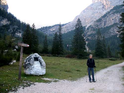
When we awoke to clear skies and only a light mist in the valley on Thursday morning, I knew it was going to be a good day.
The amber limestone of the Sass dla Crusc looked beautiful against the blue skies when viewed from our chalet.
The guidebook said to allow 7-8 hours for the round trip from Capanna Alpina so, we got the bus at 8.32 and disembarked at Sciare at 8.50 to walk up to the Capanna Alpina start.
Although we started on our own, by the time we had reached Capanna Alpina, twenty minutes later, cars were arriving in the car park and we set off at the same time as another younger, couple who would shadow us most of the way up.
It was pleasantly cool in the shade which was doubly good as the first part of the route ascends a steep, rocky track - path no 11 - up to the Col de Locia.
By now, Marie and I had gained our “mountain fitness” and we set off at a good, steady pace, soon leaving the younger couple behind. From Capanna Alpina at 1720m, we gained the Col de Locia at 2069m in forty minutes where we stopped to enjoy the views and have a drink.
We rested on the wooden seats and looking south,we could see part of the Valun de Lagacio, the valley we had descended from the Lagazuoi hut earlier in the week.
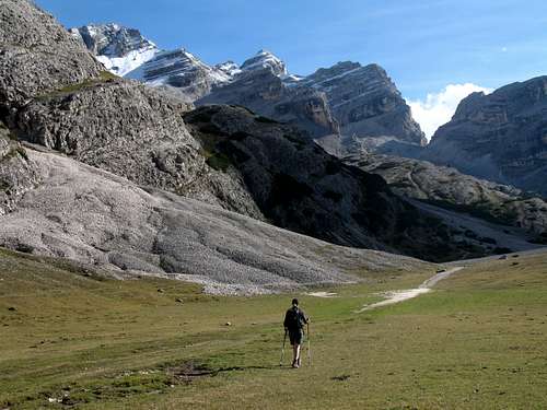
The next part of the route heads northwards and follows a gorgeous, wide valley, Le Gran Plan. At first, we followed a path parallel to the river (a tributary of the Ru Sciare) and through low growing, scrubby trees and bushes until we crossed the shallow water near the river’s source. Small clouds were blowing through the valley above our heads but it was still warm, we moved across the alpine pastures quite quickly as it was not that steep.
As we walked, we had good views of the Pizes de Ciampestrin, Mt Ciaval and back to Piza Nord looking up and on the right side of the broad valley. A path from the right joined us from the Forcela di Lech and we continued making good time on the gradual incline.

On our left, we could see the southern aspect of the Piz dles Conturines peak and gradually, the valley we were to ascend,the Busc dla Stlu appeared.
At 10.30 we reached Ju dal’ Ega at 2157m and the point where the path divides, we took the left hand route heading westwards and up towards the col between the Conturines and the Lavarela.
We continued for about 15 mins.
“Let’s stop for a drink and a snack” Marie suggested.
We were completely on our own for now and had a fantastic view looking up towards the protruding summit of the Piz dlesConturines.
We could see clouds being torn apart as they blew across its craggy top and the rock of the summit was covered with snow.
Although it was 800m above us, I still wondered if we could go for it as well?
Marie found a rock for us to sit on.
“Hey look at this!” I shouted to her.
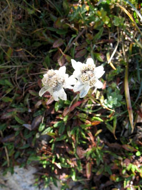
Just off the path I had found a wild Edelweiss amongst the rocks and grass. In 35 years of exploring the European Alps, this is only the second time I have seen a wild Edelweiss plant growing. (The first time was near Adelboden in Switzerland in 1985!).
We sat in the sun for a few minutes, enjoying the peace and quiet. Marie removed her zip – off trouser legs to expose her skin to the elements and to keep cool.
Footsteps told us that someone was approaching, it was the younger couple that had set off the same time as us. We nodded to them and they walked past us and then, as if this was the official stopping point, they sat on a rock nearby.
Our solitude vanished!
Marie looked aghast!
“The whole mountain side and they want to sit on top of us!”
We packed up and set off again in lovely sunlight with a cool breeze, the solitude returned…. perfect!
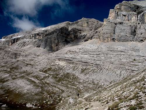
We had amazing views of the Piz Taibun, an outlying top of the Piz dles Conturines, a huge wedge shaped buttress of rock. Soon we reached the Le du Conturines, an almost dry lake.
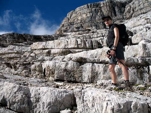
We circled around the little water left and ascended the sunlit valley on the right side. The limestone strata is spectacular at this point. The layers are stacked like dozens of thick “plates”on top of each other, then broken along a fault line to reveal the jagged edges.
I’m not someone who listens to music in the mountains, I don’t have an ipod or similar device but on this day, for some reason, I had the song “Wasted years” by Iron Maiden playing in my head.
Walking to the imaginary beat, I found I was moving steadily upwards in the glorious weather.
The only thing that slowed us down was me stopping to take photos!
As the path continued, we found we could follow each plate ledge along for a while, then scramble up to the next level and do the same.
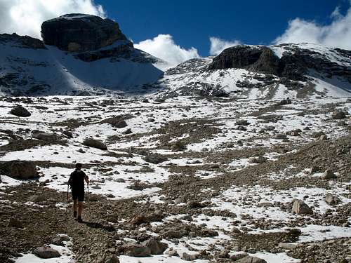
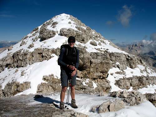
As we got higher, we started walking in the snow, the route dominated by the bulky summit of the Conturines on our left and the limestone cliffs or the Lavarela on our right.
|
|
|
Soon we found ourselves in the mist of the light clouds blowing through the high col between the two mountains at a height of 2885m.
We reached the col marker at 12.40….31/2 hours after leaving Capanna Alpina, bang on time!
For the first time that day, we could look down on the “Pralongia” plateau, the Badia valley and La Villa.
“Shall we stop for some food”, I suggested.
“No, it’s too cold”, Marie replied.
The wind had increased as it blew between the gap in the mountains and a few clouds had obscured the sun for the time being.
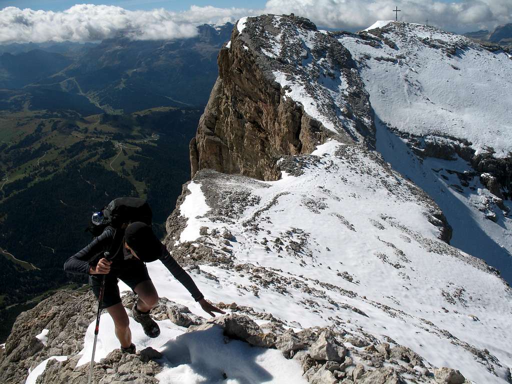
We continued on and upwards to the right and towards the Lavarela summit.
According to the guidebook, the summit should be reached in about 30 minutes but this was to take longer than I had realised.
Firstly, the snow was deeper here and quite soft and secondly, lack of food was slowing us down.
We scrambled up a small gully on a mixture of soft snow and loose rock to gain the col between the west "summit” overlooking the Badia valley and the higher, summit to the northeast?
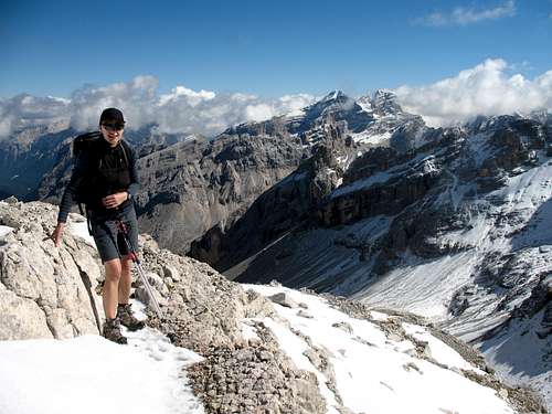
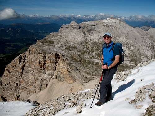
Here we had fantastic views to the west of the Sass dla Crusc and the route to the summit of L’ Ciaval that we had explored in 2012 behind the huge West summit cross, we could see across the Val Badia to the Puez plateau, the Sassongher and the Sella massif.
North and eastwards we could see into the Fanes mountains and further eastwards, the snowy peaks above Cortina.
We continued scrambling up the ridge towards the summit on icier snow. At one point, Marie lost her footing and slipped but struggled up difficult terrain.
I started to wonder about the wisdom of doing this without either axe or crampons.
“You’re trying to kill me again, aren’t you?”Marie said… I think she was joking!
Reaching the summit took longer than I had expected and although it was great weather, it was cold in the wind so having reached it we descended the snowy arête straight away. On the way down we met the younger couple again, on their way up.
We retraced our ascent route and reached the col at 2.20, still breezy and again in the shade.
“I’m starving but I’m not stopping here”, was Marie’s terse reply to my suggestion we stop for lunch.
We continued down for 20 minutes until, as the sun came out we found a good place to sit on a natural Limestone bench.
“That was too long to wait for food, I’m starting to feel shaky” Marie said.
I could feel it too and whilst our roll and crisps were a huge boost, I had lost any desire to head for the Conturines summit as well!
|
|
|
Descent
After lunch, feeling refreshed it was time to set off again.
We were concerned about the time… we didn’t want to miss the bus and have to walk back down to La Villa!
We descended the route as we had ascended, trying to follow the same familiar route.
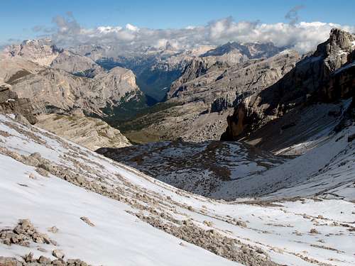
Heading eastwards we had fantastic views of the mountains above Cortina.
Passing where we had stopped and had seen the Edelweiss, we reached the path junction at Ju dal’ Ega around 4.00.
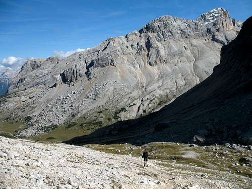
Descending southwards, the high alpine valley of Le Gran Plan looked beautiful in the afternoon light.
We reached the Col de Locia and had to rest and have the last of our food and a jelly baby for sustenance!
Then, it was slowly down the rocky track back to Capanna Alpina, arriving at 5.40pm.
“We’ve got to get the bus at 6.15”, Marie said.
“Don’t worry, it only took us 20 minutes to walk up this morning, we’ll make it now” I replied.
Sure enough, we got there at 6.05, just over 8 hours after setting off. Glad we could relax at last in the early evening sun and pleased with a fabulous day.
Five minutes later, some more people arrived.It was a couple from our chalet we recognised but hadn’t spoken to before. I had gauged they were about 10 years older than us.
“Lovely day, what have you been up to”? The man asked us.
“We’ve been up to the Lavarela”. I replied,expecting them to be impressed.
“Oh yes, so have we” he replied.
“Really….?”
It turned out, they had got the 9.12 bus (the one after us), ascended to the summit of the Lavarela then, the man had run across to the Piz dles Conturines, borrowed his wife’s ferrata kit, bagged the summit then caught her up on the way down and they descended together, arriving 5 mins after us!
“Maybe in 10 years time, we’ll be as fit as that!” Marie said later.

