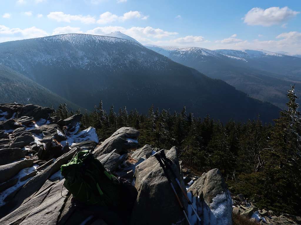
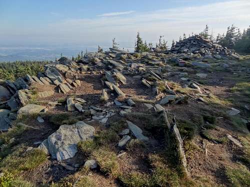
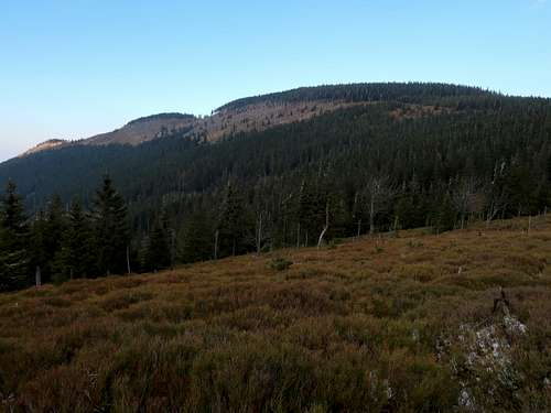
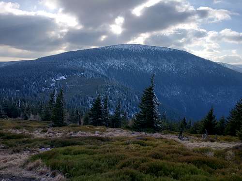
The Polish name of the summit, which literally means Rock Table, is a weird translation of the German toponym, which seems to translate as Slabby/Plate Stone. The summit is the highpoint of the section of the main ridge of the Giant Mountains (Karkonosze/Krkonoše) known as Kowarski Grzbiet (Kowary’s Ridge) in Poland and Lesní hřeben (Woody Ridge) or Střecha (Roof) in Czechia, which lies a few kilometres west of Śnieżka stretching between Sowia Przełęcz/Soví sedlo (Owl Pass, 1164m) in the west and Okraj pass (1046m) in the east. The summit is located at the west end of Kowarski Grzbiet and features a schist outcrop which must have given the mountain its name and offers a picturesque view of Śnieżka and its surroundings. This view is the main reason hikers come here. Personally, I also like the ascent up the north side of the mountain.
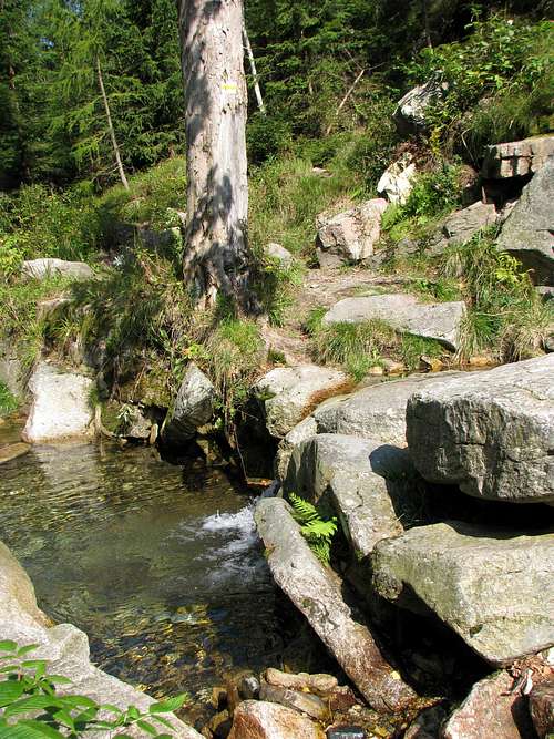
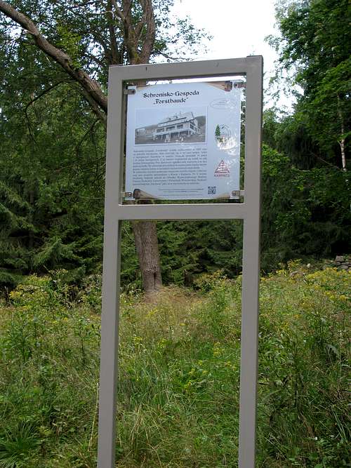
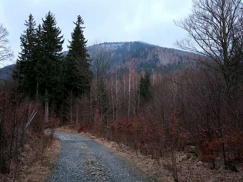
In Poland, at the north foot of the Giant Mountains, the trailheads are in either Karpacz or Kowary. The trail from Kowary is much less frequented and has an interesting stretch along Malina brook. The trails meet at about 900m at a place called Budniki, which was once the hamlet of Forstlangwasser: Over 5km northeast of Śnieżka, in a valley at about 900m on the north slope of the Kowarski Ridge, there used to be a tiny settlement whose last extant buildings fell into ruin in the 1950s. The original name of the hamlet, founded by people hiding from the Thirty Years' War (1618-1648), was Forstbauden (Forest Huts), which was later changed to Forstlangwasser. Today's Polish name of the place is a reference to its original name. Budniki was quite a unique site for a village, since – due to its location on the slopes of a deep valley – sunrays do not reach it for 113 days, from the last days of November to the middle of March. Thanks to a group of lovers of this place there is now an interpretive trail around it.
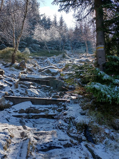
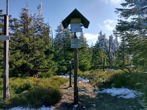
From Budniki the yellow marks climb the relatively steep north side of Kowarski Grzbiet to reach its crest at the very summit of Skalny Stół. Ascents via the main ridge are more mundane and more popular with hikers. The shortest routes, taking roughly one hour, start at Okraj pass.
To get to Horní Malá Úpa, leave Road I/14 at the town of Mladé Buky and drive north up Road 296 for nearly ten kilometres, then turn right onto Road 252.
The resort of Karpacz lies just 15km south of the centre of Jelenia Góra, a large town just north of the Giant Mountains.
The town of Kowary lies about 17km southeast of the centre of Jelenia Góra, with which it is connected by Road 367. Buses/minibuses from Jelenia Góra to Karpacz run through Kowary.
Jelenia Góra has good train and bus links with Wrocław, the capital of Lower Silesia. There is also a direct bus service between Wrocław and Kowary.
The area is part of a national park (or rather two parks: Karkonoski Park Narodowy in Poland and Krkonošský národní park in the Czech Republic. You are not allowed to camp/bivouac or stray from the waymarked trails. In Poland there is an entrance fee - an equivalent of approx. €2.00 for a day pass in 2024. In spring the trail between the summit and Okraj pass gets closed in order to protect the black grouse.
When To Climb & Mountain Conditions
If you go in high season or at a weekend, there may be a crowd at the summit.
Under winter conditions mini-crampons are advisable.
Children refers to the set of objects that logically fall under a given object. For example, the
Aconcagua mountain page is a child of the 'Aconcagua Group' and the 'Seven Summits.' The
Aconcagua mountain itself has many routes, photos, and trip reports as children.
Parents refers to a larger category under which an object falls. For example, theAconcagua mountain page has the 'Aconcagua Group' and the 'Seven Summits' asparents and is a parent itself to many routes, photos, and Trip Reports.