Toggle navigation
Mountains
Routes
Images
Trip Reports
Forum
What's New
People
Areas & Ranges
Articles
Trailheads
Canyons
Huts & Campgrounds
Albums
Logistical Centers
Fact Sheets
Lists
Custom Objects
Gear
Plans & Partners
WELCOME TO SUMMITPOST
SIGN IN
REGISTER
Weissnollen map routes
Weissnollen map routes
View High-Resolution Image
Weissnollen map routes
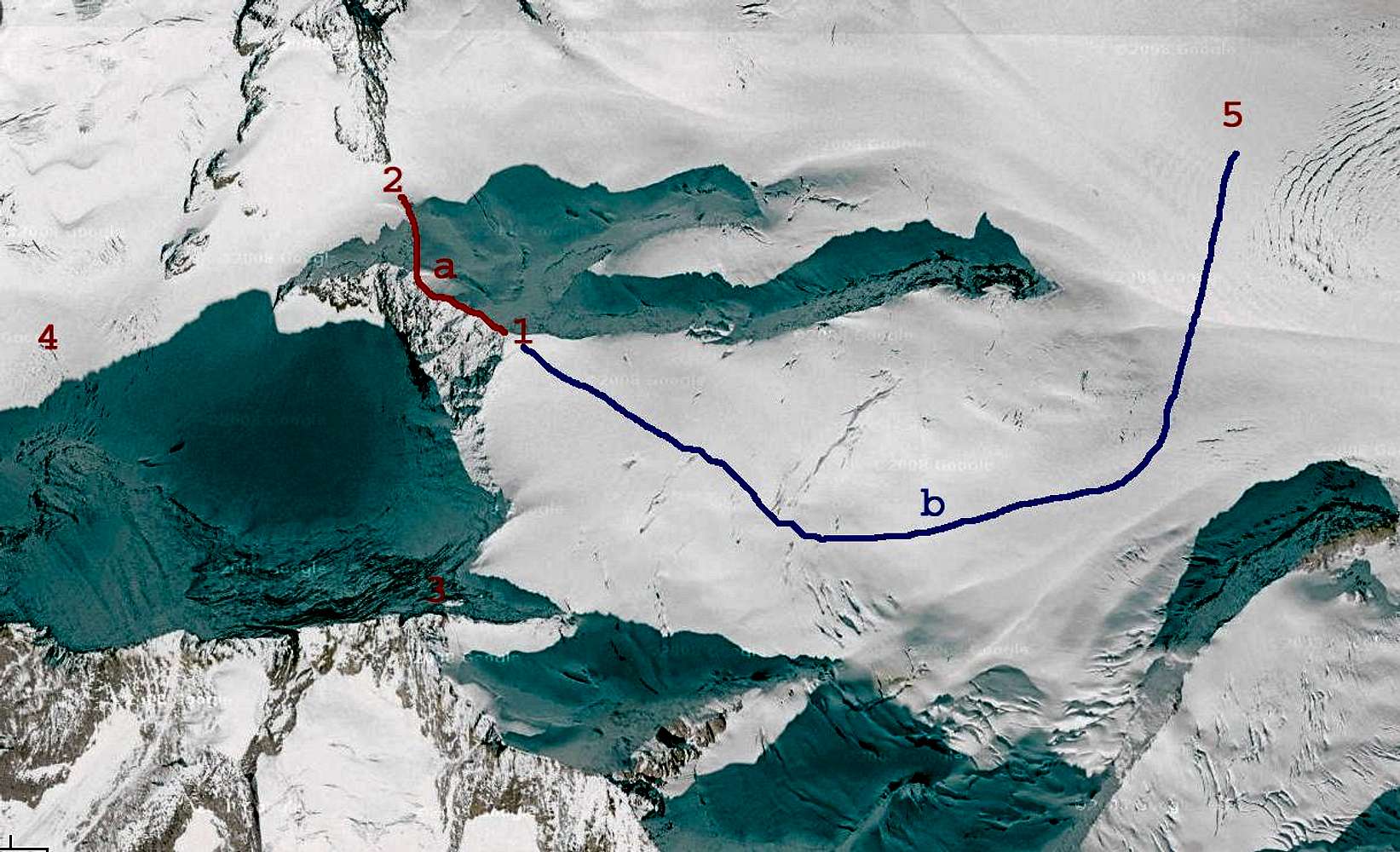
Map of Weissnollen: 1:Weissnollen, 2:Grünhornlücke, 3:Fiescher Gabelhorn, 4:Grüneggfirn, 5:Fieschergletscher. Routes: a. North West ridge (red) WS (1 hour) b. East flank (blue) L (2.5 hour)
« PREV
NEXT »
marc123
on
Aug 19, 2009 5:12 pm
Comments & voting
Other parents
Lat/Lon:
46.50956°N / 8.08817°E
Image Type(s):
Alpine Climbing
,
Topo/Diagram
,
Informational
Image ID:
542918
1525 Hits
0
% Score
0
Votes
Log in to vote
Comments
No comments posted yet.
to post!
Don't have an account?
marc123's Image Gallery
« PREV
Viewing
#109 of 112
GALLERY
NEXT »
×
You need to login in order to vote!
User Name
Password
Remember me
Forgot your password?
Log me out when I close my browser.
Keep me logged in all the time.
sign in as a user
Don't have an account?
Register now for FREE
Rating available
Suggested routes for you
People who climb the same things as you
Comments Available
Create Albums
Register Here


