"Place Moulin Loch with Bionaz Dam", by SalValThe "High" and Western Central Valleys
Getting There
By car:
- From TORINO, MILANO, etc: Motorway A5. Exit at IVREA or Quincinetto (PIEDMONT)
From IVREA Town: in West towards Pont Saint Martin, Donnas, Bard, Champdepraz, Pontey, Fénis, Saint Marcel, Grand Brissogne, Pollein, Charvensod, Gressan, Jovençan, Aymavilles, Villeneuve, Arvier, Avise, Morgex, Pré Saint Didier, Courmayeur Municipalities.
From Courmayeur Resort: in East to Morgex, La Salle, Saint Pierre, Sarre, Aosta Municipalities.
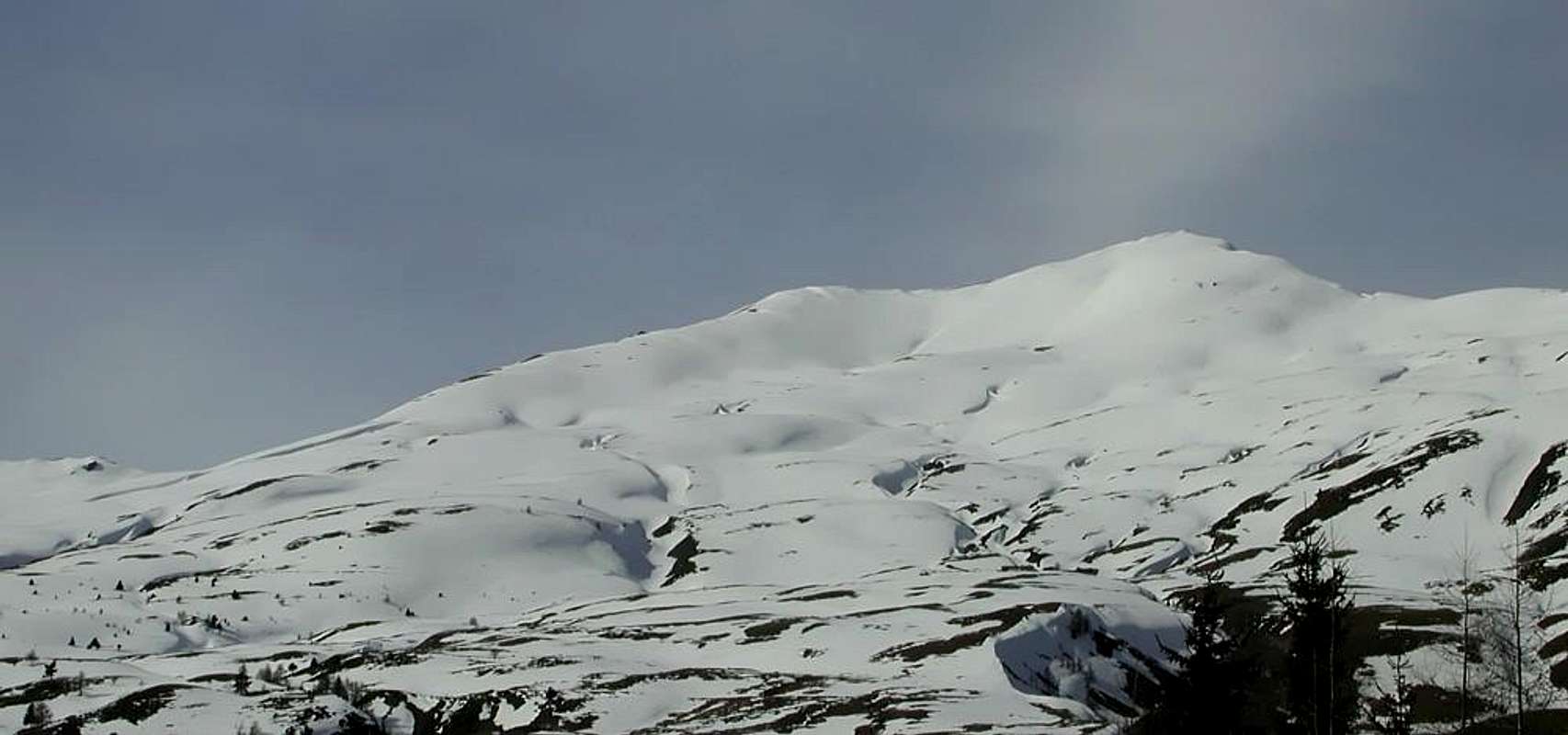
![]()
From Courmayeur to Aosta Town
From Courmayeur (1198m) towards Pont des Chèvres, Notre Dame de la Guérison, Lassy Dèsot/Perthud Villages, Gabba, Chalets du Miage, La Visaille Cave, Plan de Lognan Alp (1676m), with Municipal Road; from this to Lake Combal (1950m) and to Refuge Elisabetta-Soldini (2197m), through dirt road.
From Courmayeur-Notre Dame de la Guérison Sanctuary (1444m), through private dirt road, to Monte Bianco Refuge (1666m).
From Courmayeur-la Palud (1370m), towards Montitaz, Planpincieux (1593m) Villages, Tronchey (1620m), Praz Sec du Milieu, Lavachey (1640m), Arnouva Dèsot (1769m) Villages, through Municipal Road, to Malatrà small Valley and Walter Bonatti Refuge. Also from Arp Nouva to Elena Refuge, through dirt road on valley floor; or from the fork after Planpincieux, small bridge, towards Leuchey Dèsott, Damon Pastures to Mont de la Saxe Hump/Giorgio Bertone Refuge.
From Courmayeur-Villair Dessus (1282m), with Municipal Road and through dirt road to fork 1470 metres and path to Refuge Bertone in Val Sapin.
From La Salle 1001m), with Regional Road, towards Challancin (1610m), Cheverel, Morges (1829m), Planaval Hamlets (1750m); from this, through dirt road in North-northeast, passing Maison Blanche Pasture, to Rantin (2333m) and Bonalé (2340m) Alpages, in Upper Planaval Valley.
From La Salle, with Regional Road, towards Challancin Village, Ponteilles (1741m), Arpilles (1862m) Pastures to Bard Pass (2178m) in Arpilles Conca.
From Saint Pierre-Pommier (783m), Champretavy, Rumiod, alternative just after Persod (1351m), Ravoise, Chaillod, Clavel, Cerlogne (1580m) to Vens small Villages (1750m), with Regional Road in West-northwest. From this last to Joux Saddle (1930m): through short descent to Vertosan small Valley
From Saint Pierre-Chateau Sarriod de la Tour, Rumiod, Petit and Grand Sarriod (1444/5m), Gerbore, Vetan Dessous (1670m) and Dessus (1737m), with Regional Road to Vetan Basin. From this, through dirt road, towards Genevrine Pasture, Chatalanez, Toules, Grand Arpilles Alps to Chaz Creuse Alp (2398m).
From Sarre (657m), with Regional Road, towards Plèod, Vert Dessous and Dessus, Vareille, Caillod/Ville sur Sarre/Remondet, Moulin/la Cort, forks 1225, 1301 metres, Salet, Chavalançon (1426m) small Villages to Thouraz Dessous and Dessus Hamlets (1652m); from the last to Closella and Met small Valleys.
- From FRANCE: through the Mont Blanc Tunnel to Entrèves-crossroads to Vény/Ferret Valleys - Mountain Guides of Courmayeur - La Saxe Rock Gym - Courmayeur. By Little Saint Bernard Pass, closed since November until half May to La Thuile Valley - Pré Saint Didier - Courmayeur.
It is not necessary to take Motorway A5: you can drive on State Road n° 26, in the direction of AOSTA - IVREA - TURIN.
By plane:
- Aeroporto Internazionale "Corrado Gex" Saint Christophe (Aosta)
Val Vény and Lex Blanche Vallon
Basic Itinerary n° 1 (Lakes Comabal and Miage): from Courmayeur through Regional Road to Notre Dame de la Guérison (+ Sanctuary;
1444m), Perthud, Camping Aiguille Noire, Chalets du Miage, La Visaille, Plan de Lognan (signal no transit;
1676m;
E; 2h'00/2h'30), Lakes of Miage and Combal, with farm dirt road and continuing towards the
Lex Blanche small Valley (Elisabetta Refuge and Col de la Seigne): through Veni Valley to Lake of Combal
(1958m); from this to Refuge Elisabetta Soldini
(2197m), Tsa de la Lex Blanche
(2280m), Seigne Hill
(2514m), through dirt road concomitant with the path
n° 2/TMB/Haute Route number 2, along the Doire of Val Veny (
E; 4h'00/4h'30).
1)- The Sanctuary of Notre Dame de la Guérison (1444m), is sited at the Northern foot of Mount Chétif and immediately above the great Glacier of the Brenva. Founded by the gentleman Michel-Joseph Lanier of La Saxe, in 1760, on top of an ancient Cross called the Croix du Berrier or Cross of Stony Ground; this building became an Oratory with a statue of the Madonna. The pious villagers offered alms in return of Grace by the Holy Virgin. In 1866 the Parish Priest Menabreaz Courmayeur built the current Sanctuary clashing with the Civil Authorities, contrary to the danger of the whole area; but the Priest did not give the bone and with the cult of "Notre Dame de la Guérison" was consecrated August 25th, 1868 by the Bishop of Aosta, Monsignor Jans. July 21th, 1901 was celebrated a Mass for the Explorers who went to the North Pole, the present Duke of Abruzzi with its Guides. Hermit Laurent Girard served as Guardian for 42 uninterrupted years sleeping in a room on the Sacristy, dying here April 21th, 1884.
Val Veny e Vallone de la Lex Blanche
Itinerario di Base n° 1 (Laghi Combal e Miage): da Courmayeur tramite la Strada Regionale per Notre Dame de la Guérison (+ Santuario;
1444 m), Perthud, Camping Aiguille Noire, Chalets du Miage, La Visaille, Plan de Lognan (segnale di divieto di transito;
1676 m;
E; 2h'00/2h'30), Laghi del Miage e Combal, per mezzo della poderale e continuando verso il
Vallone de la Lex Blanche (Rifugio Elisabetta e Col de la Seigne) sempre con poderale dal Lago Combal
(1958 m); da questo al Refuge Elisabetta Soldini
(2197 m), Tsa de la Lex Blanche
(2280m), Col de la Seigne
(2514 m), con la poderale concomitante con il sentiero
n° 2/TMB/Haute Route number 2, lungo la Doire di Val Veny (
E; 4h'00/4h'30).
1)- Il Sanctuario di Notre Dame de la Guérison (1444 m), é sito alle pendici dello Chétif nonché subito sopra al grande e sconvolto Glacier de la Brenva. Fondato dal gentleman Michel-Joseph Lanier di La Saxe, nel 1760, al di sopra di un'antica Croce detta la Croix du Berrier o Croce della Pietraia; questa costruzione diventò un Oratorio con la statua della Madonna. I pii valligiani offrivano elemosine chiedendo in cambio delle Grazie da parte della Vergine Santa. Nel 1866 il Parroco Menabreaz di Courmayeur costruì l'attuale Santuario scontrandosi con le Autorità Civili, contrarie per la pericolosità dell'intera area; ma il prete non mollò l'osso e con il culto di "Notre Dame de la Guérison" venne consacrato il 25 Agosto 1868 dal Vescovo di Aosta, Monsignor Jans. Il 21 Luglio del 1901 venne officiata una Messa per gli Esploratori che andavano al Polo Nord, presenti il Duca degli Abruzzi con tutte le sue Guide di Courmayeur. L'Eremita Laurent Girard funse da Guardiano per 42 anni, ivi morendo il 21 di Aprile 1884.
Val Ferret
Basic Itinerary n° 2 (Refuge Elena): from Courmayeur-la Palud
(1370m) to subsequent parking (
1412m; in Northwest fork to Velà Chapy Hamlet
1467m; leaving left the last same, continue Northeast with Regional Road and towards Montitaz
(1550m), Planpincieux
(1593m) Hamlets, Tronchey-Golf Club
(1620m), fork to Praz Sec du Milieu and Damon
(1653m), Lavachey
(1640m), Arnouva or Arp Nouva Dèsot (Low New Alp;
1769m) Villages, through same route
(1769m);
F; 2h'30/3h'00). From Arnouva, through dirt road along the Ferret Doire on valley floor or with diagonal path
n° 25/TMB on midst hill to Elena Refuge (
2062m;
F; 1h'30/2h'00), neighbor Praz de Bar(d) Pasture.
2)- Elena Refuge, completely destroyed by an avalanche in 1960, it was rebuilt always near Alpe Pré de Bard, a term originally Celtic-Ligurian; moreover the word Bard is very common in the Valley of Aosta (see Bard Fortress) and the same result as the Noble Family Dalbard. The same was dedicated to Queen Elena of Savoy Princess Montenegro (* 1873, Cetinje, Montenegro - + 1952, Montpellier, France) and spouse of Vittorio Emanuele III° of Savoy (1896-1947), which it is also the name of the fifth Top of Grandes Jorasses (4042m), climbing 22 August 1898 by the Duke of Abruzzi with Guides Courmayeur Giuseppe Petigax, Laurent Croux, Cesare and Felice Ollier after winning also the Punta Margherita (4066m). Bivouac Cesare Fiorio, placed here since 1952, remembers instead the talented climber and pioneer of climbing without Mountain Guides, climbing partner of Carlo Ratti. In the social outing and winter to Punta Gnifetti in the New Year of 1894 he brought a freeze with its amputation of a leg rather than abandon a dying comrade. He has been dedicated to the beautiful Summit (3332m) at the entrance in Valpelline, at the beginning of the long Ridge towards the Morion.
Val Ferret
Itinerario di Base n° 2 (Rifugio Elena): da Courmayeur-la Palud
(1370 m) verso il successivo parcheggio (
1412 m; indi a Nordovest al bivio presso il Villaggio di Velà Chapy
1467 m; lasciando sulla sinistra lo stesso, continuare a Nordest con la Strada Regionale in direzione di quelli di Montitaz
(1550 m), Planpincieux
(1593 m), Tronchey-Golf Club
(1620 m), deviazione per Praz Sec du Milieu e Damon
(1653 m), Lavachey
(1640m), Arnouva oppure Arp Nouva Dèsot (Alpe Nuova;
1769 m) sempre tramite la medesima strada
(1769 m);
F; 2h'30/3h'00). Da Arnouva, con la poderale a fianco della Dora di Ferret Doire percorrendo il fondovalle con la poderale concomitante al sentiero
n° 25, oppure con il sentiero diagonale
n° 25/TMB a mezzacosta sulla soprastante collina fino al Rifugio Elena (
2062 m;
F; 1h'30/2h'00), nelle vicinanze dell'Alpe Praz de Bar(d).
2)- Il Rifugio Elena, completamente distrutto da una valanga nel 1960, é stato ricostruito sempre nei pressi dell'Alpe Prè de Bard, termine con origine celto-ligure significante Prato del Monte; tralaltro il vocabolo Bard é molto diffuso in Val d'Aosta (vedi Forte di Bard) e dallo stesso deriva il nome della Nobile Famiglia Dalbard. Lo stesso é stato dedicato alla Regina Elena di Savoia nonché Principessa del Montenegro (* 1873, Cettigne, Montenegro - + 1952, Montpellier) nonché coniuge di Vittorio Emanuele III° di Savoia e terzo Re d'Italia (1896–1947); alla Regina d'Italia è dedicata anche la quinta punta delle Grandes Jorasses (4042 m), salita il 22 Agosto 1898 dal Duca d'Abruzzi colle Guide di Courmayeur Giuseppe Petigax, Laurent Croux, Cesare e Felice Ollier in traversata dopo aver conquistato anche la Punta Margherita (4066 m). Il Bivacco Cesare Fiorio, qui collocato dal 1952, ricorda invece il valente alpinista e pioniere dell'alpinismo classico e senza Guide Alpine, compagno di cordata di Carlo Ratti; nella gita sociale-invernale alla Punta Gnifetti nel Capodanno del 1894 riportò un congelamento con relativa amputazione d'una gamba pur di non abbandonare un compagno morente. A lui é dedicata meritatamente la bella Sommità (3332 m) all'ingresso della Valpelline e sopra l'omonimo Comune ed all'inizio della lunga Cresta dei Mont Morion.
Western Central Valleys
Itinerary Basic n° 3 (Giorgio Bertone Shelter): from Courmayeur towards the just above Villair Dessous Fraction (
1282m; fountain on the roadside) through the Municipal Road; from this point, by dirt road, towards Villair Dessus (signal no transit), crossing Torrent de Sapin, forks
1409, 1470 metres at the beginning of path
n° 42/TMB towards the Refuge Giorgio Bertone
(1946m) on the rocky-grassy promontory of Mont de la Saxe. Go to cross
1547 metres (with secondary path from Trap small Village
1505m), always in Val Sapin; continue to hairpin bend
1711 metres and, changing in West, to shelter, near Praz de la Saxe Alpages (
1991m;
E/F; 1h'30/2h'00).
3)- In Val Sapin "Trou des Romains", meaning "Hole or Mine Romans" that the gold extracted here by calling the same "Aurifodinae" with abundant fields and to Mont Chetif or "Mons Captivus" that the Mont de la Saxe; in the latter, he is known locally as "Borne de la Fée or Cave of the Fairy", actually was mined silver galena rich in lead to 60/%. The inlets are still at an altitude of 1800 metres around above the Alp Chapy, but the tunnels are somewhat unsafe because of quite remarkable water seepage.
Itinerary Basic n° 4 (Court de Bard, Bard and Borromein Hills, Felita two Summit and Hill): from Challancin
(1610m), with private dirt road, towards Ponteilles
(1741m) and Arpilles (
1862m; fountain in a tree trunk) Pastures; continue East-southeast, through path diagonal
n° 2 route into forest and crossing two Torrents des Arpilles and Charvaz, reach with a final diagonal, almost level route, the Court de Bard Pass
(2178m). From this in South to:
a)- Court de Bard Summit (
2261m; E/F; 1h'30/1h'45), through path on long tableland to rocky-wooden promontory in final part. Also in North to
b)- Borromein Hill
(2314m), Punta Fetita or Felita South Antesummit
(2448m) and from this to North Top
(*; 2623m); short descent to
c)- Felita Hill. Routes with
unnumbered paths on rocky-grassy watershed (
2557m;
E/F; 1h'00/1h'15 from Bard Pass).
Itinerary Basic n° 5 (Fallère Loch and Mont Fallère): from Sarre Commune, with Regional Road, towards Plèod
(775-803m), Vert Dessous and Dessus, Vareille (+ San Pietro and Madonna degli Angeli Chapel;
1062m), Caillod/Ville sur Sarre/Remondet (+ San Pantaleone Church;
1212m), Moulin/la Cort
(1202m), alternatives
1225, 1301 metres, Salet, Chavalançon
(1426m) small Villages towards the Thouraz Dessous and Dessus Hamlets (+; San Teodulo Chapel;
1593m, 1652m; Horses ranch). From Thouraz (ancient Thôra), with dirt road concomitant with the path
n° 8A/8B in North (signal no transit immediately after in altitude
1638 metres) towards the following crossroads (in East dirt road to Vignon Metz
1725m). Continue with the path
n° 8A to the alternative
1680 metres and subsequent Moron
(1769m), Combroz
(1953m), La Comba
(2073m), Frumière
(+; 2062m), Morgnoz
(2026m), Chaz de Morgnoz
(2271m) Alpages, at the end of private farms dirt road. From this last, through small steep path directly and briefly in North, to Fallère Loch
(2415m), below Mount Fallère Southeast Face or Normal Route, which is reached by always the trail
n° 8A moving from ex Margherita Hut until the great Shoulder
(3040/3m) or Eastern Summit. From this through the East equipped Ridge (some short steps of I°+/II°-) to Vertex (
3061m;
EE/F+; 3h'00/3h'15).
Itinerary Basic n° 6 (Loé Alp and Becca France): from Grandzette Village to
a)- passage
1714 metres towards the path by Verrogne Hamlet
n° 10A to Loé Alp
(1986m); after through the path
n° 10/11 towards the small saddle
2272 metres for the Tsa de Comba
(+; 2277 m). Leaving this via and turning Southeast with the trail
n° 9A reach the Quota
(2348m), through traverse on Northwest Crest and terminal crossing to saddle
2221 metres; from this by an easy crest to the Becca France (
2312m;
E/F; 3h'00/3h'15). Also
b)- Variant: from Loé Alp crossing in East through forest before by dirt road on Plan de Neyret de Verrogne, after moraine to rocky promontory
2247 metres on final part of South Crest and Summit (
E/F+; 2h'45/3h'00). Or by Plan Neyret reach, through a secondary valley with blocks to the North, the saddle
2221 metres.
4)- At Becca France great landslide occurred July 6th, 1564. At 6 am a bag of water blew the wall Southeast completely destroying the ancient village of Thouraz burying its 600 inhabitants with all the cattle. The terrible roar was also recorded by seismographs of London and with ear to a distance of 70 Kilometres. Ancient Thôra was a very known center in the "Alps Via" between Amsterdam and Venice. Fairs were held four very important in Europe, among which was famous in particular that of "Seeds".
Alta Valle Occidentale e Centrali della Dora Baltea
Itinerario di Base n° 3 (Rifugio Bertone): da Courmayeur alla appena soprastante Frazione del Villair Dessous (
1282 m; fontana sul ciglio della strada) con la Strada Municipale; da questo punto, con poderale, verso il Villair Dessus (segnale di divieto), attraversando il Torrent Sapin, ai bivi
1409, 1470 metri all'inizio del sentiero
n° 42/TMB per il Rifugio Giorgio Bertone
(1946 m) sul promontoerio erboso-roccioso del Mont de la Saxe. Raggiungere l'incrocio
1547 metri (oppure con un sentiero secondario partendo da Trap
1505m), sempre in Val Sapin; continuare sino al tornante
1711 metri e, voltando verso Ovest, al rifugio, presso l'Alpe Praz de la Saxe (
1991 m;
E/F; 1h'30/2h'00).
3)- In Val Sapin "Trou des Romains", cioé "Buco o Miniera dei Romani" che qui estraevan l'oro chiamando la medesima "Aurifodinae" con abbondanti giacimenti sia al Mont Chetif o "Mons Captivus" che al Mont de la Saxe; in quest'ultimo, conosciuto localmente come "Borne de la Fée o Grotta della Fata", in realtà s'estraeva galena argentifera ricca di piombo al 60/%. Gli imbocchi esistono tuttora a 1800 metri sopra l'Alpe Chapy, ma le gallerie son pericolanti a causa delle notevoli infiltrazioni d'acqua.
Itinerario di Base n° 4 (Court de Bard, Colli di Bard e Borromein, due Punte Fetita e Colle): dal Villaggio di Challancin
(1610 m), con poderale, verso gli Alpeggi di Ponteilles
(1741 m) ed Arpilles (
1862 m; fontanile in un tronco); continuare ad Est-sudest, tramite il sentiero
n° 2 con lungo diagonale all'interno della foresta ed attraversando i due Torrents des Arpilles e Charvaz, raggiungere per mezzo d'un altro diagonale finale, quasi in falsopiano, il Colle Court de Bard
(2178 m). Da questa verso Sud alla:
a)- Court de Bard (
2261 m; E/F; 1h'30/1h'45), tramite percorso
non numerato sul lungo altipiano-plateau in direzione del promontorio roccioso-boschivo della parte finale. Oppure dal Col de Bard, cambiando verso Nord sempre con sentiero
non numerato, al
b)- Colle Borromein
(2314 m), Punta Fetita o Felita Anticima Sud
(2448 m) da questa alla Sommità Nord
(*; 2623 m); tramite discesina al
c)- Col Felita. Tutti percorsi con sentierini sullo spartiacque erboso-roccioso (
2557 m;
E/F; 1h'00/1h'15 dal Col de Bard).
Itinerario di Base n° 5 (Lago e Mont Fallère): dal Comune di Sarre, con la Strada Regionale verso i Villaggetti di Plèod
(775-803 m), Vert Dessous e Dessus, Vareille (+ San Pietro e Madonna degli Angeli Chapel;
1062 m), Caillod/Ville sur Sarre/Remondet (+ Chiesetta di San Pantaleone;
1212 m), Moulin/la Cort
(1202 m), biforcazioni a
1225, 1301 metri, Salet, Chavalançon
(1426 m) pervenendo ai Villaggi di Thouraz Dessous e Dessus (+; cappella di San Teodulo;
1593 m, 1652 m; ranch dei cavalli). Da Thouraz (l'antica Thora), con la poderale, concomitante con il sentiero
n° 8A/8B, verso Settentrione (subito appresso segnale di divieto al transito a quota
1638 metri) nonché verso il successivo bivio (ad Est poderale per Vignon di Metz
1725 m); proseguire alla seguente deviazione
1680 metri e poi verso gli Alpeggi di Moron
(1769 m), Combroz
(1953 m), La Comba
(2073m), Frumière
(+; 2062 m), Morgnoz
(2026 m), Chaz de Morgnoz con il
n° 8A, al termine della poderale. Da quest'ultima, tramite un ripido sentierino a Nord direttamente ed in breve si raggiunge il Lago Fallère
(2415 m), al di sotto del Versante Meridionale o Via Normale del Mont Fallère, che si raggiunge sempre con il sentiero
n° 8A passando dalla ex Capanna Margherita fino allo Spallone
(3040/3m) o Punta Orientale. Da questa tramite la Cresta Est attrezzata al Vertice (
3061 m;
EE/F+; 3h'00/3h'15).
Itinerario di Base n° 6 (Alpe di Loé e Becca France): da Grandzette con poderale verso
a)- il passaggio
1814 metri) donde al sentiero da Verrogne
n° 10A per l'Alpe di Loé
(1986 m). Quindi con il
n° 10/11 alla selletta
2272 m per la Tsa de Comba
(+; 2277 m). Lasciando questa e volgendo a Sudest con il sentiero
n° 9A alla Quota
(2348 m), tramite traversata sulla Cresta Nordovest ed alla successiva sella
2221 metri ed infine alla Becca France (
2312 m;
E/F; 3h'00/3h'15). Oppure
b)- Varianti: dall'Alpe di Loé attraversando ad Est in mezzo alla foresta dapprima con strada poderale e sentiero
n° 11B sul Plan de Neyret de Verrogne; indi tramite morene verso il promontorio roccioso
2247 metri e tratto finale sulla Cresta Sud sino in Cima (
E/F+; 2h'45/3h'00). Ancora dal Plan Neyret raggiungere, tramite una valletta con blocchi a Nord, la sella
2221 metri.
4)- Alla Becca France grande frana avvenuta il 6 di Luglio 1564. Alle ore 6 del mattino una sacca d'acqua fece esplodere la Parete Sudest distruggendo completamente l'antico Villaggio di Thôra seppellendo i suoi 600 abitanti con tutto il bestiame. Il terribile boato venne registrato fin dai sismografi di londra. Thouraz era centro molto conosciuto nella "Via delle Alpi" tra Amsterdam e Venezia; si tenevano quattro Fiere molto importanti in Europa, tra le quali particolarmente famosa quella delle "Sementi".
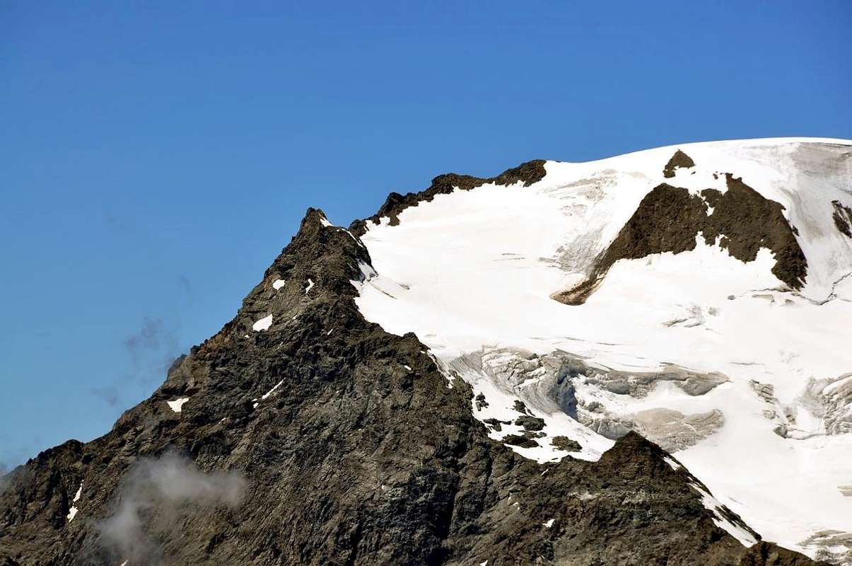
"Landslide of July 06th, 1564 on Becca France", by Osw
Gran San Bernardo, By Conca and Ollomont Valley
Getting There
By car:
- From TORINO, MILANO, etc: Motorway A5. Exit at IVREA or Quincinetto (PIEDMONT)
From IVREA Town: before in West to Aosta, after in Northwest to Gignod, Etroubles, Saint-Oyen, Saint Rhémy en Bosses, (Southwestern and Northwestern Sides) and in North to Allein, Doues, Valpelline (Northeastern Side) Municipalities.
From Courmayeur Resort: before in East to Aosta, after in Northwest to Gignod, Etroubles, Saint-Oyen, Saint Rhémy en Bosses, and in North to Allain, Doues, Valpelline Municipalities.
![]()
From Aosta Town to Merdeux Basin
From Gignod Commune (988m) with Great Saint Bernard State Road n° 27 to alternative nearby Condemine Hamlet (1137m); leaving left through Municipal Road to Grand e Petit Buthier Villages (1302m, 1439m) in Chaligne Comba. From this last, with private dirt farms roads and through Mendey, Roncaille, Rombason Pastures up to the Chaligne Shelter (1936m), below Costa Tardiva (2380m), Tardiva Hill (2410m) and neighbor the Punta Chaligne (2608m).
From Etroubles Commune (1270m), with dirt road and through Champ-Reclos (1425m), Yettes (1591m), Eteley (1716m), fork before Praz-Gallet (1626m), Ars (1975m) Pastures on Arsy Vallon, up to Chaz d'Arsy (2543mn); from this paths to Ars Pass (2534m), Costa Labiez (2632m).
From Etroubles Commune (1270m), with dirt road through Champex (1411m; fork), Flassin de Meitin (1654m), Flassin (1700m), Tsa de Flassin (2258m) Pastures on Flassin small Valley; from this paths to Fenêtre Pass (2729m), Flassin Hill (2605m), Testa Cordella (2663m) and Tête Bois de Quart (2248m).
From Saint-Oyen Commune (1377m), with State Road n° 27 to alternative 1502 metres; leaving North the same to great St. Bernard Hill, continue West to St. Leonard Fraction. From this to Citrin small Valley up to the Mont Flassin (2772m) Citrin Hill (2484m), Punta Valletta (2801m) and La Raye du Sodzé (2640m).
From Saint-Oyen Commune (1377m), with previous Municipal Road to Mottes (1660m) Fraction, Farettes (1666m) Village; from this, with path through Arp du Bois Dèsott Pastures (1936m), alternative 1959 metres to Serena small Valley up to the Hill Serena (2547m) and Testa Serena (2830m). Variant: continue West from Farettes Village to Saint Michel (1732m) Fraction; from this last, tourning South always with Municipal Road, to Arp du Bois Dèsott Pastures.
From Malatrà Hill to Grand Saint Bernard Basin Basin up to the
From Saint-Oyen (1377m), with previous road to Mottes, continue West-northwest to Devies Village (1723m) at the beginning of Merdeux Comba; from this with paths through Merdeux Dèsott (1919m), Cotes (1930m), Manda (1973m), Tsa de Merdeux (2285m) Pastures to Malatrà Hill (2928m).
From Saint Rhémy en Bosses Commune (1619m), through Municipal Road, on Merdeux Comba to Tsa de Merdeux (2285m) and Malatrà Hill (2928m).
From Saint Rhémy en Bosses Commune (1619m) to Tula Comba to Saulié Pass (2817m), Aiguille des Cengles (2869m) and Angroniettes Pass (2936m).
From Saint Rhémy en Bosses Commune (1619m) to Grand Saint Bernard Valley up to the Crévacol Hill and Testa (2498m, 2610m) Saint Rhémy Hill (2540m), Mont Rodzo (2632m), Pain de Sucre (2900m), Mont Fourchon (2902m), Fenêtre de Ferret Hill (2600m) and Grand Saint Bernard Hill (2469m).
From Allain/Doues to Ollomont/Valpelline Communes with By Basin
From Allein Commune (1251m), with Regional and Municipal Roads, to By Basin; from the entrance of this (various alpages reached by private dirt farms roads), through paths, up to the Mont Saron Southern Antesummit (2681m) and traverse on crest to Tete de la Praz (2751m) and Crou de Bleintse (2824m).
From Doues Commune (1176m), with in asphalt Municipal Road, to By Basin; from this, with paths or dirt roads, to Mont Saron (2681m), Crou de Bleintse (2824m), Letey Refuge below Champillon Pass (2430), Mont Chenaille two Summits (3144m), Tsa d'Ansermin (2388m) and Monte Rotondo (2572m).
From Ollomont Commune (1356m), trhough noumerous paths and variaous upper dirt farms roads, to By Conca; from this various routes in all directions up to the Maria Cristina Rosazza at Savoie Bivouac (2674m), Refuge Franco Chiarella-Amiante (2979m), Filon Alp (2478m), Bonne Mort Pass (2646m), Fenêtre Durand Hill (2797m), Nino Regondi Bivouac (2599m) and Lakes, Tsa de Berrio Alp (2165m), Cormet Hill (2354m) and Breuson Hill (2194m).
- From FRANCE: through the Mont Blanc Tunnel to Entrèves-crossroads to Vény/Ferret Valleys - Mountain Guides of Courmayeur - La Saxe Rock Gym - Courmayeur. By Little Saint Bernard Pass, closed since November until half May to La Thuile Valley - Pré Saint Didier - Courmayeur.
It is not necessary to take Motorway A5: you can drive on State Road n° 26, in the direction of AOSTA - IVREA - TURIN.
By plane:
- Aeroporto Internazionale "Corrado Gex" Saint Christophe (Aosta).
"... At the end of San Bernardo Valley ...", by Antonio
Western San Bernardo Valleys
Basic Itinerary n° 7 (Refuge Chaligne and Tardiva Pass): from the alternative near Condemine on SS n° 27 Gran San Bernardo reach the small Hamlet of Grand Buthier-Champlorensal
(1315m); from this towards Petit Buthier Village, Mendey
(1547m) and by the dirt road concomitant with the trail
n° 2A/3A towards Ronchaille
(1656m), Rombason
(1695m) Alp
(1668m), Chaligne new Shelter nearby the homonym Alp (
1936m;
E/F; 1h'15/1h'00), below Northeast Slope of Punta Chaligne
(2608m). Continue before to the South-southwest with the path
n° 2 reaching the Tsa de Chaligne
(2225m) and after briefly to the Northwest towards Costa Tardiva Hill (
2410m;
E/F; 0h'20).
Valloni Occidentali del San Bernardo
Itinerario di Base n° 7 (Rifugio Chaligne e Passo Tardiva): dal bivio presso Condemine sulla SS n° 27 del Gran San Bernardo raggiungere il Villaggetto di Grand Buthier-Champlorensal
(1315 m); da questi verso Petit Buthier, Mendey
(1547 m) e con la poderale concomitante con il sentiero
n° 2A/3A verso Ronchaille
(1656 m), Rombason
(1695 m) Alpe
(1668 m), nuovo Rifugio Chaligne presso l'Alpe omonima (
1936;
E/F; 1h'15/1h'00), sotto il Versante Nordest della Punta Chaligne
(2608 m). Continuare dapprima verso Sud-sudovest con il sentiero
n° 2 raggiungendo la Tsa de Chaligne
(2225 m) e poi verso Nordovest in breve tempo al Passo Tardiva (
2410 m;
E/F; 0h'20).
Great St. Bernard
Itinerary Basic n° 8 (Great St. Bernard and Entremont Valley): from the parking just after Saint-Rhémy Center towards Great Saint Bernard Valley, crossing under Saint Bernard Tunnel Road in altitude
1860 metres, forks between Praz Dzentor/Plan d'Arc
(1876m), Praz d'Arc
(1992m), Fonteinte Pastures (+;
2203m near
"La Cantine d'Aoste"); continue with State Road to Montagna Baou below Tour des Fous, and after a short tunnel in a terminal diagonal to Great Saint Bernard Lake & Hill, through Southern Slopes,
(2469m; "Roman Mansio, Jupiter Statue, Hotel Italia, Restaurant of Lake, Saint Bernard Hospice, Bazars, Exposition Saint Bernard Dogs, Ancient Morgue".
E/F; 2h '30/3h '00)). From the pass possibility of descent to Entremont Valley in Switzerland with Swiss State Road and towards the
"Combes des Morts" nearby Le Tronchet mini parking or continue te descent to Hospitalet
2116m), Bourg Saint Bernard
(1918m) near Mauvoisin long Dam, Bourg Saint Pierre
(1632m) to Orsières
(879m).
Note: This route is useful in order to do the trail with snowshoes; otherwise you must reach the junction from the parking lot to the Dzellette Arp
(1870m) and, staying on shore hydrographic left (East) of Torrent Gr. St. Bernard, continue with the trail
n° 13B/TAM/TdC/VA that, passing under Plan de Raye, rejoins the
"Napoleonic Via" towards Alp Fonteinte.
5)- Properties of Monks, Rule of St. Augustine, built "ab immemorabilis" above a statue dedicated to Jupiter, while the actual statue of San Bernardo was inaugurated in 1905; in the Church are the relics of St. Faustina taken from the Roman catacombs and donated in 1828 by Pope Leo XII° to the Hospice. A "latere or fringes" of an ancient tombstone II°/III° Century that reads "Faustina dulcis anima or Faustina sweet soul". Moreover immediately behind is the ancient "Morgue", where the dead were withheld until the spring waiting for proper burial; many deaths occurred because of avalanches in an attempt to force a passage in the middle of winter. That occurred often in the "Vallon des Morts" and who registered even recently, is also in 2015 against three Ski-Mountaineers, while in the past mainly affecting Cigarette Smugglers and Pilgrims.
Gran San Bernardo
Itinerario di Base n° 8 (Colle del Gran San Bernardo e Valle d'Entremont): dal parcheggio subito dopo il centro di Saint-Rhémy verso la valle del Gran San Bernardo, attraversando al di sotto del Tunnel sulla Strada Statale n° 27 in altitude di
1860 metri, successivi bivi per e tra gli Alpeggi di Praz Dzentor/Plan d'Arc
(1876 m), Praz d'Arc
(1992 m), Fonteinte (+;
2203m presso
"La Cantine d'Aoste"); continuare con la Statale verso la Montagna Baou sotto alla Tour des Fous, ed al successivo breve tunnel con diagonale, sotto il versante Meridionale, verso il Lago del Gran San Bernard appena precedente il Colle,
(2469m; "Roman Mansio, Statua di Giove, Hotel Italia, Ristorante del Lago, Saint Bernard Hospice, Bazars, Esposizione dei Cani del Gran San Bernardo, Antica Morgue".
E/F; 2h '30/3h '00)). Dal colle possibilità di scendere nella Valle d'Entremont in Svizzera tramite la Statale svizzera in direzione della
"Combes des Morts" presso la piazzola di Le Tronchet oppure proseguire verso Hospitalet
(2116 m), Bourg Saint Bernard
(1918 m) presso la Diga di Mauvoisin, Bourg Saint Pierre
(1632 m) sino al Comune di Orsières
(879 m).
Nota: Questo itinerario é utile volendo effettuare il percorso con racchette da neve; altrimenti conviene dal parcheggio raggiungere il bivio per l'Arp Dzellette
(1870 m) e, restando sulla sponda idrografica sinistra (Est) del Torrent Gran San Bernardo, proseguire con il sentiero
n° 13B/TAM/TdC/VA che, passando sotto Plan de Raye, si ricongiunge alla
"Via Napoleonica" verso l'Alpe Fonteinte.
5)- Costruito proprio al valico é di proprietà dei Monaci, Regola di Sant'Agostino; eretto "ab immemorabilis" sopra d'un simulacro dedicato a Giove, mentre la statua attuale di San Bernardo é stata inaugurata nel 1905. Nella Chiesa vengono conservate le reliquie di Santa Faustina prelevate dalle catacombe romane e donate nel 1828 da Papa Leone XII° all'Ospizio. A "latere" un'antica lapide del II°/III° Secolo che recita "Faustina dulcis anima". Subito dietro trovasi l'antica "Morgue", ove venivano trattenuti i morti insino a primavera in attesa d'adeguata sepoltura. Molti decessi avvenivano a causa di valanghe nel tentativo di forzarne il passaggio in pieno inverno, evento verificatosi anche recentemente (2015) nell'adiacente "Vallon des Morts" nei confronti di tre Sci-Alpinisti, mentre nel passato colpiva soprattutto Contrabbandieri e Pellegrini.
Doues Basin/Ollomont Valley
Itinerary Basic n° 9 (Letey Shelter and Champillon Hill): from Doues-Planavilla, with Municipal Road in Northwest towards Haut Praz-Bas Hamlet; from this continue in North to Pointier
(1635m), Piolet Dèsot
((1657m), Meitin, Piolet Damon Villages, Plan Taredaz
((1881m) nearby Farm Holidays
"Vorbé", Cheséry
((1969m), Baita Novella, alternative
2007 metres, Plan Debat, Notre Dame de Neige/Champillon (+ stone Cross;
(2078m; parking with wooden fountain;
(2050m;
T/E; 1h '20/1h '40), at entrance in By Conca (Basin) and where ends the paved road. Splendid circular views to 180°. From Champillon parking in Northwest with the path
High Route n° 1 towards, Pessinoille Pastures
(2146m), Alp Tsa (
2297m; source) nearby the new Letey Refuge; from the shalter through path to Champillon Pass (
2430m;
E/F; 1h '45/2h '15).
6)- In the By Basin major battles took place. In fact, they were bitterly disputed pastures among the inhabitants of the Valley of Aosta and those of the neighboring Valais, who often came from the Fenêtre Durand (also Fenetre de Calvin, because through this hill took the flight to Switzerland of Jean Calvin in March 1536) to make shipments with the aim of appropriating the territories. It remains the testimony by the Abbot Joseph Henry: "A ce Plan de Bonamort s'est livré, dans le haut moyen âge, une bataille entre les Valaisans et les Bioneins, à l'avantage de ceux-ci". Also in 1540 we record the clashes between the villagers of Ollomont and those of Bagnes for properties Alp Chermotane; the traces with "Bois-de-la-Bataille" near Glassier and the "Plan de la Bataille" at By. It was later manned by Valaisans until 1690, favored by glacial retreat.
Conca di By/Val d'Ollomont
Itinerario di Base n° 9 (Rifugio Letey e Colle di Champillon): da Doues-Planavilla, con la Strada Municipale verso Nordovest in direzione del Villaggio di Haut Praz-Bas; da questo continuare a Nord verso quelli di Pointier
(1635 m), Piolet Dèsot
((1657 m), Meitin, Piolet Damon, Plan Taredaz
((1881 m) vicino all'Agriturismo
"Vorbé", Cheséry
((1969 m), Baita Novella, bivio
2007 metri, Plan Debat, Notre Dame de Neige/Champillon (+ Croce in pietra;
(2078 m; parcheggio con fontana;
(2050 m;
T/E; 1h '20/1h '40), all'ingresso della Conca di By e dove termina la strada asfaltata. Splendida vista circolare a 180°. Dal parcheggio di Champillon con sentiero
Alta Via n° 1 verso Nordovest agli Alpeggi di Pessinoille
(2146 m) e Tsa (
2297 m; sorgente) presso il nuovo Rifugio Letey; da questo con sentiero al Colle Champillon (
2430 m;
E/F; 1h'45/2h'15).
6)- Nella Conca di By avvenivano grandi battaglie. Infatti erano aspramente contesi i pascoli tra gli abitanti della Valle di Aosta e quelli del vicino Vallese, che spesso entravano dalla Fenêtre Durand (anche Fenêtre di Calvin, perché tramite questo colle avvenne la fuga in Svizzera di Giovanni Calvino nel marzo 1536) per effettuare delle spedizioni con lo scopo di appropriarsi dei territori. Rimane la testimonianza da parte dell'Abbé Joseph Henry: "A ce Plan de Bonamort s'est livré, dans le haut moyen âge, une bataille entre les Valaisans et les Bioneins, à l'avantage de ceux-ci". Inoltre nel 1540 registriamo degli scontri tra i valligiani d'Ollomont e quelli di Bagnes per la proprietà dell'Alpe Chermotane; rimangono le tracce con il "Bois-de-la-bataille" a Glacier ed il "Plan de la Bataille" presso By. In seguito venne presidiato dai Vallesani fino al 1690.
Itinerary Basic n° 10 (Gaula Oratory, Lakes and Nino Regondi Bivouac): By the regional Road towards Valpelline up to the deviation for Ollomont Common; leaving East the first continue North toward Glassier or Glacier Hamlet. From Glacier parking, through steep but short private dirt road concomitant with path
n° 6 in South-southeast, to Crottes Pasture
(1591m); continue on nice path to Gaula Oratory, (+;
1863m;
T; 1h '00/1h '10). Places Alp
(2150m), small bridge
2223 metres on Fenêtre Torrent, Plan de Breuil immediately above Comba des Eaux Blanches, fork
2465 metres, between Clusa or Inclousa
(2418m)/Leita
(2538m) Lakes to Regondi Bivouac (
EE; 4h '30/5h '00).
Itinerario di Base n° 10 (Oratorio della Gaula, Laghi e Bivacco Nino Regondi): con la Strada Regionale per il Comune di Valpelline sino alla deviazione per quella diel Comune di Ollomont; lasciando ad Est la prima continuare a Nord verso il Villaggetto di Glassier o Glacier. Dal suo parcheggio, tramite la ripida strada poderale concomitante con il sentiero n° 6 verso Sud-sudest, in direzione dell'Alpeggio di Crottes (1591 m); proseguire sul bel sentiero per l'Oratorio della Gaula, (+; 1863 m; T; 1h '00/1h '10). Da questo raggiungere quello di Places (2150 m), il successivo ponticello 2223 metri sul Torrent Fenêtre ed il Plan de Breuil subito sopra la Comba des Eaux Blanches (dell'Acqua Bianca); da qui al bivio 2465 metri, tra i Laghi Clusa od Inclousa (2418 m)/Leità o Leitou (2538 m) nelle immediate vicinanze del Bivacco Nino Regondi (EE; 4h '30/5h '00).
Valpelline
Getting There
By car:
- From TORINO, MILANO, etc: Motorway A5. Exit at IVREA or Quincinetto (PIEDMONT)
From IVREA Town: in West towards Pont Saint Martin, Verrès, Châtillon, Nus, Aosta in West and to Gignod, Valpelline, Oyace and Bionaz Municipalities in Northeast from Aosta Town.
From Courmayeur Resort: in East-southeast (Norheastern side) to Aosta, Gignod, Valpelline, Oyace, Bionaz Municipalities in Northeast and to Nus, Châtillon, Verrès, Pont Saint Martin Communes to South-southeast.
From Valpelline towards Valpelline Valley
From Valpelline (580m), with Regional Road, to Oyace Commune (1316-1377m); from this to Northern and Southern Walloons (Brison, Crête Sèche, Vertsan, Comba be la Tsa, Comba du Grand Chamin, Comba des Lacs and Comba d'Orein up to the entrance on Petite/Grande Murailles/Valpelline Hill small Valley.
From Oyace (1377m), with the Regional Road, to Bionaz Commune (1612m) and Places Moulin artificial Dam (1970/80m) and Northern and Southern Walloons (Bella Tsa, Combes de Valcornière, Livourneaz, Montagnayes; Vessonaz, Verdonaz, Vieille, Verdzignolaz, Arpisson, Gran Comba and Roisan-Praperiaz Basin.
Valpelline
Basic Itinerary n° 11 (Crossing from Valpelline Common towards Ollomont by Breuson also Brison Pass): from Valpelline-Semon (+; 1061m) towards Chez la Ville Village, and through the trail n° 3 to the two forks 1525, 1700 metres along Brison Torrent, Gay (1721m) and Arsines Alpages (1703m; E/F; 2h'30/2h'40; source). Little Variant: from Valpelline to Fressionaz Dessous (1150m) Fraction, with Main Road to Ollomont Municipality; from this, path in East-Northeast, through Plan Coudray Wood, to fork 1440 metres and, path direct in North, to Arsines Alpages (E; 2h'15), below Pointe Sereina (2283m). From Semon Village, Chez la Ville, with path in North, towards Bas Brison (1545m), Dzone Zoon (1695m) small Villages up to the Brison l'Arp (2195m; F+; 3h '15/3h '30), below Mont Berrio (3077m)/Punta Fiorio (3332m). From Semon, Brison l'Arp, crossing Brison Torrent in homonym Comba, to Brison Pass (2194m; EE/F+; 3h'45/4h'00), between Pointes d'Ollomont (2721m)/Mont Faceballa (+; 2516m); descent West possibility to Berrio Damon Alp (1982m) in Berrio Comba, above Ollomont (classic crossing for the inhabitants).
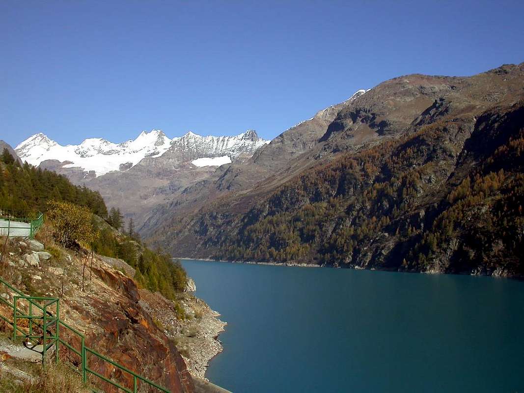
7)- Valpelline is a valley wild and lonely that is directed towards the great Dam Bionaz. It is separated from that of the Gran San Bernardo reaching the Petites and Grandes Murailles on the border with the Valtournanche, while in the South along a watershed divides those of Baltea St. Barthelemy. But by definition is the valley of the Place Moulin Dam, built in the immediate postwar period. Something more "artistic" can be found in "The Tornalla", the "La Tour" in 1100 and property of the Savoy until 1500 and home to the Court of the Lords of Quart. Oyace for the "Tour" of the same name is dated 1300, but built, probably with castle and town walls, on the foundations of one of the X Century. But his parish is the oldest and precedes the year 1000, according to a document dated April 20, 1176 in which Pope Alexander III° confirmed his "protection". Here he lived the Parish Priest Abbé Joseph-Marie Henry, Botanist, Writer and Mountaineer, until his death (* Courmayeur, March 10, 1870 - + Valpelline, 1947); He was responsible for many works on the History of the Valley of Aosta and its dialect "patois", including the "Guide du Valpelline" of 1925.
Valpelline
Itinerario di Base n° 11 (Traversata da Valpelline ad Ollomont tramite il Col Brison o Breuson): da Valpelline-Semon (+; 1061 m) al Villaggio di Chez la Ville, bivio 1525, 1700 metri affianco al Brison Torrent, e con sentiero n° 3 alle Alpi di Gay (1721 m), Arsines (1703 m; E/F; 2h'30/2h'40; sorgente). Mini Variante: da Valpelline alla Frazione di Fressionaz Dessous (1150 m), con la strada principale per Ollomont; da questa, sentiero in Est-Nordest, attraverso il Bosco di Plan Coudray, verso il bivio 1440 metri e, con sentiero a Nord, all'Arsines (E; 2h'15), sotto la Pointe Sereina (2283 m). Da Semon, Chez la Ville, con sentiero a Nord, in direzione di Bas Brison (1545 m), Dzone Zoon (1695) Villaggetti e da questi all'Arp de Brison (2195 m; F+; 3h '15/3h '30), sotto al Mont Berrio (3077 m)/Punta Fiorio (3332 m). ancora da Semon, Brison l'Arp, attraversando il Brison Torrent nell'omonima Comba, verso il Colle Brison (2194 m; EE/F+; 3h'45/4h'00), in mezzo alle Pointes d'Ollomont (2721 m)/Mont Faceballa (+; 2516 m). Possibilità di scendere ad Ovest sull'Alpe Berrio Damon (1982 m) nella Comba del Berrio, sopra Ollomont (classica traversata per i locali).
7)- Valpelline é una valle selvaggia e solitaria indirizzantesi verso la mastodontica Diga di Bionaz. Si separa da quella del Gran San Bernardo raggiungendo Grandes e Petites Murailles al confine con la Valtournanche, mentre a Mezzogiorno un lungo spartiacque la divide da quelle della Dora Baltea e di St. Barthélemy. Ma per antonomasia é la valle della Diga di Place Moulin, costruita nell'immediato dopoguerra. Qualcosa di più "artistico" lo troviamo a "La Tornalla", alla "La Tour" del 1100 e proprietà dei Savoia fino al 1500, nonché sede del Tribunale dei Signori di Quart. Ad Oyace la "Tour" omonima porta la data del 1300, ma costruita, probabilmente con castello e cinta muraria, sulle fondamenta di un'altra del X° Secolo. La sua Parrocchia é più antica e precede l'anno 1000, come da documento del 20 Aprile 1176 in cui Papa Alessandro III° vi confermava la sua "protezione". Quivi fù Parroco l'Abbé Joseph-Marie Henry, Botanico, Scrittore ed Alpinista, fino alla morte (* Courmayeur, 10 marzo 1870 – + Valpelline, 1947); a lui si devon molte opere sulla Storia della Val d'Aosta e sul suo dialetto "patois", tra le quali la "Guide du Valpelline" del 1925.
Oyace
Itinerary Basic n° 12 (Crête Sèche Refuge and Berrier Alps): from Oyace (1377m) or Bionaz (1612m), by Regional Road to Dzovenno Hamlet (1587-1599m); continue North on Municipal Road to Chez les Rey (1641m) and Ru or Ruz (Brook) Hamlets (1700m; great parking; fountain; toilettes). From this, with dirt road in North, before to Primo Pasture (1857m); after, crossing Moulin Torrent in windings road (forks 2074m, 2087m), to Berrier various Alpages (2167m, 2187m, 2197m; source neighbor Vertsan Torrent; T/E; 2h '00/2h '15), below Mont de Crête Sèche (2941m)/Mont de Charmontane (2896m). With Eastern Variants: from Dzovenno to Ruz Village (1700m) with Municipal Road; from this last towards Primo Pasture, through dirt road with old path-muletrack concomitant to alternative 1950 metres around. With path unnumbered and not signalled on wooded promontory directly in North-northwest to Berrio di Governo (Gouvernement isolated Boulder) and, through short diagonal North-northwest, to following Crête Sèche Refuge (2389; E/F; 2h'45/3h'00). Eastern Variants: or with path more in East from a)- alternative 2074 metres on dirt road to fork (2249m; source into a slab); also from b)- Berrier Alps, with long diagonal path in West to source 2249 metres, Berrio di Governo, shelter.
Oyace
Itinerario di Base n° 12 (Rifugio di Crête Sèche ed Alpe del Berrier): da Oyace (1377m) oppure da Bionaz (1612m), con la Strada Regionale per il Villaggio di Dzovenno (1587-1599 m); proseguire verso Settentrione sulla Strada Municipale per quelli di Chez les Rey (1641 m) e Ru o Ruz (Ruscello) (1700 m; grande parcheggio; fontanile con tettoia; toilettes). Da questo, con la poderale a Nord, dapprima all'Alpeggio di Primo (1857 m); quindi, attraversando il Torrent Moulin al successivo tornante (bivi 2074 m, 2087 m), verso i vari Alpeggi del Berrier (2167 m, 2187 m, 2197 m; sorgente presso il Torrent de Vertsan; T/E; 2h'00/2h'15), al di sotto dei Mont de Crête Sèche (2941 m)/Mont de Charmontane (2896 m). Tramite le Varianti Orientali: da Dzovenno al Villaggetto di Ruz (1700 m) sempre tramite la Strada Municipale; da quest'ultimo ancora all'Alpe di Primo; per mezzo della poderale concomitante con la vecchia mulattiera raggiungere il bivio 1950 metri circa. Quindi con un sentierino non numerato né segnalato direttamente verso Nord-nordovest al Berrio di Governo (masso isolato in loco detto del Governo) e, con corto diagonale a Nord-nordovest, al successivo Rifugio di Crête Sèche (2389 m; E/F; 2h'45/3h'00). Varianti Orientali: o tramite sentierino più ad Est dal a)- bivio 2074 metri sulla poderale verso quello (2249 m; sorgente in una placca rocciosa); ed ancora dall'b)- Alpi Berrier, con lungo diagonale ad Ovest alla sorgente 2249 metri, indi al Berrio di Governo e rifugio.
Bionaz
Itinerary Basic n° 13 (Grand Chamin or Chamen Alps and Sassa Bivouac): from Bionaz Municipality, with Regional Road, to Ferrère (1687m) small Village, alternative 1642 metres to Chami(e)n Hamlet (+; 1714m) neighbor Déré le Melet Alpage (1690m). From this, through dirt farms road and along the very old path n° 6 (after the construnction of dirt road, now in ruins completely covered with wild vegetation, altogether and fully abandoned) towards fork 1984 metres and, easily crossing on a small bridge Grand above the Chamin Torrent, to Grand Chamin Pastures (2010-2023m; source; E/F; 1h'30/1h'45). Continue North always through the path n° 6, that from this point "resurfaces" concomitant to private dirt road, towards Crottes Alp (2183-92m), where the farm dirt road expiring. Continue, now exclusively through the path, up to the fork 2292 metres, below Berger de la Sassa (characteristic rocky monolith shaped shepherd above the deep valley; 2772m). From this, turning East-northeast, with small path before along the moraines neighbor torrent, after on edge of the same over the Sassa Torrent, through a more steep terminal part on lateral right (North) moraine of the Oriental Glacier, to Ceresa/Sassa Bivouac (2973; EE/F; 6h'15/6h'30; water source about 100 metres to Northeast), sited on a rocky promontory underlying the large glacial basin formed by Becca Labié (3463m)/Becca de la Sassa (3497m)/Pointe de la Bouetta (3540m)/Little Becca Blanchen (3591m)/Grand Becca Blanchen (3679m)/Sassa Pass (3256m)/Becca des Lacs (3470m)/Nez (Nose) Bovet (about 3330m)/Mont Rouge or Becca Bovet (3443m).
Variant: starting later on Main Road by the winding 1856 metri before Places de Moulin through diagonal path n° 3 to the West-northwest towards Grand Chamin Alp.
Bionaz
Itinerario di Base n° 13 (Alpi Grand Chamin o Chamen e Bivacco della Sassa): dal Comune di Bionaz, con la Strada Regionale per Places de Moulin, verso il Villaggetto di Ferrère (1687 m) ed al bivio 1642 metri verso il Villaggio di Chamin (+; 1714m) presso l'Alpe Déré le Melet (1690 m). Da questo, con poderale verso Settentrione, affiancata dal vecchio sentiero n° 6 verso l'Alpe Grand Chamin (dopo la costruzione della medesima, attualmente appare in totale disfacimento e ricoperto da selvaggia vegetazione, e quindi in pratica completamente abbandonato nonché impraticabile) e, facilmente traversando il Torrent Grand Chamin su d'un ponticello, raggiungerla (2010 m; sorgente a 2023 metri; E/F; 1h'30/1h'45). Procedere sempre tramite il sentiero n° 6, che da questo punto "riemerge" concomitante alla medesima, a Nord in direzione dell'Alpe Crottes (2183-92 m), dove temina la poderale. Proseguire, ormai esclusivamente per mezzo del sentiero, insino al bivio 2292 metri, sotto al Berger de la Sassa (monolite a guisa di "Pastore" soprastante il vallone; 2772 m). Da questo, svoltando ad Est-nordest, con un sentierucolo dapprima lungo le morene nelle vicinanze del torrente, indi sul filo delle medesime e sopra il Torrent de la Sassa, a mezzo d'una più ripida parte finale sul bordo laterale destro (Nord) della morena del Glacier Oriental, fino al Bivacco Ceresa/Sassa (2973 m; EE/F; 6h'15/6h'30; sorgente a circa 100 metri verso Nordest), situato su d'un promontorio roccioso sottostante al largo bacino glaciale formato da Becca Labié (3463 m)/Becca de la Sassa (3497 m)/Pointe de la Bouetta (3540 m)/Little Becca Blanchen (3591 m)/Grand Becca Blanchen (3679 m)/Sassa Pass (3256 m)/Becca des Lacs (3470 m)/Nez (Nose) Bovet (3330 metri circa)/Mont Rouge o Becca Bovet (3443 m).
Variante: partendo più avanti sulla Regionale dal tornante 1856 metri prima di Places de Moulin con sentiero n° 3 in diagonale ad Ovest-nordovest all'Alpe Grand Chamin.
Comments
No comments posted yet.