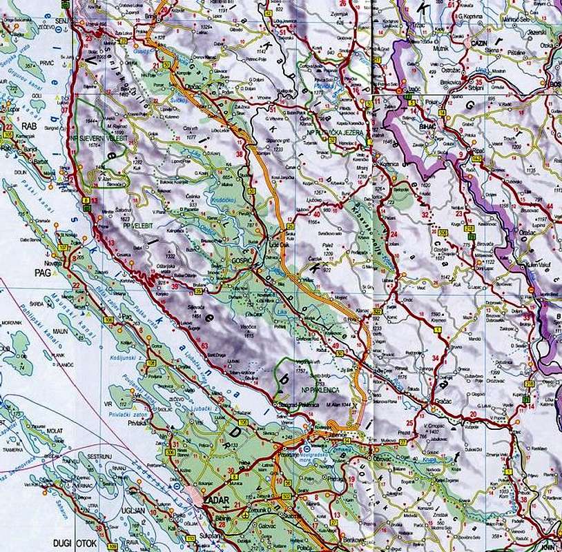
Velebit massif and surrounding area, map scale 1:500000. Map is not perfectly clear and readable but this is the 'smallest' scale map which can fit
150km long Velebit into allowed 650 pixels and still remain good enough. It helps to get sense where Velebit is and what is around. ---> Velebit stretches between the
Vratnik pass on the NW and bend of river
Zrmanja on the SE. It is mostly placed along the coast of
North Adriatic while SE Velebit goes inland. Doted
green line around Velebit is the border of
Velebit Nature Park which includes entire massif and its
2274km^2. On Velebit are also
North Velebit National Park and
Paklenica National Park. --->
North & Mid Velebit area map. --->
South & SE Velebit area map.


