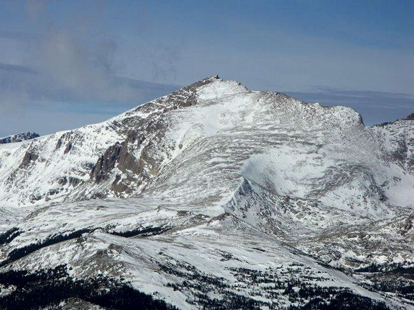
Chiefs Head Peak seen from Meadow Mountain (southeast). At the center of the picture rises the so-called
North Ridge, which leads from Mount Orton to the summit. In reality, it is the southeast ridge of Chiefs Head. The
class 2 route along the ridge provides the easiest access to the summit. The left skyline is the west ridge, also a class 2 route, albeit with a longer approach from Wild Basin than the southeast ridge. The right skyline is the east ridge, connecting Chiefs Head Peak to Pagoda Mountain. The col separating the two summits is the low point visible at the right of the picture; it can be reached from Glacier Gorge by an
interesting snow climb. Rocky Mountain National Park. December 2004.


