
|
|
Mountain/Rock |
|---|---|
|
|
37.76633°N / 118.70371°W |
|
|
Mono |
|
|
Spring, Summer, Fall |
|
|
11160 ft / 3402 m |
|
|
Overview
Glass Mountain is the highpoint of the Glass Mountain Range southeast of Mono Lake in central Mono County. Most of the peaks in the immediate area, including Glass Mountain, are part of the Long Valley Caldera and therefore volcanic in nature. The geology of Glass Mountains consists primarily of various lava domes and rhyolite or obsidian flows, mostly occurring from 2.1 to 0.8 million years ago.
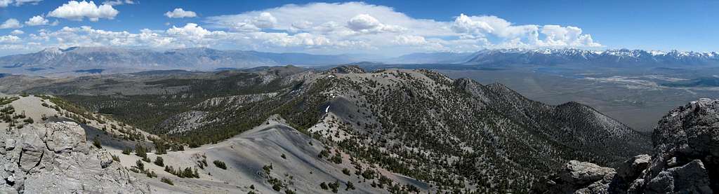
The summit is usually accessed via a short but steep class 1 use trail in Inyo National Forest near Highway 120 in the Mono Basin area. The drive is scenic, and though the hike is short the views are outstanding and rewarding. The panorama includes much of the Sierra Nevada, the White Mountain Range, Mono Lake, and Owens Valley stretching off in various directions.

Getting There

Sawmill Meadows Road
Glass Mountain is most easily approached from Highway 120 between Lee Vining and Benton, California. There is a high-speed dirt road most of the drive, passable by low clearance vehicles. Note that Highway 120 passes through a lot of steep washes in this area. Although well paved, it is not a road that is drivable at excessive speeds, especially at night.
Sawmill Meadows Trailhead (37.77388° N, 118.68380° W)
From Benton, drive 13.6 miles west on Highway 120 and turn left onto unpaved but well graded and signed Black Canyon Road. If coming from Lee Vining the turnoff is 31.8 miles east of Highway 395. After 0.8 miles turn right at an intersection onto Sawmill Meadows Road and continue 6.6 miles to another intersection and turn left to stay on Sawmill Meadows Road. After 3.2 miles keep right and continue another 0.4 miles to an intersection with an old jeep road on the right. dshoshone reports that this jeep road has recently been closed by the USFS by placing a log across it, so park your vehicle here.