Toggle navigation
Mountains
Routes
Images
Trip Reports
Forum
What's New
People
Areas & Ranges
Articles
Trailheads
Canyons
Huts & Campgrounds
Albums
Logistical Centers
Fact Sheets
Lists
Custom Objects
Gear
Plans & Partners
WELCOME TO SUMMITPOST
SIGN IN
REGISTER
Trinchera Peak
Additional Parents
Image
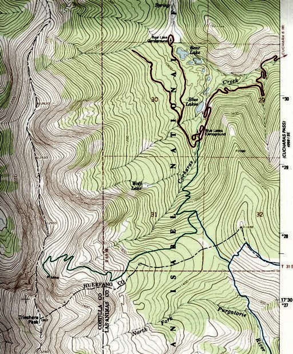
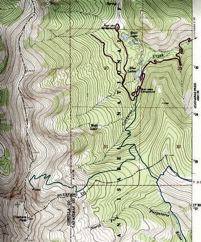
From the USGS 7.5 minute quad...
View High-Resolution Image
From the USGS 7.5 minute quad...
From the USGS 7.5 minute quad map photorevised 1982. Red routes--main roads. Green route--Trinchera Peak Road. Blue route--North Fork Trail.
« PREV
NEXT »
billokc
on
Dec 26, 2003 2:36 pm
Comments & voting
Other parents
Lat/Lon:
37.28910°N / 105.165°W
Image Type(s):
Topo/Diagram
Image ID:
36784
4762 Hits
73.06
% Score
3
Votes
Log in to vote
Comments
No comments posted yet.
to post!
Don't have an account?
Trinchera Peak
(Mountain/Rock)
« PREV
Viewing
#50 of 150
GALLERY
NEXT »
billokc's Image Gallery
« PREV
Viewing
#40 of 156
GALLERY
NEXT »
×
You need to login in order to vote!
User Name
Password
Remember me
Forgot your password?
Log me out when I close my browser.
Keep me logged in all the time.
sign in as a user
Don't have an account?
Register now for FREE
Rating available
Suggested routes for you
People who climb the same things as you
Comments Available
Create Albums
Register Here


