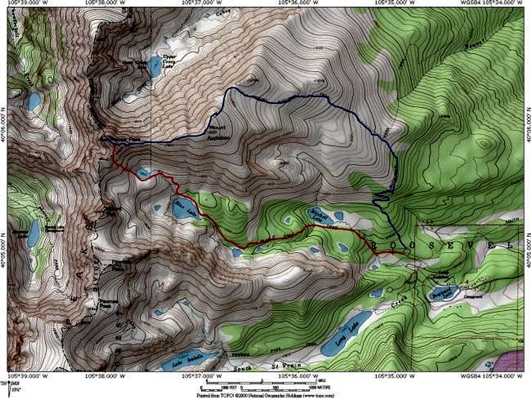
This map depicts the two primary routes on Piaute Peak. The red route is the standard ascent that follows the Blue Lake drainage. The blue route is the ridge traverse from Mount Audubon. These routes may be linked to make a grand loop. Map created with National Geographics Topo! software.
Jon Bradford


