Toggle navigation
Mountains
Routes
Images
Trip Reports
Forum
What's New
People
Areas & Ranges
Articles
Trailheads
Canyons
Huts & Campgrounds
Albums
Logistical Centers
Fact Sheets
Lists
Custom Objects
Gear
Plans & Partners
WELCOME TO SUMMITPOST
SIGN IN
REGISTER
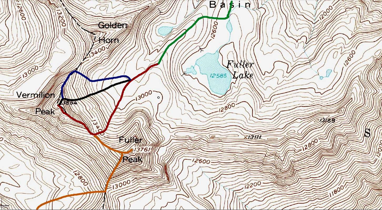
Vermilion Peak Routes
View High-Resolution Image
Vermilion Peak Routes
Green:
Ice Lake Basin Approach - Class 1,
Red:
Southeast Ridge - Class 2+,
Black:
Vermilion Dollar Couloir - Class 3,
Blue:
Northeast Ridge - Class 3,
Orange:
Southwest Basin - Class 3. Click to enlarge.
« PREV
NEXT »
Brian Kalet
on
Dec 10, 2013 4:15 pm
Comments & voting
Other parents
Lat/Lon:
37.79940°N / 107.8285°W
Image Type(s):
Hiking
,
Topo/Diagram
Image ID:
879318
2822 Hits
0
% Score
0
Votes
Log in to vote
Comments
No comments posted yet.
to post!
Don't have an account?
Vermilion Peak
(Mountain/Rock)
You are at
the First
Image
Viewing
#1 of 1
GALLERY
You are at
the Last
Image
Brian Kalet's Image Gallery
« PREV
Viewing
#380 of 414
GALLERY
NEXT »
Vermilion Peak
(Mountain/Rock)
Loading....
Southeast Ridge
(Route)
Loading....
Vermilion Dollar Couloir
(Route)
Loading....
×
You need to login in order to vote!
User Name
Password
Remember me
Forgot your password?
Log me out when I close my browser.
Keep me logged in all the time.
sign in as a user
Don't have an account?
Register now for FREE
Rating available
Suggested routes for you
People who climb the same things as you
Comments Available
Create Albums
Register Here


