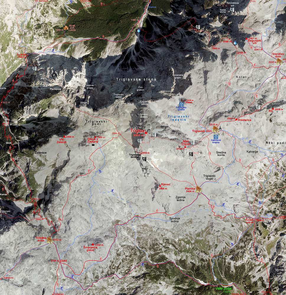
This is a very detailed map of Triglav narrow massif, based on orto photo image. In addition to some points of interest, you will find here:
> all official marked paths. Those more difficult than T1 (on the Swiss Hiking Scale) are labelled and if they are ferratas, also their difficulty grading on the ferratas scale is shown. For example: B, T4.
> Ski routes (descents only) are drawn by guidebook descriptions and difficulty (steepness) only for those, where I have own experience.
Harder climbs and alpinistic ski routes are not shown.
See the original, high resolution version for all details!


