Toggle navigation
Mountains
Routes
Images
Trip Reports
Forum
What's New
People
Areas & Ranges
Articles
Trailheads
Canyons
Huts & Campgrounds
Albums
Logistical Centers
Fact Sheets
Lists
Custom Objects
Gear
Plans & Partners
WELCOME TO SUMMITPOST
SIGN IN
REGISTER
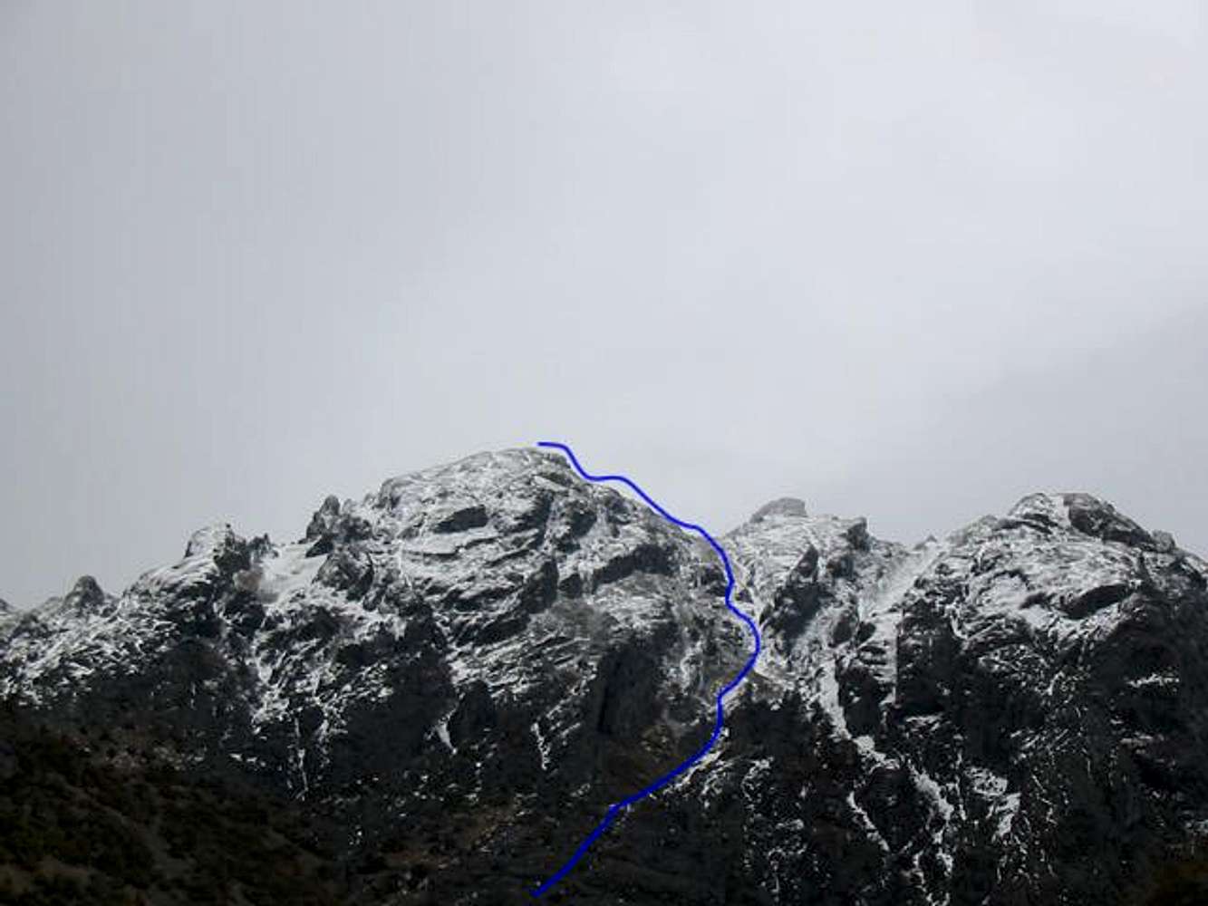
This shows the line of...
View High-Resolution Image
This shows the line of...
This shows the line of ascent up the drainage to the south side of the summit monolith. For more challenge, pick one of the chutes to the north
« PREV
NEXT »
bearbnz
on
Mar 13, 2003 8:38 pm
Comments & voting
Other parents
Lat/Lon:
41.20100°N / 118.555°W
Image ID:
18171
3361 Hits
72.6
% Score
3
Votes
Log in to vote
Comments
No comments posted yet.
to post!
Don't have an account?
King Lear Peak
(Mountain/Rock)
You are at
the First
Image
Viewing
#1 of 1
GALLERY
You are at
the Last
Image
bearbnz's Image Gallery
« PREV
Viewing
#317 of 518
GALLERY
NEXT »
King Lear Peak
(Mountain/Rock)
Loading....
West Slopes Direct
(Route)
Loading....
×
You need to login in order to vote!
User Name
Password
Remember me
Forgot your password?
Log me out when I close my browser.
Keep me logged in all the time.
sign in as a user
Don't have an account?
Register now for FREE
Rating available
Suggested routes for you
People who climb the same things as you
Comments Available
Create Albums
Register Here


