Toggle navigation
Mountains
Routes
Images
Trip Reports
Forum
What's New
People
Areas & Ranges
Articles
Trailheads
Canyons
Huts & Campgrounds
Albums
Logistical Centers
Fact Sheets
Lists
Custom Objects
Gear
Plans & Partners
WELCOME TO SUMMITPOST
SIGN IN
REGISTER
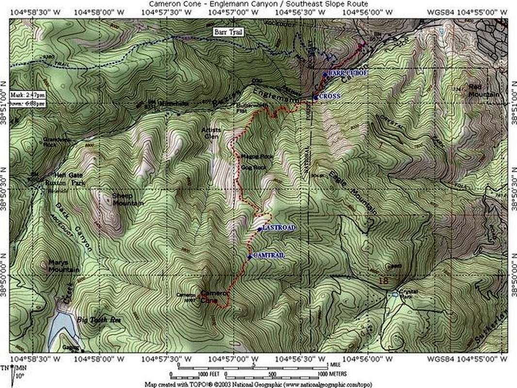
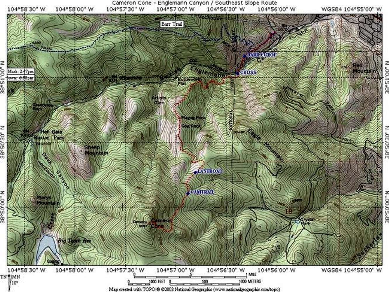
This shows the approximate...
View High-Resolution Image
This shows the approximate...
This shows the approximate route. This is an updated map and is pretty accurate, as I was able to stay on trail almost the whole way up. Map created with Topo! software (www.topo.com). You can download a higher resolution image of this map
here
.
« PREV
NEXT »
mmoerk
on
Oct 12, 2004 12:50 am
Comments & voting
Other parents
Lat/Lon:
38.83140°N / 104.9539°W
Image ID:
73455
4559 Hits
73.45
% Score
4
Votes
Log in to vote
Comments
No comments posted yet.
to post!
Don't have an account?
Cameron Cone
(Mountain/Rock)
You are at
the First
Image
Viewing
#1 of 1
GALLERY
You are at
the Last
Image
mmoerk's Image Gallery
« PREV
Viewing
#110 of 150
GALLERY
NEXT »
Cameron Cone
(Mountain/Rock)
Loading....
Englemann Canyon / Southeast Slope
(Route)
Loading....
×
You need to login in order to vote!
User Name
Password
Remember me
Forgot your password?
Log me out when I close my browser.
Keep me logged in all the time.
sign in as a user
Don't have an account?
Register now for FREE
Rating available
Suggested routes for you
People who climb the same things as you
Comments Available
Create Albums
Register Here


