This is a topo of the entire...

This is a topo of the entire...

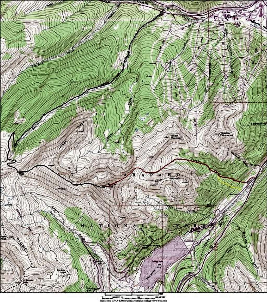
This is a topo of the entire winter-safe Northeast Ridge Route (red.) The yellow section of route is the optional ascent route that bypasses the very rugged lower Copper Creek Drainage. The black route is another winter safe route that ascends Geller Creek to Searle Pass. From the pass its an easy hike up the windscoured northwest ridge to the summit.
Kane
on May 4, 2004 11:29 pm
Image ID: 51998

Comments

Post a Comment
Viewing: 1-1 of 1
Grant

Grant - May 5, 2004 12:02 am - Voted 10/10

very nice

Kane, Since Dave Muller's book (Colorado Mountain Hikes for Everyone, 1987) describes driving up the road a few miles, which of course no one can do now. You have described a different and realistic way to climb Jacque without doing it from I-70. Thanks, you’re the man.......


Viewing: 1-1 of 1