Toggle navigation
Mountains
Routes
Images
Trip Reports
Forum
What's New
People
Areas & Ranges
Articles
Trailheads
Canyons
Huts & Campgrounds
Albums
Logistical Centers
Fact Sheets
Lists
Custom Objects
Gear
Plans & Partners
WELCOME TO SUMMITPOST
SIGN IN
REGISTER
Paklenica
Additional Parents
Image
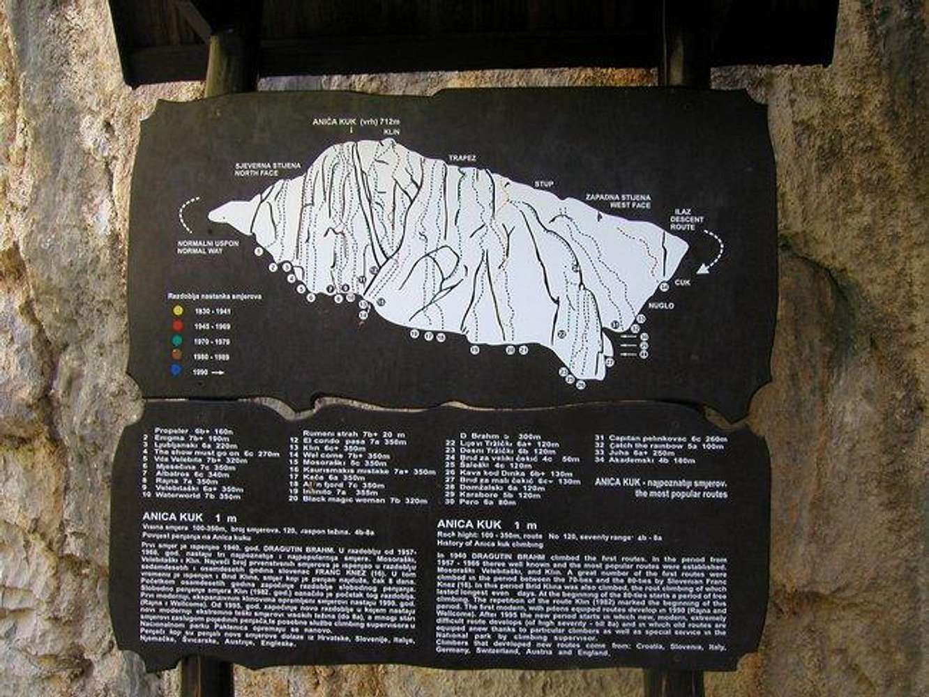
The table in Paklenica vally...
View High-Resolution Image
The table in Paklenica vally...
The table in Paklenica vally where are named all the routes in Anica kuk.
Foto: Bor Sumrada
« PREV
NEXT »
Bor
on
Feb 14, 2005 10:39 am
Comments & voting
Other parents
Lat/Lon:
44.34040°N / 15.47480°E
Image ID:
90028
1978 Hits
70.59
% Score
1
Votes
Log in to vote
Comments
No comments posted yet.
to post!
Don't have an account?
Paklenica
(Area/Range)
« PREV
Viewing
#183 of 192
GALLERY
NEXT »
Bor's Image Gallery
« PREV
Viewing
#1920 of 1947
GALLERY
NEXT »
×
You need to login in order to vote!
User Name
Password
Remember me
Forgot your password?
Log me out when I close my browser.
Keep me logged in all the time.
sign in as a user
Don't have an account?
Register now for FREE
Rating available
Suggested routes for you
People who climb the same things as you
Comments Available
Create Albums
Register Here


