Toggle navigation
Mountains
Routes
Images
Trip Reports
Forum
What's New
People
Areas & Ranges
Articles
Trailheads
Canyons
Huts & Campgrounds
Albums
Logistical Centers
Fact Sheets
Lists
Custom Objects
Gear
Plans & Partners
WELCOME TO SUMMITPOST
SIGN IN
REGISTER
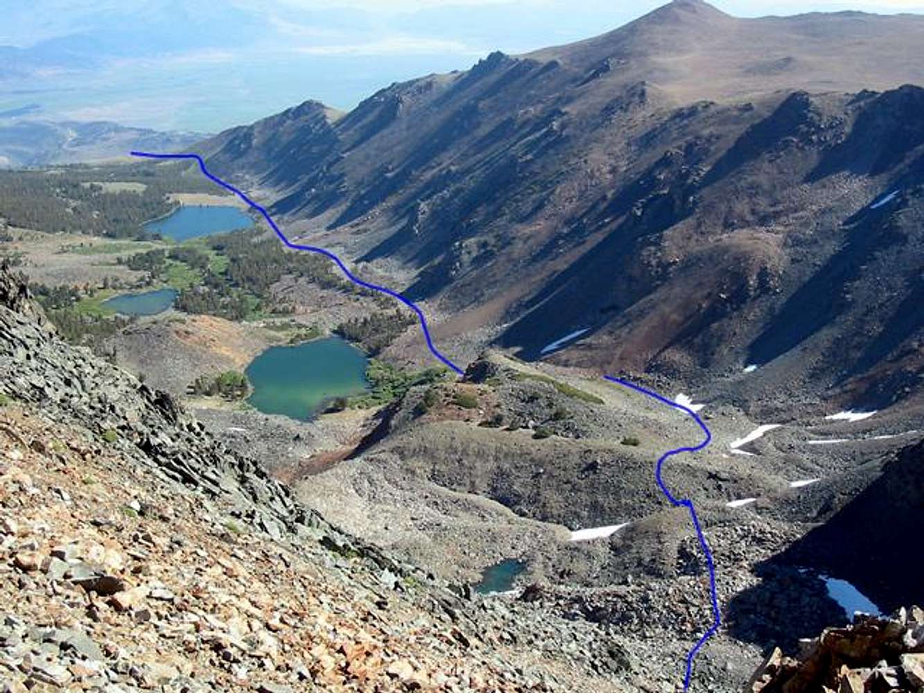
The route through the...
View High-Resolution Image
The route through the...
The route through the Tamarack Basin, past Tamarack Lake, some unnamed lakes, and Hunewill Lake. July 26, 2004
« PREV
NEXT »
bearbnz
on
Jul 29, 2004 12:17 am
Comments & voting
Other parents
Lat/Lon:
38.10110°N / 119.323°W
Image ID:
62579
2670 Hits
72.08
% Score
2
Votes
Log in to vote
Comments
No comments posted yet.
to post!
Don't have an account?
Tamarack Peak (Peak 11,778)
(Mountain/Rock)
You are at
the First
Image
Viewing
#1 of 1
GALLERY
You are at
the Last
Image
bearbnz's Image Gallery
« PREV
Viewing
#353 of 518
GALLERY
NEXT »
Tamarack Peak (Peak 11,778)
(Mountain/Rock)
Loading....
East Slope/Northeast Ridge
(Route)
Loading....
×
You need to login in order to vote!
User Name
Password
Remember me
Forgot your password?
Log me out when I close my browser.
Keep me logged in all the time.
sign in as a user
Don't have an account?
Register now for FREE
Rating available
Suggested routes for you
People who climb the same things as you
Comments Available
Create Albums
Register Here


