
|
|
Mountain/Rock |
|---|---|
|
|
47.40013°N / 11.70029°E |
|
|
6896 ft / 2102 m |
|
|
Overview
 The Stanser Joch
Getting There
The mountain can be climbed from Jenbach, from Stans, from Pertisau or Maurach. I only have experience with the route from Jenbach. If someone has more detail for the other routes, I'll happily update the page.
Route
From Jenbach
In the center of town, follow streets north past the church, then turn left (west) on a side street that gets you to the foot of the ridge (about 650 m). A faint but nonetheless marked (red and white) trail climbs steeply up the ridge to a flat spot where power lines cross the trail (780 m), shortly followed by a wild animal feeding area which is marked as being closed after dark. At this point the ridge begins climbing steeply, the trail heavily strewn with old leaves. At one point, there is a "via ferrata" cable on the trail to assist getting over some steeper rocks, though forest remains deep. A minor summit called the Brandkögerl is noted on a sign as being 1 minute distant (I didn't bother :)).![Pleasant ridge walking]() Pleasant ridge walking
Pleasant ridge walking
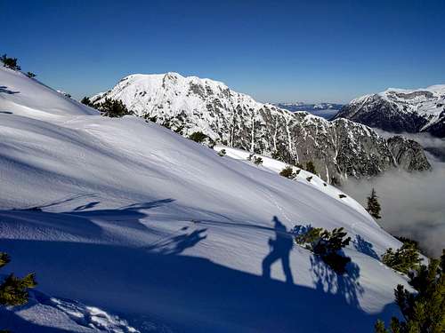 Pleasant ridge walking
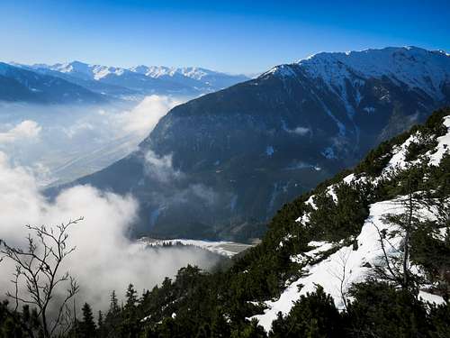
At around 1500 meters, the Jöchlalm is reached, which has a small warming hut. The ridge becomes more open, and the next 300 meters of elevation gain are especially pleasant, alternating between trees and steep grassy hillocks. Finally, at about 1900 meters the country opens up and the distant summit is visible -- a cross on the ridge crest above a cluster of avalanche fences protecting Stans from ruin. Built over a 5 year period from 1986 to 1991, they ensure against a repeat of the 1689 tragedy that left 24 dead [source: Wikipedia (German)].
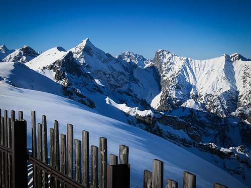
The summit at 2102 meters is easily reached by following the ridge. Fantastic views abound, north to the Achensee, west into the Karwendel, and south to the Inn, possibly shrouded in cloud far below. Beyond that the Zillertal Mountains. Plenty of room here for a picnic.
From Stans
A mix of forest road and trail can be followed directly north from town to the summit. The climb is likely to be unpleasant on a hot summer day!
From Pertisau
Due south from the little village on the Achensee, trail climbs to the Rodelhütte Pertisau. Skirt the Zwölferkopf via trail on it's left side and make for the Bärenbaldalm at about 1450 meters. Traverse the west side of the Bärenkopf on trail to the Weißenbachsattel at 1686 meters. From here, trail climbs directly up the north slope through occasional avalanche fences to the summit of the Stanser Joch (2102 m).
From Maurach
Head southwest out of town on road into the Weißenbach valley. Pass the Weißenbachalm (1606 m, possible refreshments available) to reach the Weißenbachsattel, from which the summit is easily reached just as the route from Pertisau.
 The Sonnjoch