Toggle navigation
Mountains
Routes
Images
Trip Reports
Forum
What's New
People
Areas & Ranges
Articles
Trailheads
Canyons
Huts & Campgrounds
Albums
Logistical Centers
Fact Sheets
Lists
Custom Objects
Gear
Plans & Partners
WELCOME TO SUMMITPOST
SIGN IN
REGISTER
Mount Chiquita
Additional Parents
Image
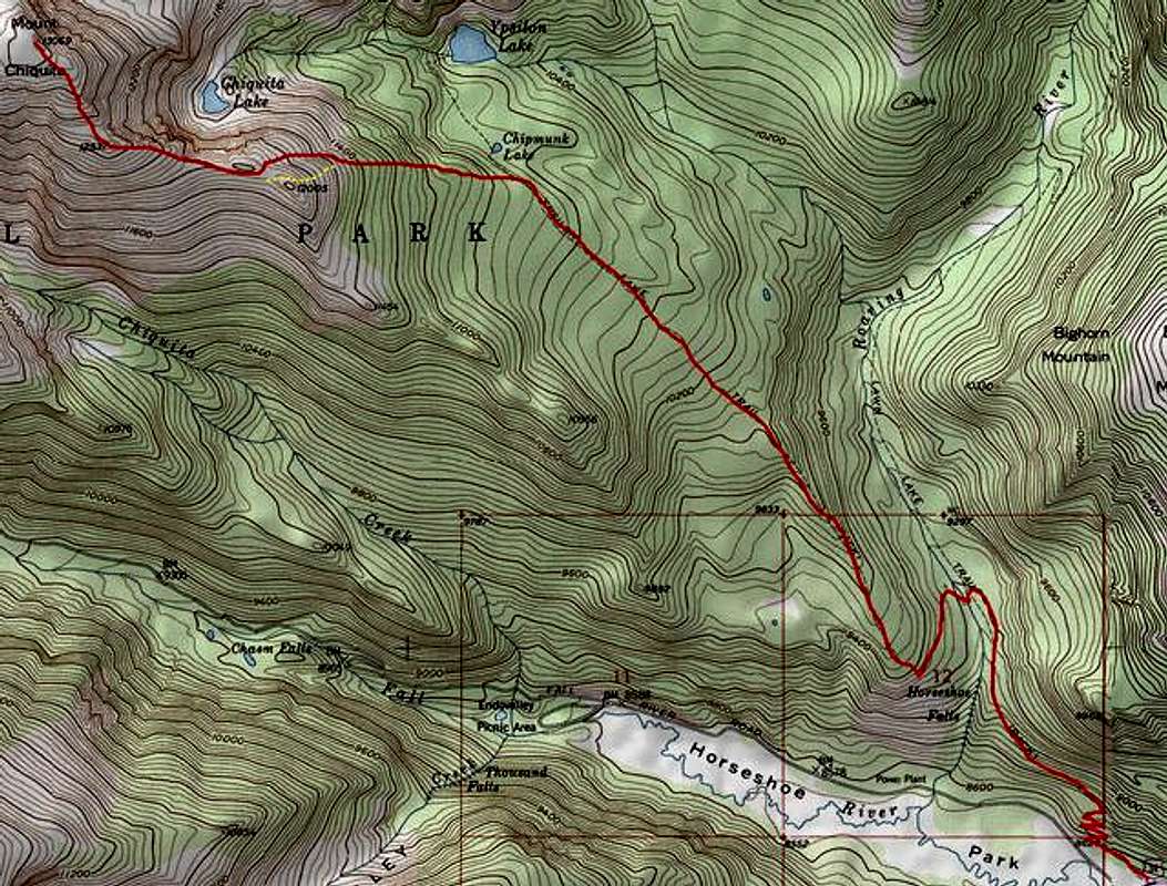
Southest Ridge Route ...
View High-Resolution Image
Southest Ridge Route ...
Southest Ridge Route
RED: Approach & route
YELLOW: Alternate to avoid avy danger en route to pt. 12,005.
« PREV
NEXT »
smudge
on
Apr 2, 2005 8:25 pm
Comments & voting
Other parents
Lat/Lon:
40.44420°N / 105.6887°W
Image ID:
98368
2715 Hits
71.06
% Score
1
Votes
Log in to vote
Comments
No comments posted yet.
to post!
Don't have an account?
Mount Chiquita
(Mountain/Rock)
« PREV
Viewing
#28 of 34
GALLERY
NEXT »
smudge's Image Gallery
« PREV
Viewing
#337 of 352
GALLERY
NEXT »
×
You need to login in order to vote!
User Name
Password
Remember me
Forgot your password?
Log me out when I close my browser.
Keep me logged in all the time.
sign in as a user
Don't have an account?
Register now for FREE
Rating available
Suggested routes for you
People who climb the same things as you
Comments Available
Create Albums
Register Here


