Southeast Route Topo

Southeast Route Topo

As viewed from Mt. Larrabee on Sept. 8, 2007 (It's best to view the original size image for better detail.) A -- steep forest, heather, and talus; B -- the 6850-ft saddle in the main ridge; C -- the initial ridge up-climb goes around the right side of a rocky bump; D -- turn right after about 150 feet of up-climbing; E -- traverse the red face on small ledges and mixed ground (some solid slabs, some looseness); F -- ascend a sandy, stepped gully to the left of "de Gaulle's Nose"; G -- traverse a scree apron under a rock wall; H -- scramble up a gully past a lingering snow block, using a moat as necessary, to a notch then traverse another ledge to the chimney; I -- the famous chimney; J -- the last gully; K -- the final South Ridge scramble to the top.
Klenke
on Sep 13, 2007 3:35 pm
Image ID: 336542

Comments

Post a Comment
Viewing: 1-2 of 2
Andino

Andino - Sep 14, 2007 3:44 am - Voted 10/10

Nice description...

very well presented !

cheamclimber

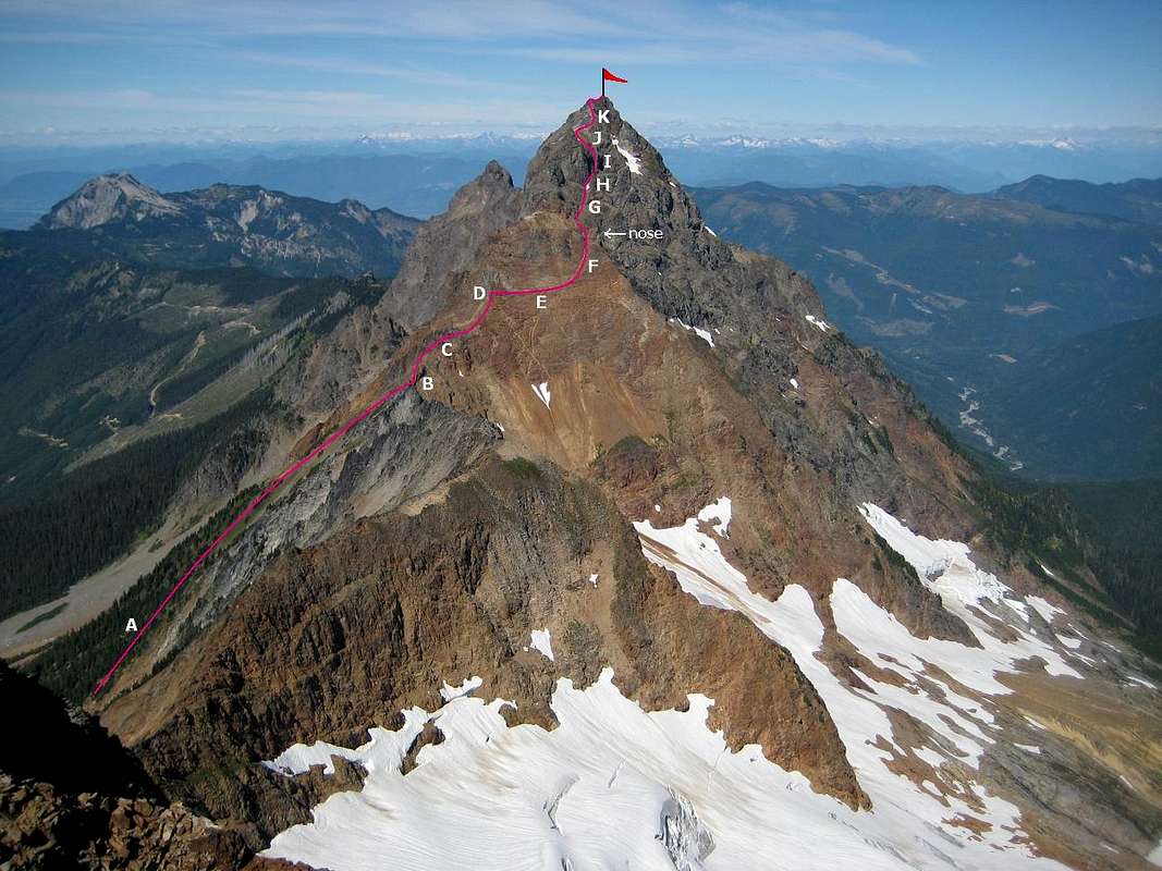
cheamclimber - Oct 28, 2007 12:38 pm - Voted 10/10

Great Topo

Good job, very accurate. When I did this peak I approached from Tamahi Creek FSR (left of and behind ABP) this was also a good approach and didn't take too long either.

Viewing: 1-2 of 2