Toggle navigation
Mountains
Routes
Images
Trip Reports
Forum
What's New
People
Areas & Ranges
Articles
Trailheads
Canyons
Huts & Campgrounds
Albums
Logistical Centers
Fact Sheets
Lists
Custom Objects
Gear
Plans & Partners
WELCOME TO SUMMITPOST
SIGN IN
REGISTER
Sky Pilot Mountain
Additional Parents
Image
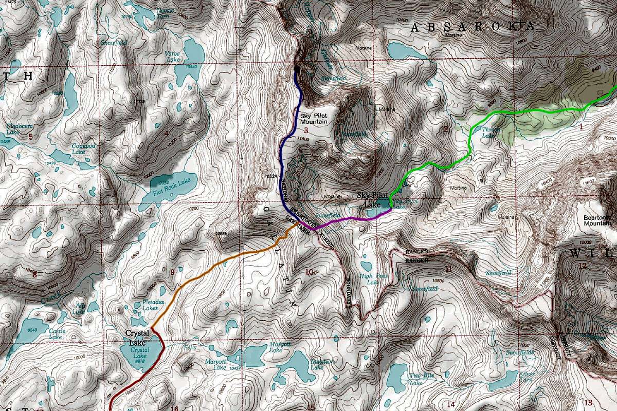
Sky Pilot Route Map
View High-Resolution Image
Sky Pilot Route Map
RED: Crystal Lake approach from the South GREEN: Sky Pilot Lake Approach from the West ORANGE: South Ridge via Crystal Lake climb (Class 2+) PINK: South Ridge via Sky Pilot Lake snow climb (Class 2+) BLUE: South Ridge
« PREV
NEXT »
Matt Lemke
on
Aug 30, 2012 1:33 am
Comments & voting
Other parents
Image Type(s):
Topo/Diagram
Image ID:
810303
7478 Hits
71.06
% Score
1
Votes
Log in to vote
Comments
No comments posted yet.
to post!
Don't have an account?
Sky Pilot Mountain
(Mountain/Rock)
« PREV
Viewing
#14 of 18
GALLERY
NEXT »
Matt Lemke's Image Gallery
« PREV
Viewing
#3307 of 4807
GALLERY
NEXT »
Beartooth Range
(Area/Range)
Loading....
Montana 12ers Project
(Album)
Loading....
×
You need to login in order to vote!
User Name
Password
Remember me
Forgot your password?
Log me out when I close my browser.
Keep me logged in all the time.
sign in as a user
Don't have an account?
Register now for FREE
Rating available
Suggested routes for you
People who climb the same things as you
Comments Available
Create Albums
Register Here


