The purpose of providing this map is to help orient those who might need a bit more clarification and I'll provide GPS coordinates in lat/long nad 27 format.
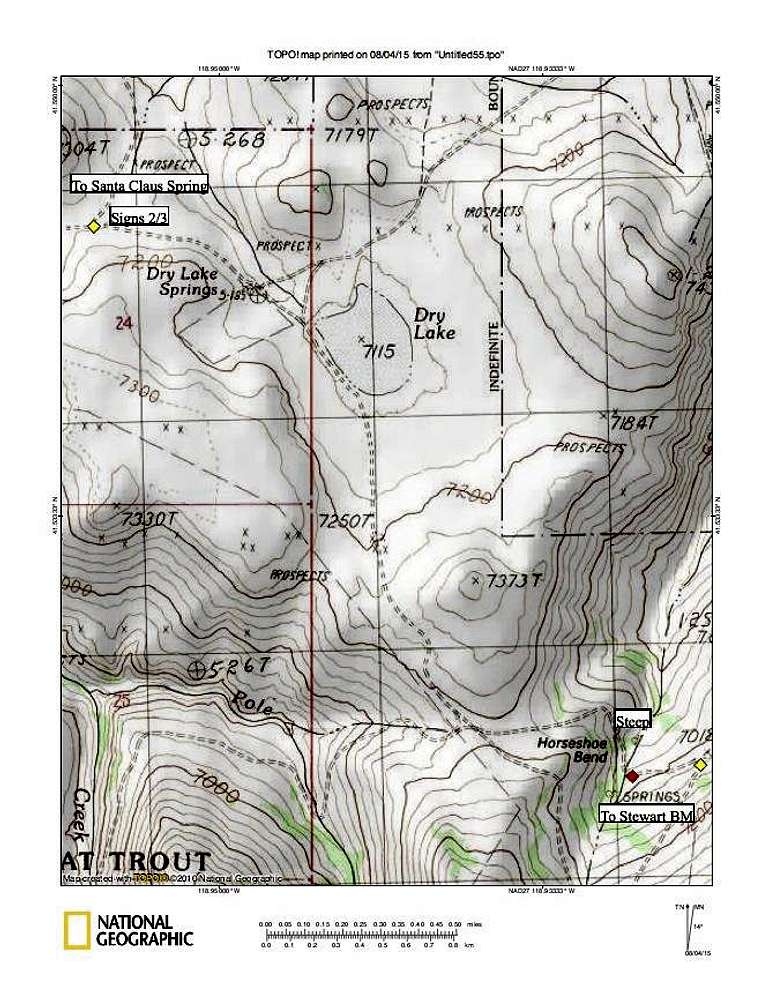
After leaving the Santa Claus Springs area and heading southerly, signs 2 and 3 are found at coordinates 41.5444 118.9565 (elev 7140). Here you turn east toward the Bartlett Creek Ranch and head for a lesser road that turns off of the road at the point marked on the topo map as 7018 T. GPS coordinates for this road are 41.5237 118.9249. In getting to this point, you drop into Horseshoe Bend and cross a small stream. As you drop down, the road is steep at first and you might need 4WD to get back up later on. After crossing the creek, the road heads up toward the 7018 spot where the lesser road takes off from. You will pass
this sign if you are on the correct road. The lesser road will take you to the base of Stewart but it is rough in spots and I remember passing through one gate that you need to open and close. That gate was about 1/2 mile from the Bartlett Ranch road.
I've given as much info as I can remember but I can't emphasize enough the importance of good maps, GPS coordinates and not trying to find your way to this isolated mountain without them. Road conditions can change so be prepared, Google earth would be a good choice. The topos used here are from the National Geographic DVD sets and the maps are from the 70's. Having said that, we found our way to the mountain using these maps and the Benchmark map book and hopefully you will be successful in your efforts as well.


