
-
 16785 Hits
-
 73.06% Score
-
 3 Votes
|
|
Route |
|---|---|
|
|
38.84420°N / 106.3133°W |
|
|
Hiking, Mountaineering, Scrambling, Skiing |
|
|
Spring, Summer, Fall, Winter |
|
|
Most of a day |
|
|
Class 2 |
|
|
Trailhead/Approach
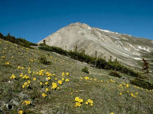
From Buena Vista, follow the Cottonwood Pass Road (CO Road 306) for 9.1 miles west to the signed parking area on the right which is at 9,400 feet. This trailhead is accessible in the winter as well as the winter closure gate is right at the parking area. Follow the Colorado Trail north as it crosses through some willows and begins switch-backing up an open grassy slope before starting the ascent into Avalanche Gulch on the creeks east side. At 10,400 feet it crosses to the creeks west side and continues north through nice forests all the way to the East Ridge at 11,950 feet. The trail crosses the ridge at a saddle and begins descending the other side. In the winter during dry spells, this trail often is well packed nearly the entire way to the ridge. Once you reach the ridge after 3 miles from the trailhead, the climb begins.
An alternative trailhead you can use to reach this same saddle is the Silver Lakes Trailhead which is located along Forest Road 365, the same road used for the North Cottonwood Trailhead which is used for the standard routes on Mount Harvard and Columbia. The Colorado Trail heads towards the west up Silver Creek for 3.3 miles and reaches the same saddle in the East Ridge as described above.
Route Description
From the saddle, turn west and begin walking along the broad and gentle ridge. This route is a long 2.4 miles to the summit so be sure you give yourself plenty of time as this is a long ways to be above treeline. The ridge will narrow and become steeper in places with some sections of more exposed Class 2 but any obstacles you come to can be bypassed to one side of the crest or another. You will have one ridge bump (Point 13,420) that you will cross en-route so to avoid unnecessary elevation gain/loss, skirt around this bump on its south side over large talus. Once past this, the final ascent to the summit is on gentler terrain. The view of the long southwest ridge of Mount Columbia can be seen the entire way.
RT Distance: 10.5 Miles
RT Elevation Gain: 5,000 feet
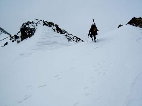
 Ascending the East Ridge | 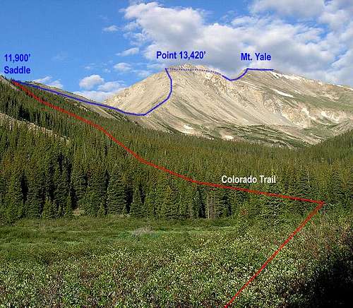 View of the East Ridge from the beaver ponds at 11,100' in Silver Creek | 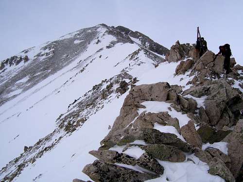 East Ridge of Mount Yale in winter |
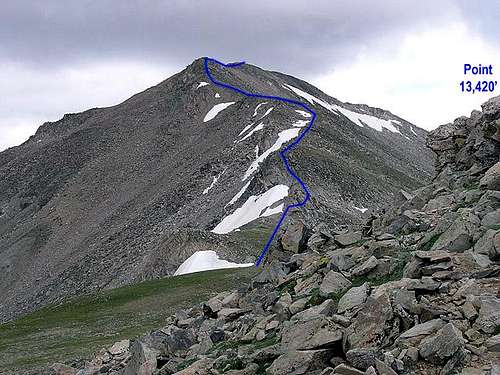
Bypassing Point 13,420...the East Ridge is shown

Route Map as seen on 14ers.com
Essential Gear
Summer
Be sure you have enough water for a long day climb. Sturdy shoes are nice on all the rough talus as well as some extra clothing like rain gear and a light wind breaker. Afternoon storms are common in the summer so make sure you are at treeline and on your way down by noon which may require you to start at or before sunrise. In earlier season like June an axe might come in handy.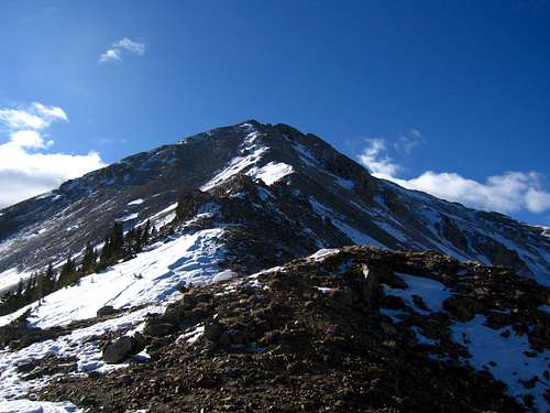
Summer conditions during winter in 2012!
Winter
A winter climb will involve quite a bit more gear including, but not limited to: Ice axe, avalanche rescue gear, snowshoes/skis, microspikes/crampons, stiff mountineering boots, insulated jacket and pants, head and face protection, thick gloves, extra food and potentially bivy gear. Some people carry a sleeping bag on all winter climbs in the Colorado Rockies because if you do get caught out overnight, freezing to death is a real concern.
Full blown winter conditions