

-
 30974 Hits
-
 88.14% Score
-
 26 Votes
|
|
Route |
|---|---|
|
|
45.92739°N / 7.87677°E |
|
|
Mountaineering, Ice Climbing |
|
|
Spring, Summer |
|
|
Most of a day |
|
|
Alpine F+ |
|
|
Overview
This page will be kept in honour of Cyrill Rüegger, the SP member known as Cyrill, who was the former owner of this page, died on June 13th 2009 on Piz Palù together with his wife.
Punta Gnifetti Normal Route
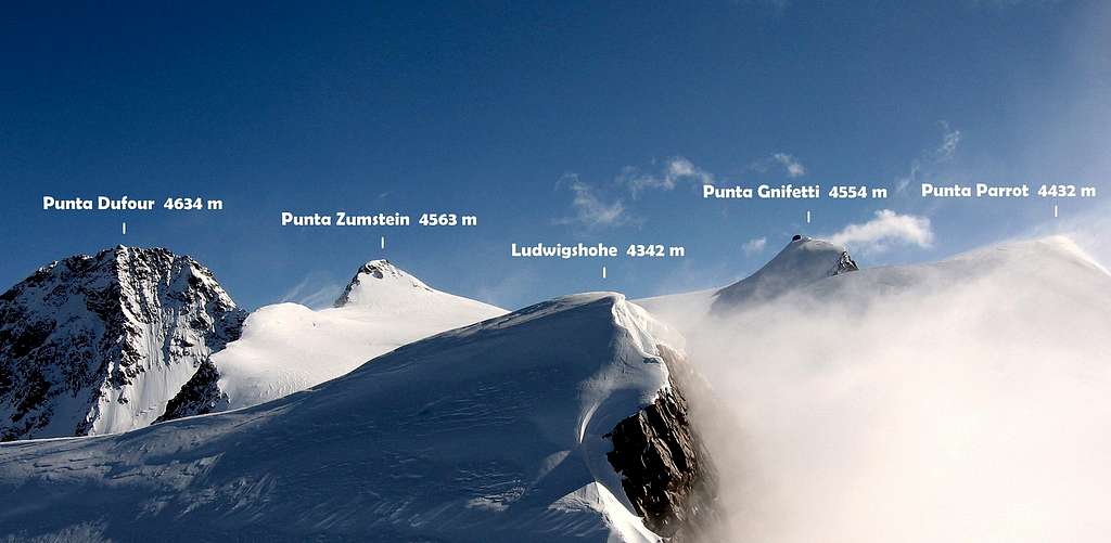
Punta Gnifetti/Signalkuppe 4554 m (Gnifetti in italian, Signalkuppe in German) is a well known mountain belonging to the Monte Rosa Group, Pennine Alps. Located on the Italian-Swiss border, Punta Gnifetti is an important orographic hub and the fourth summit of Monte Rosa massif in order of height, after Punta Dufour m 4634, Punta Nordend m 4609 and Punta Zumstein m. 4563.
The Italian sides have two impressive and very high walls, the first one is the impressive East wall overlooking Macugnaga, the second one is the Valsesia wall facing Alagna Valsesia, with superb routes on both walls, amongst the most difficult and longest mixed itineraries in the Alps. They contrast with the Swiss side, showing gentle-angled slopes and completely covered with snow and ice. The Italian Normal route takes place in the last part along the Swiss side. Punta Gnifetti is surely one of the most known and attended destination in Monte Rosa group, being attainable by this easy Normal Route starting on the Italian side and crossing the Lys Col, moreover facilitated by the presence of the cable-cars and two important points of support, the Ref. Gnifetti and the Ref. Mantova.
 4559 m")
")
Punta Gnifetti is considered as one of the easiest 4000s of the Alps, when climbed following the Normal Route described in the previous chapters. Check here the complete list of the 82 alpine Fourthousanders and the 46 minor summits: Club4000. However the Normal Route should not be underestimated, above all in reason of the high altitude and the presence of numerous crevasses on the glacier. On the summit, since 1893, it's situated the Rifugio Regina Margherita, the highest alpine hut and astronomical observatory in Europe.
History
The mountain was named Punta Gnifetti in honor of the parish priest of Alagna Giovanni Gnifetti, who realized the first ascent on August 9th, 1842 with Cristoforo Ferraris, Cristoforo Grober, Giacomo and Giovanni Giordani, Giuseppe Farinetti and two porters. Giovanni Gnifetti had already attempted to climb on July 26-27, 1834, June 28-29, 1836, and August 12, 1839.


The German name "Signalkuppe" (Cima del Segnale in Italian) comes from the presence of a characteristic rocky pinnacle on the summit - the signal for the very - that was demolished during the construction of the Capanna Regina Margherita.
Getting there
From Italy
Two different approachs roads are possible depending if coming from the Valle di Gressoney (Aosta) or from the Val Sesia (Piemonte).
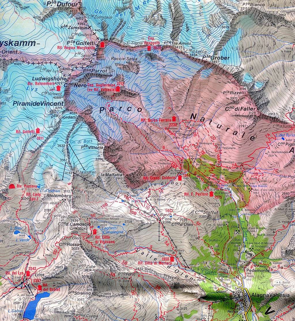
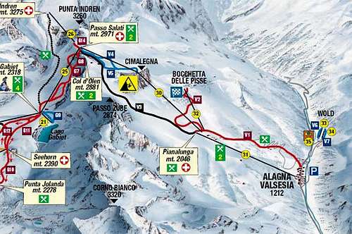
Access via the Valle di Gressoney (Aosta Valley) - From the A5 Torino – Aosta Highway, exit Pont St. Martin and take the Valle di Gressoney, getting to Gressoney St. Jean, Gressoney La Trinité and Staffal. From Staffal take the cableway to Alpe Gabiet – Passo dei Salati - Indren glacier. The first cableway brings to the middle station of Alpe Gabiet (there is a bar- restaurant called Rifugio Lys) a few minutes from the Gabiet Lake. The second cableway brings to Passo dei Salati, where you can find the new lift to Punta Indren 3250 m. From Indren it starts the walk. From the lift, follow the track crossing the glacier and in about 20 minutes you reach a fork, a low and a high track. Follow the low one until the end of the glacier. Go beyond a rock with fixed ropes (15 meters), than climb up again and shortly the Refuge Mantova hut is reached. It takes about 1 hour from the lift-station to the hut. If you choose the high track where the snow ends it begins a mixed path (rocks and snow) and after a few bends you reach an equipped path. When you reach the topo of this path you see on the left, below, the Refuge Mantova. The time required is about 1 hour. To reach the Capanna Gnifetti from the Mantova Hut you have to cross the Garstelet glacier. This will take up to 30 minutes longer. For information about the cableway from Gressoney to Indren (including prices, timetable) see here: Gressoney cableway.
Access via the Val Sesia (Piemonte) - From the A26 Highway exit to Romagnano Sesia and take the road to Varallo Sesia. Here continue following all the Val Sesia road to Alagna Valsesia. From Alagna Valsesia take the skilifts in three sections: Telecabina Alagna-Pianalunga - Funifor Pianalunga-Passo dei Salati – Funifor Passo dei Salati-Indren. Info here: Alagna Valsesia cableway.
Alagna Valsesia and Gressoney skilifts map
Alternatively by walk (no cable car) it will take 6 h from Alagna
Get to Punta Indren on the marked hiking path n. 5 from Alagna via Dosso (1357m). You go to the Alpe Oltu (1847m, cable car station, 1,5 h) and furth up the Valle d'Olen. You go along the Sasso del Diavolo and reach almost Colle d'Olen, where you turn right to the Vigevano-hut (3 h). You go further along Passo Salati (2936m) to the ridge-crest and traverse Stolemberg. On the side of the Indrenglacier, you reach the station (1 1/4 h, totally 6 h).
From Switzerland
You reach Alagna by car on the road E62 from Brig via Simplonpass. Turn off at Ornavasso (near Lago Maggiore) and drive to Omegna. Here turn right and drive along the western side of Lago Orta to Borgosésia. In Borgosésia you take the road to the N an reach Alagna via Varallo and Scopello. You can reach Aosta through the Great St.Bernard Tunnel or the Great St.Bernard Col, then from Aosta reach Pont St. Martin and here take the road running in Val Gressoney to Staffal.
1. To Punta Gnifetti From the Rif. Città di Mantova or Rif. Gnifetti
2. To the Rif. Città di Mantova 3498 m or Rif. Gnifetti 3611 m Get to the Rif. Gnifetti from Punta Indren, 3260 m (cable car from Alagna or Gressoney) in 1,5 h via the Rif. Città di Mantova, 1 h to Rif. Città di Mantova. In the lower part, it is a marked path (n. 5). The traverse of the glacier is not marked. From Punta Indren, traverse the ski-run, slowly going up on the Indrenglacier till you reach the outstanding rock band above which the Mantova-hut is situated (yellow-red signs). You climb up the rock steps (fixed ropes). To reach the Gnifetti Hut from the Mantova Hut you have to cross the glacier going up over the E-side of the glacier to the N and at the end on the rocks to the Gnifetti hut. This will take up to 30 minutes longer.
Route Description
Punta Gnifetti Normal Route
Difficulty: F+ (Alpine scale)
Difference in level: 950 m from Capanna Gnifetti - 1085 m from Rifugio Mantova
A must for those looking for a simple itinerary on a great mountain. The climb is easy, but involves a full glacier's equipment. Lys Glacier has several crevasses - often hidden in early summer - so it is necessary to cross it by proceeding enroped.

Route description - The Normal route to the summit of Punta Gnifetti/Signalkuppe starts from either Refuge Gnifetti m. 3611 or Mantova m. 3470. From the shelters – Rifugio Mantova or Capanna Gnifetti – gain the starting point of the Lys Glacier, which begins nearby Capanna Gnifetti.


Enter the glacier and follow it at first diagonally to the left (toward North-East) along a steep ramp, then toward North rising on moderate ice-slopes, never too away from the steep slopes of Vincent. In some sections the route presents a few passages between wide crevasses. Continue always along the track, usually present in summer, heading to the Lys Col.

After passing a series of irregular slopes, the itinerary gets the snowy basin below the Balmenhorn at about 4000 m. with the statue of Christ under which it's located the little bivouac. Finally, the route reaches the Colle del Lys just near Eastern Lyskamm to the left. Descending briefly, the route takes a long and mainly flat trajectory just below a few small seracs at the base of Punta Parrot, then leads below the Colle Gnifetti and the Capanna Margherita.

Increasing the incline the track rises up to the slope with some bends. Two different ways to get the summit: you can climb a track that separates from the main one to the right, heading directly and steeply to the summit or more easily you can get the Colle Gnifetti with the main track and then turn to right and follow the ridge to the summit.
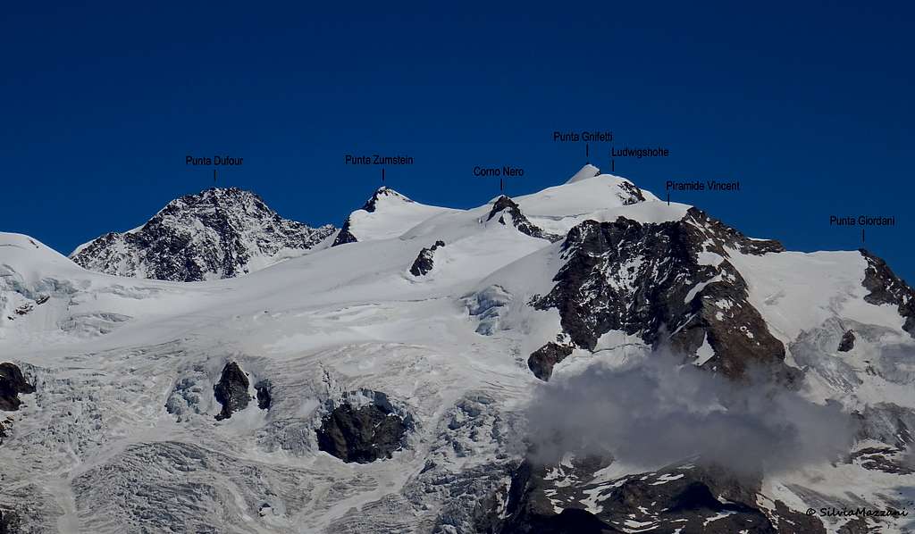
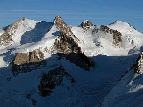
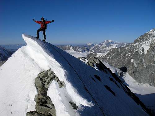
Eastern Lyskamm from the Normal route |
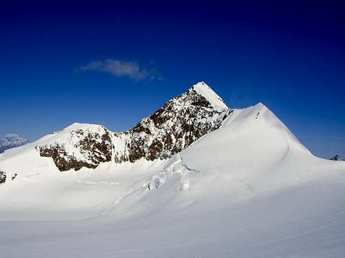
Summit of Punta Gnifetti seen from Punta Zumstein - Photo hiltrud.liu |
Time request: five hours from ref. Gnifetti, five hours and half from ref. Mantova.
Descent: reversing the same itinerary
Essential Gear
Skies during winter and spring, full glacier gear (ice-axe, crampons, rope, slings, carabiners) during the summer.
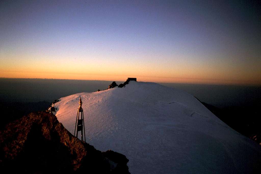
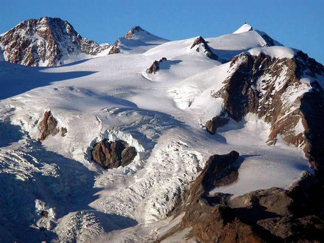
Different perspectives of Punta Gnifetti


Red Tape
No fees no permits required
Huts
- Rifugio Città di Mantova m. 3470
Situation: Garstelet Glacier
Open: from June to September
Size: 85 persons + 15 in the winter-shelter
Guardian: Guide di Gressoney
Hut's phone : 0039 0163 78150 / 347 0802910
Email: info@rifugiomantova.it
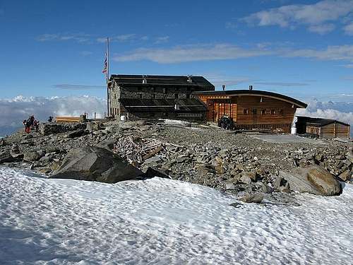
Rifugio Mantova 3498 m |
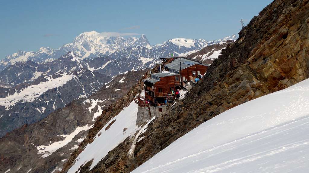
Capanna Gnifetti 3611 m - Photo giampiero assandri |
Situation: rockspur between the Lysglacier and the Garsteletglacier
Open: spring from middle March to middle May - summer from middle June to middle September
Size: 176 persons + 4 in the winter-shelter
Hut phone : 0163 78150 / 347 0802910 Email: info@rifugimonterosa.it
Situation: summit of Punta Gnifetti
Open: from June to September
Size: 70 persons + 12 in the winter shelter

When to climb
Mountaineering: best months are June, July, August and September.
Ski-mountaineering: from the end of February to the end of May
Meteo
Meteo Regione Valle d'Aosta
Meteo Regione Piemonte
Guidebooks and maps


 Guidebook")

"Il grande libro dei 4000" Marco Romelli, Valentino Cividini - Idea Montagna Editore, 2015
“Tutti i 4000” – L’aria sottile dell’alta quota” – CLUB 4000 CAI TORINO – Vivalda Editori
“The 4000 of the Alps” Richard Goedeke (CAAI) – All the normal routes to the 4000m. summits of the Alps – Libris Edition
“Monte Rosa” Gino Buscaini - Guida dei Monti d'Italia C.A.I.-T.C.I.
In Memory of Cyrill Rüegger
A note from the SP staff Cyrill Rüegger, the member we all used to know as Cyrill and Digitalis, died on June 13th 2009 in an avalanche on the summit ridge of Piz Palü together with his wife Tanja and a common friend. They were swept down by the avalanche into a couloir underneath the east summit and died instantly. Their bodies were retrieved from the Palü Glacier by helicopter a day after the accident.
Cyrill joined SP in March 2006 and soon was one of the most prolific contributors on the site with almost 70 mountain and 5 range pages to his profile. He was an accomplished climber, bagging almost 1000 summits in not quite seven years. Among them are 35 4000ers and 272 3000ers, almost all of them in his home country Switzerland.
While contributing a lot on SP, Cyrill's real internet home was www.hikr.org where he contributed 585 mountain profiles and reports in his native language German. Cyrill also posted on www.bergsteigen.at and other climbing sites, often under his real name but also under the pseudonym Digitalis. He was a botanist by profession and also contributed his knowledge about medical plants to different websites. Cyrill will be greatly missed by all.
This page will be kept in honour of Cyrill, one of SP's most prolific members and most active mountaineers.
Rest in peace, brother!