
|
|
Route |
|---|---|
|
|
40.32770°N / 105.692°W |
|
|
Scramble |
|
|
Most of a day |
|
|
I, Class 3-4 |
|
|
Introduction
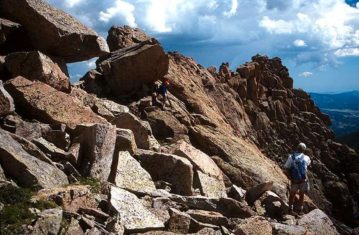
The summit ridge. Which way to go from here?
In his excellent book Rocky Mountain National Park - Classic Hikes & Climbs, Gerry Roach says of this route "reach the ridge 200 yards west of the summit and scramble east along it (Class 3) to the summit". Roach's description is, I think, intentionally vague. Part of the skill and fun of mountaineering is making some routefinding decisions, and being given precise instructions removes that element of the climb. Roach doesn't want to take that aspect away.
I will give more details, but I'm not sure I have found the best route, since I call it Class 4. You can have some fun exploring around up there.
Approach
See the Getting There section on the main page for reaching the basin near Grace Falls, a location of exceptional beauty.Disclaimer: Note that much of the approach once you descend into the basin by Grace Falls involves slogging up (and down) extremely loose talus and scree, everone's favorite activity. Rocks of all sizes are easily dislodged. Whether several hours of this grunt work is worth the short but fun scrambling on the summit ridge is something you will have to decide for yourself.
Route Description

On the summit ridge
From Grace Falls the Little Matterhorn rises prominently above you to the north west. Your first objective is to gain the summit ridge. There is a low point on the ridge near a climber-eating lizard that guards the way.
Follow the upward slope and turn towards the lizard as soon as it looks to your taste. From below the lizard appears to be a large gendarme, not taking on its lizard-like appearance until you are closer. Once you arrive there is no need to tackle the lizard directly, it can be passed alongside without disturbing it.
On the narrow ridge you are faced with three choices: skirt the ridge to the right, skirt it to the left, or tackle it head on. Combining these options is another option. The famous Capitol Peak knife-edge ridge has prompted much discussion on this subject.
Once past the lizard the best route seems to be stay to the north (left) side of the ridge. There is some downclimbing involved and the exposure is not for the faint of heart. The rock is covered with lichen and it can be slimy after a rain. At one point it seems best to cross over to the south side. The ridge is mostly class 3, with an occasional class 4 moved thrown in to spice things up. It all goes, but comfort with exposure is necessary, and this is not a good place to be in bad weather.
The summit is nicely perched at the end of the ridge.
There have been at least two fatalities from falling near here, so take your routefinding decisions seriously:
July 31, 1953
Kathryn Rees was near the summit with her party of eight other women when she lost her balance and fell a fatal 150 feet. Sandra Miller, one of the group's leaders fell en-route to get help and slipped on a snow slope, resulting in a tumble to her death.
Source: Accidents in North American Mountaineering, 1954
August 16, 1992
Jon Hofstra fell 1,000 feet while descending a 4th Class chimney. He was later found dead and evacuated by helicopter.
Source: Accidents in North American Mountaineering, 1993
Source, SP member John Kirk's lists: http://listsofjohn.com/Accidents/LittleMatterhorn.html
brenta - Aug 13, 2004 2:29 am - Voted 10/10
Route CommentWe found three cairns between the lizard and the summit. The first two were on the North face, and the third was on the South face. To reach the summit we crossed again to the North of the ridge. The route that follows the cairns is Class 3. The stretch on the South face is exposed, but on solid rock with excellent handles and footholds.
Nelson - Aug 15, 2004 12:16 am - Hasn't voted
Route CommentOK, thanks for the update. Did you knock the cairns down?! Only half kidding. It's possible the cairns were there on our ascent but I would have certainly ignored them. There are so many cairns scattered around everywhere that, with few exceptions, they simply mean "someone else was here". They don't necessarily indicate that you are on route, or that the person who built them knew where they were. I have several stories where they actually steered you off route, though that was presumably not their intent. I did destroy those cairns. One was quite large.
In this case it sounds like they steered you either north or south. Considering those were the only two options they are not providing any useful information.
Anyway, hope you had a great climb on this fun little mountain.
brenta - Aug 16, 2004 12:49 pm - Voted 10/10
Route CommentCairns are sometimes as deceptive as the pitons that retreating climbers leave off-route. Besides, they may be gone soon, for natural or other causes. In this case, however, I just wanted to note that the difficulties are quite modest if one keeps initially to the N of the ridge and then crosses to the S (after the second cairn). I should have also pointed out that the cairns are not so visible when one climbs towards the summit. We just found them along what looked like the line of least resistance.
Yes, it was a fun cliimb. Thanks for creating its page. We went down into Tourmaline gorge. The descent on the N face from the saddle E of the lizard leads to one tricky spot, a short, shallow chimney, which I found more challenging than the ridge, but makes for better memories once one forgets the trudge up from Lake Odessa to regain the lost elevation. There is a faint trail between Tourmaline Lake and Lake Odessa, but we only came upon it towards the end of the descent.