|
|
Route |
|---|---|
|
|
40.30880°N / 105.69°W |
|
|
Mountaineering |
|
|
Most of a day |
|
|
Steep Snow, a possible 5.0 or so move |
|
|
Approach
Please see "Getting There" section on the Main Page.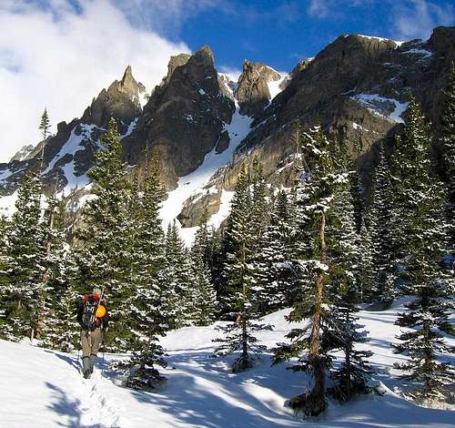
Dragon's Tail seen from the approach hike. May, 2006
Route Description
An easy two mile approach, then 1,500 feet of moderately steep climbing. Throw in a possible rock step, maybe iced over, with a 4th class move or two. Add dramatic views of the nearby North Face of Hallett Peak and a distant Longs Peak. What more could you ask for?! This is the Dragons Tail Couloir, just above the popular hike to Emerald Lake.
This route is typically climbed in late spring through early summer. Too early in the spring and collapsing cornices and south facing spring avalanches could await you. Too late in the summer and a long slog over loose talus is your fate. Time it right and this provides for a terrific, short, day. In fact you could be home for lunch!
For some reason Gerry Roach did not include this route in his highly recommended guidebook to Rocky Mountain National Park. Maybe he was keeping some gems for himself? My friend and I climbed this two weeks after doing Mt. Meeker's Dream Weaver, and we were certain that Dragon's Tail would merit the Roach certified *Classic* rating.
The couloir is clearly visible on your right when you are standing at Emerald Lake. You can pass the lake through trees on the right, or around the left side on an open snow slope. Have your axe handy as sliding into the lake is embarrassing.
The lower part of the couloir starts gradually but the angle increases as the couloir narrows. There is a fork in the upper part of the route, and the lower section is the recipient of anything falling from either side of the fork. Inspect both sides for cornices before starting up, but note: you can't see the top of the left fork from the base of the climb, so a small pair of binoculars comes in handy to have a look during the approach. There is often a debris flow track that comes mostly out of the right fork.
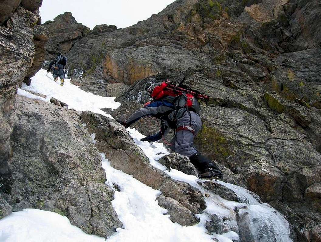
The normal finish is to take the left fork. This narrows and steepens more, until it is about 30 feet wide and an angle of at least 55 degrees. Again, you may have to do one or two 4th class moves to get over some rock steps.
The route tops out a few hundred vertical feet below the summit of Flattop mountain, but that is still 0.8 miles away. For descent follow the ridge on your right down towards the Flattop Mountain trail. If there is a lot of snow on the ground it is often best to stay left of a prominent rock rib at about 11,000' until you reach the Lake Helene trail. This avoids slogging through the trees on the Flattop trail.
Essential Gear
Mountaineering ice axe, crampons, and a helmet. You may elect to carry a length of 8.5 mm rope and some snow and/or rock pro depending on conditions and your comfort level.
Lugging snowshoes up the climb to have in hand (so to speak) for the descent can be a good idea. The northern facing slopes of the standard descent route may harbor deep snow long after the approach hike is melted out or consolidated.
Parting Shot
Climbing above the rock step in the upper part of the left fork.