
-
 13976 Hits
-
 74.92% Score
-
 5 Votes
|
|
Route |
|---|---|
|
|
31.97806°S / 70.11292°W |
|
|
Download GPX » View Route on Map |
|
|
Mountaineering |
|
|
Summer |
|
|
Expedition |
|
|
Walk-up with altitude considerations |
|
|
Overview
This is the main route for climbing Mercedario. Thought technically no more than a walk-up, the altitude, weather and isolation are the main dangers here. Navigation is fairly straightforward.
Approach
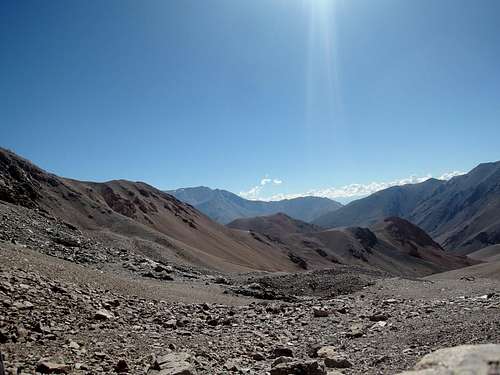
See the mountain’s main page. Rent a car or hire someone to drive you to the Laguna Blanca shelter at 3150m. The road continues further, but it is gated and locked (as of February 2018). If you see it unlocked, see an alternative at the end of this page.
Route Description
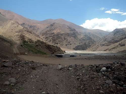
Segment 1: The unmanned Laguna Blanca shelter offers only basic shelter, but you may find locals gathering there.
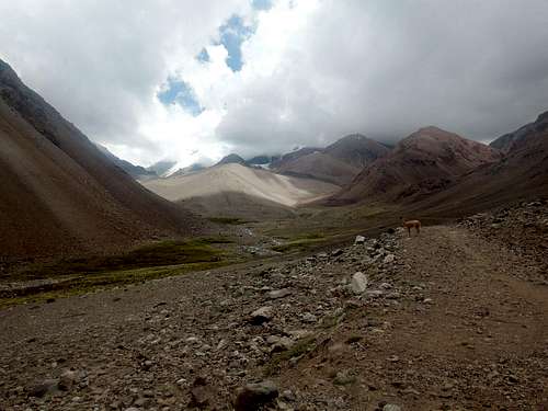
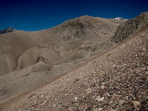
From there, an easy-going path, which used to be a mining road, ascends the valley on climber’s right of a creek. 3.9km later, Guanaquitos is reached at 3600m.
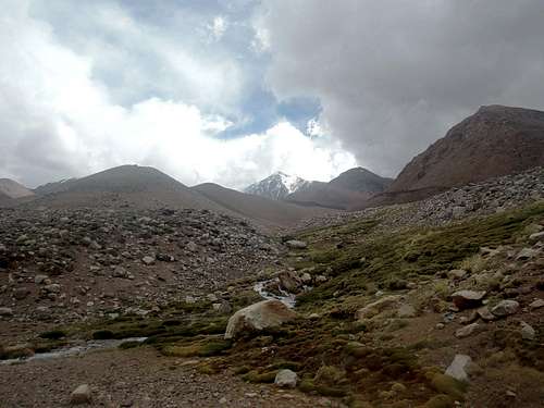
Segment 2: Guanaquitos is a surprisingly green area where the climber is rewarded a first view of Mercedario’s summit. Clear water can be obtained from two streams, unlike the main creek, but treat it as guanacos are plenty in the area.
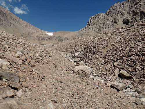
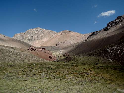
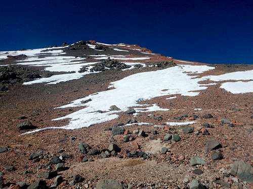
At the second stream, turn right and follow it, leaving the old road. When the valley opens up and the stream temporarily disappears under rocks, keep near the valley bottom on climber's left. At the end of the valley, a steep climb awaits, then Cuesta Blanca is seen and soon reached at 4.4km and 4375m.
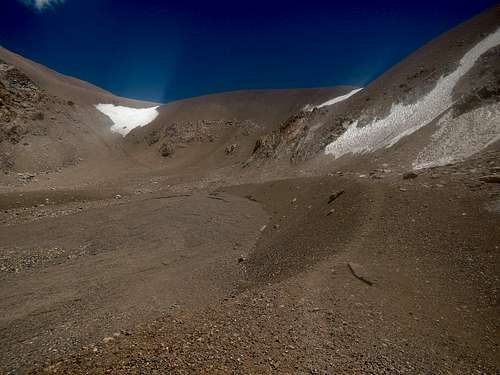
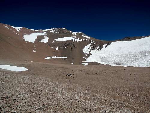
Segment 3: Cuesta Blanca, as a bowl, is already quite sheltered. Clear water flows in the stream. Your pick on treating it or not.
Many paths ascend the bowl on its forward-right slope. Once on top of it, follow the valley up and as it flattens, aim for the highest point slightly left until a last slope leads you to Pirca del Indio at 3.8km and 5175m.
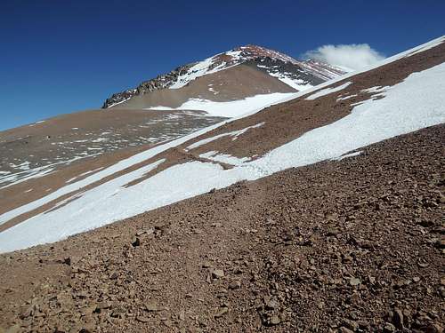
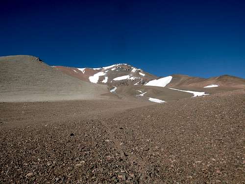
Segment 4: Pirca del Indio is also inside a bowl, but its orientation makes it less sheltered than Cuesta Blanca, so previous climbers have built fortifications. To believe whether one of these pircas is actually of Inca origin is up to you. At the bottom of the glacier on the northern slopes, liquid water can be found during daytime.
Two paths ascend the bowl: one to the left (east), switch backing up; the other straight (south), more suited for descent. Once they meet back, it is only a short ascent until a traverse leads to La Hoyada, at 2.6km and 5650m.
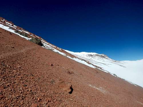
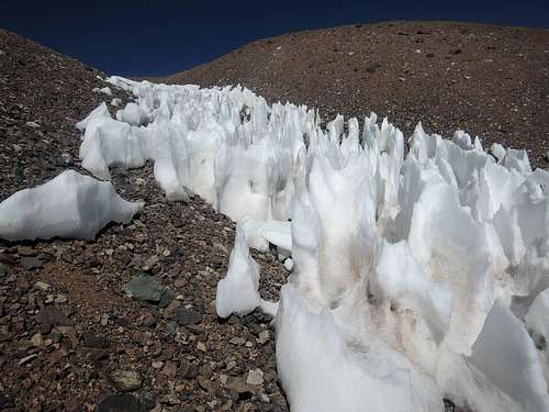
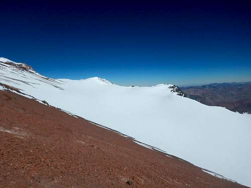
Segment 5: Unsheltered and with few rocks to make significant walls, La Hoyada is at the mercy of wind. Melt ice from snow or glacier nearby.
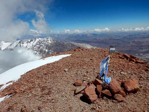
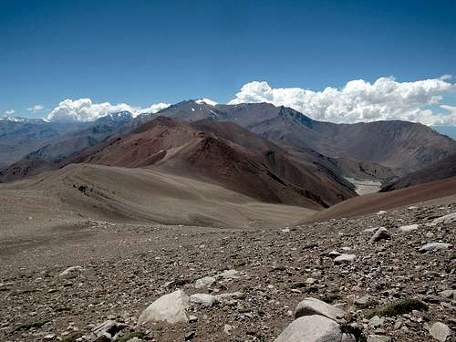
Reach and ascend the ridge south of the camp. Many switchbacks later, the path leaves the ridge and enters a flat spot at 6100m, El Diente. After that, it is a very long traversing ascent between the ridge on climber's left and the Hoyada glacier on climber's right. So many false summit are passed – I was told seven but did not count – that even near the real summit at 4.2km, I took out my GPS as I thought another further one was higher! Easy scramble to summit.
Strategy and variations
Strategy
It would be very easy to ascend this route too fast. One should plan for a schedule similar to Aconcagua, except maybe with one less day for the approach and exit. Count at least 14 days on the mountain.
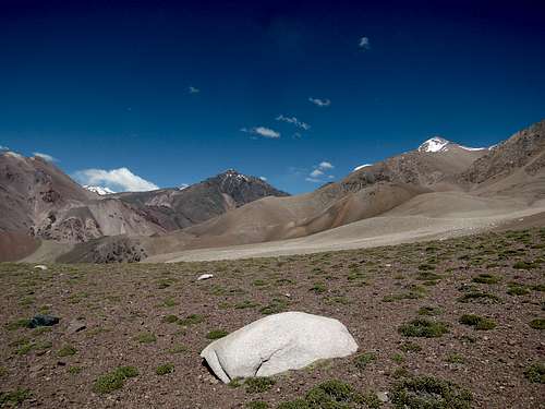
One acclimatization hike would be to follow the old mining road past Guanaquitos to the Paduszek and Caballito glaciers.
I have seen alternative smaller camp spots between 3800 and 4000m (along the stream, limit of mules), around 4520m (nice view in the middle of a steep slope, no water), between 4800 and 5000m (anywhere flat), around 5300m (on ridge by the ascent track, beautiful but wildly exposed, no snow), around 5350m (by the descent track, not that flat), around 5625m, around 5725m (past a dead animal corpse) and around 6100m (El Diente).
My timings on the ascent, including breaks but not stops. Segment 1: 1:45. Segment 2: 3:30. Segment 3: 4:00. Segment 4: 3:30. Segment 5: 7:00 (+2:00 down). I was pre-acclimatized and did no gear carry. For comparison, my summit day on Aconcagua from Colera camp was 7:00 up and 1:40 down.
Variations
See the descent on the GPS track.
This is attractive for ascent if the gate past the Laguna Blanca shelter is unlocked. Drive to a right bend at 3770m. Follow the drainage up SW and then across a plateau SSW until the top of a ridge, aiming for S31°55.515’ W70°02.710’. Keep a WSW traverse around 4175m with a scramble at the end to join the trail around 4225m. If the gate is locked, one can still use this for descent only to make a loop and see a different landscape, which I did, but it is somewhat more effort than sticking to the trail. No water.
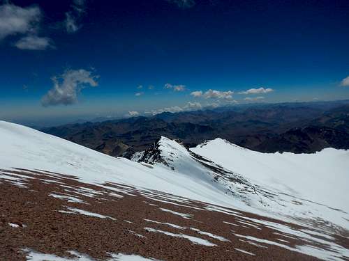
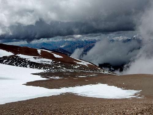
From La Hoyada to the summit, instead of following the trail near the ridge, it is also possible to climb the glacier or follow along it and veer back up the trail whenever past 6200m. On my way down, I took a wrong fork from the normal path and ended up partly doing this variation. No crevasse seen, but the slope was not steep enough to glissade.
Essential Gear
Ice axe and crampons, but it is possible not having to use them. Keep your poles during summit day in that case.
4-season tent and knowing how to rig it properly, especially for wind. Snow is less of a concern but could be.
Consider winter hiking boots with strap-on crampons, if they are of sufficient warmth and you can keep them dry a few days in a row. Do test before. You may save some money over 6000m boots or some weight over plastics.
-15C would be a normal temperature for daytime at summit and nighttime at high camp. I prepared for -25C to be safe.
External links