
|
|
Mountain/Rock |
|---|---|
|
|
33.81440°N / 116.6783°W |
|
|
10834 ft / 3302 m |
|
|
Overview
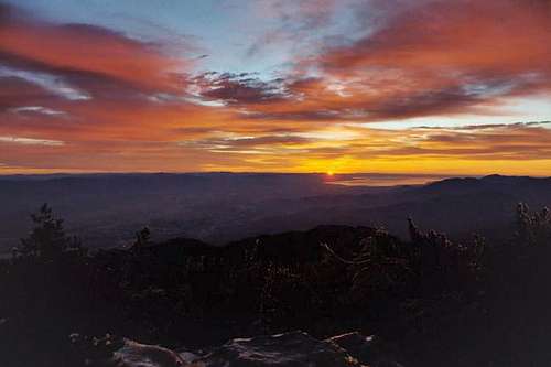
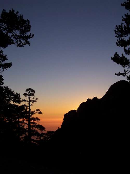
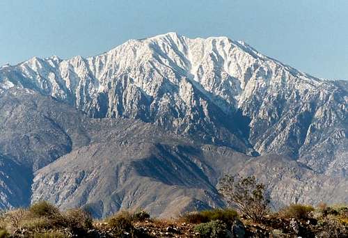
The summit of San Jacinto Peak is the highest point in the San Jacinto Range located east of Los Angeles near the town of Palm Springs. The high country wilderness within the Mt. San Jacinto State Park offers many miles of hiking trails, granite peaks, dense forests, and beautiful mountain meadows.
The aerial tram near Palm Springs offers easy access to the high country or one can enter the wilderness area near the town of Idyllwild.
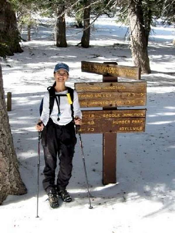
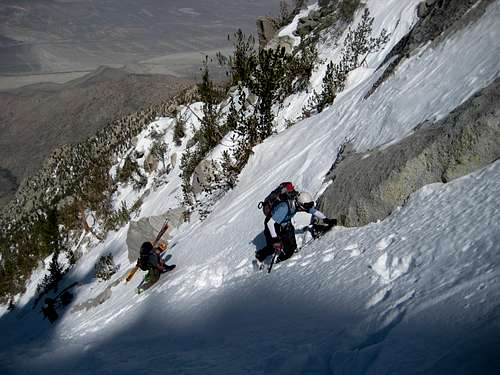
The north face of San Jacinto rises nearly 10,000 feet from the desert floor in a horizontal distance of fewer than 5 miles. There are several routes/trails to the 10,834 foot summit. Probably the most popular is the Round Valley Trail starting at the top of the aerial tramway.
Also starting on the Palm Springs side of the mountain is the infamous Cactus To Clouds Trail with 10,400 feet of elevation gain! The Snow Creek Route climbs directly up the 10,000 foot north face and can offer excellent snow and ice climbing with 9,600 feet of elevation gain. The Devil's Slide, Marion Mountain, Deer Springs, Fuller Ridge, and Seven Pines trails all will take you to the summit. These trailheads are on the Idyllwild side of the mountain.
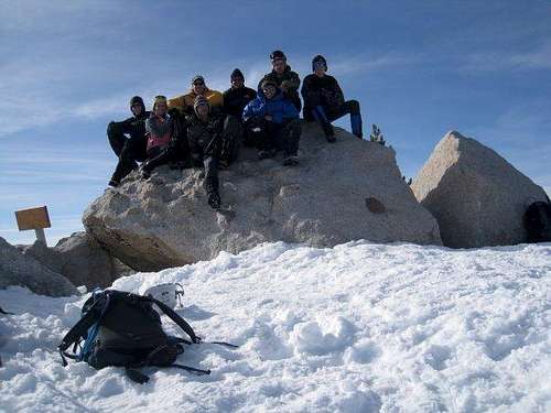
January 10, 2004
Getting There
If climbing the peak via the Palm Springs Aerial Tramway, from Los Angeles take I-10 eastbound to CA 111, and turn right at the Palm Springs Tramway sign. Drive to the end of the road. This is about a 120-mile drive from Los Angeles.
Take the tramway to the upper station and get your wilderness permit from the ranger station located a 1/4 mile beyond the tram station.
The Cactus To Clouds trailhead is located at the Palm Springs Desert Museum in the town of Palm Springs. Same directions as above except continue on CA 111 until you reach Palm Springs where the highway becomes Palm Canyon Drive. Make a right onto W. Tahquitz Canyon Way to Museum Drive. The museum is at 101 Museum Drive.
Also, the trail can be reached by making a right turn onto W. Ramon Road and following it until the end.
The start of the Snow Creek route is off of CA 111. Turn right on the first road (Snow Creek Road) beyond the exit of I-10. Drive south towards Snow Creek Village and park in a large dirt turnout on the left side of the road at the Snow Creek Village sign. This is before you actually get to the village.
For the western and southern approaches, from Los Angeles take I-10 eastbound to Banning (about 85 miles), then take CA 243 southbound towards Idyllwild (about 25 miles). There are four trailheads which can be used for the hike to the summit: Seven Pines, Fern Basin, Deer Springs and Humber Park (Devil's Slide trailhead). Seven Pines and Fern Basin trailheads are reached from CA 243 by turning left just past the Alandale Ranger Station toward the Stone Creek, Fern Basin, and Marion Mountain campgrounds.
For Seven Pines, follow signs toward Fern Basin, but before reaching there turn left on road 4S02, toward Dark Canyon campground and continue to the trailhead approx. 1.5 miles past the campground.
For Fern Basin, follow signs for the Fern Basin and Marion Mountain campgrounds. The trailhead begins on road 4S71 between the two campgrounds. The Deer Springs trailhead is on CA 243 on the left side of the road just before it enters the town of Idyllwild. The Devil's Slide trailhead is at Humber Park in the town of Idyllwild. Turn left at the National Forest Ranger Station and follow the signs towards Humber Park.
Red Tape
All parking at the trailheads, with the exception of the Palm Springs Aerial Tramway, require a National Forest Adventure Pass. These can be purchased at any of the Ranger Stations or from many local merchants for $5.00 a day or $30.00 for an annual pass. Author: grandwazoo Date: Feb 17, 2004 1:22 PM
Parking at the end of Ramon requires no permit or fee. (Cactus to Clouds route) Author: kk6yb Date: Sept 02, 2003 3:07 PM
For the Deer Springs trailhead, park at the trailhead on highway 243, which is USFS land and requires a Forest Adventure Pass. Don't park in the parking lot across the street! This used to be OK, but now the visitor's center is enforcing their fees of $2 per person per day. That parking lot is actually on land owned by Riverside County, who runs the visitors center.
A permit is required for entry into the San Jacinto Wilderness and State Park. These can be obtained from the Ranger Station in Idyllwild at 25905 State Highway 243 or at the Ranger Station located 1/4 mile beyond the Mountain Station at the top of the Palm Springs Aerial Tramway.
When To Climb
Year round. San Jacinto is a wonderful place to snowshoe or ski during the winter.
Camping
Camping is allowed in the State Park by permit only. There are also many campgrounds in and around the Idyllwild area.
Mountain Conditions
San Bernardino National Forest (951)659-2117
Mt. San Jacinto State Park (951)659-2607
External Links
- Palm Springs Aerial Tramway Official website of the ps tramway....be sure to check out the conditions before heading off to there.
- HPS Roundup - Mar 27, 2005
- 2005 Southern California 8000m Challenge
- cactus to clouds to San Jacinto This website has a link to another website with lots of information under "From Cactus to Clouds"
brusy - Mar 9, 2007 9:32 pm - Hasn't voted
parking passyou do not need the parking pass @ Deer Springs trailhead. it's free
tarol - Jul 5, 2014 9:13 am - Voted 9/10
Adventure Pass & Wilderness PermitsAdventure Passes are only required at trailheads that have amenities: restrooms and picnic tables are the two that are easiest to remember and look for Also applications for the wilderness permit for the federal wilderness can be found here: http://www.fsva.org/pdf/Wilderness%20Permit%20App%20MSJW.pdf for the state wilderness: http://www.parks.ca.gov/pages/636/files/dpr409.pdf